Arizona Backcountry Discovery Route (AZBDR)

This site may earn a commission from merchant affiliate links, including eBay, Amazon, and others.

fudgypup

Pack Dog
Joined
Oct 22, 2013
Messages
226
Reaction score
8
Bike
BMW R1200GS Adventure
A few years ago, Touratech USA and Butler Maps did this route across the state of Washington (located in the Pacific Northwest of the US) that attempted to cross the entire state mostly on back country dirt roads.  Of course, Touratech was hoping it could sell a bunch of protective after market parts for fat old white guys like me (I'm "big boned") who dreamed of doing an adventure like this.  Needless to say, it took off quite well and became a popular trip to take.

Since then they have embarked on creating new BDR's for most of the spacious Western US states that still have lots of open space like Colorado, Utah, Wyoming, Idaho, Arizona, New Mexcio, etc...  You can check out their site (backcountrydiscoveryroutes.com) and see for yourself.  I did Colorado last year and can post a report of that one later.

This time it was the state of Arizona, where I actually grew up.  I was born in CA but raised in AZ (like the movie title).  I lived there for 15 years but never really even saw the places I saw just a few weeks ago riding the route.  It is set up as a six day route but we did it in five.

This German guy I used to ride with moved up to the Seattle area and told me some of his riding friends there were planning this trip, so I hooked up with them.  Six of them from the Seattle area rode their bikes to AZ, which at 1400 miles, is a very long way.  It's only about 385 miles for me.

Arizona is known for being VERY hot in the summer.  I recall one day growing up the temperature got to 122 (50C).  This is why we went in the spring.

I had been looking at last year's COBDR video I did and saw from the number of views my video got that this next one was likely to get quite a few eyeballs as well.  I thought why not use that for good, so we decided to do a fundraiser for a charity called "Lost for a Reason."  They assist children and families of the Navajo Nation.  They are also kind of the official charity of the BDR series and a lot of us riders know who they are and what they do.  They have some cool stickers they offer for sale you might be interested in, like their logo with the South African flag. (lostforareason.org).  JJ Lewis (headshrinker on advrider.com) came with us as well.
wpid-photo-20140504214946_zpsb9c0ad55.jpg


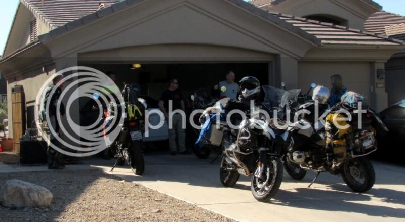
We met at my sister's house in Scottsdale on a Saturday night (May 3).  It's funny with adventure riding in that you have never met someone before in your life but if you met to go adventure riding, then there's an immediate bond and it doesn't matter that you were strangers the day before.  We had quite a time that night getting to know each other, having some great bbq, swimming and downing a few bottles of wine and beer.

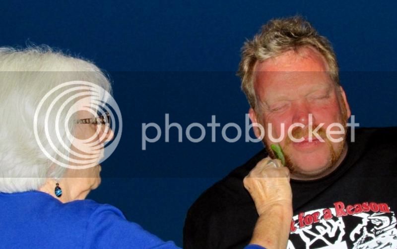
My mom even addressed Ronald's sunburn with some aloe vera
wpid-photo-20140503225937_zps73d8ced4.jpg


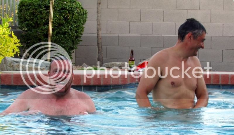
Ronald (Dutch) and Jesper (Dane) enjoying the pool
wpid-photo-201405032259363_zps5d797c66.jpg


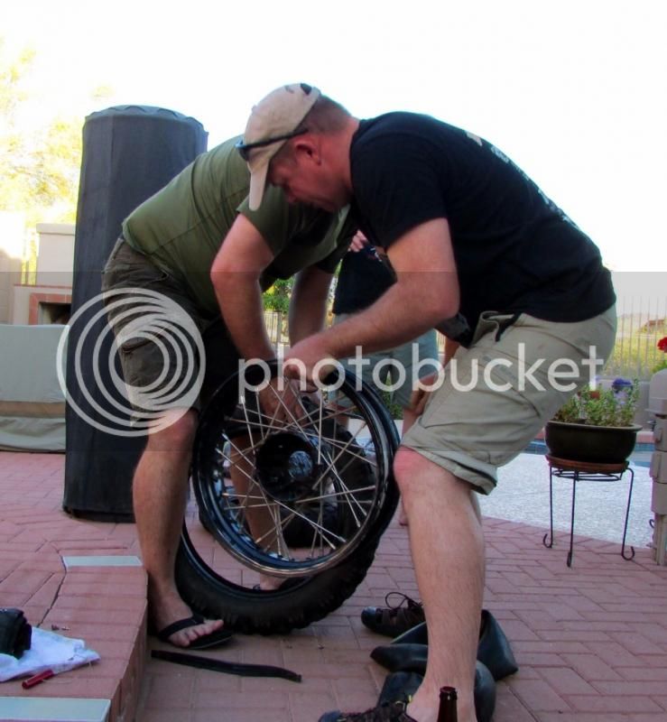
I changed my rear tire there at my sister's house (because I'm a man)
wpid-photo-201405032259364_zpsb9e32cf9.jpg


But the other guys had to go to the BMW dealer the next day to have theirs changed  :imaposer:
AZBDR002_zps22eb59b3.jpg


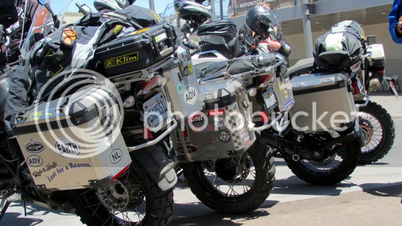
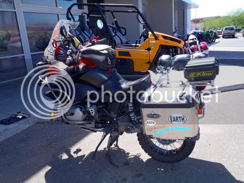
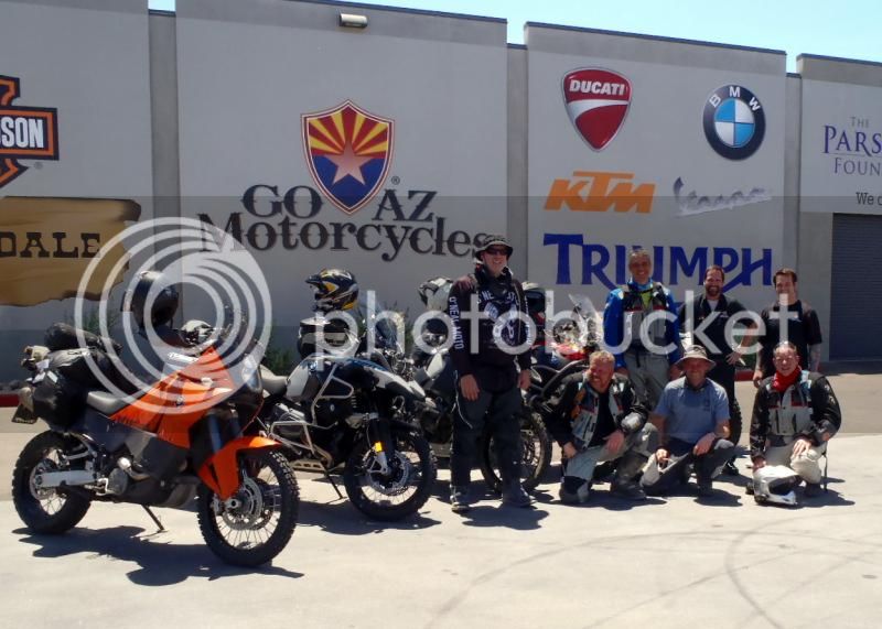
We set out for Tombstone that afternoon and got this send off picture from GoAZ BMW
AZBDR003_zpsb750cc35.jpg


Pretty maids all in a row
IMG_6117_zps44c55a8a.jpg


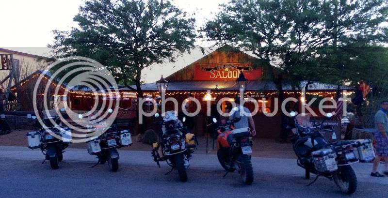
We got to Tombstone and stayed in a little motel (I wanted to camp).  It was Sunday night and most everything was closed.  We got to this bar and I hear some idiot say "we don't want BMW's around here..."  I was very hungry at that point and not in a great mood and thinking "what a stupid thing to say" and was anxious to meet the guy who said it.  As it turns out, the guy who said it was a bit too old and drunk to be taken seriously.  So I didn't get my dream of having a shootout at the OK Corral.  Besides, they didn't have any food there anyways, so we had to leave and find another place to eat.
IMG_1439_zps53d1c63a.jpg
 
wpid-photo-201405052252412_zps299589e2.jpg


We got an early start out of Tombstone and headed south to the Mexican border and started the tracks at the Coronado National Memorial or park or something (where this photo was taken).  Some nice views, then down and along the border.  Plenty of US Border Patrol there but we didn't see any Mexican drug cartels shooting or Mexicans sliding under the fence.  It was a quiet Monday morning.

Starting point
AZBDR004_zps10fecac1.jpg


wpid-photo-201405052252423_zps066e82ce.jpg


Wiel (another Dutchman) pretends here he's relieving himself, which we all found very funny
wpid-photo-20140505225242_zps394c613f.jpg


View down from what we just came up from
AZBDR009_zps3028136d.jpg


Looking south to Mexico
AZBDR006_zps6244fac4.jpg


I assumed the whole state south of the rim country was desert, but this area was more like higher altitude grasslands with lots of ranches.
wpid-photo-201405052252425_zps6e6fc3ea.jpg


Love this shot
wpid-photo-201405052252433_zpsea47fa41.jpg


wpid-photo-201405052252434_zps68cd0098.jpg


Even though I saw our leader Wiel puzzling over his gps a few times, we got to the town of Sonoita pretty quickly and had a late morning snack then just kept going.  This was where we ran into a section of deep sand.  I ride a lot of that here so I didn't have as much trouble but quite a few of us did.  Didn't get any pictures of that but you'll see video of the struggles later.

AZBDR012_zps1324e8b0.jpg


We got through that section eventually and started heading through some challenging and rocky two-track.  I got to a gate, opened it and let everyone go through before I closed it.  I saw the guys in front went up a ways then turned right up a pass.  The three of us in the back followed but I quickly realized we were not on the tracks, according to my gps.  We were supposed to turn left, not right but that's the way Wiel led the five other riders.  So we waited there for a long while for them to return.  I figured there were five of them and they all have gps; they'll figure out they're doing the wrong way and come back.  Nope...

We did get a call from one of them saying they were going to go another way to the highway and meet us at the gas station in Benson, but they ended up being stuck out there for about five hours.  They went through some really rough stuff and didn't want to turn around, but it kept getting worse.  They ran out of energy so they stopped to make a meal before finally turning around and coming back the way they came, then taking the proper tracks back out the way we came.  We saw all this on our smart phones tracking their SPOT locators.  We left them a message to meet us at the campground and they rolled in just before sunset.

Turns out what happened was Wiel was using a Garmin 60Csx (same as me) but had loaded the full resolution tracks and not the 500 point ones.  His gps truncated the route and his "routing" function was telling him to go another way based on the basemap he had loaded in there.  I know this because I made the same mistake two years ago.

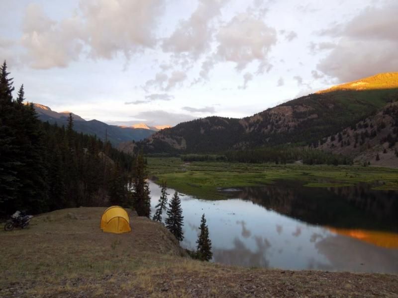
My tent at camp that night
10247328_781090208575850_3370836343232839081_n_zpsb62c0b4a.jpg


We determined since Wiel had loaded the wrong tracks, that I would lead the next day.  I'll keep mentioning this, but I can't say how important it is to know how to load your gps with the right tracks and use your gps properly.  Ask other riders how they do it.  Get comfortable with it.  Don' t just follow the guy in front of you because when you get separated, you're going to need to know how to get out of there.  Out of 8 of us, we all had gps but only three of us had the right tracks and knew how to use them.  This would turn out to burn us a few more times during the trip.

Some key mistakes seem to be:

  • 1.  not filtering your tracks to 500 points or less on a unit that requires that (not all do)
  • 2.  trying to load more than 20 tracks on a unit that won't allow that
  • 3.  not following your tracks but trying to route your way to a destination which lets your gps unit direct you off your tracks a different way

If there's one thing these panniers are good for, it's holding a lot of beer and ice after a very long difficult day of riding
10259956_781090518575819_1069701392116235488_n_zps3cb2fea4.jpg
 
Subscribed :thumleft:

Keep it coming...
 
Looking forward to the rest of your RR FP.
 
Ian in Great Brak River said:
Looks good, have you done the TAT, Trans America Trail ?

Thank you :)  I have not done the TAT yet, but a friend of mine, James, did it and filmed a documentary about it in which he was struck by lightning! 
[flash=480,385]https://www.youtube.com/v/8IJI45tYwWU[/flash]

Here is his story:  rltmovie.com.

I need a smaller bike to do that and all I have now is my GSA.  Had a KTM 500 last year but got rid of it because I have no truck or trailer and wasn't riding it enough to justify the cost.
 
I was very glad the guys made it back safe and sound the night before.  It could have been really bad.  They were in one place for so long on the SPOT page that I thought somebody got hurt.  Luckily, it was just a case of not using a gps correctly (for five hours).

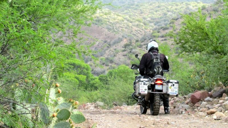
Day 2 had us riding some slab, then a dirt "highway" north following the San Pedro river.  Lots of cool scenery including cactus, rocks, trees and even a dead snake!  I lead the day, yet guess who was still jawing me about "are you sure this is the right way?"
wpid-photo-201405042149472_zps7f58794b.jpg


This was on his detour the day before where he took out that yucca plant.
wpid-photo-20140505232059_zps738b6240.jpg


Looked like a rosy boa (non venomous).  Rattlesnakes are the worst we have over here.  Not like a mamba or cobra or anything.
AZBDR018_zps42f26414.jpg


Spring time
AZBDR020_zpseb513033.jpg

AZBDR014_zpsc7ff7f68.jpg


AZBDR019_zpsc5ef8943.jpg


Even this giant sagharo (sa-war-o) with the tires hung over it
AZBDR025_zpscc774c93.jpg


scale
AZBDR024_zpsb1ae959f.jpg


Tom on his 950.  There were two 950's, a 650, a brand new LC GSA, 3 oil head GSA's and a 990
AZBDR022_zpsd32f0eb2.jpg


Ron on his 990
IMG_6168_zpsd071571b.jpg


Prickly pear cactus
wpid-photo-201405071136591_zps9bfde640.jpg


After the fast section, we went through a very cool sandy two track section that was fun because you had to keep your momentum up as well as dodge tree branches with thorns at the same time.  "We're going the wrong way!"  Okay, Wiel.

Found this old concrete walled house from the territorial days, probably 100 years old
AZBDR026_zpsaa6a7ff0.jpg

tree growing through the window
AZBDR029_zpsa7c361a1.jpg

AZBDR028_zps9456a5eb.jpg


After that we started to climb up into the mountains.  Here's Jesper rolling around in some dirt while his brand new LC GSA sleeps next to him
wpid-photo-20140505233014_zps3eebd672.jpg


It got pretty technical (for loaded big bikes) as you'll see later in the video.  It got us up into the pine trees and some cooler temps
AZBDR055_zps549ad935.jpg


John is a cowboy from Oregon.  Great guy and rider.
AZBDR033_zpsa4d1acef.jpg


Gotta love Ronald's dutch sea captain's beard.  "Wonder twin powers, ACTIVATE!"
AZBDR035_zps1e48a84b.jpg


We came down the other side of the mountain into the town of Globe and ate at an interesting place where some slack-jawed local in a twangy western accent said "oh hey is that there one of them KTR's?"  Yeah buddy, it's a "KTR."  :imaposer:

AZBDR037_zpse3c5a2e4.jpg


They wanted to cut a day out of the trip, so we decided to keep going and find a camping spot along the way.  We ended up at Cherry Creek near this water crossing and called it a day.
AZBDR045_zps628d682a.jpg


Bliss
wpid-photo-20140507113701_zps70026bc4.jpg
 
Thanks for sharing.  :thumleft:  Please keep it comming. What make is that camping chairs ?
 
Winston said:
Thanks for sharing.  :thumleft:  Please keep it comming. What make is that camping chairs ?

my camping "chair" was one of my panniers but I think most of the other guys had those tube frame chairs made by Alite.  Jim had some kind of folding thing that lies directly on the ground but I don't know who makes it.  He says he doesn't like it and would have preferred one of the Alite style chairs.  I have an Alite chair too but I wanted to pack light.  I learned the consequences of weight on the last day of the trip...
 
This would turn out to be a challenging day.  They had wanted to cut a day out of the trip, which is why we went beyond Globe the day before and camped at Cherry Creek.  To get to Winona/Flagstaff that day would mean we'd have to ride longer, a bit quicker, take less breaks and a minimal lunch break.  Since Wiel's gps wasn't working and I was leading the riders, I also kind of became the de facto leader left to make all these decisions.  It got pretty crazy the first two days as guys kept asking "so where are we eating lunch, where are we camping, what are we doing?..."  It was clear we needed not just a leader, but to clearly plan and agree on what we were going to do moving forward.  The saying goes: "Plan the ride.  Ride the plan."

It's funny how in our day to day jobs we know there is a LOT of planning and leadership that goes into what we do.  Years of experience, budgeting, planning, scenario testing, etc...  But then we go out there as amateur riders with little planning and expect it to run smoothly (it doesn't).

So the plan was to eat breakfast at camp from whatever you had with you like cereal, energy bars, whatever.  We'd ride to Young and get gas, but then just grab something at the gas station for food and keep going.  Didn't exactly work out that way...

Wiel was also still chasing ghosts in his gps and insisting we should be going another way, or that I had us on the wrong track.  This boiled over at the end of the day and I wanted to punch him in the face.  :imaposer:  He is really a great guy but you know how a long day of adventure can wear on your nerves, especially when someone is 0 for 3 with his own gps and insists he knows the way to go.

My face at the start of the day, all bright and cheery
AZBDR044_zpsa2a262d4.jpg


Here's me in a familiar view that day, waiting for everyone else to put their helmets on and go...
IMG_6283_zpsf7ce4b08.jpg


I was lucky enough to have ridden this section before.  I was visiting family in AZ over Christmas, 2012 and some riding buddies I know there invited me to ride this section (in the snow).  There is this really beautiful section here where you look up at these beautiful cliffs and see where ancient peoples used to live in their cliff dwellings.

IMG_6301_zps1cf13caa.jpg


AZBDR048_zpscd15b664.jpg


AZBDR047_zps391d7b11.jpg


AZBDR050_zps72841d30.jpg


wpid-photo-201405071137021_zps255ddd87.jpg


wpid-photo-201405071137013_zpsedf0deca.jpg


wpid-photo-20140507113702_zps84c20205.jpg


At this point we had to decide on an "advanced" section up ahead and whether to do that or take the regular route to Young.  I suggested given our ambitious goal of Winona/Flagstaff, that we should avoid the tough section.  Tom had done the same thing with the deep sand the first day, not because he struggles with sand, but because he didn't want to be waiting all day and lifting other peoples' bikes.  I could see by the average riding ability that there was a good chance someone was going to get stuck, break a bike, or injure themselves.  Wiel and I opted for the regular route to Young.  Again, the plan was to meet at the gas station, gas up, maybe get some food there and keep going.

We got to the gas station and found there was really no food there and we weren't sure how long the guys on the hard section were going to take, so we went over to a place I had eaten at before called Antlers (that has free wifi).  We got there at about 10:45 am and they opened at 11:00.  By the time the guys got out of the hard section (no carnage) and we had eaten and gassed up, it was 1:30!  We had to make tracks quickly.

Luckily, we had a lot of straight and fast forest roads and didn't stop that much.  At around 3:30 I said we were making good time and that it was possible we'd be at Winona by 5:30 but we have to press on and not make a lot of stops.  I said if we are still not there or close by 5:00, we'll stop and evaluate camping where we are.  Everyone agreed.

Jim at the Mogollon (mogey-yon) rim overlook
AZBDR058_zps516855f2.jpg


We got to a section with a washed out bridge and there was a local sheriff there who said we would be okay to skirt around it on a narrow path.

wpid-photo-201405100947252_zps93d473cd.jpg


IMG_6369_zps5b7c43b2.jpg


wpid-photo-201405100947251_zpse352c52d.jpg


Unfortunately, we got into some really rough and rutted roads that required us to go very slow (lots of sharp baby head rocks).  At 5:00, the four of us in the front stopped to wait for the others.  It was a bad place to camp and was very windy and cold, so we chose to keep going.  The skies started getting dark and it began to rain.  We were in some really rough stuff and just wanted to get to Winona as soon as possible.

And this is where Wiel starts in again with his gps confusion...  He says "we're on the adavnced route!"  I just shook my head and said "well, if you want an easier route, this road we just turned off will take you straight to the highway if you like" but he continued to follow.  I could tell he was getting agitated the harder the terrain got.  He was convinced we were on the advanced route.  It was raining and 44 degrees (7C) so I didn't want to stop and show him my gps and my paper map and show him his error, so I just kept going.  We finally got to a nicer dirt road and he blasts by me yelling "follow me!"  I thought okay Wiel, as long as you're on the blue line (on my gps) I'll follow you.  We get to Winona (6:30), gas up and inside the gas station is about the time I wanted to punch him in the face.  I said let me show you where we were, where we were not, and how we were on the tracks the whole time.  I pointed out where we were when I showed him the escape route.  I said and that's when we turned north, right?  He said yes.  I said and see that red line there on the map showing the advanced route?  He said yes.  I said that's the advanced route, which is south of where we were.  We were never on the advanced route, okay?  He backed down finally.  I've only been doing this for years now ;)  I told him it's not a big deal, that I made the same mistakes with the same GPS unit a few years ago.  His problem was not just that his tracks were truncated (<500 points) but he was using his gps to route himself to the destination and that routing function kept taking him off the tracks we were supposed to follow.  I told Jesper I was going to punch Wiel in the face and he said "well that's Wiel... even when he's wrong, he's right."  Funny now in retrospect....

But the fun didn't end there.  Jim and John rolled in 10 minutes later, then the rest of the group about 20 minutes later (almost dark), except for JJ.  Where's JJ?  I get a voicemail from him saying he posted up but no one ever came behind him so he's going to set up his tent out there alone and come out in the morning.  I called him back and got his voicemail and said dude, just come now; you're only like 3 miles from the gas station and we'll wait.  He got there 15 minutes later.  Turns out his problem was not just that he didn't have the tracks loaded, but that someone in front of him didn't post up and he blew past a turn.  It's really important to have a gps, have the tracks and know how to use it.  Obviously important also to post up at turns and not go further until the next guy comes.  Also not to get too far ahead of the sweep rider.

It's cold, dark and wet so we opted to ride into Flagstaff (10 miles west), eat pizza and get a hotel.  Simple, right?  As we got off the highway, we stopped to let the guys in the back catch up.  Wiel went back to get them and as they rode up, we kept going to the pizza place, but apparently Wiel wasn't with them.  Wiel shows up 5 min later at the pizza place and he's really mad we left him.  :(  One of those days.  Well, at least we were all together now, warm and fed, right?

I got on my hotels.com app on my phone and started to search for a hotel.  I found one and asked everyone if they were cool with that and of course, the last guy I asked says "nah, that hotel sucks."  That was my breaking point and I said, okay then you book us a hotel and proceeded to eat my pizza.  Wiel ended up booking us a hotel (Howard Johnson Inn) and when we got there, Wiel exploded at the guy saying he'd already paid online.  The guy said that was just an authorization, that they only charge when you show up.  The guy said the rooms are in high demand and he doesn't have time for our shit, do we want the room or not?  We got Wiel to shut up and took the room.  What a day!

Then we woke up to this...

AZBDR060_zpsf1363169.jpg
 
A good night's sleep seemed to calm everyone's frayed nerves and we awoke to a fresh layer of wet snow.

wpid-photo-201405100947254_zpsbf105d73.jpg


Probably best we didn't camp as I hate packing a wet tent.

Some apologies were offered, some kisses were exchanged and all was patched up from the day before.  Lots of good lessons for us.  Mainly it's the value of planning your ride but we also felt that we were too ambitious in cutting out a day.  That's really the point of a trip; to enjoy the journey and not rush through it.  I heard about some guy who set a record for traveling between Deadhorse, Alaska and Ushaia, Argentina in something like 28 days.  What's the point to that?

Half the group was upset at having waited all day for slower riders.  One guy said "I spent over two hours yesterday just waiting for other riders."  The other half were upset and having been rushed all day.  Well, you did say you wanted to cut out a day, right?  To remedy this, I suggested we split up into an A/B grouping.  We all decided which group we wanted to be in and agreed to meet up in Cameron.  That seemed to work very well.

We still needed to spend time planning the day, though.  I made sure we knew exactly how many miles it would be and who would need gas when, where we met up and where we were going to camp (35 miles past Cameron at the Little Colorado river overlook of the Grand Canyon).

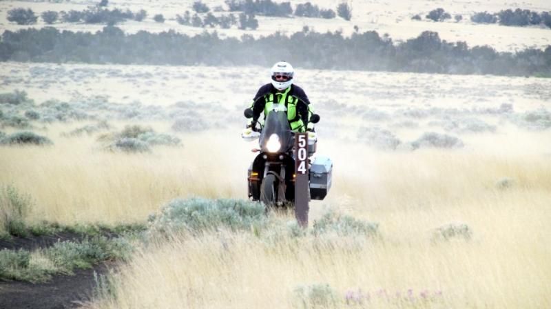
The dirt section began right out of Winona where we came off the trail the day before.  It was black volcanic sand, which was fun and smooth to ride in until it became quite deep.  Had to keep the speed up, so I'm glad the A group I was in understood that and didn't try to do the Harley shuffle the whole way through.  We quickly lost the B group, not because we were that much faster, but because they stopped to take more pictures.

wpid-photo-201405100947261_zps20c8336f.jpg


wpid-photo-20140510094726_zpsc91c1efe.jpg


This section turned out to be really LONG.  Even us "fast" riders didn't get to Cameron until 4:30 (we left just after 10:00 am).

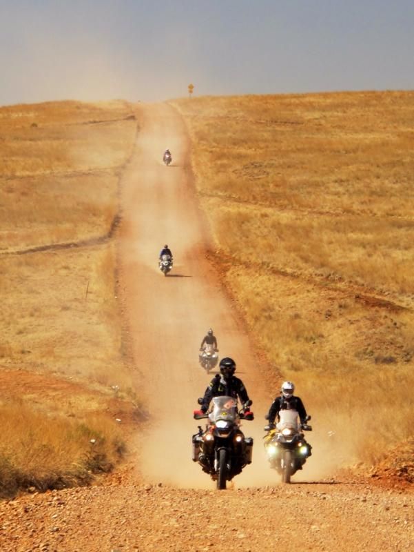
Came to this area and really liked this road leading off into the distance

AZBDR070_zps55441dab.jpg


JJ was tired (we all were)
AZBDR068_zps3b7795bc.jpg


Some moody b&w's.
AZBDR062_zps88bf4d55.jpg


Fudge-pop (me) "I only came for the gasoline"
AZBDR066_zps71e214cf.jpg


Cowboy John
AZBDR065_zps37ff22cb.jpg


JJ.  JJ is quite a remarkable guy.  He works for the federal government and is a child counselor.  They flew him in to counsel the kids at that huge school shooting in Sandy Hook you might have heard about.  He sees all the bad stuff on the reservation, so this trip was a good break for him.  He and Ron Grace run the "Lost for a Reason" charity.

AZBDR063_zps2a43ad58.jpg


The roads on the Navajo reservation are REALLY bad.  I had my only tip over of the trip as my front wheel got stuck in a rut.  Nice, huh?
10325278_784433541574850_2744722091646272566_n_zps8c8cbcdd.jpg


We got to Cameron at 4:30 and ate.  We saw the B group was still way out at the rim of the Grand Canyon and realized if they didn't take this paved road back to us, that they were going to be a very long time getting back.  Luckily they took the paved road and showed up at 5:30.

I said that if we wanted to make that campground, we were going to have to get going like right now!  I put all my stuff on and then went across the parking lot to get some gas.  I filled up and was pushing it off the center stand when the whole rear end just collapsed!  I looked at the rear shock and saw this..

10308078_782851175066420_3085343499281108886_n_zpsf2ed3fca.jpg


I was pretty shocked about my shock.  I was glad it hadn't done that while 1. I was riding it and 2. out in the middle of nowhere.  I think the terrain and the loaded panniers (and my "big bones") did it.  It's a Wilbers with a 5 year warranty and I should have it back tomorrow (June 2).  At this point there was really nothing my riding buddies could do for me, so I said some quick goobyes and they took off to make the campground by dark.  I stayed there at a motel and got what I thought would be a free tow 100 miles south to Camp Verde, but it turns out it was $275.  A mechanic friend of a friend, Josiah Brennan of Dirtball Customs, drove all the way up from the Phoenix area with a loaner shock for me AND he installed it right there in the parking lot in front of Starbucks!  And he wanted nothing for it!  I got him to at least take some gas money for his trouble.

Despite all the drama (would make a great reality tv show), I would ride again with any of these guys.  I hope they'd ride with me again too.  We are planning a Baja trip for this fall/winter.  They were all really great to get to know.  That seems to be something adventure riding is known for.

Hope you all enjoy the video...

[flash=480,385]https://www.youtube.com/v/scsHdQ2jMnY[/flash]
 
Here's a video from last year's Colorado Backcountry Discovery Route.  This was a bit easier than Arizona and more scenic.

[flash=480,385]https://www.youtube.com/v/DDiCz6fWuOo[/flash]

1074151_673046779389959_1089481270_o_zpsc4225c0a.jpg


1074581_673046789389958_732785222_o_zps9d13cbaa.jpg


999506_10200112717247896_1703173939_n_zps7dfcab47.jpg


600509_10200630762830080_1729397060_n_zps7232ef52.jpg


1016277_665473193480651_689980601_n_zpseebc231e.jpg


1039954_10151705822811113_56855354_o1_zpsbad1f090.jpg


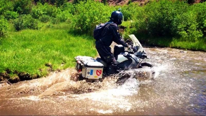
Water seems a bit too high, huh?  It was.
GOPR4703_zps9f5452ca.jpg


Got waterlogged and had to do an oil change in the field (we bottled the oil and disposed it properly later)
COBDR033_zpse337e631.jpg


COBDR026_zps144ade38.jpg


GSA Condo
20130701_165338_zpsd5374368.jpg


20130701_110448_zps7967116a.jpg


my favorite shot
DSCN0164-001_zps30a5eeea.jpg


A wet Ophir pass
COBDR006_zps7496eac5.jpg


Telluride
20130630_121709_zps7ee0241b.jpg


Monument Valley (in Utah)
20130629_161307_zps7e3edbdb.jpg


Great RR. Thanks for sharing. You ous tackled some amazing places.  :ricky: Give those ous a "cold one"  :bar:
 
fudgypup said:
Ian in Great Brak River said:
Looks good, have you done the TAT, Trans America Trail ?

Thank you :)  I have not done the TAT yet, but a friend of mine, James, did it and filmed a documentary about it in which he was struck by lightning! 
[flash=480,385]https://www.youtube.com/v/8IJI45tYwWU[/flash]

Here is his story:  rltmovie.com.

I need a smaller bike to do that and all I have now is my GSA.  Had a KTM 500 last year but got rid of it because I have no truck or trailer and wasn't riding it enough to justify the cost.

Holly Smokes that was close!!
 
:imaposer:
I changed my back tyre, because i'm a man  :spitcoffee:

Loved the report, lovely pics, man alive that colorado trip is super scenic!

O0
 
Some really beautiful Places.Thanks for sharing.
 
Top