Leftless
Race Dog
- Joined
- Nov 7, 2006
- Messages
- 561
- Reaction score
- 0
- Location
- Western Cape
- Bike
- Honda CRF-1000L Africa Twin
I phoned Andy660 late yesterday for a little excursion I had planned for this morning.
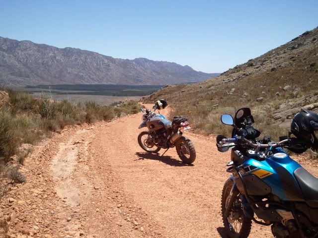
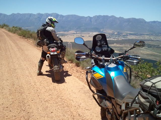
I have been plotting some real old mountain trails or to be more precise the early cape settler’s wagon trails for over a year. The interesting portions are where they crossed the mountains. There are more than 20 documented passes to the North and East of the CT within 100km. Five of these were turned into modern day tar roads, some into hiking and mountain bike trails and some forgotten.
Back to the story … Andy pitched around 8 and we set off. This being my first trip in about six months I took it fairly slow and jumped onto the first railway track I could find. Had to see in the bike works and that I actually remember to ride – it felt that long.
The bike turned into an instant hooligan (just like I remember), down the tracks, over fences, across farm yards, sliding through corners – I just held on for dear life…
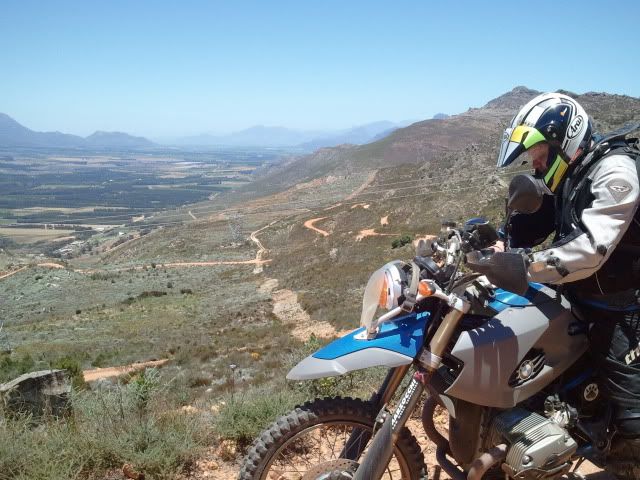
Now, just to put things in perspective, the cartographers of the 1800’s did not have gps units loaded with topographical maps, nor did they have Google Earth so the old maps were left open for interpretation. Or goal was to locate some of the tracks I have identified as old trails. We succeeded to locate five trails on the list although I was actually just looking for three - for the day that was.
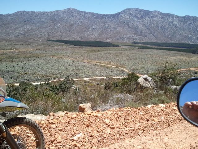
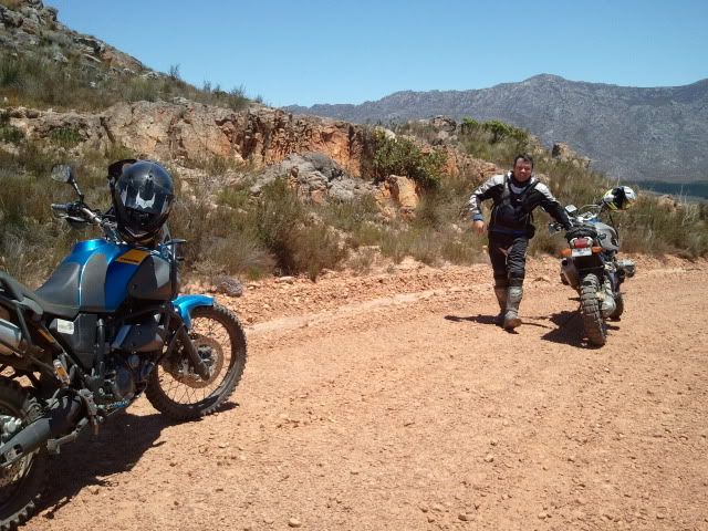
One track was not openly accessible and we continued to look for a “back entrance” to the trail as we heard the farmer is a bit difficult. This means we had to cross some forestry land, cross a mountain range on what looks like a hiking trail and join the track mid-way.
Now neither Andy or myself were actually planning on riding any of the trails, the purpose of the ride was to verify the locations. My hand is not quite fixed or healed properly and Andy’s balance is slightly off, so we were just “looking”. The bikes on the other hand had some different ideas – just checking if this might be the road became riding up some restricted road constantly looking over our showers to if forestry were following….
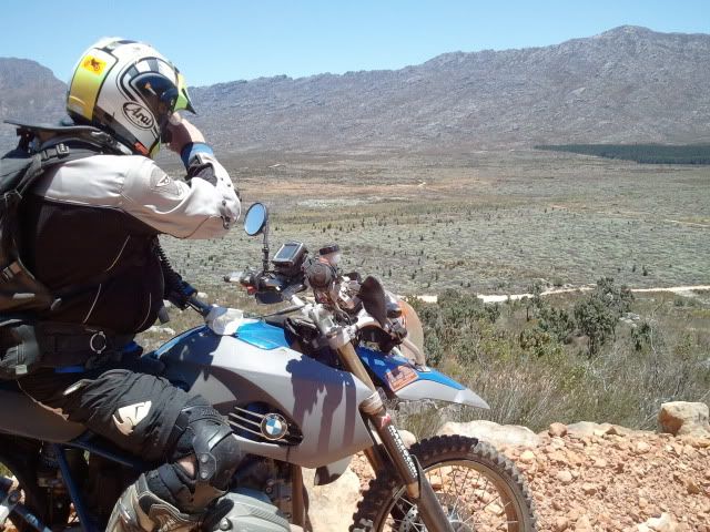
Over the top and out of sight we stopped to take some picks, them heard it… A helicopter, a JetRanger nogal, straight up where we were, it hovered for a sec checking us out (I could almost touch it) it continued and turned – oh f*@k, nous daar k#k! went through both my and Andy’s minds. Funny how the mind thinks up crap when you know you are some place tou think you shouldn’t be.


We continued into the valley found what we were looking for and quietly left again. Coming down the track I was expecting forestry to be waiting, but nothing. At the refuelling stop we asked the locals about the track and they reported that the valley is open to the general public but that some permits were required and could be purchased in Wolseley.
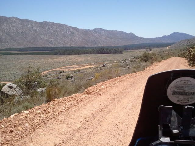
We came back via Slanghoek rd – what a stunning road. Although tar it is really beautiful with some stunning buildings and views of the mountains. From there we crossed DuToits Kloof, stop for a snack at the top and returned home safely.
Andy, thanks for great company along a very tame route.
I have been plotting some real old mountain trails or to be more precise the early cape settler’s wagon trails for over a year. The interesting portions are where they crossed the mountains. There are more than 20 documented passes to the North and East of the CT within 100km. Five of these were turned into modern day tar roads, some into hiking and mountain bike trails and some forgotten.
Back to the story … Andy pitched around 8 and we set off. This being my first trip in about six months I took it fairly slow and jumped onto the first railway track I could find. Had to see in the bike works and that I actually remember to ride – it felt that long.
The bike turned into an instant hooligan (just like I remember), down the tracks, over fences, across farm yards, sliding through corners – I just held on for dear life…
Now, just to put things in perspective, the cartographers of the 1800’s did not have gps units loaded with topographical maps, nor did they have Google Earth so the old maps were left open for interpretation. Or goal was to locate some of the tracks I have identified as old trails. We succeeded to locate five trails on the list although I was actually just looking for three - for the day that was.
One track was not openly accessible and we continued to look for a “back entrance” to the trail as we heard the farmer is a bit difficult. This means we had to cross some forestry land, cross a mountain range on what looks like a hiking trail and join the track mid-way.
Now neither Andy or myself were actually planning on riding any of the trails, the purpose of the ride was to verify the locations. My hand is not quite fixed or healed properly and Andy’s balance is slightly off, so we were just “looking”. The bikes on the other hand had some different ideas – just checking if this might be the road became riding up some restricted road constantly looking over our showers to if forestry were following….
Over the top and out of sight we stopped to take some picks, them heard it… A helicopter, a JetRanger nogal, straight up where we were, it hovered for a sec checking us out (I could almost touch it) it continued and turned – oh f*@k, nous daar k#k! went through both my and Andy’s minds. Funny how the mind thinks up crap when you know you are some place tou think you shouldn’t be.
We continued into the valley found what we were looking for and quietly left again. Coming down the track I was expecting forestry to be waiting, but nothing. At the refuelling stop we asked the locals about the track and they reported that the valley is open to the general public but that some permits were required and could be purchased in Wolseley.
We came back via Slanghoek rd – what a stunning road. Although tar it is really beautiful with some stunning buildings and views of the mountains. From there we crossed DuToits Kloof, stop for a snack at the top and returned home safely.
Andy, thanks for great company along a very tame route.
![image953 [1024x768].jpg](https://cdn.imagearchive.com/wilddog/data/attach/83/83552-image953-1024x768-.jpg)