ianhogg
Race Dog
- Joined
- Apr 24, 2010
- Messages
- 1,510
- Reaction score
- 31
- Location
- 34 Stanbury Street, Proserpine, QLD
- Bike
- Kawasaki Versys
The Bridges of Ngubevu County
A couple of weeks ago my friend Mike sent me an email from JHB asking if I would like to do a Zululand ride with Ben and himself. Ben was testing equipment for his trip through Africa and Mike just wanted a ride. Sounded good to me. My family wants to know why I want to go riding with guys less than half my age but the answer is that they are the only people who ask. My riding partner wife merely does as instructed!
Mike had planned a route through 1000hills to Greytown, through Umvoti to Ngubevu, Pomeroy to Elandskraal through the Mazabeko valley pass (recommended), Rorkes Drift, Isandlwana and then overnight at Babanango valley. Next day to Denny Dalton Gold mine, Inhlazatshe lookout point, Vryheid, Ladysmith, Ingula hydropower site and the Van Reenen tunnel. At that point he would load up on his lift to return to JHB and Ben and I would toddle home to Durbs along the N3. I’ll post the GPS File later. That was largely what we did but not the subject of this ride report which is:
The bridges of Ngubevu and exciting developments to come.
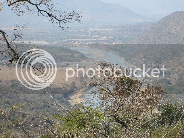
If I had grown up in Ngubevu I think I would have regarded it as the arse end of the universe. It certainly is the end. To the west are the mountains of the Tugela Gorge. To the North the confluence with the Buffels river and Ngbevu river (same map, different spelling). To the East are mountains and the confluence with the Mooi River. If it wasn’t for this particular geographical logjam it would be a great ride from Weenen down the Tugela through the gorge to Shu Shu and beyond.
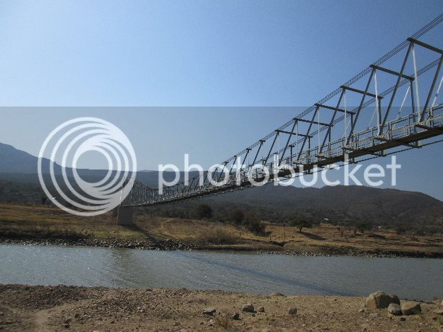
The ANC may have spent the last 20 years of our tax money on Johnny Walker, sushi and Swiss banking but there has been some tax money that they haven’t worked out how to steal yet and that has been at work here. Over a very short time this area has sprouted 5 bridges finished or in gestation. From the Tugela Ferry side we have:
1) S28 45.353 E30 29.249 Suspension bridge built 2013 to Azizi
2) S28 45.556 E30 31.906 existing suspension bridge you saw on TV for poor little school kids
3) S28 44.372 E30 36.202 Ngbevu ford now with bridge pillars for concrete causeway
4) S28 44.388 E30 37.080 Ngubevu Tugela bridge now complete
5) S28 44.380 E30 39.258 proposed new bridge into Tugela Gorge
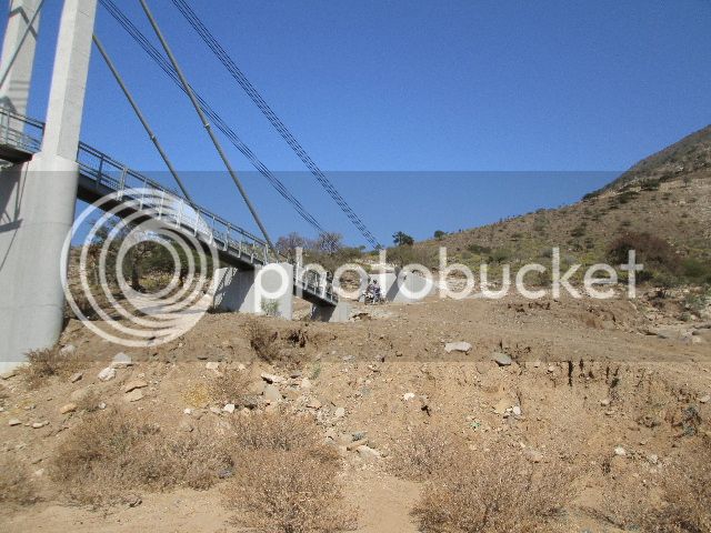
Your next question may be: will the proposed bridge be a concrete deck or a suspension bridge. Answer is that it doesn’t really matter to any of us adventure bikers. See the picture below of a big fat Beemer with panniers the size of shipping containers fitting quite neatly between the railings.
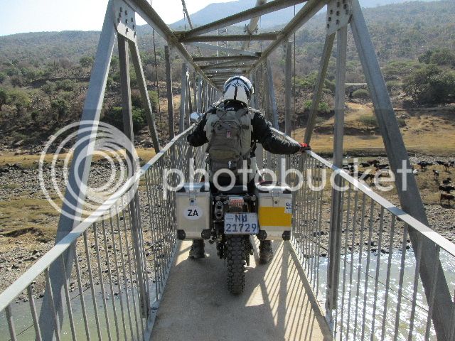
Bridges one and two get you onto the South side. Interesting but not ground breaking (Note: Not Gunda Gunda compliant) The Ngubevu ford and the main Tugela bridge we know about which brings me to the next bridge to be built.
Bridge into Tugela Gorge.
I have looked at this area with Trevorwb and we both agreed that this would be the location of a cattle ford and had planned to look at this from the Jameson drift Tugela Gorge side but have never quite got there. When Ben, Mike & myself got there it was immediately apparent that this was the case. The river is about waist deep and judging by the tracks it is used quite often.
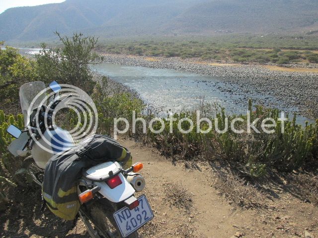
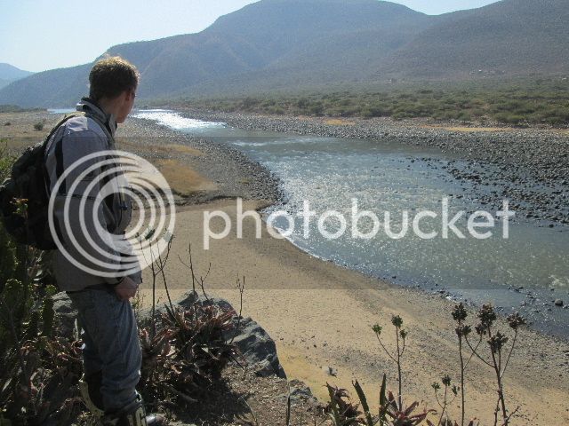
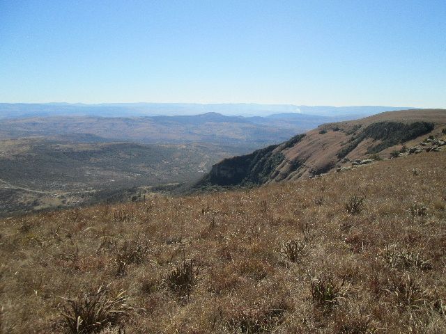
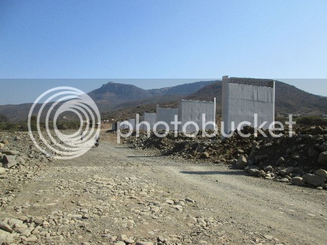
If we had arrived on plastics without pack it would have been do-able. Mike was keen to give it a go anyway but the reality of manhandling a drowned 250kg of Beemer out of the river would have taken the gloss off the day so we skipped it. As we returned to the road we had an interview with a well turned out local who thought we were the engineers coming to start the project. He pointed out the marker beacons for the bridge and told us the the Minister had to come and turn over some sod. His words. Once this bridge is built you will be able to ride almost straight across from Weenen to Tugela Ferry and on to Ulundi through some fantastic terrain. A quick couple of previews for you:


A couple of weeks ago my friend Mike sent me an email from JHB asking if I would like to do a Zululand ride with Ben and himself. Ben was testing equipment for his trip through Africa and Mike just wanted a ride. Sounded good to me. My family wants to know why I want to go riding with guys less than half my age but the answer is that they are the only people who ask. My riding partner wife merely does as instructed!
Mike had planned a route through 1000hills to Greytown, through Umvoti to Ngubevu, Pomeroy to Elandskraal through the Mazabeko valley pass (recommended), Rorkes Drift, Isandlwana and then overnight at Babanango valley. Next day to Denny Dalton Gold mine, Inhlazatshe lookout point, Vryheid, Ladysmith, Ingula hydropower site and the Van Reenen tunnel. At that point he would load up on his lift to return to JHB and Ben and I would toddle home to Durbs along the N3. I’ll post the GPS File later. That was largely what we did but not the subject of this ride report which is:
The bridges of Ngubevu and exciting developments to come.
If I had grown up in Ngubevu I think I would have regarded it as the arse end of the universe. It certainly is the end. To the west are the mountains of the Tugela Gorge. To the North the confluence with the Buffels river and Ngbevu river (same map, different spelling). To the East are mountains and the confluence with the Mooi River. If it wasn’t for this particular geographical logjam it would be a great ride from Weenen down the Tugela through the gorge to Shu Shu and beyond.
The ANC may have spent the last 20 years of our tax money on Johnny Walker, sushi and Swiss banking but there has been some tax money that they haven’t worked out how to steal yet and that has been at work here. Over a very short time this area has sprouted 5 bridges finished or in gestation. From the Tugela Ferry side we have:
1) S28 45.353 E30 29.249 Suspension bridge built 2013 to Azizi
2) S28 45.556 E30 31.906 existing suspension bridge you saw on TV for poor little school kids
3) S28 44.372 E30 36.202 Ngbevu ford now with bridge pillars for concrete causeway
4) S28 44.388 E30 37.080 Ngubevu Tugela bridge now complete
5) S28 44.380 E30 39.258 proposed new bridge into Tugela Gorge
Your next question may be: will the proposed bridge be a concrete deck or a suspension bridge. Answer is that it doesn’t really matter to any of us adventure bikers. See the picture below of a big fat Beemer with panniers the size of shipping containers fitting quite neatly between the railings.

Bridges one and two get you onto the South side. Interesting but not ground breaking (Note: Not Gunda Gunda compliant) The Ngubevu ford and the main Tugela bridge we know about which brings me to the next bridge to be built.
Bridge into Tugela Gorge.
I have looked at this area with Trevorwb and we both agreed that this would be the location of a cattle ford and had planned to look at this from the Jameson drift Tugela Gorge side but have never quite got there. When Ben, Mike & myself got there it was immediately apparent that this was the case. The river is about waist deep and judging by the tracks it is used quite often.


If we had arrived on plastics without pack it would have been do-able. Mike was keen to give it a go anyway but the reality of manhandling a drowned 250kg of Beemer out of the river would have taken the gloss off the day so we skipped it. As we returned to the road we had an interview with a well turned out local who thought we were the engineers coming to start the project. He pointed out the marker beacons for the bridge and told us the the Minister had to come and turn over some sod. His words. Once this bridge is built you will be able to ride almost straight across from Weenen to Tugela Ferry and on to Ulundi through some fantastic terrain. A quick couple of previews for you:


