C
Camelman
Guest
A six centimeter long cricket landed next to me. Couldn't blame him, it was the only shade in the thirty-seven degree heat. I was lying on my back under the bike looking at the kickstand with disgust. My wife was sitting on the side of the road, staring into space, tools in the dust in front of her. We finished our water twenty minutes ago, the one and a half liter lasting us the last three hours. I hated this part of any trip. The part where things go wrong. Murphy dictates that it will always be in the most remote, in-accessible place. And true to form, here we were, ten kilometers from the exit of Hekshoogte pass, a two-path sand and stone nightmare connecting Eksteenfontein with Kotzehoop. Damn Murphy! Who was he anyway!
A week ago my wife and I had stared our yearly vocation by driving with the car to Kotzehoop, located ten kilometers from the Vioolsdrift border post, on the South African side of the Orange River (Now Gariep River??). It was the Monday morning at 0700, five days after we had arrived, that I had the bright idea to return home, fetch the bike, then do the trip back to the same place, but this time sticking as close as possible to the West Coast. The four days preceding this point, we had spent our days kayaking on the river and had explored twenty kilometers of the river up, and downstream of our camp site at Fiddlers Creek. I had finished reading three books, but kept looking at the map, and wondering what that piece of mountain and sand looked like between Alexander bay and Vioolsdrift.
Back home in Cape Town, we bought the luggage frame and soft bags from Topbox's shop. These would contain all our clothes, the soft top-bag, and tank-bag will contain our food, cooking, and eating utensils. We were going to stay in self catering accommodation all the way, but took our lightweight sleeping bags with, just in case. I also strapped on a five liter jerry-can for extra fuel, with the tyre leavers, and fuel nozzle riding on top of the soft top-bag. I weighed the luggage after we packed, and with a empty jerry-can the luggage weighed in at 25kg. That was within spec for the bikes sub-frame. All packed up, with full tanks and us on top, the KTM 950 Adventure weighed approximately 435kg.
Day 1:
Thursday morning after break feast we started out to Lambersbay, which would be our first overnight stop. As usual, it was raining in Cape Town. A quick coffee-stop in Velddrif via the West-coast road, then on to Elands-bay. The gravel road next to the railway line, which is a shortcut in those parts, was so badly washed out, that I stuck to the tar. Twenty kilometers from Lambertsbay the tar ended, and the mud bath began. By the time we reached Lambertsbay, we were covered in mud.
It was the first time I'd been to Lambertsbay, and immediately liked it. We would overnight at Agape Accommodation in Beach road, which was at first one small room, then the hostess upgraded us to a two bedroom apartment set on top of the garage. All for R250. Bargain!
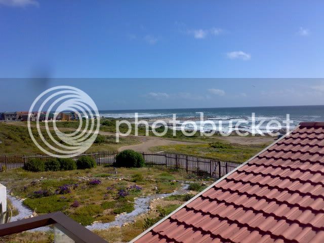
The view from the apartment.
The rest of the afternoon was spent exploring the beach and harbor, which was filled with diamond dredges. These diamond dredges were the size of a fish trawler, with what seemed like a huge vacuum pump sucking sand via a hose into the boat, where it would be filtered for diamonds. The next evening we would overnight in Hondeklipbaai, but from the beginning this was going to be a rough day.
Day 2:
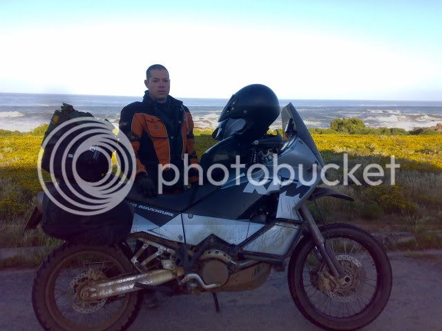
07:00 on Day 2
Reaching the filling station in Lamertsbay, we were told that there was no unleaded. The closest town for fuel would be Graafwater. So off we went to Graafwater. At Graafwater, the same story. The fuel truck was late, we would have to try Clanwilliam. I was already on reserve, and it seemed our trip was going to be stalled. I chastened myself for not filling the jerry-can in Cape Town, but at that time I didn't want the extra weight if I was not going to use it. Little did I know! Now I know you could put LRP into the KTM, but you need to uncouple a wire under your seat, and I was not sure which one, so I rather left it.
The reserve light had been on for the past 10km when we set out for Clanwilliam. I knew we could do at least 50km on reserve, so with luck and sticking to 100km/h we could make it. I silently prayed in my helmet, not to be stuck on the side of the road without fuel. This would be the beginning of a very religious week for us, as we would find out.
Finally we reached Clanwilliam, and filled up. 22l. This means we were running on fumes when we reached the filling station, the trip meter showed 340km. This time I filled the jerry-can as well.
Sticking to the N7 we headed for Klawer, then left on the R363 for Vredendal, Ebenhaeser, then straight for the coast.
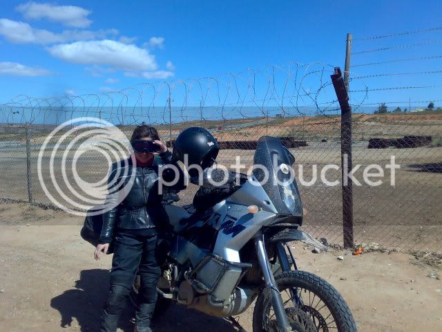
Outside Ebenhaeser
This was tar all the way, and we were making good time, but reaching the Namaqua Sands Mine, I got lost. I had missed a vital turn-off and had ended up in thick sand. After a mission to turn around, I backed tracked, then zoomed in to 30m on the GPS and tried again. This time I found the crossing I missed the first time. The area we were in were criss-crossed with sand paths, and it was no wonder I had missed it, I reckoned! At this stage the GPS showed 59km to Groenrivier. Now you might think me careless after you read what we were about to go through, but at this stage I was on the Southern-Africa streetmaps on the GPS and it showed a road going North, parallel to a track showing on Tracks4Africa, which was closer to the sea. So I reckoned, that this road would be okay. With the GPS showing 30km to go, I was proven wrong. The sometimes sandy two-path jeep track had become a sand-monster, with ruts 40cm deep, and soft sand at the bottom of the rut.
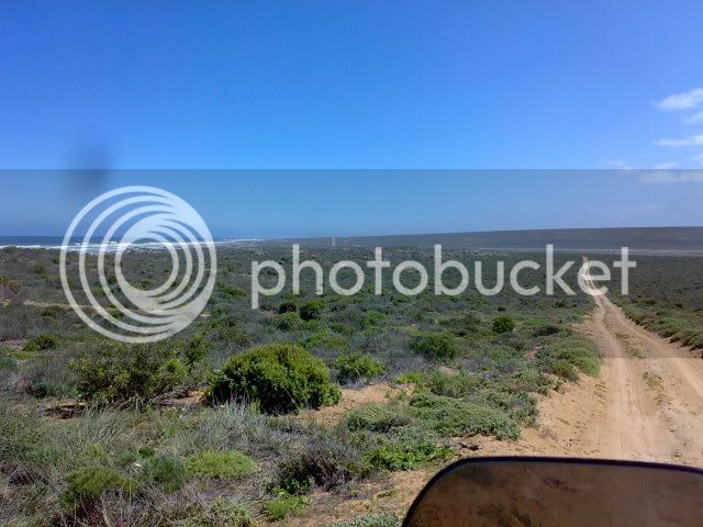
The jeep track.
Riding alone, I would normally have stood up, got my speed up, and rode it normally, but with a half-ton bike and my vroutjie-doutjie on the back, I was really trying not to fall and was grinding in first gear, duck-walking and and almost falling every 50 meters. When we would hit really thick patches of sand, my wife would dis-mount and walk the distance. I would gun it through and wait on the other side. At this rate we would still be stuck in the sand by nightfall, and soon afterwards the reserve light came on. After doing only 150km we were using much more fuel than expected. I emptied the jerry-can in the fuel tanks. 10 seconds each.
We could not turn back, as we would not have enough fuel to reach the filling station. We would have to continue and refuel in Garies. I realized that I would have to ride this road in my normal style, so I stood up, got up to second gear and rode. It was nerve-wrecking and tiring. Every now and again we we hit a really bad section, and I would lose the plot. I would fall on to the seat, and duck-walk like crazy, but I could save the bike every time. As we were doing 20-30km/h and the wind was at our backs at the same speed, there was hardly any air-flow through the radiator. The radiator fan was on but the heat indicator was showing one bar under max. I was also soaking wet in my kit, and sweat was running from my sleeves like water. I actually thought my camelbak had broke when I noticed it the first time! I was worried that I would become tired as my arms, legs and shoulders were aching from the constantly struggle. I hated myself for putting my wife through this. I have been in similar physical states many times during my first 10 years after leaving school, and I knew I could pull through. I had to pull through. There was just no way I was going to let my body give up. No way. I clenched my jaw, and on shaky legs continued.
Although tiring, the scenery was awesome. The barren landscape was green after recent rains, and wildflowers were everywhere. The strong wind had stirred the sea into a frenzy, and with the huge swell hitting the rocks, caused the spray to shoot a incredible height before falling like rain on the rocks below. Twice we came across groups of 4x4's as they camped along the shore. There could have been now where as tranquil and splendid a place to camp as there on the wild coast.
As we stood at the base of the lighthouse at Groenrivier, we thanked God. We had made it. Some quick pictures and a water-break later, we headed for Garies, according to the GPS, the closest fuel.
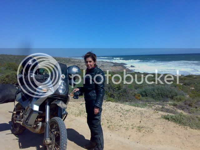
At Groenrivier
The gravel road was full of deep ruts and rocks as the rains the past days had caused some flooding, it seemed. Even though rough, this road was like the highway after our past three hours of hardship. Only one of the two service stations in Garies had fuel. We hastily refueled, bought some water, refilled the camelbak, and headed north on the N1. 7Km out of Garies we turned left on a gravel road and followed the Bitterrivier, then the Spoegrivier.
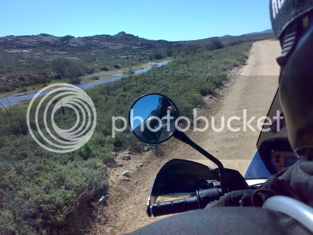
Following the Spoegrivier
The road had been washed away as well, and again the scenery was breathtaking. All the rain and transformed this normally dry landscape into a garden. The wind was blowing strong from our left, which caused me to ride the bike at a angle of 10 degrees, viewing the road between the right handlebar and the screen. After being in the saddle since 07:00, we were looking forward to reaching our destination.
One cannot call Hondeklipbaai a town. Maybe a settlement, with a shop, but not much else. The view houses/huts/shacks were spaced far apart, with the six roads between them. The place where we would overnight was called Skulpieskraal, and was owned by a couple from Midrand in Gauteng. Tired of the city life, and their three kids finished with school and working, they had decided to give it up, and settle here. They had build a tented camp consisting of six tents with two beds each, sheltered with nylon netting from the elements. There was a communal mess and showers. Although rough for R250 per night, the friendliness of the owners and the cleanliness of the bedding and campsite, made for a fabulous experience.
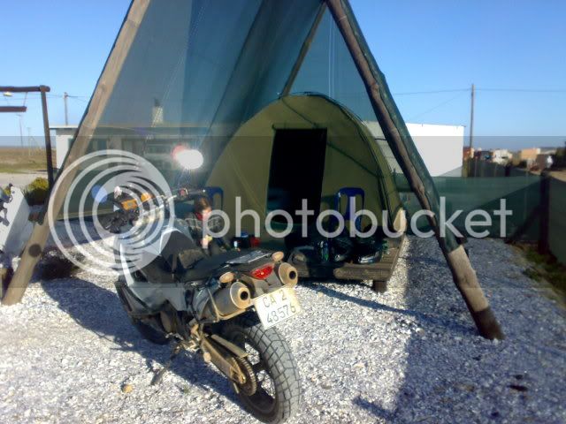
Our gear in front of the tent
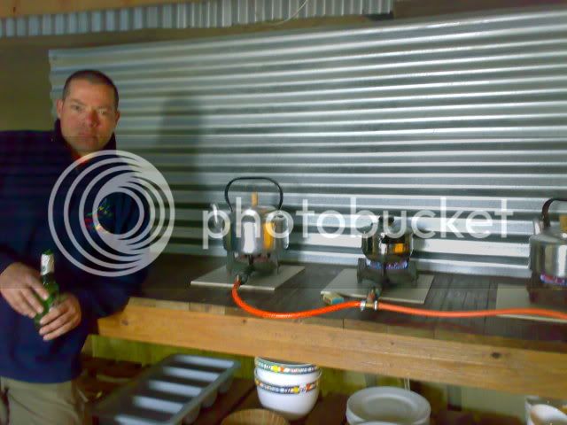
Chowing down in the communal mess area
Tired and weary we warmed our meal of two minute noodles and meatballs in tomato sauce, had a chow, a shower, then went to bed at 20:00. We had ridden 10 hours over rough and unforgiving terrain. I never had a last thought, just slept as my head was on its way to the pillow.
Day 3:
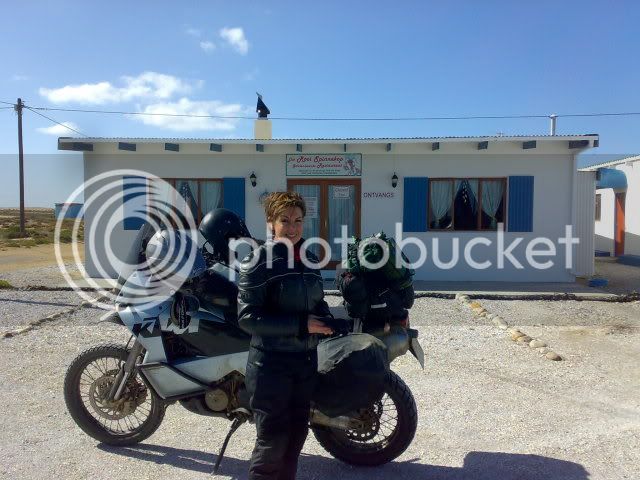
The restaurant at the tented camp which only opens on request, or when the cap is full. We were the only ones. so no luck for us!
I had promised my wife that I would do my best to keep today's route as easy as possible. The shortest route seemed to be via the De Beers mining area. Everyone had informed us that you need to apply in advance for a permit to enter this area, but we though we would give it a shot anyway. It was a breeze. Informing the personnel at the gate that we were only passing through to Port Nolloth, they took down our id numbers from our drivers licenses, and waved us through.
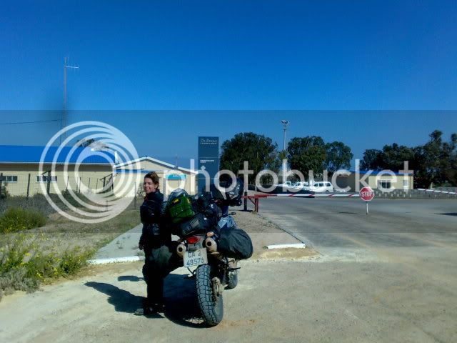
The de Beers entrance gate
The road was all tar to Kleinsee. The straightest tar road I've ever seen. You could see your future and past on that road. Accept to dodge the occasional tortoise crossing the road, the road was open, and we were cruising comfortably at 120km/h. The guards at the first gate had informed the rest of the checkpoints, and we were waved through. From Kleinsee we were back on gravel heading for Port Nolloth, but we could do 100km/h and the Distance to Go indicator on the GPS was clocking down steadily. The landscape was drier here than further south with the mine fence on our left the only sign of civilization. Every now and again we would be able to see the sea. Reaching the R382, we were back on tar and leaning into the cross wind from the left.
Our first stop was the fuel station, then we found the lodging. We had booked a room at a place called Kusweg Akkomodasie, and to our surprise found a 5 bedroom house with everything, including TV and even cd's waiting for us. All for R250. I personally thought that this was the bargain of the century. It was across from the sea, with beautiful views of the coastline. Diamond mining seemed to be the main business at the docks, but the town had everything a small town consists of, a Spar grocery store, pharmacy, cop-shop, hotel, a restaurant and even a gym. The two boat wrecks lying on the rocks, professed to the harshness of the sea in this parts.
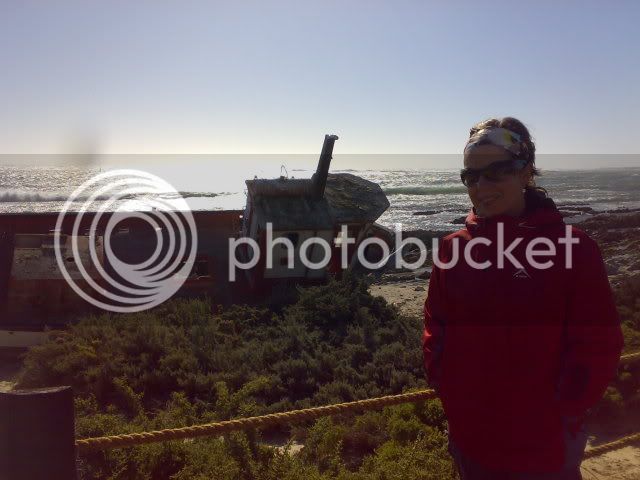
One of the boat wrecks
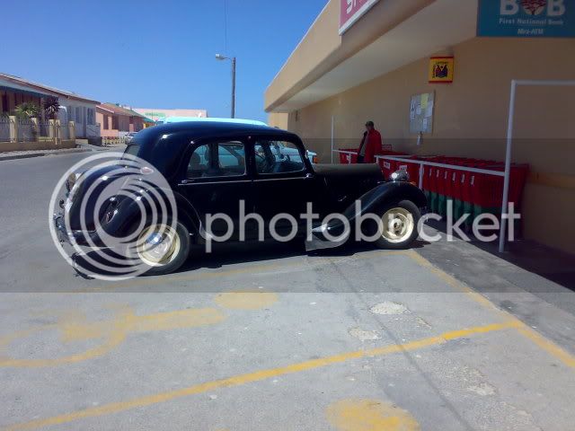
A cool car I found in front of the Spar. It had a big white D badge. Anybody know what the make is?
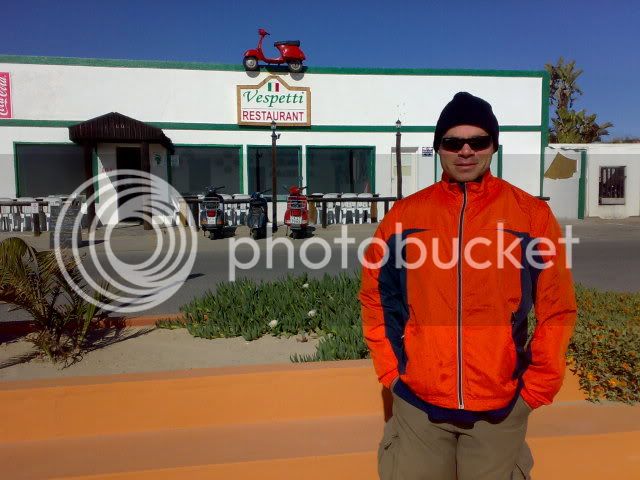
Cool restaurant. Note all the scooters.
To get to the harbor, the boats would have to follow a thin channel of buoys, with a the swell from abeam. Not a easy feat I'm sure. We spent the rest of the afternoon lying around the house, and strolling on the newly erected walkway above the rocks on the beach. The walkway seemed to be the main attraction in town, and while walking we had to dodge a wedding party taking pictures on it. The history of Port Nolloth extends way back and seems it had only had two owners, the Strandlopers, and de Beers. Many moons ago they used to transport ore on small railway trucks pulled by mules, with one of the first locomotives guarding the entrance to the harbour.
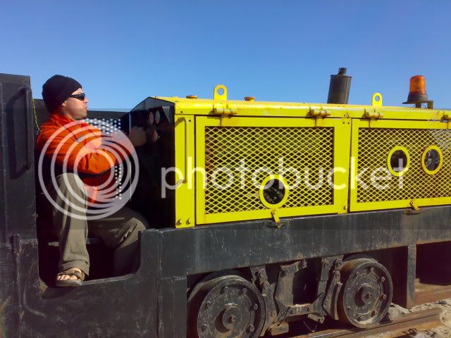
The locomotive at the harbour entrance
The only negative of the accommodation was that my bike had to stand in the road. This made me nervous. So Marie-Louise and I build a ramp, and pushed the bike onto the stoep. I was much happier. We went to bed early, as the following day we would be entering unknown territory with Tracks4Africa our only guidance through the Richtersveld. I had learned my lesson early on, just after my purchase of the Tracks4Africa maps, not to always believe a track showing on the GPS is a road.
On that occasion we were on our way with a fully loaded BMW 650 Dakar to my mom's in Ladismith near Outshoorn. The GPS at that time was the smaller model Garmin eTrex and one could only load waypoints, then link them in a route. It had no moving map feature. 30 km from Ladismith we ended up on a abandoned railway track. The railway had been removed, and only the stones remained. We rode for 12km on those stones. It was extremely tiring. Afterwards I had lost my faith in Tracks4Africa and had always ensured I have a back-up plan should that road not exist, or should it only be a footpath. For the trip through the Richtersveld I had made three DP's or Decision Points. At every DP there would be a alternative route to opt out and get back to the main roads. If we felt that the road was to bad, we could abandon it at any of this points. The last one I made the PNR or Point of No Return. After this, we cannot turn back, and would have to continue forward as we would only have enough fuel to reach Ebenheiser, which was the closest fuel at 60km from Kotzehoop, our destination. Looking at the contour lines along the track we would take, I was excited, but also worried. On those tracks, one would be lucky to see a vehicle in a day. That evening before dark I went over the bike bolt by bolt, and made sure that everything was in order. At 21:00 we were asleep again. We would be up at 05:00 the next day for the final stage to Kotzehoop and two days rest.
A week ago my wife and I had stared our yearly vocation by driving with the car to Kotzehoop, located ten kilometers from the Vioolsdrift border post, on the South African side of the Orange River (Now Gariep River??). It was the Monday morning at 0700, five days after we had arrived, that I had the bright idea to return home, fetch the bike, then do the trip back to the same place, but this time sticking as close as possible to the West Coast. The four days preceding this point, we had spent our days kayaking on the river and had explored twenty kilometers of the river up, and downstream of our camp site at Fiddlers Creek. I had finished reading three books, but kept looking at the map, and wondering what that piece of mountain and sand looked like between Alexander bay and Vioolsdrift.
Back home in Cape Town, we bought the luggage frame and soft bags from Topbox's shop. These would contain all our clothes, the soft top-bag, and tank-bag will contain our food, cooking, and eating utensils. We were going to stay in self catering accommodation all the way, but took our lightweight sleeping bags with, just in case. I also strapped on a five liter jerry-can for extra fuel, with the tyre leavers, and fuel nozzle riding on top of the soft top-bag. I weighed the luggage after we packed, and with a empty jerry-can the luggage weighed in at 25kg. That was within spec for the bikes sub-frame. All packed up, with full tanks and us on top, the KTM 950 Adventure weighed approximately 435kg.
Day 1:
Thursday morning after break feast we started out to Lambersbay, which would be our first overnight stop. As usual, it was raining in Cape Town. A quick coffee-stop in Velddrif via the West-coast road, then on to Elands-bay. The gravel road next to the railway line, which is a shortcut in those parts, was so badly washed out, that I stuck to the tar. Twenty kilometers from Lambertsbay the tar ended, and the mud bath began. By the time we reached Lambertsbay, we were covered in mud.
It was the first time I'd been to Lambertsbay, and immediately liked it. We would overnight at Agape Accommodation in Beach road, which was at first one small room, then the hostess upgraded us to a two bedroom apartment set on top of the garage. All for R250. Bargain!

The view from the apartment.
The rest of the afternoon was spent exploring the beach and harbor, which was filled with diamond dredges. These diamond dredges were the size of a fish trawler, with what seemed like a huge vacuum pump sucking sand via a hose into the boat, where it would be filtered for diamonds. The next evening we would overnight in Hondeklipbaai, but from the beginning this was going to be a rough day.
Day 2:

07:00 on Day 2
Reaching the filling station in Lamertsbay, we were told that there was no unleaded. The closest town for fuel would be Graafwater. So off we went to Graafwater. At Graafwater, the same story. The fuel truck was late, we would have to try Clanwilliam. I was already on reserve, and it seemed our trip was going to be stalled. I chastened myself for not filling the jerry-can in Cape Town, but at that time I didn't want the extra weight if I was not going to use it. Little did I know! Now I know you could put LRP into the KTM, but you need to uncouple a wire under your seat, and I was not sure which one, so I rather left it.
The reserve light had been on for the past 10km when we set out for Clanwilliam. I knew we could do at least 50km on reserve, so with luck and sticking to 100km/h we could make it. I silently prayed in my helmet, not to be stuck on the side of the road without fuel. This would be the beginning of a very religious week for us, as we would find out.
Finally we reached Clanwilliam, and filled up. 22l. This means we were running on fumes when we reached the filling station, the trip meter showed 340km. This time I filled the jerry-can as well.
Sticking to the N7 we headed for Klawer, then left on the R363 for Vredendal, Ebenhaeser, then straight for the coast.

Outside Ebenhaeser
This was tar all the way, and we were making good time, but reaching the Namaqua Sands Mine, I got lost. I had missed a vital turn-off and had ended up in thick sand. After a mission to turn around, I backed tracked, then zoomed in to 30m on the GPS and tried again. This time I found the crossing I missed the first time. The area we were in were criss-crossed with sand paths, and it was no wonder I had missed it, I reckoned! At this stage the GPS showed 59km to Groenrivier. Now you might think me careless after you read what we were about to go through, but at this stage I was on the Southern-Africa streetmaps on the GPS and it showed a road going North, parallel to a track showing on Tracks4Africa, which was closer to the sea. So I reckoned, that this road would be okay. With the GPS showing 30km to go, I was proven wrong. The sometimes sandy two-path jeep track had become a sand-monster, with ruts 40cm deep, and soft sand at the bottom of the rut.

The jeep track.
Riding alone, I would normally have stood up, got my speed up, and rode it normally, but with a half-ton bike and my vroutjie-doutjie on the back, I was really trying not to fall and was grinding in first gear, duck-walking and and almost falling every 50 meters. When we would hit really thick patches of sand, my wife would dis-mount and walk the distance. I would gun it through and wait on the other side. At this rate we would still be stuck in the sand by nightfall, and soon afterwards the reserve light came on. After doing only 150km we were using much more fuel than expected. I emptied the jerry-can in the fuel tanks. 10 seconds each.
We could not turn back, as we would not have enough fuel to reach the filling station. We would have to continue and refuel in Garies. I realized that I would have to ride this road in my normal style, so I stood up, got up to second gear and rode. It was nerve-wrecking and tiring. Every now and again we we hit a really bad section, and I would lose the plot. I would fall on to the seat, and duck-walk like crazy, but I could save the bike every time. As we were doing 20-30km/h and the wind was at our backs at the same speed, there was hardly any air-flow through the radiator. The radiator fan was on but the heat indicator was showing one bar under max. I was also soaking wet in my kit, and sweat was running from my sleeves like water. I actually thought my camelbak had broke when I noticed it the first time! I was worried that I would become tired as my arms, legs and shoulders were aching from the constantly struggle. I hated myself for putting my wife through this. I have been in similar physical states many times during my first 10 years after leaving school, and I knew I could pull through. I had to pull through. There was just no way I was going to let my body give up. No way. I clenched my jaw, and on shaky legs continued.
Although tiring, the scenery was awesome. The barren landscape was green after recent rains, and wildflowers were everywhere. The strong wind had stirred the sea into a frenzy, and with the huge swell hitting the rocks, caused the spray to shoot a incredible height before falling like rain on the rocks below. Twice we came across groups of 4x4's as they camped along the shore. There could have been now where as tranquil and splendid a place to camp as there on the wild coast.
As we stood at the base of the lighthouse at Groenrivier, we thanked God. We had made it. Some quick pictures and a water-break later, we headed for Garies, according to the GPS, the closest fuel.

At Groenrivier
The gravel road was full of deep ruts and rocks as the rains the past days had caused some flooding, it seemed. Even though rough, this road was like the highway after our past three hours of hardship. Only one of the two service stations in Garies had fuel. We hastily refueled, bought some water, refilled the camelbak, and headed north on the N1. 7Km out of Garies we turned left on a gravel road and followed the Bitterrivier, then the Spoegrivier.

Following the Spoegrivier
The road had been washed away as well, and again the scenery was breathtaking. All the rain and transformed this normally dry landscape into a garden. The wind was blowing strong from our left, which caused me to ride the bike at a angle of 10 degrees, viewing the road between the right handlebar and the screen. After being in the saddle since 07:00, we were looking forward to reaching our destination.
One cannot call Hondeklipbaai a town. Maybe a settlement, with a shop, but not much else. The view houses/huts/shacks were spaced far apart, with the six roads between them. The place where we would overnight was called Skulpieskraal, and was owned by a couple from Midrand in Gauteng. Tired of the city life, and their three kids finished with school and working, they had decided to give it up, and settle here. They had build a tented camp consisting of six tents with two beds each, sheltered with nylon netting from the elements. There was a communal mess and showers. Although rough for R250 per night, the friendliness of the owners and the cleanliness of the bedding and campsite, made for a fabulous experience.

Our gear in front of the tent

Chowing down in the communal mess area
Tired and weary we warmed our meal of two minute noodles and meatballs in tomato sauce, had a chow, a shower, then went to bed at 20:00. We had ridden 10 hours over rough and unforgiving terrain. I never had a last thought, just slept as my head was on its way to the pillow.
Day 3:

The restaurant at the tented camp which only opens on request, or when the cap is full. We were the only ones. so no luck for us!
I had promised my wife that I would do my best to keep today's route as easy as possible. The shortest route seemed to be via the De Beers mining area. Everyone had informed us that you need to apply in advance for a permit to enter this area, but we though we would give it a shot anyway. It was a breeze. Informing the personnel at the gate that we were only passing through to Port Nolloth, they took down our id numbers from our drivers licenses, and waved us through.

The de Beers entrance gate
The road was all tar to Kleinsee. The straightest tar road I've ever seen. You could see your future and past on that road. Accept to dodge the occasional tortoise crossing the road, the road was open, and we were cruising comfortably at 120km/h. The guards at the first gate had informed the rest of the checkpoints, and we were waved through. From Kleinsee we were back on gravel heading for Port Nolloth, but we could do 100km/h and the Distance to Go indicator on the GPS was clocking down steadily. The landscape was drier here than further south with the mine fence on our left the only sign of civilization. Every now and again we would be able to see the sea. Reaching the R382, we were back on tar and leaning into the cross wind from the left.
Our first stop was the fuel station, then we found the lodging. We had booked a room at a place called Kusweg Akkomodasie, and to our surprise found a 5 bedroom house with everything, including TV and even cd's waiting for us. All for R250. I personally thought that this was the bargain of the century. It was across from the sea, with beautiful views of the coastline. Diamond mining seemed to be the main business at the docks, but the town had everything a small town consists of, a Spar grocery store, pharmacy, cop-shop, hotel, a restaurant and even a gym. The two boat wrecks lying on the rocks, professed to the harshness of the sea in this parts.

One of the boat wrecks

A cool car I found in front of the Spar. It had a big white D badge. Anybody know what the make is?

Cool restaurant. Note all the scooters.
To get to the harbor, the boats would have to follow a thin channel of buoys, with a the swell from abeam. Not a easy feat I'm sure. We spent the rest of the afternoon lying around the house, and strolling on the newly erected walkway above the rocks on the beach. The walkway seemed to be the main attraction in town, and while walking we had to dodge a wedding party taking pictures on it. The history of Port Nolloth extends way back and seems it had only had two owners, the Strandlopers, and de Beers. Many moons ago they used to transport ore on small railway trucks pulled by mules, with one of the first locomotives guarding the entrance to the harbour.

The locomotive at the harbour entrance
The only negative of the accommodation was that my bike had to stand in the road. This made me nervous. So Marie-Louise and I build a ramp, and pushed the bike onto the stoep. I was much happier. We went to bed early, as the following day we would be entering unknown territory with Tracks4Africa our only guidance through the Richtersveld. I had learned my lesson early on, just after my purchase of the Tracks4Africa maps, not to always believe a track showing on the GPS is a road.
On that occasion we were on our way with a fully loaded BMW 650 Dakar to my mom's in Ladismith near Outshoorn. The GPS at that time was the smaller model Garmin eTrex and one could only load waypoints, then link them in a route. It had no moving map feature. 30 km from Ladismith we ended up on a abandoned railway track. The railway had been removed, and only the stones remained. We rode for 12km on those stones. It was extremely tiring. Afterwards I had lost my faith in Tracks4Africa and had always ensured I have a back-up plan should that road not exist, or should it only be a footpath. For the trip through the Richtersveld I had made three DP's or Decision Points. At every DP there would be a alternative route to opt out and get back to the main roads. If we felt that the road was to bad, we could abandon it at any of this points. The last one I made the PNR or Point of No Return. After this, we cannot turn back, and would have to continue forward as we would only have enough fuel to reach Ebenheiser, which was the closest fuel at 60km from Kotzehoop, our destination. Looking at the contour lines along the track we would take, I was excited, but also worried. On those tracks, one would be lucky to see a vehicle in a day. That evening before dark I went over the bike bolt by bolt, and made sure that everything was in order. At 21:00 we were asleep again. We would be up at 05:00 the next day for the final stage to Kotzehoop and two days rest.


