You are using an out of date browser. It may not display this or other websites correctly.
You should upgrade or use an alternative browser.
You should upgrade or use an alternative browser.
To the Lungs of the Earth
- Thread starter NiteOwl
- Start date
This site may earn a commission from merchant affiliate
links, including eBay, Amazon, and others.
Clockwork Orange
Race Dog
- Joined
- May 22, 2006
- Messages
- 2,784
- Reaction score
- 113
- Location
- United Kingdom
- Bike
- KTM 990 Adventure
Those scenes from Angola are amazing. Thanks again for the updates :thumleft:
- Joined
- Aug 5, 2010
- Messages
- 2,054
- Reaction score
- 327
- Location
- Hout Bay
- Bike
- KTM 890 Adventure R Rally
With travel being severely restricted at the moment reports like this at least let us dream. Very nice so far.
NiteOwl
Pack Dog
- Joined
- Dec 31, 2012
- Messages
- 98
- Reaction score
- 0
- Location
- Office Adventurer
- Bike
- Honda XRV 750 Africa Twin
Thanks for the positive comments.
This trip report may be getting rather long, but when I did the planning I found information about Angola beyond the Doodsakker, as well as the equator region, really elusive.
Hopefully this report will provide a better insight into a country that is still there to be explored, with virtually non-existent tourist infrastructure. The flip side of that is, of course, that is still unspoilt by the inevitable march of development, with great vistas especially along the coastal route. Although this is supposed to be a malaria area, the southern semi-desert area (Namibe) and the highlands are probably quite safe.
As a bonus, you can camp just about anywhere so it's possible to save on accommodation and fuel (which is about half the price in South Africa). Despite the widespread poverty there is virtually no begging, and we found the police very helpful.
The main stumbling block, apart from the present covid crisis, is the sheer distance involved just to reach the border- around 2400km. Even on a big bike, that would take at least three days from Gauteng.
I will provide some statistics at the tail of this tale.
NiteOwl
Pack Dog
- Joined
- Dec 31, 2012
- Messages
- 98
- Reaction score
- 0
- Location
- Office Adventurer
- Bike
- Honda XRV 750 Africa Twin
There are some people who will actively seek out gravel tracks, sand dunes or riverbeds to get their biking kicks. I’m not one of them. For the long trips that we do, I will take the most suitable and interesting roads to balance pleasure, effort and risk.
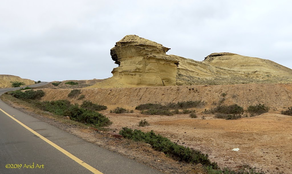
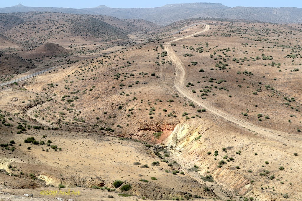
So we happily hit a pristine tar road again, which winds its way through more spectacular landscapes all the way to Namibe (Moçamedes).
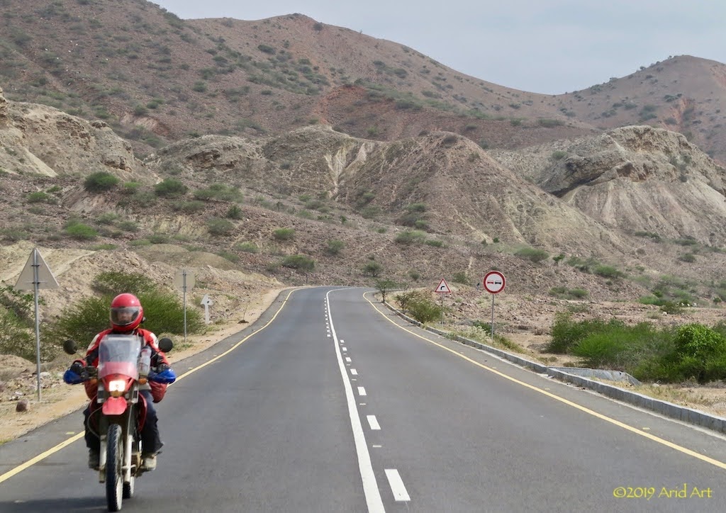
The wind erosion and iridescent mineral layers are reminiscent of South America.
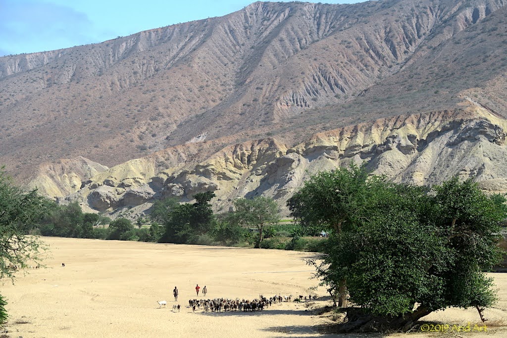
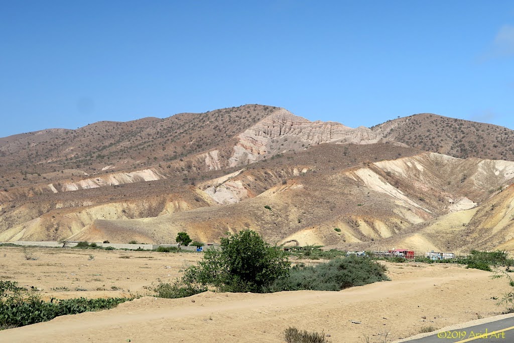
The variety is amazing.
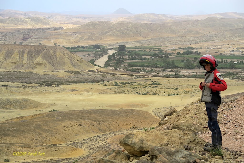
So come along for the ride!
[youtube]https://youtu.be/KXygxbSf3LQ [/youtube]
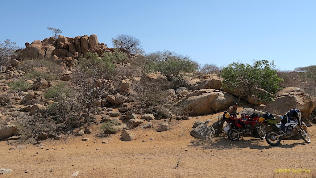
Time for some lunch in a shady spot ...
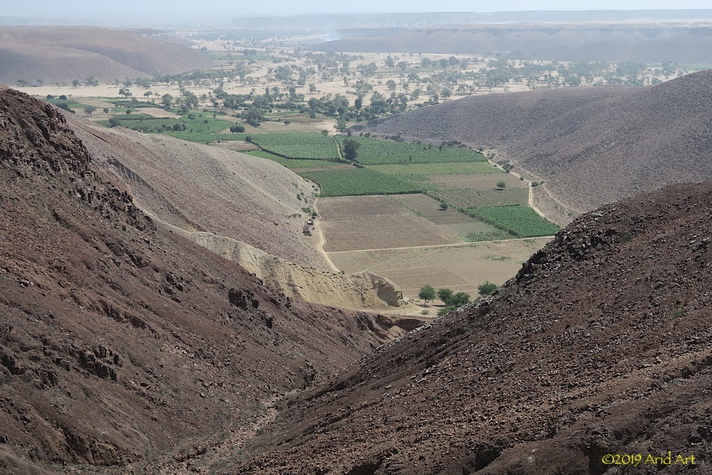
... before the descent down to the coast.
We refuel on the outskirts of Namibe, and head for the boulevard along the beach.
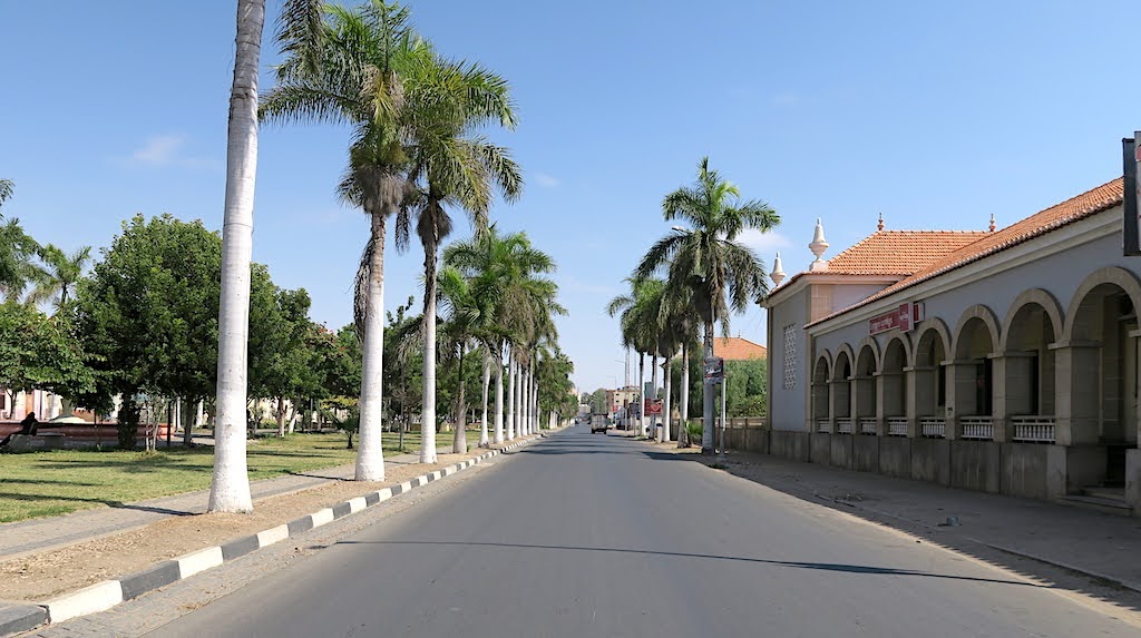
It’s a classic Portuguese layout, with colourful buildings lining the street.
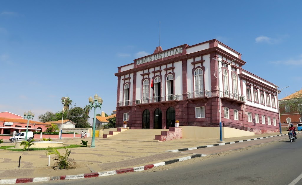
Of course, a visit to Flamingo Lodge is de rigueur for any SA biker worth his/ her salt, so that’s where we’re heading next. Since we haven’t done the Doodsakker route, we pass the airfield toward Tombua to turn off at the Rio Flamingo riverbed: the “standard” approach.
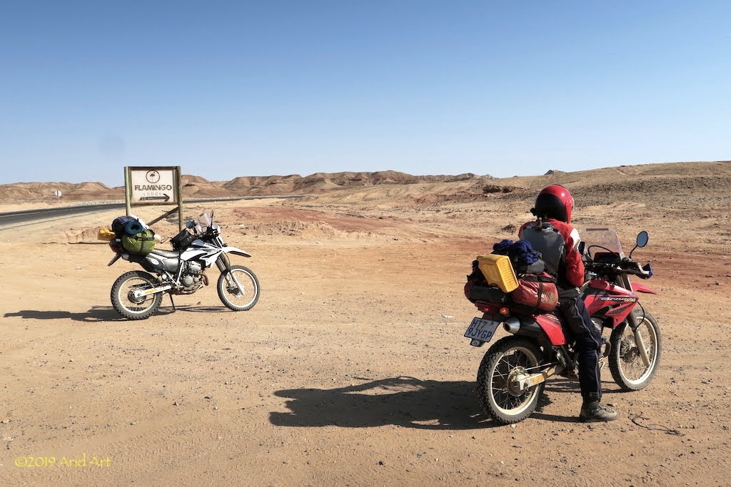
Looking at the Dakar guys, there must be a way to ride this loose stuff once you pick up enough speed, but the combined lack of horsepower and talent count heavily against us. And our clutches.
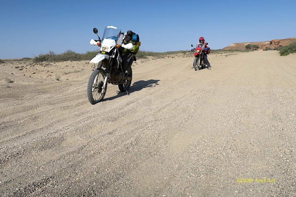
I rarely turn back on a route- if it starts badly it can only get better- but after one kilometre in the riverbed we leave the other 22km behind us and get back onto the Namibe-Tombua road. Today, discretion is the better part of valour.
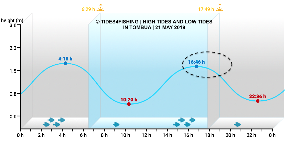
According to T4A there is another route over the dunes from the airport, after which it should be possible to ride along the beach. Sounds much easier, right?
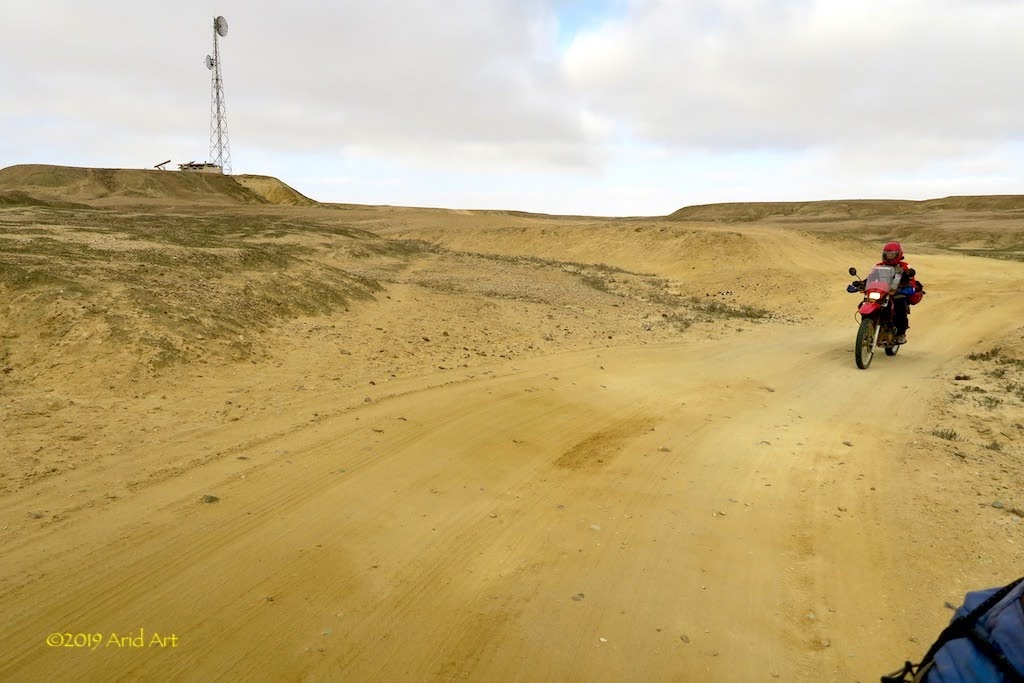
Twenty minutes later, we find a firm gravel road heading seawards- the beach road. Initial progress is good, but as I’m about to pat myself mentally on the back for my discretion, we hit the dunes.
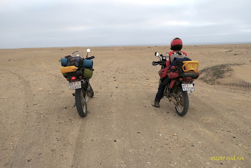
Instead of heading straight towards the sea, the tracks run southwards, parallel to the beach. It’s thick sand and our progress slows down to a crawl. It takes another kilometre or so before we can see the sea, and I cut across the dunes to reach the beach.
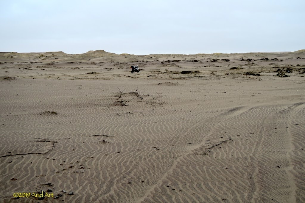
Unfortunately it’s high tide, and the sand is soft everywhere. Better to stay on the fishermen's tracks.
Most of the time the rear tyre digs in and the only way to move is to help the bike by paddling it along.
Every now and then we get some traction, and on the GPS Flamingo Lodge slowly creeps closer. It’s dusk when we see a huge sandy hill looming in front of us.
Progress on a level track has been tedious, but this is a bridge (hill?) too far, even with our tyres deflated to 1 bar.
I park my bike and climb to the top whilst waiting for my wife to catch up. The lodge is still 10km from here, but unfortunately there is no cellphone signal even up at the top. Oops.
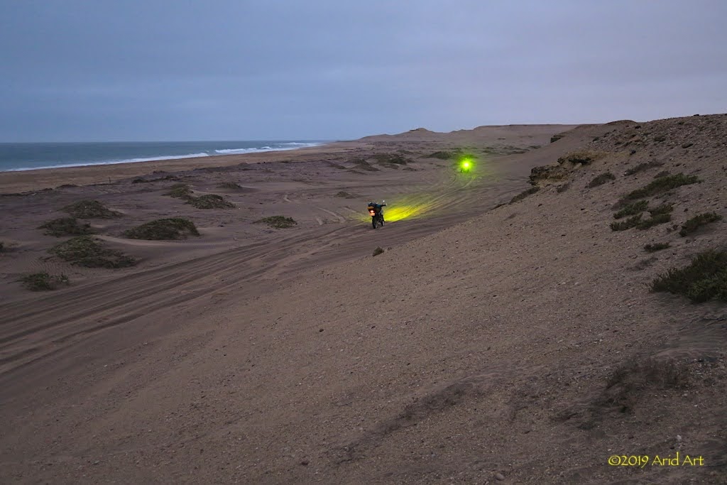
We explore the options, but going around this obstacle is not possible because the water is right up against the rocky side, and navigating that in the dark is a bad idea.
A local fisherman passed us early on the sandy track, but we have seen no-one since. Then, in the distance, we see a bakkie labouring towards us. It’s got Gauteng plates, and inside it are three South Africans on a fishing holiday; a father and his two beefy sons. They are on their way back to Flamingo Lodge. Suddenly, help is at hand!
I hop on my bike and follow the bakkie, with a son on either side pushing for all they’re worth. I spray them with sand, and manage to get to the top without dropping the bike. We’re all a bit out of breath, but… there’s another bike to get up here. It’s hard work for men and machines, but eventually we are all at the top of the hill.
We’re now on the gruispad to the lodge. From here, it’s “less hard, I did not say easy”, the father explains. Indeed, this pad is just as sandy as the tracks that got us this far. It’s funny how, in stressful situations like this, one does not always think of ways to make your life easier. Like dumping our luggage on the bakkie! Instead, we do lots of pushing, paddling and spinning for the next two hours with our helpers patiently leading the way.
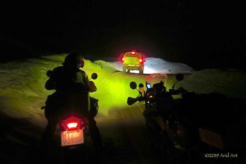
It’s eight o’clock by the time we pull up at the well known entrance to Flamingo Lodge. We’re welcomed by the owner, Rico Sakko, but he’s unimpressed with our sand riding skills.
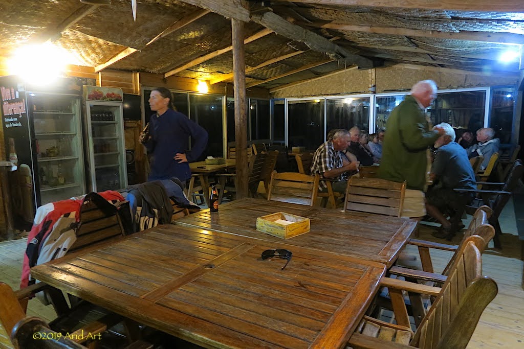
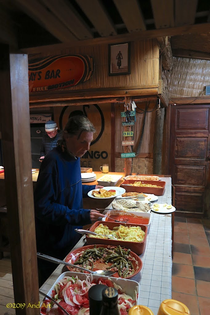
A touring party from Bredasdorp is finishing their dinner, and we are invited to help ourselves to the buffet on offer. It’s a generous spread, and the beer is even more welcome.
It’s great being able to communicate without a language barrier, and Rico knows this country intimately. He has been here right through the civil war, seen it all, never left.
The touring party is camping, so all of the chalets are available. We’re sweaty and smelly and despite the steep price, the thought of a hot shower and a proper bed after the effort of getting here is too much to resist. There’s the niggling problem of getting back out of here, but that’s tomorrow’s problem.
So we happily hit a pristine tar road again, which winds its way through more spectacular landscapes all the way to Namibe (Moçamedes).
The wind erosion and iridescent mineral layers are reminiscent of South America.
The variety is amazing.
So come along for the ride!
[youtube]https://youtu.be/KXygxbSf3LQ [/youtube]
Time for some lunch in a shady spot ...
... before the descent down to the coast.
We refuel on the outskirts of Namibe, and head for the boulevard along the beach.
It’s a classic Portuguese layout, with colourful buildings lining the street.
Of course, a visit to Flamingo Lodge is de rigueur for any SA biker worth his/ her salt, so that’s where we’re heading next. Since we haven’t done the Doodsakker route, we pass the airfield toward Tombua to turn off at the Rio Flamingo riverbed: the “standard” approach.
Looking at the Dakar guys, there must be a way to ride this loose stuff once you pick up enough speed, but the combined lack of horsepower and talent count heavily against us. And our clutches.
I rarely turn back on a route- if it starts badly it can only get better- but after one kilometre in the riverbed we leave the other 22km behind us and get back onto the Namibe-Tombua road. Today, discretion is the better part of valour.
According to T4A there is another route over the dunes from the airport, after which it should be possible to ride along the beach. Sounds much easier, right?
Twenty minutes later, we find a firm gravel road heading seawards- the beach road. Initial progress is good, but as I’m about to pat myself mentally on the back for my discretion, we hit the dunes.
Instead of heading straight towards the sea, the tracks run southwards, parallel to the beach. It’s thick sand and our progress slows down to a crawl. It takes another kilometre or so before we can see the sea, and I cut across the dunes to reach the beach.
Unfortunately it’s high tide, and the sand is soft everywhere. Better to stay on the fishermen's tracks.
Most of the time the rear tyre digs in and the only way to move is to help the bike by paddling it along.
Every now and then we get some traction, and on the GPS Flamingo Lodge slowly creeps closer. It’s dusk when we see a huge sandy hill looming in front of us.
Progress on a level track has been tedious, but this is a bridge (hill?) too far, even with our tyres deflated to 1 bar.
I park my bike and climb to the top whilst waiting for my wife to catch up. The lodge is still 10km from here, but unfortunately there is no cellphone signal even up at the top. Oops.
We explore the options, but going around this obstacle is not possible because the water is right up against the rocky side, and navigating that in the dark is a bad idea.
A local fisherman passed us early on the sandy track, but we have seen no-one since. Then, in the distance, we see a bakkie labouring towards us. It’s got Gauteng plates, and inside it are three South Africans on a fishing holiday; a father and his two beefy sons. They are on their way back to Flamingo Lodge. Suddenly, help is at hand!
I hop on my bike and follow the bakkie, with a son on either side pushing for all they’re worth. I spray them with sand, and manage to get to the top without dropping the bike. We’re all a bit out of breath, but… there’s another bike to get up here. It’s hard work for men and machines, but eventually we are all at the top of the hill.
We’re now on the gruispad to the lodge. From here, it’s “less hard, I did not say easy”, the father explains. Indeed, this pad is just as sandy as the tracks that got us this far. It’s funny how, in stressful situations like this, one does not always think of ways to make your life easier. Like dumping our luggage on the bakkie! Instead, we do lots of pushing, paddling and spinning for the next two hours with our helpers patiently leading the way.
It’s eight o’clock by the time we pull up at the well known entrance to Flamingo Lodge. We’re welcomed by the owner, Rico Sakko, but he’s unimpressed with our sand riding skills.
A touring party from Bredasdorp is finishing their dinner, and we are invited to help ourselves to the buffet on offer. It’s a generous spread, and the beer is even more welcome.
It’s great being able to communicate without a language barrier, and Rico knows this country intimately. He has been here right through the civil war, seen it all, never left.
The touring party is camping, so all of the chalets are available. We’re sweaty and smelly and despite the steep price, the thought of a hot shower and a proper bed after the effort of getting here is too much to resist. There’s the niggling problem of getting back out of here, but that’s tomorrow’s problem.
Rooi Wolf
Race Dog
Such a good read. Beautiful pictures to boost!
Thanks for taking time out to share ur epic journey!
Thanks for taking time out to share ur epic journey!
Crossed-up
Pangaman
I am so enjoying this "Role of Honour" RR!
Looking forward to the rest.
Looking forward to the rest.
NiteOwl
Pack Dog
- Joined
- Dec 31, 2012
- Messages
- 98
- Reaction score
- 0
- Location
- Office Adventurer
- Bike
- Honda XRV 750 Africa Twin
We need to get make progress in getting home, and although the setting of the lodge is pretty, it’s wet and windy.
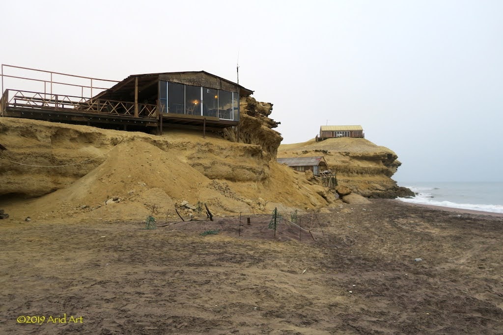
If you’re not a fisherman, it’s difficult to find a reason to hang around here, and we really don’t want to repeat last night’s effort to get back to Namibe. Rico says it will be a doddle if we ride along the beach, as low tide is approaching and the sand is kliphard.
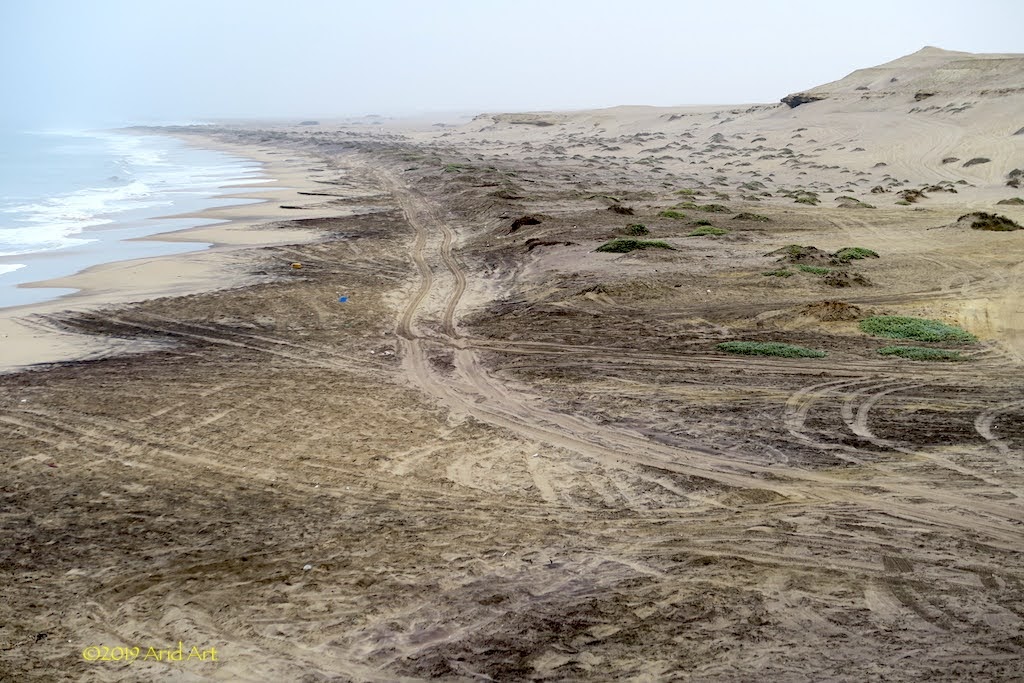
After breakfast, I ride out to the beach test this statement and sure enough, once I get close to the waterline, traction is good. To put the cherry on top, the lodge’s bakkie has to fetch supplies from Namibe and will guide us along the beach. And take our luggage. Whoohoo!
Back at the campsite, the tour group is just getting their breakfast. Our guides of last night, the Carstens, are nowhere to be seen- gone fishin' !
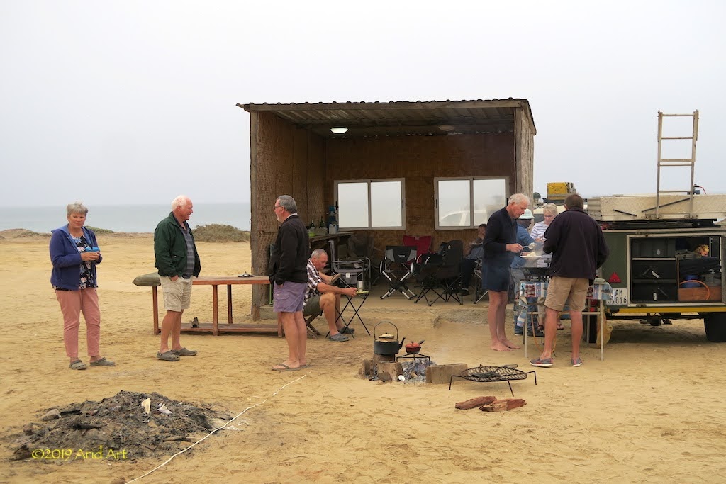
It looks like only Toyotas are allowed to come along …
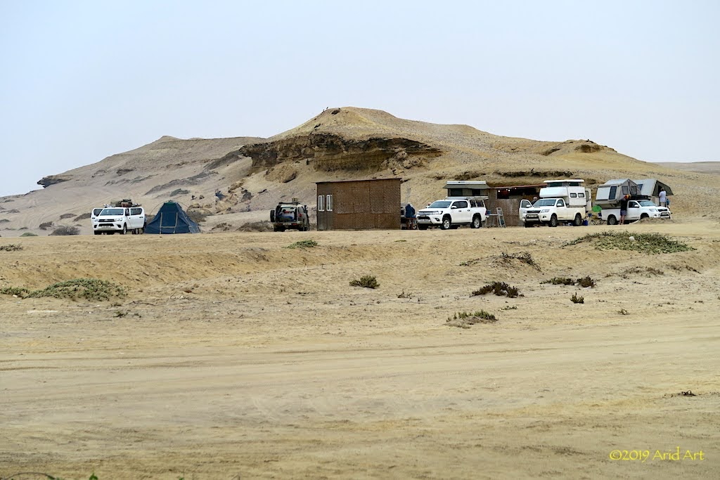
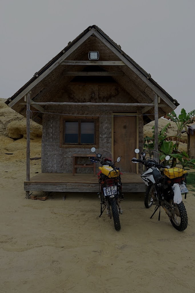
Soon enough Emile, who works at the lodge as a guide, pulls up in a Voetspore-branded Land Cruiser (another Toyota!) in front of our cabin.
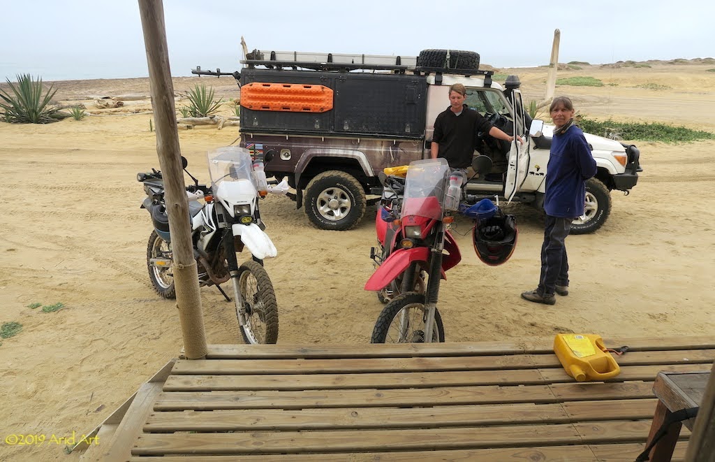
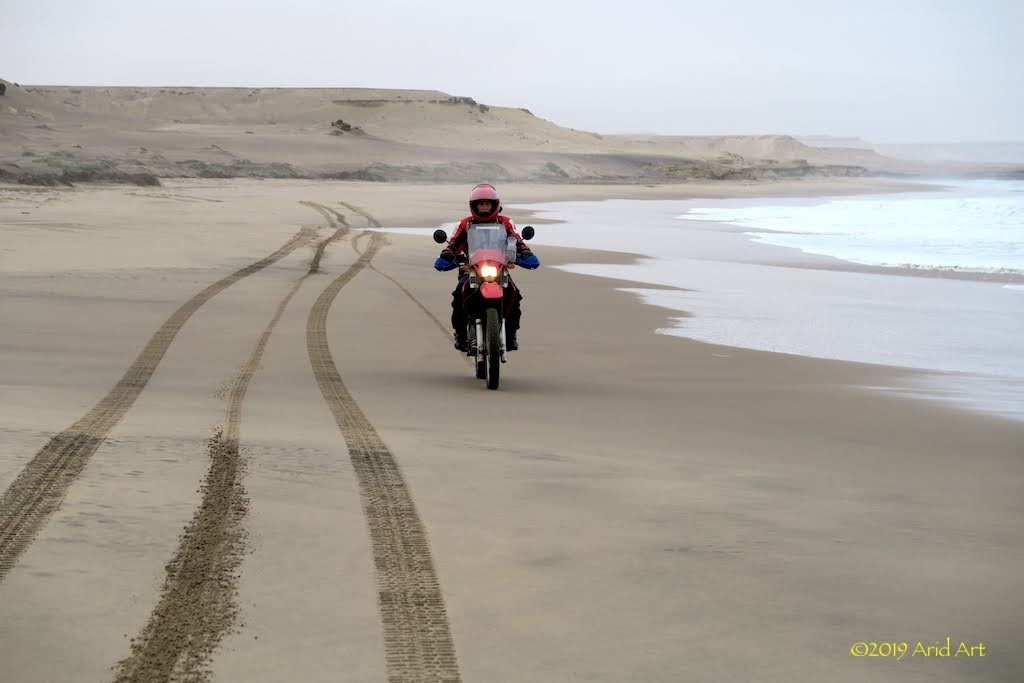
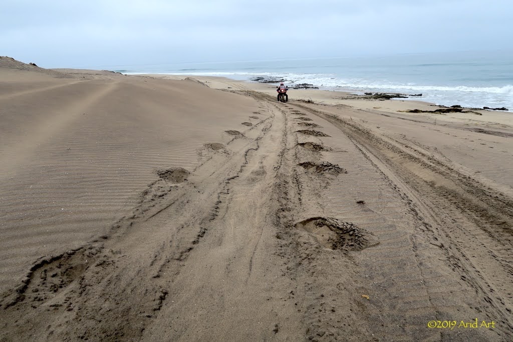
We load up our luggage, settle the bill and off we go. It’s way easier than last night and actually good fun. With decent traction we can really let rip along the edge of the waterline, following Emile’s tracks.
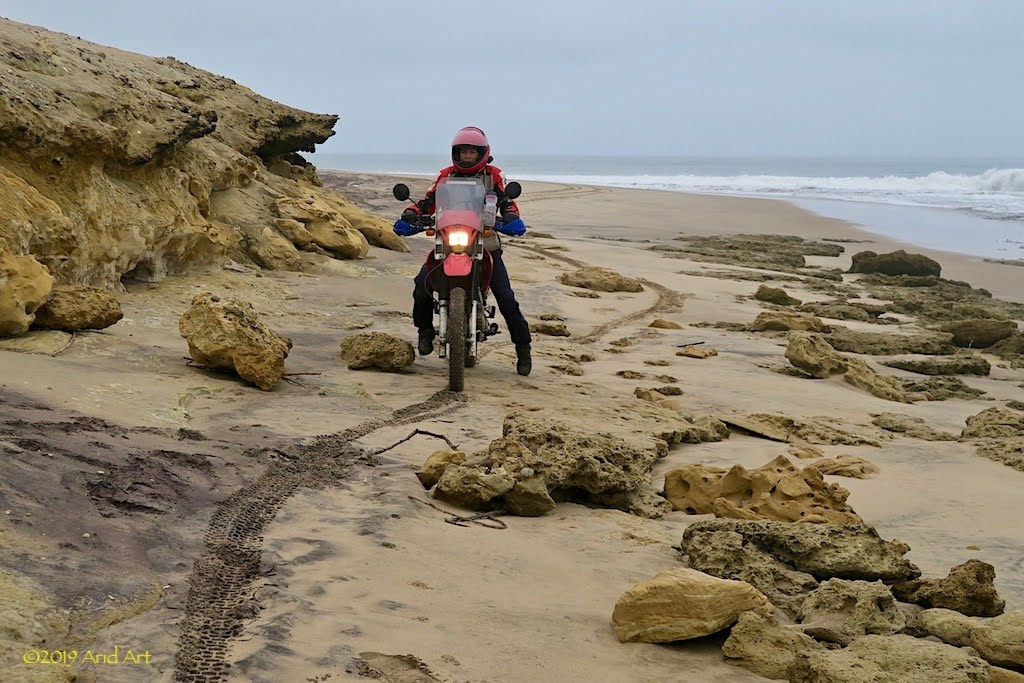
But it’s not all plain sailing. Every kilometre or so there are rocky outcrops which force us back onto last night’s tracks.
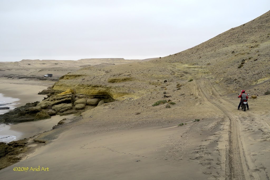
It’s fine if you can maintain momentum, dismal if you stop. Spot the paddleprints.
Other rocky sections have gaps that we can get through, while the bakkie has to do a detour.
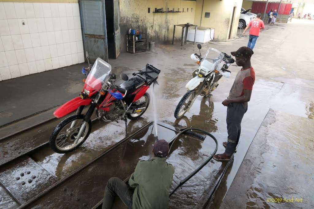
All too soon we are back on the clay track towards the airport, where Emile stops to hand us our luggage back. After re-inflating the tyres, we do the last bit back to the tar and in Namibe, Emile directs us to a washbay as we need to get rid of that salt water. Once again, everything is unpacked and the bikes get a thorough hosing.
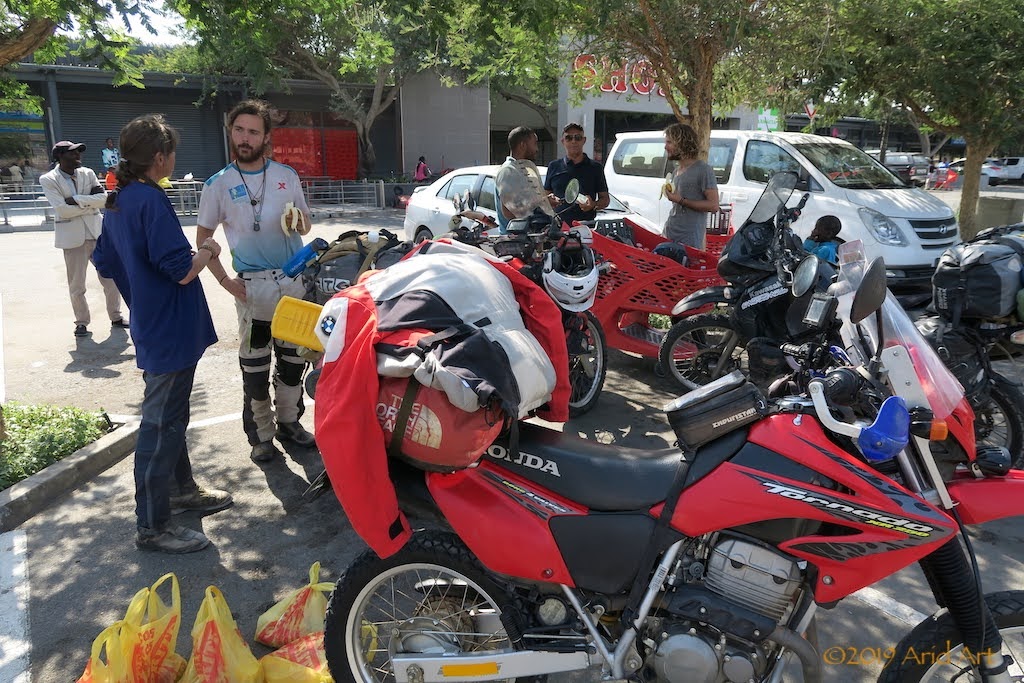
Our destination for today is Lubango, due east from here, but we need to stock up on a few things before we go. Namibe also has a Shoprite, and when we pull into the parking lot we find two packmules:
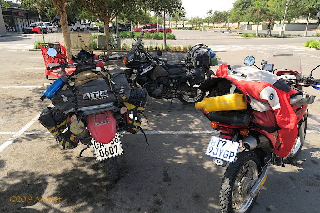
It’s not hard to spot the owners inside the supermarket. They turn out to be two friends from Cape Town who are on their way to Croatia, via Morocco and Spain. Marcel and Caz have come through Lubango from Namibia and even managed to ride up van Zyl’s Pass with their overloaded KLRs packed with every conceivable widget and gadget, including a drone and some sponsored wazoogies! But they wisely decided to give Flamingo Lodge a miss. You can read about their trip here: https://www.instagram.com/thewestcoastwander/?hl=en
We exchange stories and discuss the route via Dombe Grande pass.
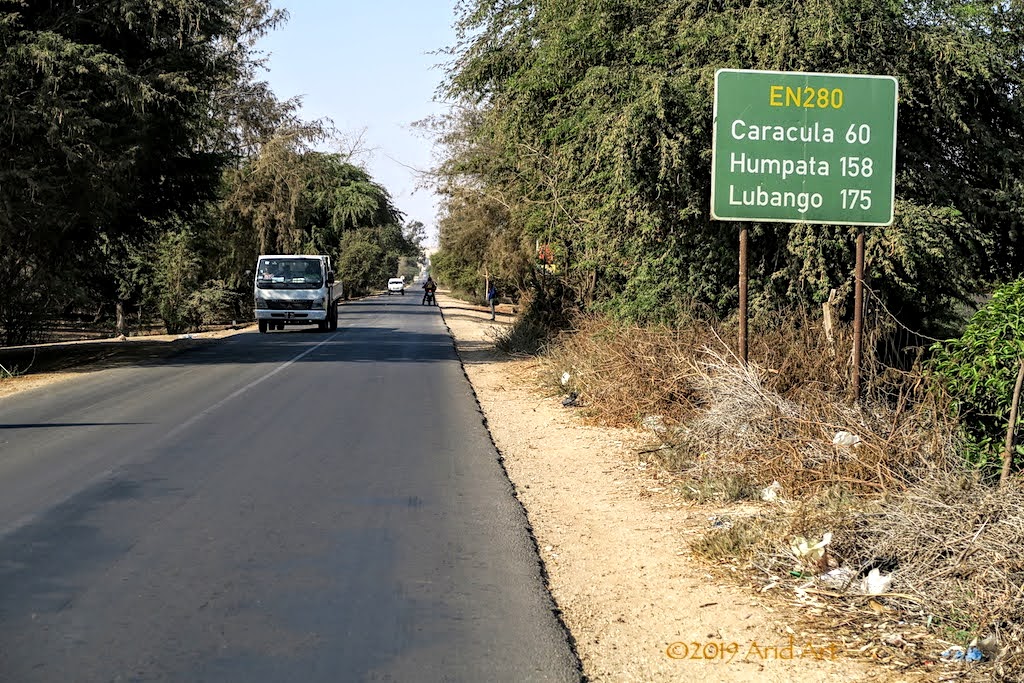
We depart together, taking each other’s routes in reverse. Our second treat for the day is the Serra da Leba pass.
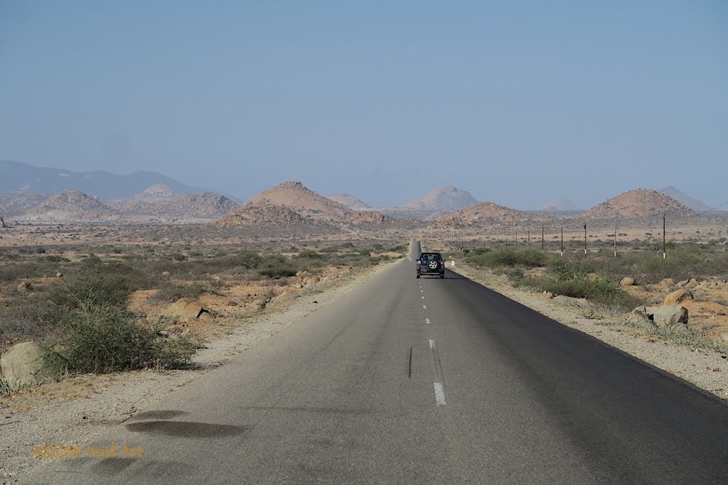
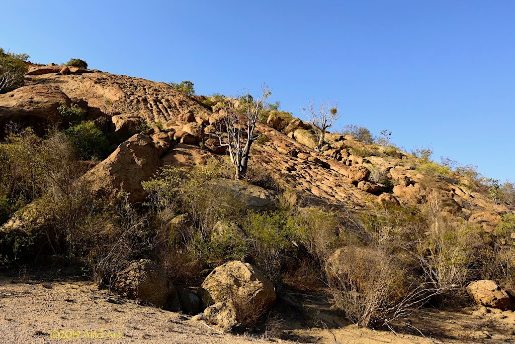
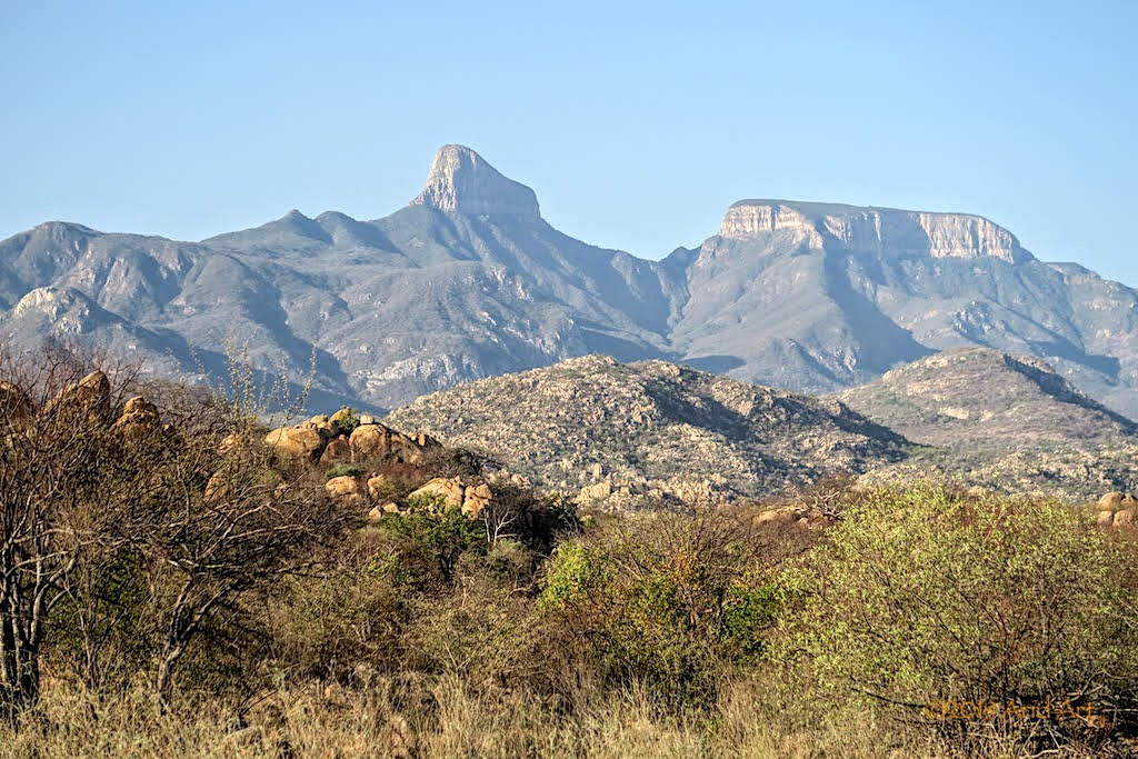
The initial section is fairly flat, with rocky outcrops scattered around. More great scenery.
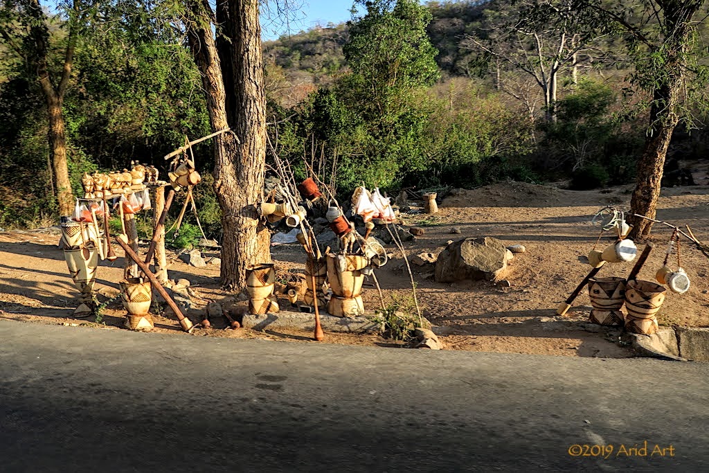
Near the foot of the pass it gets a bit touristy- the first time we experienced this in Angola- with arts and crafts for sale in artisan stalls lining the road.
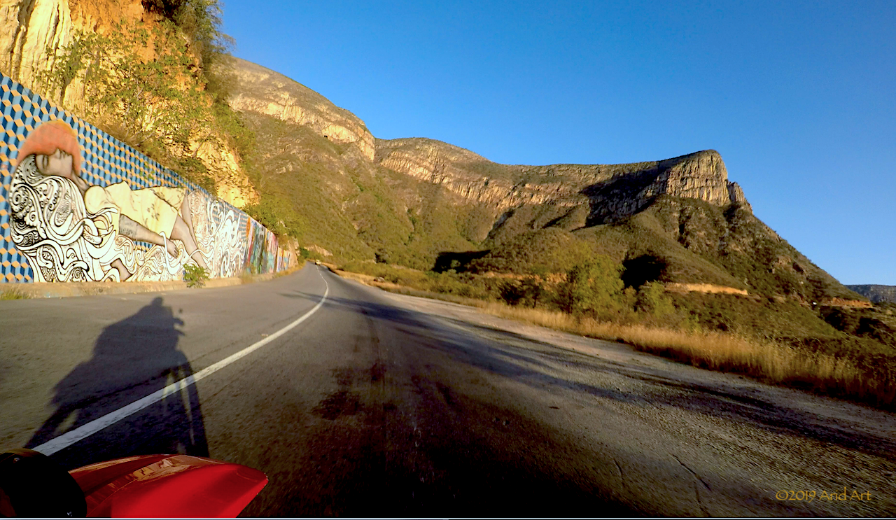
What I didn’t realise is that there is some eye-catching graffiti along the way. Fortunately we can view it at our leisure on the GoPro video afterwards.
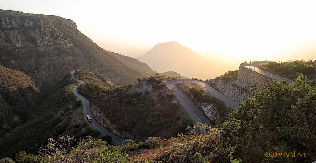
As many people have reported before, it’s a spectacular pass that just gets better as you get higher. A quirk of engineering in an otherwise undeveloped land.
This video gives a good overview of the experience (filmed by a family with a camper truck):
[youtube]https://youtu.be/KSQu0xWVWk4[/youtube]
The sun is close to the horizon by the time we reach the top. Our target for the day is Lubango, which is still 50km away, so we don’t get to explore the view from the rim and reach the Shoprite there only just before it closes. We refuel the bikes opposite the shopping centre, but after last night’s splash-out, we can’t afford Casper’s again. Our bikes also need their final oil service, so we ride out of town to look for a free camping spot.
It takes all of 24km of risky night riding before we find a suitable clearing beyond the city limits. It’s below the road deck, so we pitch our tent close to the shoulder, where there is some undergrowth and where our tent is less visible. By the time the oil is changed, the traffic has gone silent and we enjoy our last supper in Angola. With the increase in elevation has come a welcome decrease in mosquitos, but it’s also noticeably cooler.
If you’re not a fisherman, it’s difficult to find a reason to hang around here, and we really don’t want to repeat last night’s effort to get back to Namibe. Rico says it will be a doddle if we ride along the beach, as low tide is approaching and the sand is kliphard.
After breakfast, I ride out to the beach test this statement and sure enough, once I get close to the waterline, traction is good. To put the cherry on top, the lodge’s bakkie has to fetch supplies from Namibe and will guide us along the beach. And take our luggage. Whoohoo!
Back at the campsite, the tour group is just getting their breakfast. Our guides of last night, the Carstens, are nowhere to be seen- gone fishin' !
It looks like only Toyotas are allowed to come along …
Soon enough Emile, who works at the lodge as a guide, pulls up in a Voetspore-branded Land Cruiser (another Toyota!) in front of our cabin.
We load up our luggage, settle the bill and off we go. It’s way easier than last night and actually good fun. With decent traction we can really let rip along the edge of the waterline, following Emile’s tracks.
But it’s not all plain sailing. Every kilometre or so there are rocky outcrops which force us back onto last night’s tracks.
It’s fine if you can maintain momentum, dismal if you stop. Spot the paddleprints.
Other rocky sections have gaps that we can get through, while the bakkie has to do a detour.
All too soon we are back on the clay track towards the airport, where Emile stops to hand us our luggage back. After re-inflating the tyres, we do the last bit back to the tar and in Namibe, Emile directs us to a washbay as we need to get rid of that salt water. Once again, everything is unpacked and the bikes get a thorough hosing.
Our destination for today is Lubango, due east from here, but we need to stock up on a few things before we go. Namibe also has a Shoprite, and when we pull into the parking lot we find two packmules:
It’s not hard to spot the owners inside the supermarket. They turn out to be two friends from Cape Town who are on their way to Croatia, via Morocco and Spain. Marcel and Caz have come through Lubango from Namibia and even managed to ride up van Zyl’s Pass with their overloaded KLRs packed with every conceivable widget and gadget, including a drone and some sponsored wazoogies! But they wisely decided to give Flamingo Lodge a miss. You can read about their trip here: https://www.instagram.com/thewestcoastwander/?hl=en
We exchange stories and discuss the route via Dombe Grande pass.
We depart together, taking each other’s routes in reverse. Our second treat for the day is the Serra da Leba pass.
The initial section is fairly flat, with rocky outcrops scattered around. More great scenery.
Near the foot of the pass it gets a bit touristy- the first time we experienced this in Angola- with arts and crafts for sale in artisan stalls lining the road.
What I didn’t realise is that there is some eye-catching graffiti along the way. Fortunately we can view it at our leisure on the GoPro video afterwards.
As many people have reported before, it’s a spectacular pass that just gets better as you get higher. A quirk of engineering in an otherwise undeveloped land.
This video gives a good overview of the experience (filmed by a family with a camper truck):
[youtube]https://youtu.be/KSQu0xWVWk4[/youtube]
The sun is close to the horizon by the time we reach the top. Our target for the day is Lubango, which is still 50km away, so we don’t get to explore the view from the rim and reach the Shoprite there only just before it closes. We refuel the bikes opposite the shopping centre, but after last night’s splash-out, we can’t afford Casper’s again. Our bikes also need their final oil service, so we ride out of town to look for a free camping spot.
It takes all of 24km of risky night riding before we find a suitable clearing beyond the city limits. It’s below the road deck, so we pitch our tent close to the shoulder, where there is some undergrowth and where our tent is less visible. By the time the oil is changed, the traffic has gone silent and we enjoy our last supper in Angola. With the increase in elevation has come a welcome decrease in mosquitos, but it’s also noticeably cooler.
NiteOwl
Pack Dog
- Joined
- Dec 31, 2012
- Messages
- 98
- Reaction score
- 0
- Location
- Office Adventurer
- Bike
- Honda XRV 750 Africa Twin
The anticipation of today’s border crossing means a light sleep and early getaway. It feels like we’re on the home stretch, even though there are still nearly 3000km to cover. By coffee time we are near the granite mine of Chibemba. Big blocks lie scattered along the road- quite useful as a table.
We again refuel at Cahama, but at Xangongo we leave the tar to take a look at the Calueque dam that feeds into the Ruacana weir at the border with Namibia. The protection of the Kunene Water Scheme was South Africa’s declared motivation for getting involved in the Angolan conflict in 1975, when it was still under construction.
We find a shady spot under the trees next to the gravel road for our lunch break before tackling the sandy stretch that follows the Cunene river towards the dam.
The scenery along road belies the fierce fighting that took place here in 1988, which resulted in the destruction of the dam wall, pump station and pipeline. Today, only bullet holes are left as a reminder.
Repair work on the dam only commenced in 2012, and to this day the Kunene Water Scheme has yet to reach its designed capacity, resulting in persistent seasonal fluctuations of its power generation for Namibia.
We miss the turnoff to the dam wall, but this lookout (some 40km north of it) has a great viewpoint. This is part of the dam reservoir, and the water level is clearly quite low.
The dam wall and pumping station are 20km southwest of Naulila, where we get flagged down by a jovial policeman who keeps a register of the passing traffic.
Although it’s in Angola, the facility was built by South Africa to provide both water and electricity for Ovamboland, where 25% of Namibia’s population resides. A 300km network of open canals distributes this lifeblood from the Calueque dam through the region to this day. The water for the hydro-electric generators is fed from the Ruacana weir through a pressure tunnel to the underground power station in Namibia.
The last bit gets more sandy, with sand puddles in the lower dips. They’re difficult to see as the shadows creep across the road, and the best technique is to slow down before the rim before gunning it through the soft stuff to the other side. I nearly lose it when I spot a puddle too late, but manage to squirrel through to firmer ground.
And so we reach the border post. It’s poorly indicated on the Angolan side and badly run on the Namibian side: it takes them an hour to produce our TIPs, but at least we manage to get through just before they close.
The canal on the Namibian side is in much worse shape than on the Angolan side.
After a short sharp turn around the fence, we hit the C46 tar road. We lose time locating an ATM in Oshifo and only just manage to get some beer and cider before the shop closes. Getting back to Namibia feels worthy of a small celebration!
As we descend back to the Cunene river towards the Hippo Pools campsite, I hit reserve but fuel will have to wait until tomorrow as darkness falls around us.
A woman unlocks the gate as we pull up, and assures us that there is hot water in the donkey. For the princely sum of R50 each we have the entire camp to ourselves and pitch the tent within one of the braai circles overlooking the river. Time to unwind at last.
The showers do indeed boast hot water, but the bathrooms have deteriorated markedly since my previous visit in 2011.
Instead of backtracking via the Okavango, we head south for the Transkalahari next morning- the shortest route. We pull in at Ruacana to refuel, and spot two young Himbas doing the same. It's tricky wearing modern safety gear and those traditional braids, but they have clearly managed to solve that problem!
Namibia almost feels like home, and of course there are proper campsites here. In addition, we are now spoilt with picnic spots as well.
Some classic Namibian scenery along the way.
With this being Namibia, the road south is pretty straight. Late in the afternoon some sand gets whipped up, darkening the sky.
We pull off at Ombinda Country Lodge just outside Outjo, where new camping spots with private ablutions have just been completed. Even the grass is lush- a regular oasis.
After supper, we go to bed without the tent’s outer layer – no likelihood of rain here- but by midnight it’s cold enough to require the outer cover. Hello winter!
More accommodation on offer along the way:
With wildlife to boot.
Apart from the anthills that are scattered around...
… we see warthogs every few kilometres throughout the day until we approach Gobabis. They forage in the grass along the fences lining the road, but make a run for it when you stop.
The odd gemsbok too ... the contrast of abundant wildlife here compared to what we have experienced north of the border is striking.
The campsite at the edge of the town looks like a starting point for the German tourists who rent those Toyota 4x4 expedition bakkies to tour the country. They really are fully equipped to explore the country.
We pitch our tent amongst them and enjoy a supper in the restaurant. An old farmer at the table next to mentions that this is the driest season in his lifetime- half of his boreholes have dried up.
The air is crisp as we hit the Transkalahari highway the next morning.
It’s come of age this year (2019)!
There’s a shop selling delicious pies just before the border, and checking back into Botswana is a breeze. We don’t even need a new TIP as they are valid for 3 months. We do need to carry fuel, however, to cover the 400km to Kang. Anyone who has travelled this road will know that it is… boring!
We reach Kang on fumes and pull in at the Motel, which has a campsite next to the highway and a small ablution block for each campsite, as well as rooms one can rent.
South Africa is now just a day-trip away and by late afternoon we are through the Lobatse border post onto the N4 and back on home soil.
The density of people living along this road is striking compared to Botswana’s modest population- there are houses and huts as far as the eye can see all the way to Zeerust. The speed of the vehicles here is noticeably faster than that of our laid-back neighbours. It’s a bit of a shock to the system to hit the rat race so suddenly.
We spot a neat motel just outside the town and spoil ourselves with a Wimpy takeway- haven’t seen one of those for months!
To avoid the traffic on the N4 the next morning, we take the back roads home through Koster. It’s way more relaxing meandering past the farms.
By early afternoon it’s all over as we finally get back home, all in one piece. Even our dogs seem to have forgotten who we are, staring curiously at the strange contraptions carrying us through the gate. After such a long time on the road, it's going to take some adjustment not to look in the rear view mirror anymore.
What a stunning trip well done to both of you and to the two Tornado's!!! :thumleft: :thumleft: :thumleft: :thumleft:
Where did you get on the Trans Kalahari did you go down via Windhoek? If so was via Grootfontein not a shorter option?
Where did you get on the Trans Kalahari did you go down via Windhoek? If so was via Grootfontein not a shorter option?
Osadabwa
Race Dog
Thanks for that, really a unique ride on this forum. Proper Wild Dogs you are. You are 10x smarter than most to strike out on those small bikes instead of the Beluga class cruisers most overland travelers take and 100x gutsier than most for hitting Angola and the untouchable points North. Really enjoyed the Congo bits... never made it there, or Angola for that matter (lack of guts and time), though I passed through Hippo Pools campsite in 2003 and bought a floppy fisherman's hat at a duka there that I have to this day. What sticks with me is the Himba boys' braids which you captured in that pic in the helmet... wish I'd taken one then. So many memories! A journal entry from then:
"Out and back we'd seen a few Himba on the roads - dark skin, beads and waist cloths - among the bush and cattle... always smiling. There's something about such traditional people in a place with as much modernity as Namibia... like complimentary colors really. At the turnoff shop we bought pilchards and Allstar biscuits (and a new, reversible tan and black fishing hat for me) and scared away a group of tiny kids frightened by our getup. A teenaged boy on a donkey rode up in a loincloth sporting a braided Mohawk to buy soap, just soap. A quick peek at the waterfalls, and we were back to the campsite."
Then we killed ourselves on the Kunene River road to Epupa because we were on... big stupid bikes! Live and learn. Well done on the ride, thanks for writing it up and congrats for making it home!
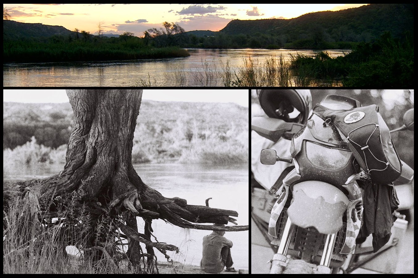
Above: Hippo Pools Campsite, 2003
"Out and back we'd seen a few Himba on the roads - dark skin, beads and waist cloths - among the bush and cattle... always smiling. There's something about such traditional people in a place with as much modernity as Namibia... like complimentary colors really. At the turnoff shop we bought pilchards and Allstar biscuits (and a new, reversible tan and black fishing hat for me) and scared away a group of tiny kids frightened by our getup. A teenaged boy on a donkey rode up in a loincloth sporting a braided Mohawk to buy soap, just soap. A quick peek at the waterfalls, and we were back to the campsite."
Then we killed ourselves on the Kunene River road to Epupa because we were on... big stupid bikes! Live and learn. Well done on the ride, thanks for writing it up and congrats for making it home!
Above: Hippo Pools Campsite, 2003
NiteOwl
Pack Dog
- Joined
- Dec 31, 2012
- Messages
- 98
- Reaction score
- 0
- Location
- Office Adventurer
- Bike
- Honda XRV 750 Africa Twin
Thanks for the comments. This took longer to write up than to ride!
ChrisL: sorry for the typo, we crossed into Botswana at Gobabis and yes, via Windhoek.
Grootfontein would probably have been further, unless one goes through Boesmanland and via Drotsky's Caves. That bit is slow and sandy.
Osadabwa: yes, that River Road to Epupa is hard work on a big bike. A smaller bike is much easier to handle and we have learnt to pack light. It's useful to be able to carry all your luggage when the need arises. Not a very popular trend on this forum.
ChrisL: sorry for the typo, we crossed into Botswana at Gobabis and yes, via Windhoek.
Grootfontein would probably have been further, unless one goes through Boesmanland and via Drotsky's Caves. That bit is slow and sandy.
I was thinking if you were at Otjiwarongo the 111 up to Otavi and 96 to Grootfontein would be much less than the 174 and 79 down to Windhoek.
If in Grootfontein you would use the new tar road down to Gobabis and then Buitepos.I see now it is only 50kms+- difference between Wndhoek or Grootfontein from Otji.
Anyway how much oil did the two stars of this trip use?
Thank you. an excellent read, all the way from August 2019. Quite a keyboard journey!
Clockwork Orange
Race Dog
- Joined
- May 22, 2006
- Messages
- 2,784
- Reaction score
- 113
- Location
- United Kingdom
- Bike
- KTM 990 Adventure
Absolutely fantastic. Thanks for all your effort in sharing your journey with us :3some:
Wow, this was an incredible journey. Saw your report today in the Ysterperd and only realized now you guys did it on Tornado's!!! Excellent!!
I might have missed this (if so apologies), what issues did you have to sort out on the bikes during the entire trip (broken stuff and services).
Also those screens... can you maybe message me details on the design. Mine is still without screen. Looks like a clever design.
I might have missed this (if so apologies), what issues did you have to sort out on the bikes during the entire trip (broken stuff and services).
Also those screens... can you maybe message me details on the design. Mine is still without screen. Looks like a clever design.
Similar threads
- Replies
- 2
- Views
- 929


