You are using an out of date browser. It may not display this or other websites correctly.
You should upgrade or use an alternative browser.
You should upgrade or use an alternative browser.
To the Lungs of the Earth
- Thread starter NiteOwl
- Start date
This site may earn a commission from merchant affiliate
links, including eBay, Amazon, and others.
NiteOwl
Pack Dog
- Joined
- Dec 31, 2012
- Messages
- 98
- Reaction score
- 0
- Location
- Office Adventurer
- Bike
- Honda XRV 750 Africa Twin
Apart from offering sightseeing trips into the Reserve, the Lodge also runs a rehabilitation program for injured animals and birds confiscated from poachers or saved from the bushmeat trade. Maja is the (Swiss) veterinarian in charge of this, and she is assisted by Komo (a pygmy from the local community). One of these animal species has been the prime motivator for us to make this long trip:
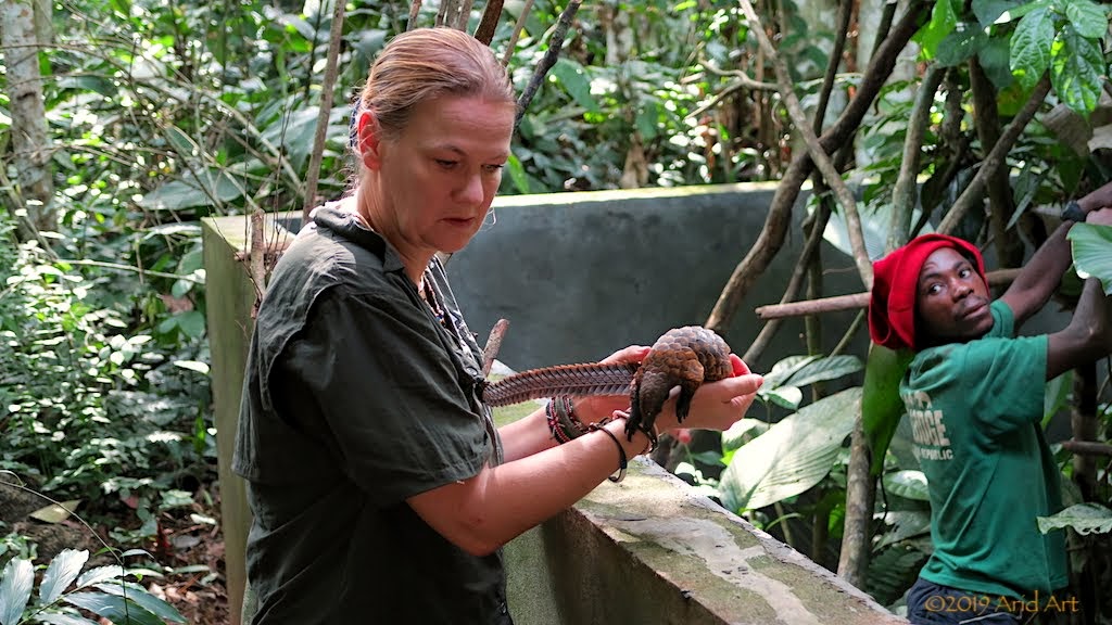
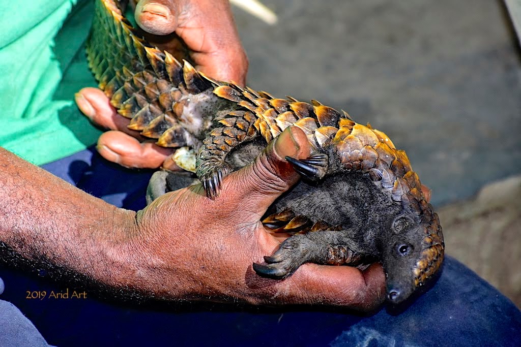
This is a young black-bellied pangolin (ietermagog), whose mother was a victim of the bushmeat trade. She wasn't well when she was brought to Sangha Lodge, so she is being nursed here until she is ready for release back into the forest.
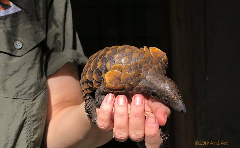
Most of the rescuees are pangolins; the most trafficked animals on earth. They cannot harm anyone as they have no teeth, but get hunted for their scales, which consist of keratin- like rhino horns. The market is the same; potions in Asia to heal ....what exactly?
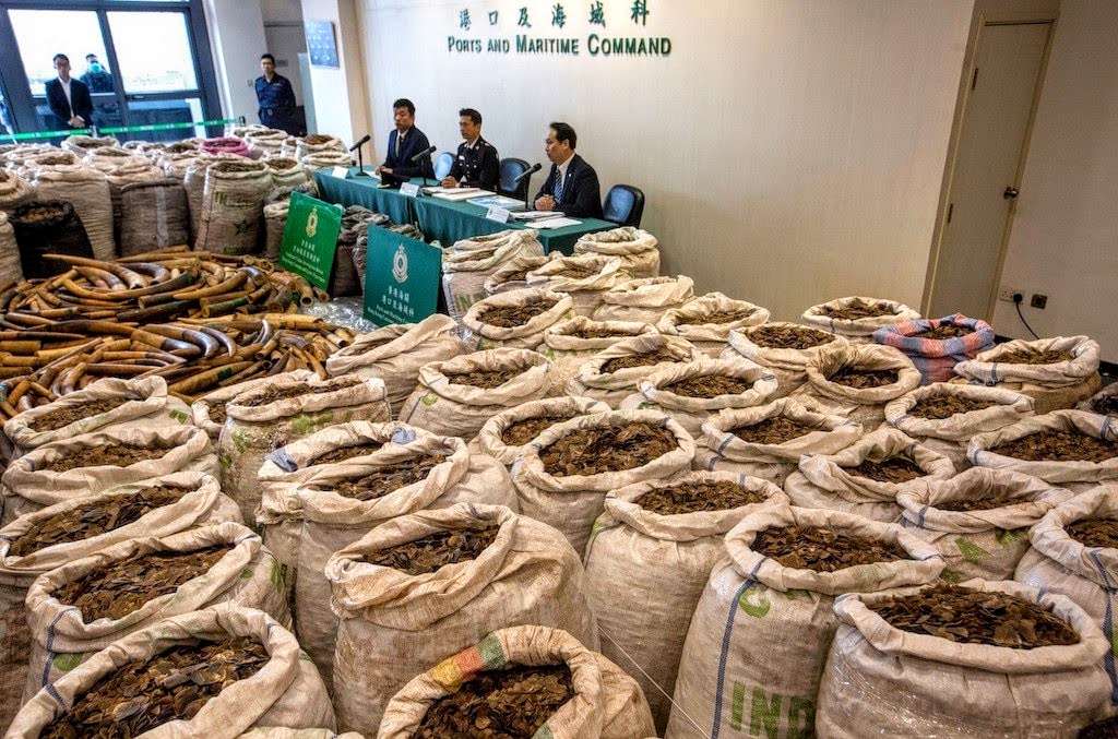
As if the slaughter of these poor creatures for their scales is not enough, the meat is also traded as a delicacy. Since pangolins are endangered as a result, any trade in them is illegal. It's not a very successful ban, however, and confiscations occur too late.
There are eight pangolin species in the world (all threatened), of which four occur in Africa.
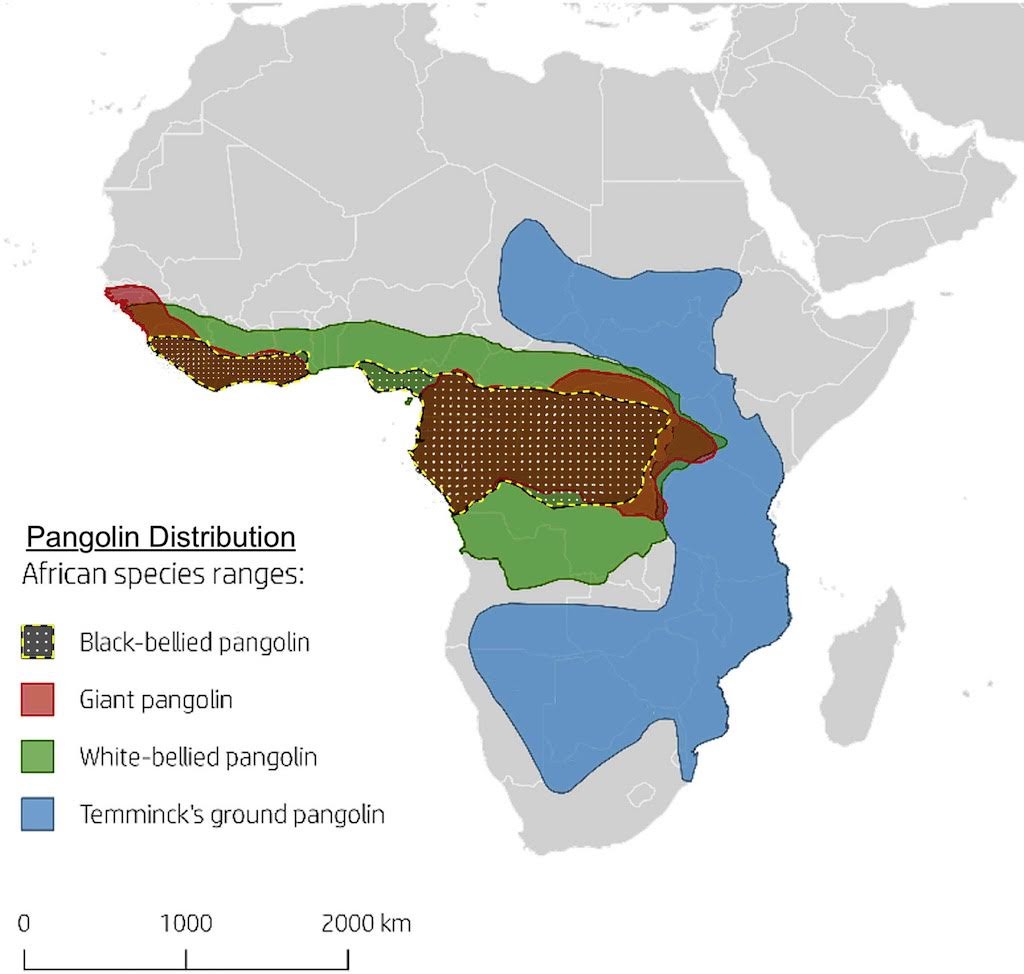
The most common of these in this region is the black-bellied pangolin, the only specialised arboreal (tree climbing) pangolin. They grow to a length of about 70 cm and weigh up to 2½ kilograms. Pangolins have super-long, sticky tongues which they extend to pick up ants and termites.
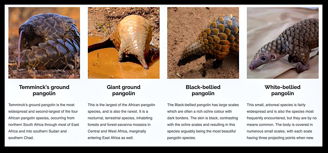
Pangolins are solitary creatures, and little is known about them because most species are nocturnal. The black tailed species are active by day and night, but are difficult to observe through the dense foliage. In order to get warm, they climb to the top of the tree canopy early in the morning to bask in the sun before looking for breakfast.
They have an exceptionally long tail that they use almost like monkeys to climb trees. Or stairs.
[youtube]https://www.youtube.com/watch?v=zSNVTkjkweQ[/youtube]
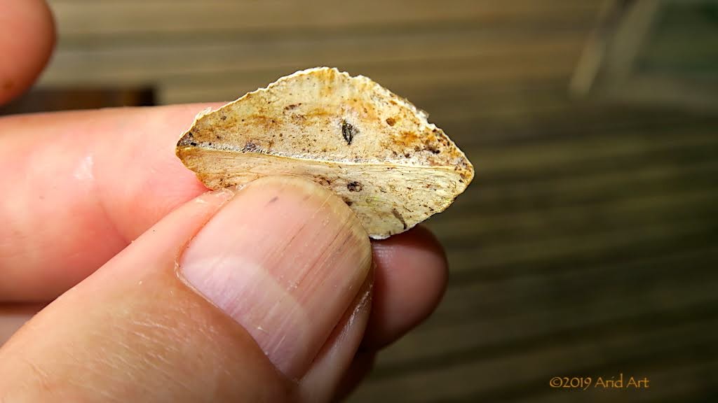
Pangolins are really difficult to look after in captivity- their diet consist exclusively of ants and termites, and collecting enough to feed them is no easy task, so at Sangha Lodge they are kept in an enclosed area at night and released into trees during the day to feed, where they are tracked by Ba'Aka pygmies. They catch ants by pushing their sticky tongues into ant-nests that they break open with their claws. Their scales grow out of their skin almost like our hair does (only in flat bunches) which protects them from predators. When threatened, they roll up into a ball to hide the only part of their body that is unprotected- their bellies.
Here's what a scale looks like from close up:
Although they may look like reptiles, pangolins are actually mammals. The females have two teats from which their young suckle, and they carry the baby around on their tails. Although their scales protect them from predators, they also provide a hiding place for parasites: ticks, to be specific. Part of the task of rehabilitating pangolins therefore involves removing these ticks. It's done with tweezers.
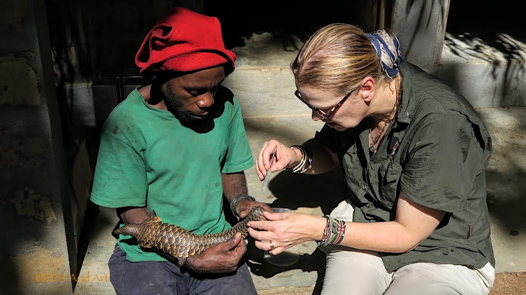
It's a time-consuming process which has to be done in short stages to avoid stressing the animal.
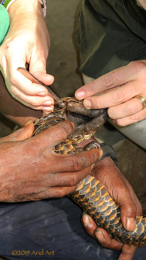
All done for the day!
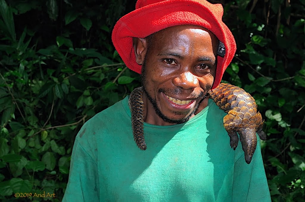
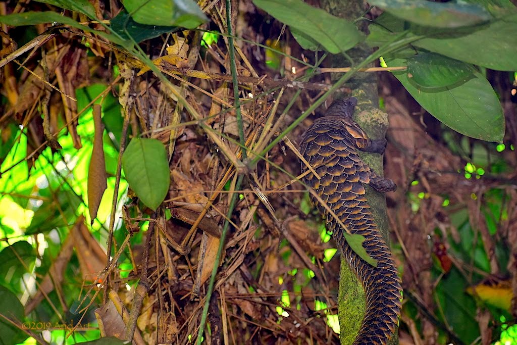
After the cleanup, this youngster gets carried into the forest and put onto a tree trunk, which she scales with surprising agility.
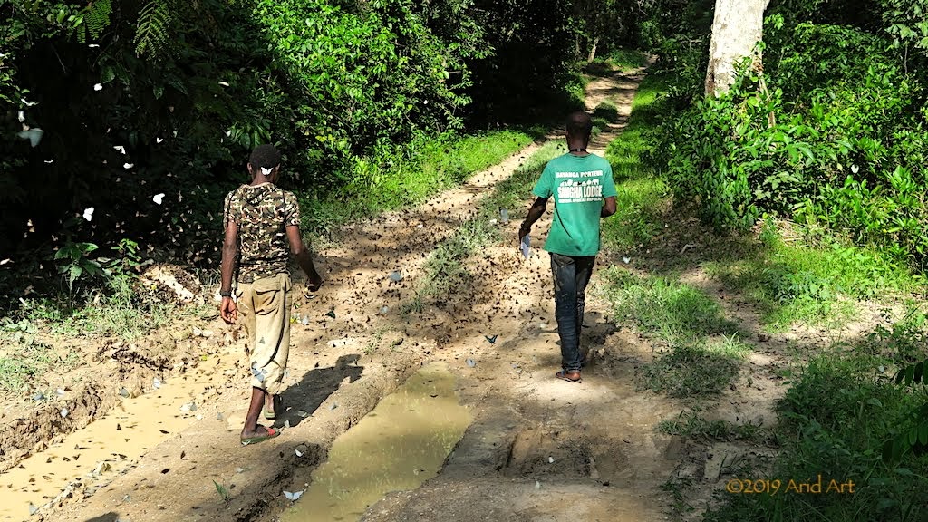
Later in the day Maja takes us for a walk into the forest nearby with two trackers to show off her released charges that are now fending for themselves. It happens to be butterfly season, and we disturb clouds of them drinking from the puddles in the muddy tracks leading to the lodge.
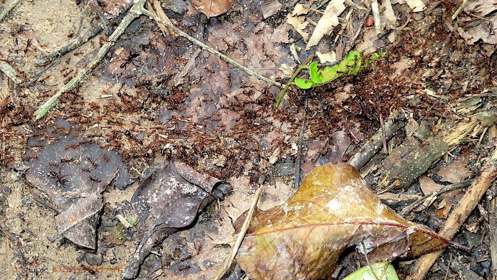
On the forest floor, army ants move along a track. Their soldiers are the largest ants on earth and they do not nest but move constantly, consuming vast quantities of insects in their path. Due to their numbers and aggressive behaviour, they can be dangerous even to larger mammals, and are not part of a pangolin's diet.
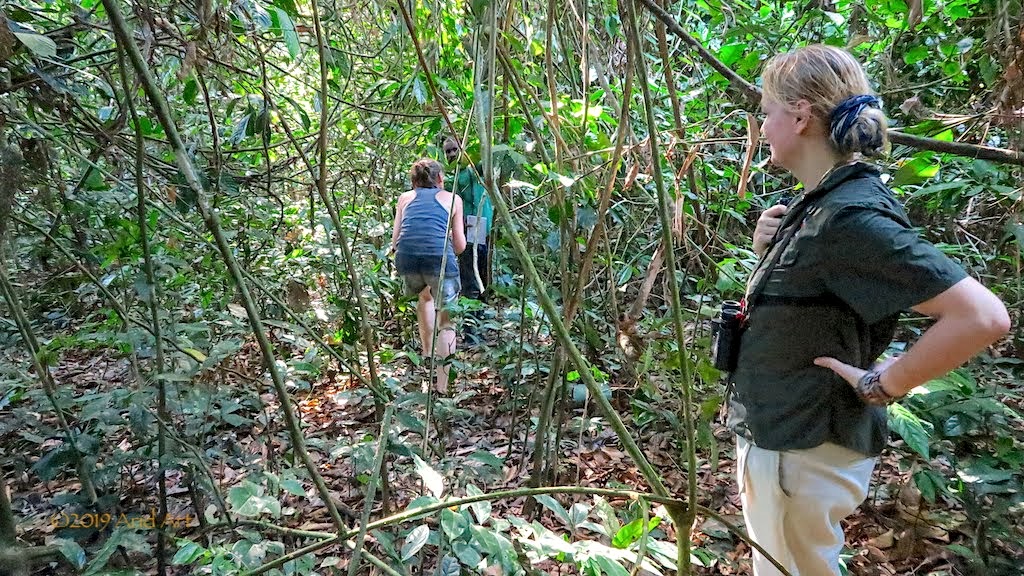
Ba'Aka trackers are employed to follow the pangolins and make notes of their observations. Reaching them through the dense growth takes quite some ducking and diving.
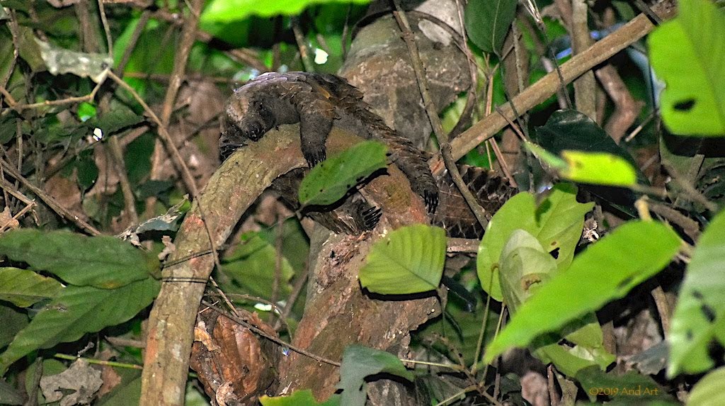
One of the tracked pangolins is resting on one of the lower branches of a tree, where it's pretty dark.
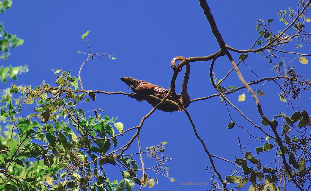
Another one is looking for food high up in the canopy, using his tail as counterbalance:
Unlike the WCS camp at Bomassa, Sangha Lodge's rehabilitation effort is privately run, without the support of a major sponsor and they rely on scientists who are prepared to support the programme on a voluntary basis in exchange for the unique research opportunity.
[youtube]https://www.youtube.com/watch?v=pExjiHw8OuY[/youtube]
In order to attract more visitors, there's a significant upgrade project on the go. Bas has been hired to coordinate the construction project. On the one end the pub and dining area are getting expanded ...
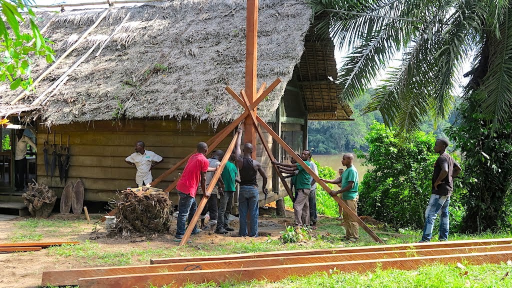
... while at the other new chalets are under construction. With all those trees around, wood is the cheapest and most authentic building material, but cement for foundations and interior fittings have to be brought in from Cameroon- no Builders Warehouse around the corner here.
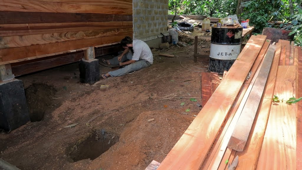
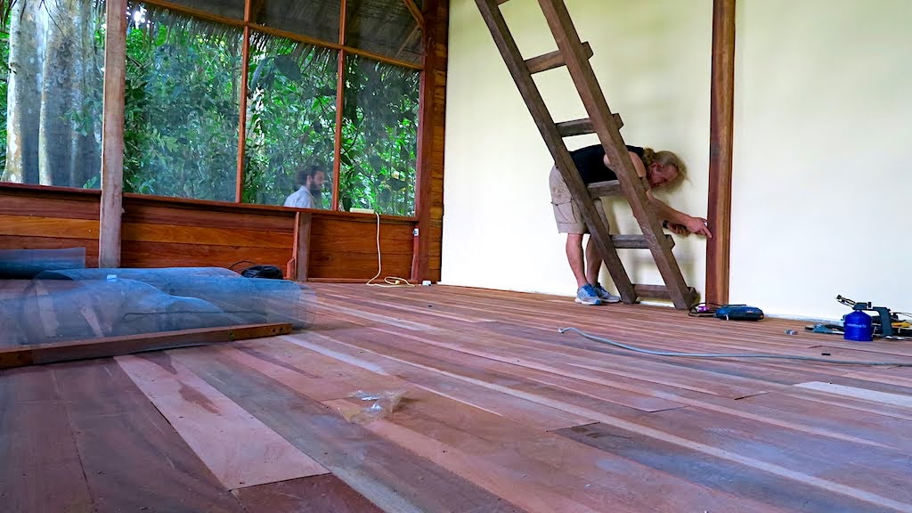
The new design is more upmarket, to meet the expectation of European visitors. There's also a verandah overlooking the river, and a much better all-round view through the mosquito netting.
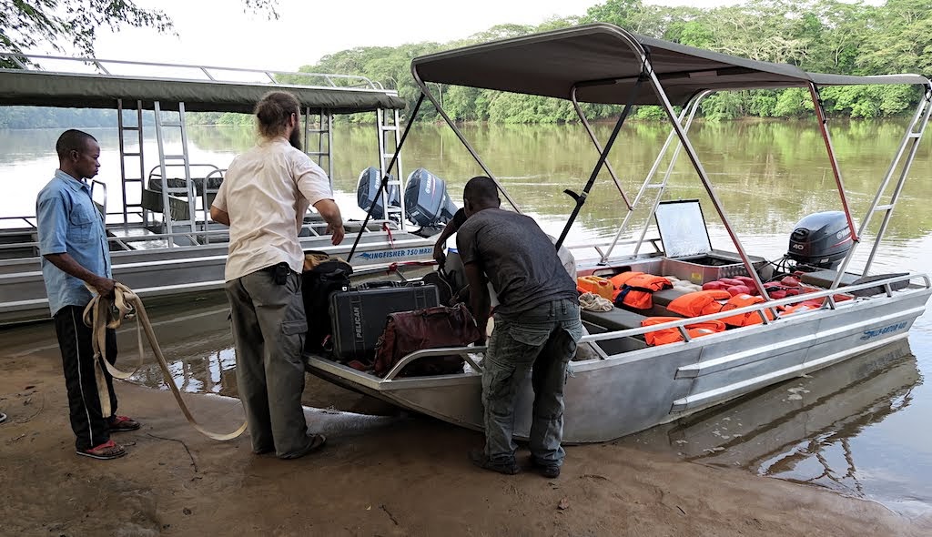
All good things come to an end, and our stay at Sangha is no exception. Because Bas also needs to get back home (his family lives in Zambia) he is joining us on the return trip, together with Alon, who has to collect a vehicle in Ouesso. Blaise is again at the controls.
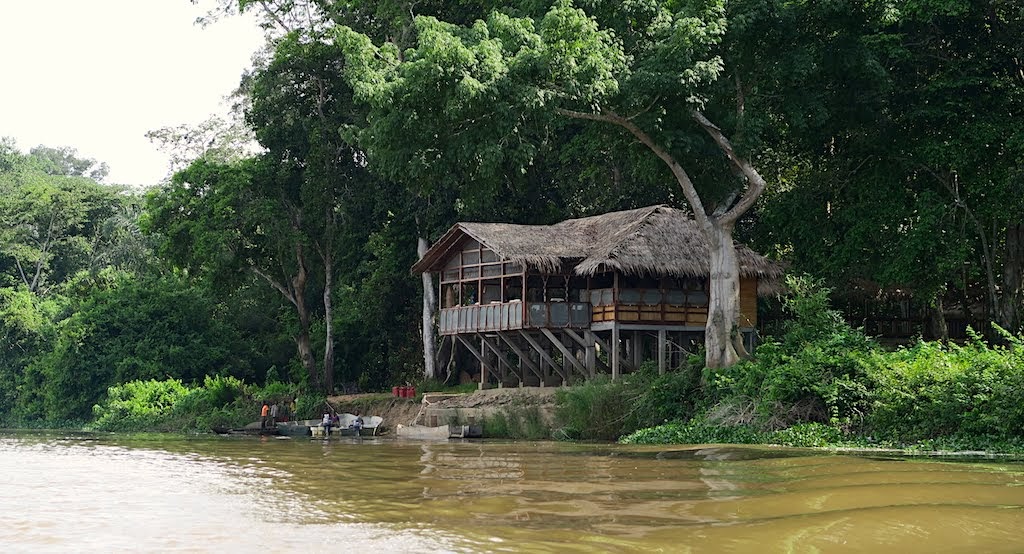
Needless to say, we have to repeat all the passport rubber stamping (and associated payments) of the "up" trip. We pass Doli Lodge, a similar establishment to Sangha, on the way to our first stop at Bayanga.
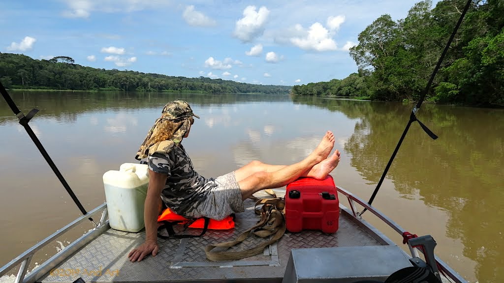
Bas has made himself at home on the bow of the boat, enjoying the sunshine. It's out of necessity too; his toolboxes fill much of the space in the boat that isn't taken up with fuel and water.
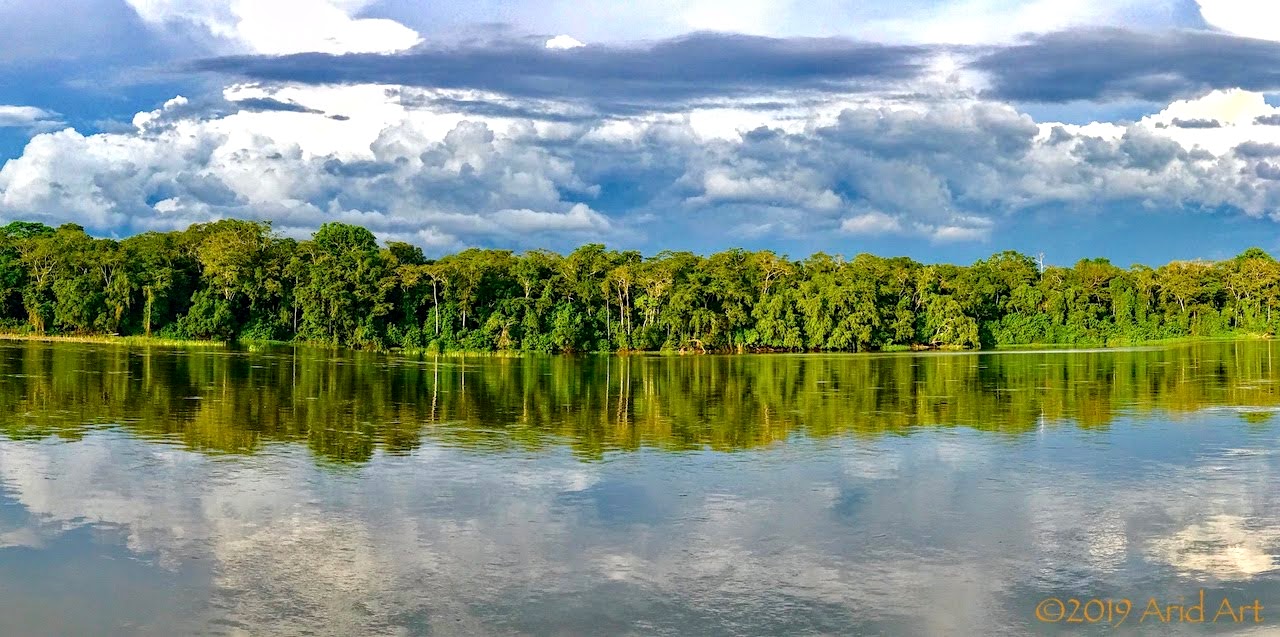
The trees lining the river make for a spectacular and memorable panorama as we pass. And yes, those are rainclouds darkening the sky.
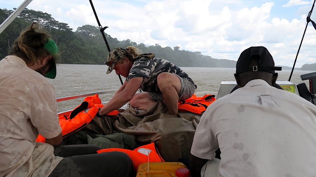
It does not take long before our path crosses the curtain of rain bucketing down. There's a scramble to cover the luggage and peel out raincoats and it gets pretty cool. The rain stops as suddenly as it started.
Despite the fact that we are now moving downstream, our speed is only 15 km/h due to the extra passengers, luggage and fuel. It's slow going, made worse by the extra care now required to avoid the sandbanks.
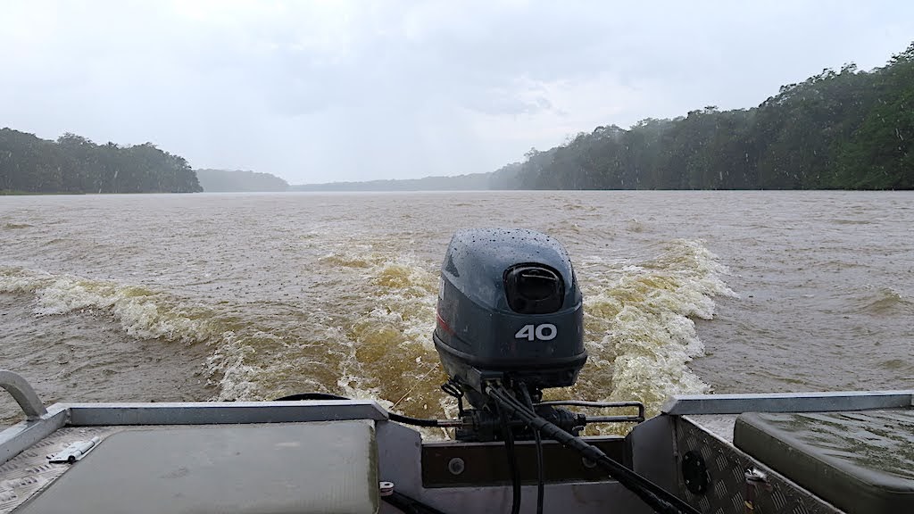
The trip takes the entire day, and we only reach the WCS camp at dusk. Fortunately for us, the visitors they were expecting have been delayed, and there's accommodation available for all of us for the night. My dreams are filled with the gurgling of a 40 HP outboard motor.
This is a young black-bellied pangolin (ietermagog), whose mother was a victim of the bushmeat trade. She wasn't well when she was brought to Sangha Lodge, so she is being nursed here until she is ready for release back into the forest.
Most of the rescuees are pangolins; the most trafficked animals on earth. They cannot harm anyone as they have no teeth, but get hunted for their scales, which consist of keratin- like rhino horns. The market is the same; potions in Asia to heal ....what exactly?
As if the slaughter of these poor creatures for their scales is not enough, the meat is also traded as a delicacy. Since pangolins are endangered as a result, any trade in them is illegal. It's not a very successful ban, however, and confiscations occur too late.
There are eight pangolin species in the world (all threatened), of which four occur in Africa.
The most common of these in this region is the black-bellied pangolin, the only specialised arboreal (tree climbing) pangolin. They grow to a length of about 70 cm and weigh up to 2½ kilograms. Pangolins have super-long, sticky tongues which they extend to pick up ants and termites.
Pangolins are solitary creatures, and little is known about them because most species are nocturnal. The black tailed species are active by day and night, but are difficult to observe through the dense foliage. In order to get warm, they climb to the top of the tree canopy early in the morning to bask in the sun before looking for breakfast.
They have an exceptionally long tail that they use almost like monkeys to climb trees. Or stairs.
[youtube]https://www.youtube.com/watch?v=zSNVTkjkweQ[/youtube]
Pangolins are really difficult to look after in captivity- their diet consist exclusively of ants and termites, and collecting enough to feed them is no easy task, so at Sangha Lodge they are kept in an enclosed area at night and released into trees during the day to feed, where they are tracked by Ba'Aka pygmies. They catch ants by pushing their sticky tongues into ant-nests that they break open with their claws. Their scales grow out of their skin almost like our hair does (only in flat bunches) which protects them from predators. When threatened, they roll up into a ball to hide the only part of their body that is unprotected- their bellies.
Here's what a scale looks like from close up:
Although they may look like reptiles, pangolins are actually mammals. The females have two teats from which their young suckle, and they carry the baby around on their tails. Although their scales protect them from predators, they also provide a hiding place for parasites: ticks, to be specific. Part of the task of rehabilitating pangolins therefore involves removing these ticks. It's done with tweezers.
It's a time-consuming process which has to be done in short stages to avoid stressing the animal.
All done for the day!
After the cleanup, this youngster gets carried into the forest and put onto a tree trunk, which she scales with surprising agility.
Later in the day Maja takes us for a walk into the forest nearby with two trackers to show off her released charges that are now fending for themselves. It happens to be butterfly season, and we disturb clouds of them drinking from the puddles in the muddy tracks leading to the lodge.
On the forest floor, army ants move along a track. Their soldiers are the largest ants on earth and they do not nest but move constantly, consuming vast quantities of insects in their path. Due to their numbers and aggressive behaviour, they can be dangerous even to larger mammals, and are not part of a pangolin's diet.
Ba'Aka trackers are employed to follow the pangolins and make notes of their observations. Reaching them through the dense growth takes quite some ducking and diving.
One of the tracked pangolins is resting on one of the lower branches of a tree, where it's pretty dark.
Another one is looking for food high up in the canopy, using his tail as counterbalance:
Unlike the WCS camp at Bomassa, Sangha Lodge's rehabilitation effort is privately run, without the support of a major sponsor and they rely on scientists who are prepared to support the programme on a voluntary basis in exchange for the unique research opportunity.
[youtube]https://www.youtube.com/watch?v=pExjiHw8OuY[/youtube]
In order to attract more visitors, there's a significant upgrade project on the go. Bas has been hired to coordinate the construction project. On the one end the pub and dining area are getting expanded ...
... while at the other new chalets are under construction. With all those trees around, wood is the cheapest and most authentic building material, but cement for foundations and interior fittings have to be brought in from Cameroon- no Builders Warehouse around the corner here.
The new design is more upmarket, to meet the expectation of European visitors. There's also a verandah overlooking the river, and a much better all-round view through the mosquito netting.
All good things come to an end, and our stay at Sangha is no exception. Because Bas also needs to get back home (his family lives in Zambia) he is joining us on the return trip, together with Alon, who has to collect a vehicle in Ouesso. Blaise is again at the controls.
Needless to say, we have to repeat all the passport rubber stamping (and associated payments) of the "up" trip. We pass Doli Lodge, a similar establishment to Sangha, on the way to our first stop at Bayanga.
Bas has made himself at home on the bow of the boat, enjoying the sunshine. It's out of necessity too; his toolboxes fill much of the space in the boat that isn't taken up with fuel and water.
The trees lining the river make for a spectacular and memorable panorama as we pass. And yes, those are rainclouds darkening the sky.
It does not take long before our path crosses the curtain of rain bucketing down. There's a scramble to cover the luggage and peel out raincoats and it gets pretty cool. The rain stops as suddenly as it started.
Despite the fact that we are now moving downstream, our speed is only 15 km/h due to the extra passengers, luggage and fuel. It's slow going, made worse by the extra care now required to avoid the sandbanks.
The trip takes the entire day, and we only reach the WCS camp at dusk. Fortunately for us, the visitors they were expecting have been delayed, and there's accommodation available for all of us for the night. My dreams are filled with the gurgling of a 40 HP outboard motor.
- Joined
- Oct 26, 2016
- Messages
- 972
- Reaction score
- 813
- Location
- Umdloti
- Bike
- Honda CRF-1000L Africa Twin
This really is an incredible report and opportunity you had, thank you for posting.
Really enjoying this report, looking forward to the rest!
- Joined
- Oct 19, 2008
- Messages
- 17,333
- Reaction score
- 5,191
- Location
- Bothasig , Cape Town
- Bike
- Honda CRF-1000L Africa Twin
I love seeing some amazing conservation efforts.Well done.. awesome stuff.
Conservation is going to have an uphill battle in the next generation, the Chinese are starting to buy whole sections of countries to strip for their insatiable appetite,
https://www.businessinsider.com/ecuador-selling-its-rainforest-to-china-2013-3?IR=T
Conservation is going to have an uphill battle in the next generation, the Chinese are starting to buy whole sections of countries to strip for their insatiable appetite,
https://www.businessinsider.com/ecuador-selling-its-rainforest-to-china-2013-3?IR=T
NiteOwl
Pack Dog
- Joined
- Dec 31, 2012
- Messages
- 98
- Reaction score
- 0
- Location
- Office Adventurer
- Bike
- Honda XRV 750 Africa Twin
Happily, our tour operator had already washed and loaded up the bikes when we arose after a sumptuous breakfast the next morning.
All we had to do was to hop on the plane and head back h... oops, wrong thread

Return leg to follow. Shortly.
All we had to do was to hop on the plane and head back h... oops, wrong thread

Return leg to follow. Shortly.
NiteOwl
Pack Dog
- Joined
- Dec 31, 2012
- Messages
- 98
- Reaction score
- 0
- Location
- Office Adventurer
- Bike
- Honda XRV 750 Africa Twin
Each journey to a distant destination holds the tantalising challenge of a return leg.
A worrying thought has been gnawing away at us during our stay at Sangha Lodge- our DRC visas were issued for multiple entry, but are only valid for one month. That month started ticking away on our departure, which was…. one month ago. Oops.
The internet is awash with sad tales of overlanders meeting their match at the DRC’s border posts without visas. Together with Angola, these two countries have diverted many a traveller eastwards due to their dogmatic visa requirements. At least Angola is no longer an issue for South African passport holders, but the DRC is holding out as a bastion against tourism. I scoured various forums and blogs to see how others had managed this hurdle while at Sangha Lodge, but the list was a short one.
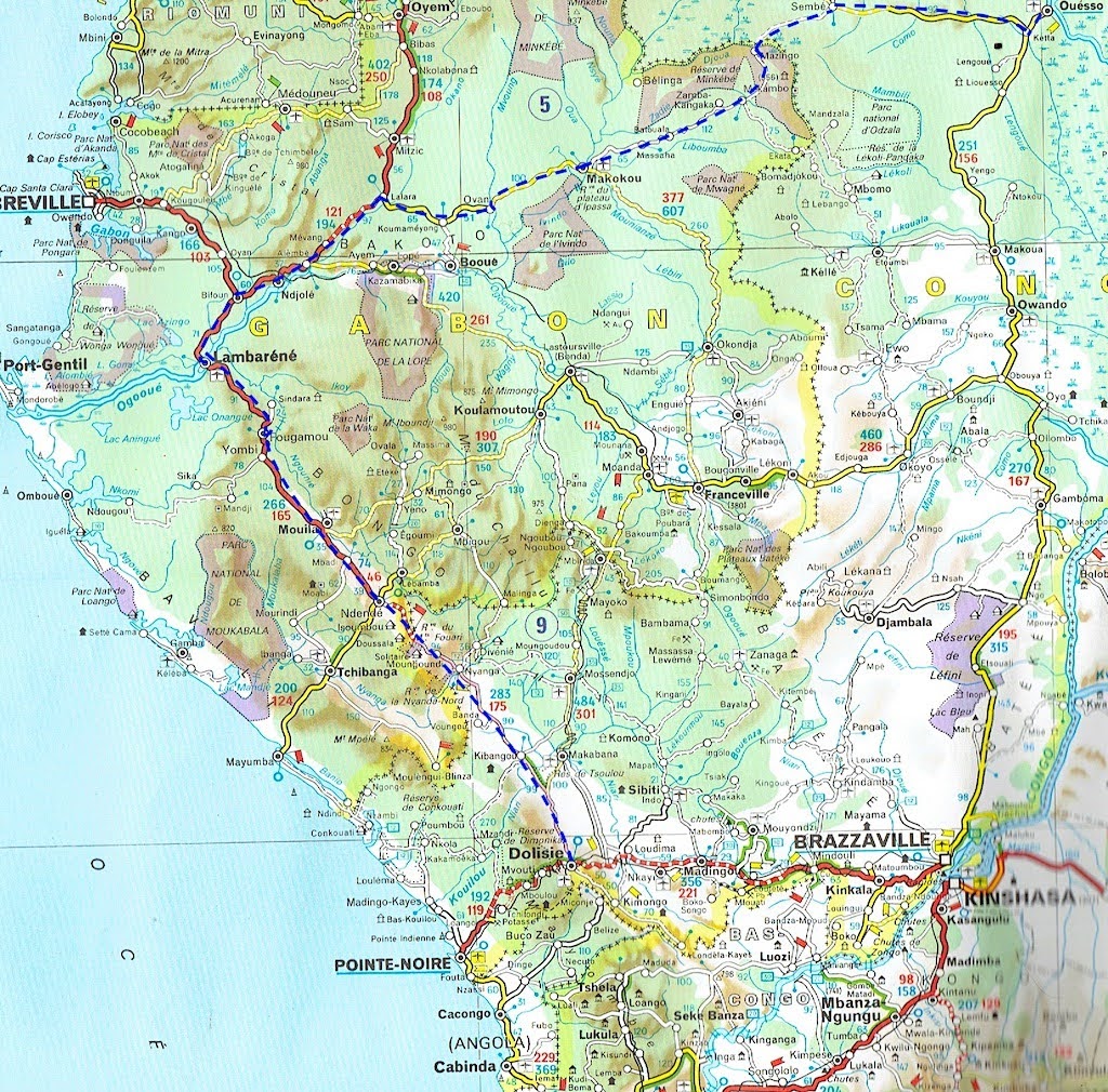
Left or right- which is right? We basically have two options for our return leg:
* Reverse the route southwards through the Congo that brought us here
* Head west to Sembé and cross over into Gabon at Mazingo
The former is a familiar path, the latter a new country with new unknowns and two additional border crossings- never a great prospect, even though South Africans don’t need a visa to enter Gabon. Not sure why?
It would be great to see more animals in one of Gabon’s parks and visit Lambaréné (Albert Schweizer’s residence) but parks / reserves along the coast tend to be really pricey and we have a time constraint: mrs Owl needs to get back to the office.
The familiar comforts of Brazzaville are enticing and it seems logical that an extension of our visas for its neighbour should be easy to arrange there. So we settle on the low-risk option and aim for the RN2 again.
After breakfast the next morning we say our goodbyes to Alon, Bas and Blaise who will do the trip to Ouesso by boat that we will cover by bike.
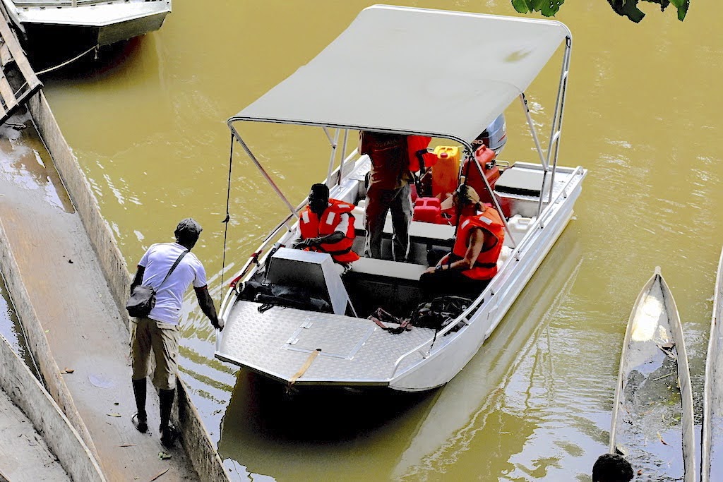
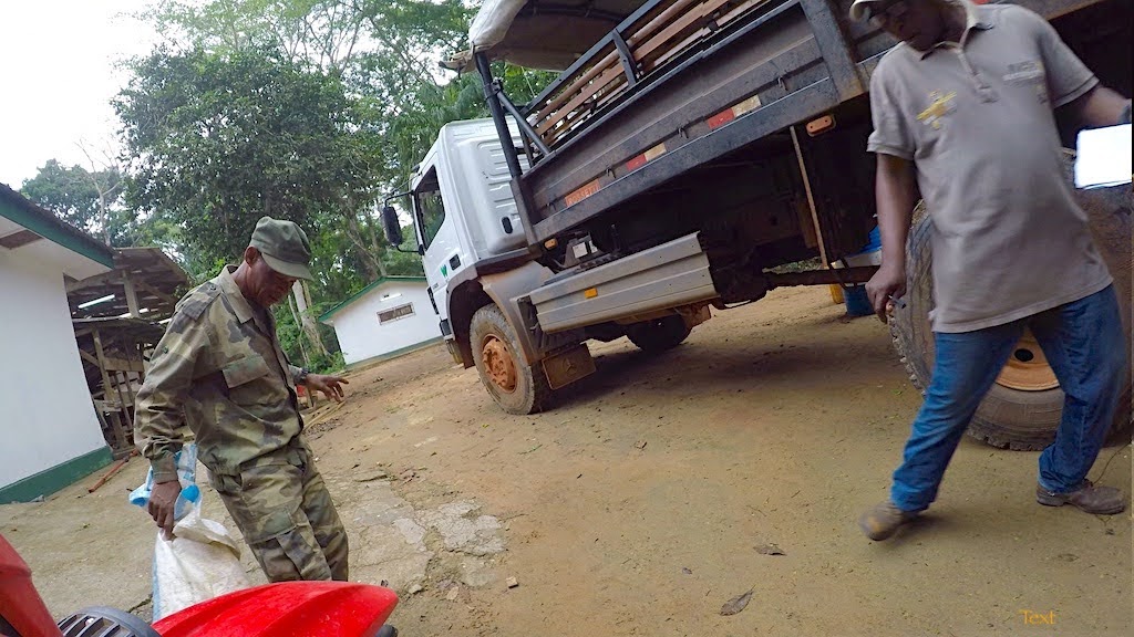
We underestimated the distance to Bomassa on our way here, so we need extra fuel to make it back. There are no pumps along the way, but the WCS has a depot and they are prepared to sell some. So, after a quick lube of the chains we ride down to the fuel store. A funnel is inserted into my tank and the fuel gurgles downwards.
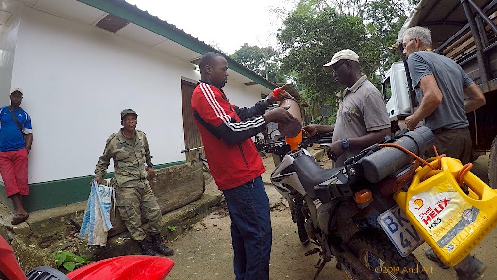
All goes well until a small green snake falls out of a tree in front of mrs Owl’s bike. To her surprise, a ranger tramples it to a pulp in an instant as the fuel filler beats a hasty retreat. So much for wildlife conservation.
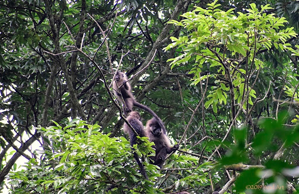
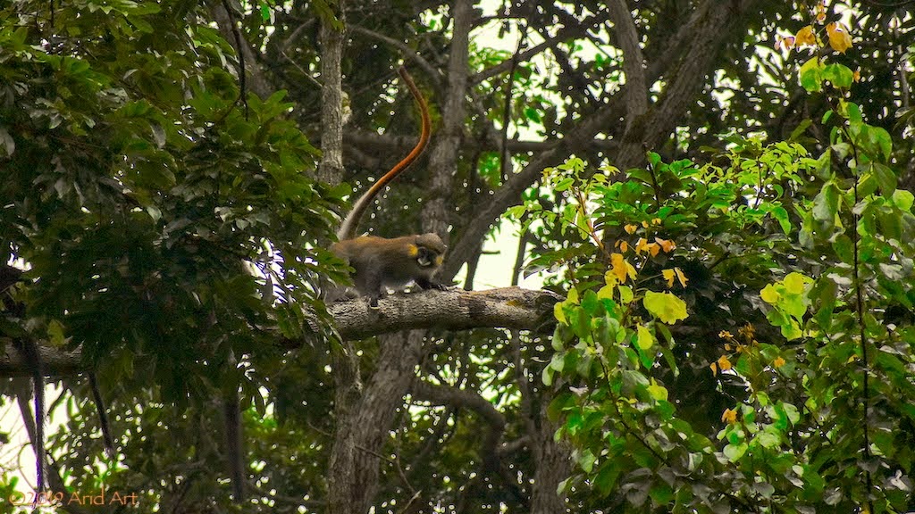
There’s some action high up in the surrounding trees today, and it turns out that they are primates. Even with a telephoto lens, they are hard to make out in the foliage. We manage to identify a troop of grey mangabeys and some moustached guenon monkeys playing. Proof of life, at last!
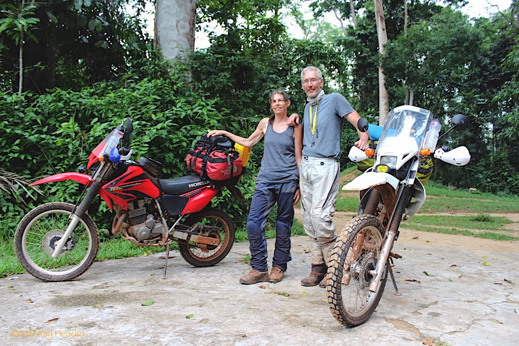
After collecting all our kit from the office and settling our bill, we can repack the bags and saddle up. Ray, the husband of the financial manager, takes an interest in our vehicles and later mails us some pics:
Although it hasn’t rained during the night, I’m worried about the potentially slippery tracks from here to Kabo. In fact, it was a major concern when choosing the tyres for this trip, as I expected much more rain. Whereas almost any tyre will work in sand, it’s a well-known fact that mud sticks to tyres way better than the other way round!
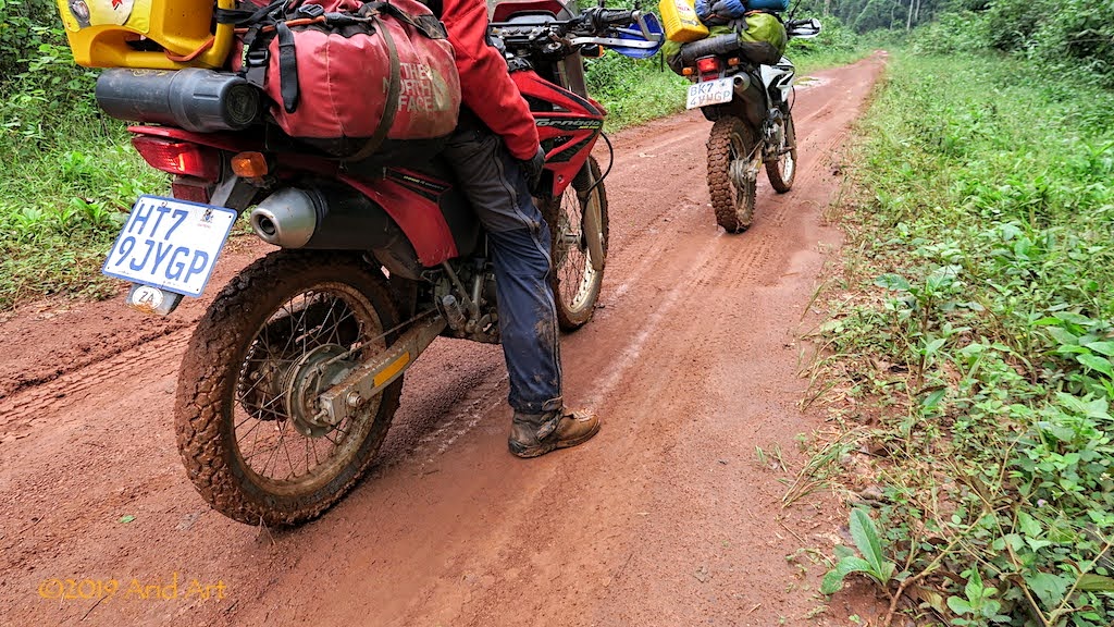
Especially when there’s camber involved.
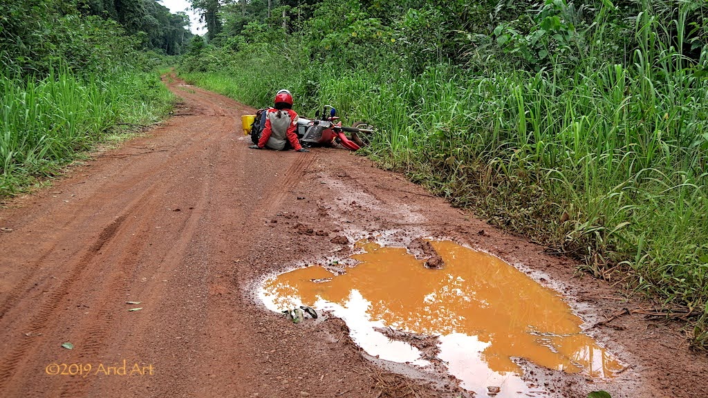
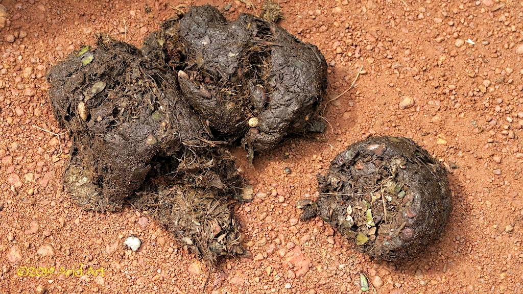
Forest elephants may be endangered but there are plenty of signs that they are in the vicinity today.
Their diet is on display in the piles of dung lying about- quite nutty!
Fortunately the forest roads after Kabo are well drained and dried by the time we reach them. We make good progress until we pull over at the entrance to the forest, before tackling the last stretch from Pokola back to the ferry.
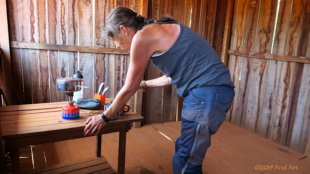
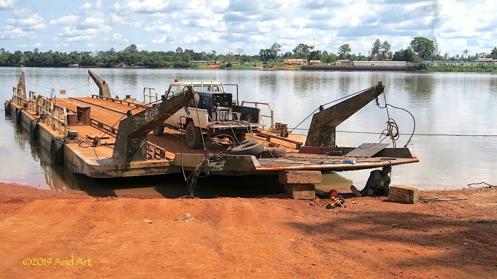
Within an hour we are back at the river once more, where there’s a queue of trucks. When we get to the front, it’s clear why: a welder is busy repairing the ramp. So everybody has to wait.
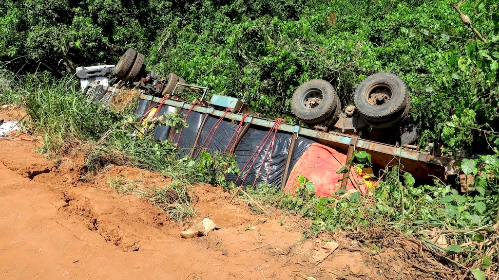
Along the side of the road a truck with cooking oil aboard has flipped over: slippery when wet?
Around the ramp, people have sought shade under the trees, munching snacks whilst watching the welder. Three pigs have been tied up and they’re squealing so their owners cool them down with water from the river. We buy cold drinks from an ice tub while waiting for the repairs and chat with a truck driver carting timber from Cameroon. He says the Congolese are lazy and don’t produce anything. From what we have seen it’s hard to argue- just about everything here is imported.
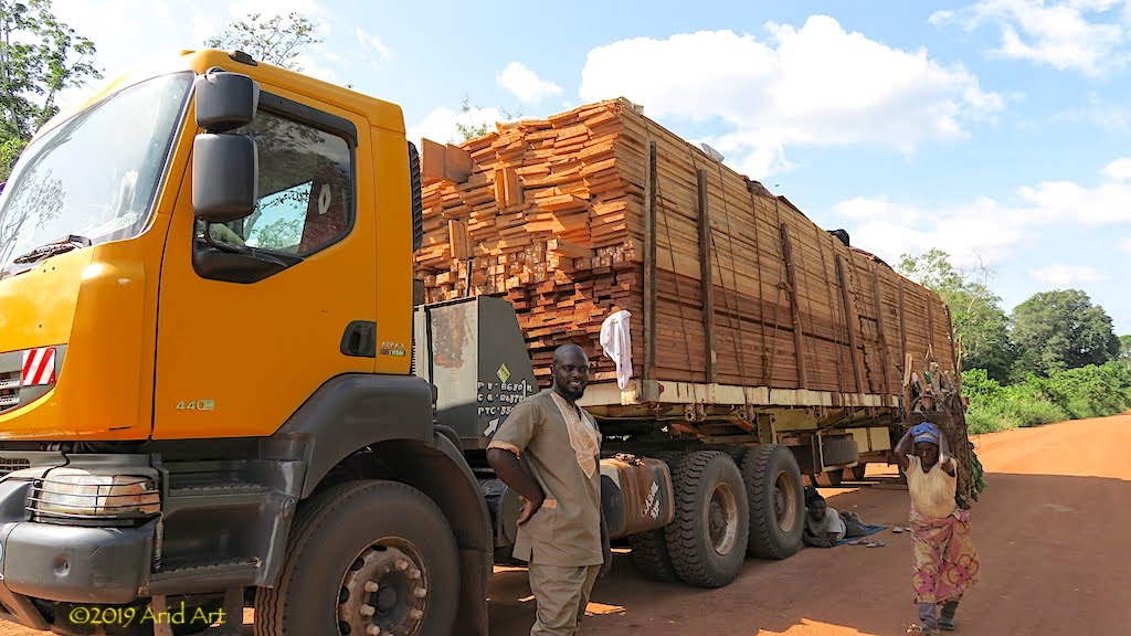
After a few hours the ferry is ready to resume service and we get directed to park behind the three pigs.
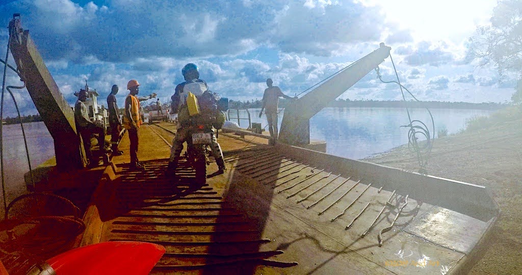
And so we cross the Sangha. On the Ouesso side, we return to the registry office to sign back into the province. It doesn’t go well.
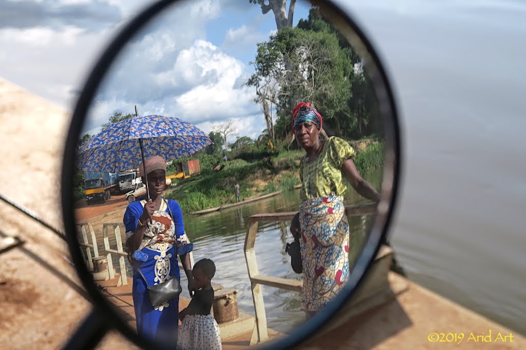
The official isn’t happy with our passports and I get escorted to an immigration office nearby. After a few minutes an official arrives on a moped and invites me inside. The problem, and this is repeated a number of times to emphasise the seriousness of the situation, is that we did not get exit and re-entry stamps for the Congo after visiting the CAR. That was all supposed to happen in Kabo...
Happily, there’s a solution when Money is involved and despite a stubbornly dry inkpad, the requisite exit (backdated!) and entry stamps are expertly added to our passports after a few thousand CFAs have changed hands. It’s basically the same amount we would have had to pay in Kabo and I get a free lift back to the registry office on the rickety moped to boot.
All of these delays have taken up most of the afternoon, and after refuelling and restocking in Ouesso it’s clear that we won’t get very far out of town before dusk.
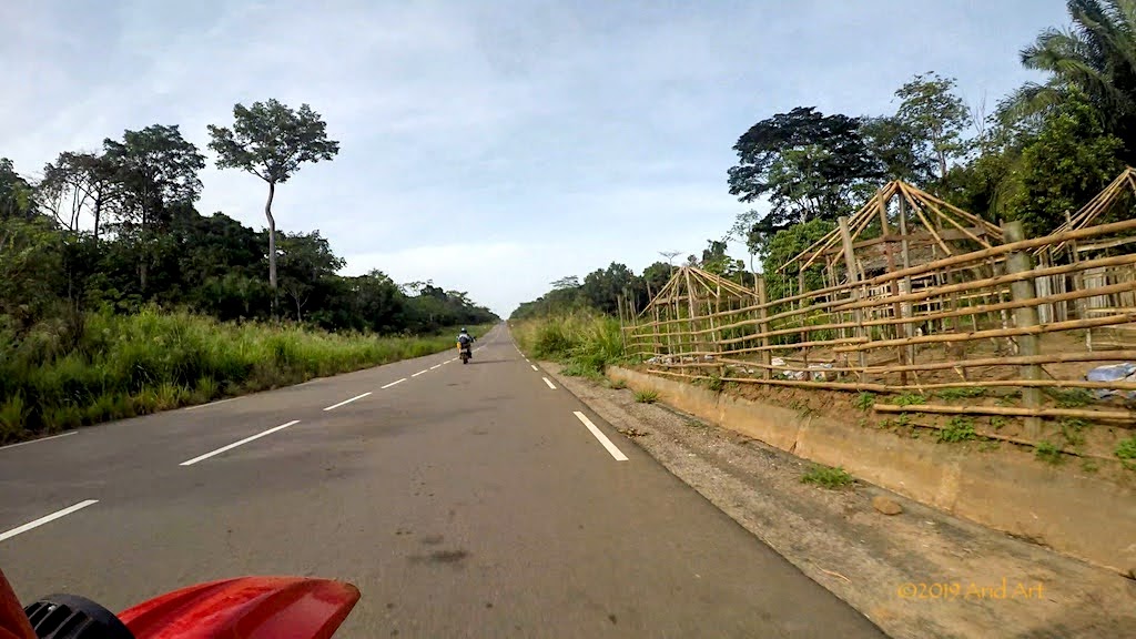
In fact, we manage only 50km before scanning the side of the road. Having gotten a taste of wild camping in the Congo, this is now our accommodation of choice. Obviously, it’s also much cheaper. But finding a gap in this foliage is not that easy…
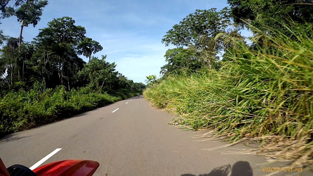
..and where there is a gap, there are people.
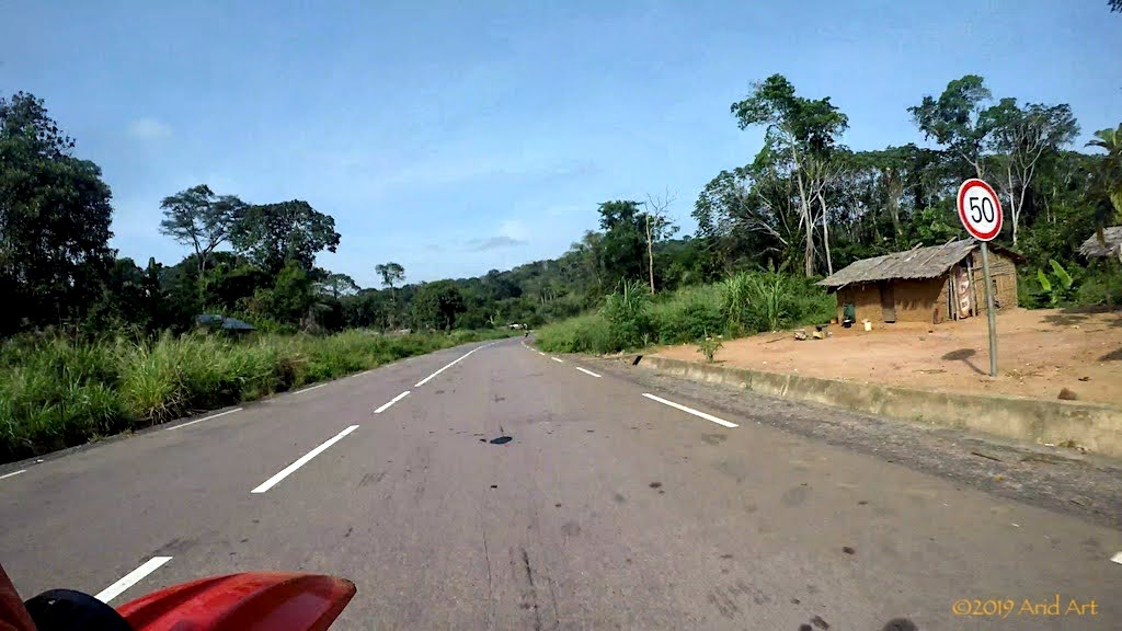
After a false start down a soggy forest road, we spot a deserted container next to the road with a clearing around it. It looks ideal, with enough vegetation to hide us from the passing traffic. But as we unpack, a fellow appears. We cannot camp here: his boss will fire him if we do. But hey, there’s a solution: he just happens to have a veggie patch just on the opposite side where we can camp for a nominal fee, and it’s un bien meilleur endroit (a much better spot). Hmmm.
Grudgingly, we follow him to his jardin. It seems rather close to the road and a bit muddy, but it’s getting late so we settle on a few hundred CFA and pitch our tent.
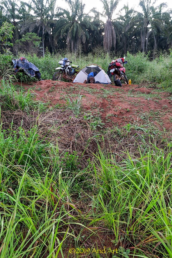
We’re woken by the traffic at first light and it’s obvious that we are clearly visible from the road. Everything is quite soggy from the dew, and every vehicle duly slows down to check us out before continuing. It’s clearly time to get a move on.
We’re still getting dressed when a local policeman pulls up on his scooter and calls me over. He’s surprised at my underpants, but recovers quickly to ask for our documents. Then he wants to know the usual where-to-where-from stuff before finally pointing at his bike’s fuel tank and our containers, suggesting we contribute to filling it. It’s time to do the universally understood shoulder-raising ne comprends pas mime; this country is expensive enough without bribes.
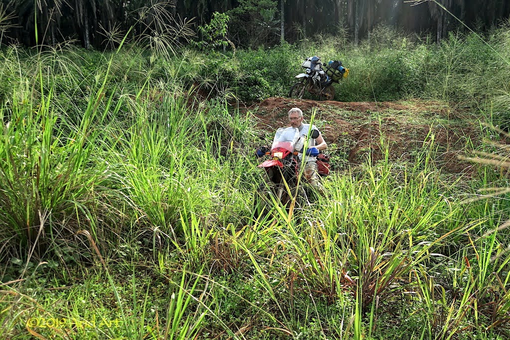
As usual, it’s a great ride till our first coffee stop with the air crisp and cool.
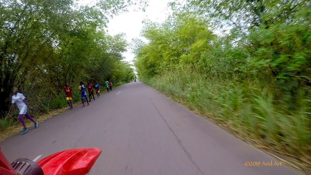
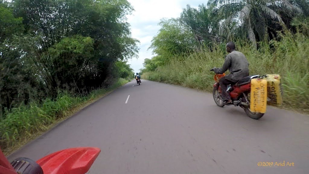
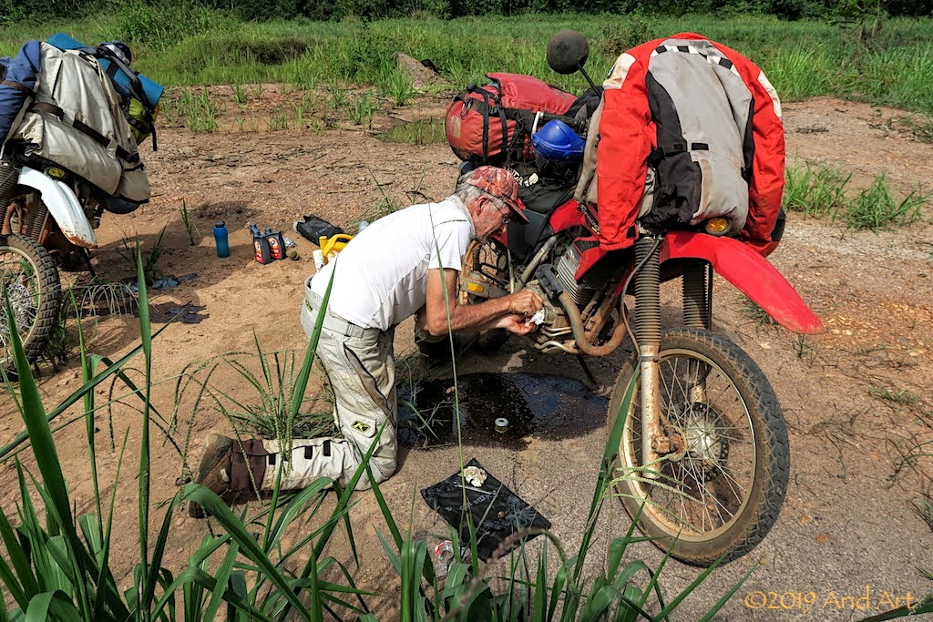
Except that this stop is not just for coffee: our bikes have done 6 000 km by now, which means another oil service. Part of the attraction of last night’s container was the opportunity to also do an oil change out of sight, as we bought oil and extra fuel in Ouesso.
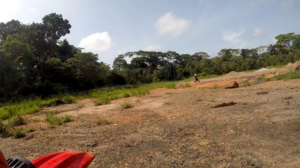
After an hour our opportunity presents itself at a large clearing next to the road, with empty bitumen drums and piles of gravel scattered around. We pull in a fair distance from the road and after emptying our fuel containers, I set to work on the drain plugs while an army of mosquitos sets to work on our faces. Even with our hats and Buffs, we still get stung and our insect repellent dissipates too quickly to have any lasting effect.
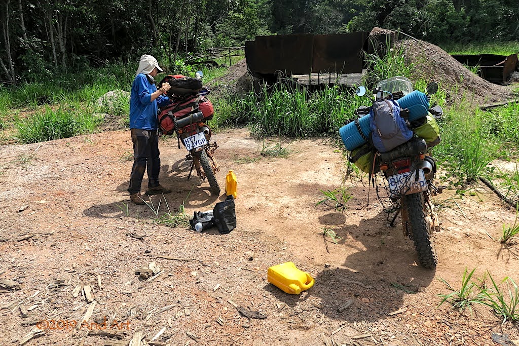
With all the bitumen around here, a few litres of oil in the soil won’t make much of a difference, so the whole process is fairly quick.
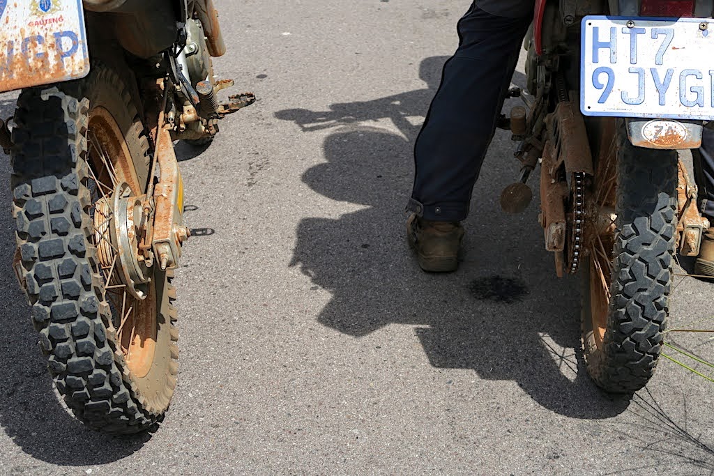
Back on road, we check the tyres; they’re still in great shape. Another benefit of lighter bikes.
Once again, we pass the roadblock at Odzala Reserve, and this time we get herded to a tent to have our passports checked.
Progress is good, and by lunchtime we cross the equator once more. We take a closer look at the monument this time.
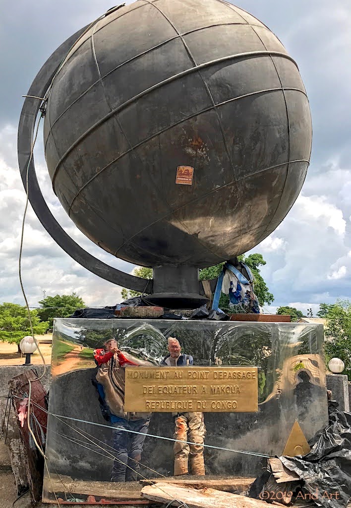
And here’s a panorama of the Congo Republic’s equator marker in all its glory:

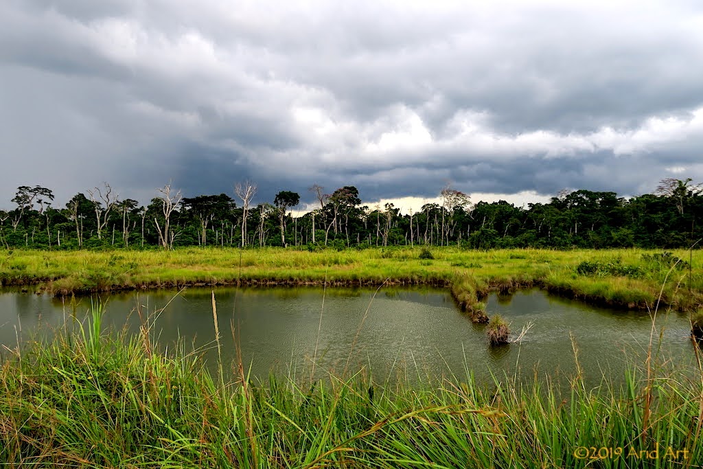
The rest of the day proceeds without further complications, although the weather is often overcast- a feature around Central Africa.
We refuel in Owando without even hitting reserve (330 km), and top up again in Oyo (111 km further). By now it’s time to start planning for supper, so we also stock up on water, eggs and bread.
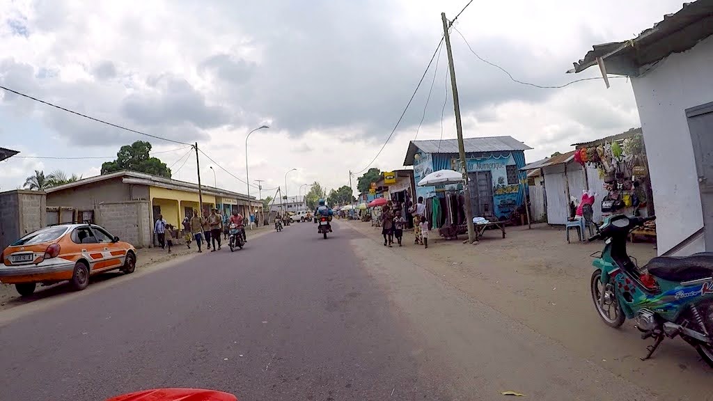
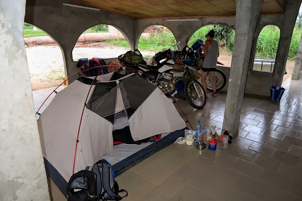
We need to find a camping spot, and there are ominous clouds in the distance. Perhaps wild camping will not be such a famous idea if we get hit by a heavy rainstorm tonight, so as we pass a sign for a Roman Catholic church we decide to try our luck. It turns out to be good move: two elderly men walk up and ask if we need a place to sleep! Instead of the open church, we get led to the adjacent building which has, apart from a generous verandah, a reasonably clean toilet and bucket shower as well.
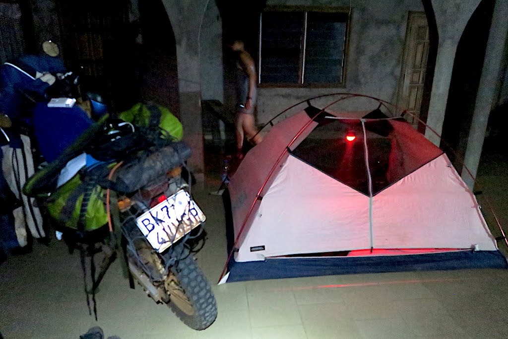
The price to be paid turns out to be a couple of young fraternity members who park themselves in front of our tent to watch every move we make. We get given a bunch of bananas and reciprocate with some biscuits while we make supper, and after showering we are finally left alone.
Although we could see the curtains of rain in the distance before darkness fell, our area stays dry.
A worrying thought has been gnawing away at us during our stay at Sangha Lodge- our DRC visas were issued for multiple entry, but are only valid for one month. That month started ticking away on our departure, which was…. one month ago. Oops.
The internet is awash with sad tales of overlanders meeting their match at the DRC’s border posts without visas. Together with Angola, these two countries have diverted many a traveller eastwards due to their dogmatic visa requirements. At least Angola is no longer an issue for South African passport holders, but the DRC is holding out as a bastion against tourism. I scoured various forums and blogs to see how others had managed this hurdle while at Sangha Lodge, but the list was a short one.
- Having read “From Estonia with Love”on AdvRider, I knew that Margus and Kariina had failed to get a DRC visa after more than a week of waiting at the border post at Matadi before limping west to Soyo. There they managed to load their bike on a boat to Cabinda, thus sailing north around the short coastline of the DRC. https://advrider.com/f/threads/from-estonia-with-love-round-the-world.480532/page-88
- An(other!) Estonian named Kristo Käärman managed to catch a flight out of Cabinda’s airport on an Angolan military Antonov plane after some haggling. https://kaarmann.com/angola-back-in-the-ussr/
- The most amusing tale was on a blog called Free Wheely by a Frenchman named Jean-Baptiste who met his comeuppance in Cabinda trying to get across the DRC border at Yema. He too eventually got a spot on a boat that sailed southwards around the DRC, landing in Soyo. https://freewheely.com/2014/03/congo-cabinda-drc-angola/
Left or right- which is right? We basically have two options for our return leg:
* Reverse the route southwards through the Congo that brought us here
* Head west to Sembé and cross over into Gabon at Mazingo
The former is a familiar path, the latter a new country with new unknowns and two additional border crossings- never a great prospect, even though South Africans don’t need a visa to enter Gabon. Not sure why?
It would be great to see more animals in one of Gabon’s parks and visit Lambaréné (Albert Schweizer’s residence) but parks / reserves along the coast tend to be really pricey and we have a time constraint: mrs Owl needs to get back to the office.
The familiar comforts of Brazzaville are enticing and it seems logical that an extension of our visas for its neighbour should be easy to arrange there. So we settle on the low-risk option and aim for the RN2 again.
After breakfast the next morning we say our goodbyes to Alon, Bas and Blaise who will do the trip to Ouesso by boat that we will cover by bike.
We underestimated the distance to Bomassa on our way here, so we need extra fuel to make it back. There are no pumps along the way, but the WCS has a depot and they are prepared to sell some. So, after a quick lube of the chains we ride down to the fuel store. A funnel is inserted into my tank and the fuel gurgles downwards.
All goes well until a small green snake falls out of a tree in front of mrs Owl’s bike. To her surprise, a ranger tramples it to a pulp in an instant as the fuel filler beats a hasty retreat. So much for wildlife conservation.
There’s some action high up in the surrounding trees today, and it turns out that they are primates. Even with a telephoto lens, they are hard to make out in the foliage. We manage to identify a troop of grey mangabeys and some moustached guenon monkeys playing. Proof of life, at last!
After collecting all our kit from the office and settling our bill, we can repack the bags and saddle up. Ray, the husband of the financial manager, takes an interest in our vehicles and later mails us some pics:
Although it hasn’t rained during the night, I’m worried about the potentially slippery tracks from here to Kabo. In fact, it was a major concern when choosing the tyres for this trip, as I expected much more rain. Whereas almost any tyre will work in sand, it’s a well-known fact that mud sticks to tyres way better than the other way round!
Especially when there’s camber involved.
Forest elephants may be endangered but there are plenty of signs that they are in the vicinity today.
Their diet is on display in the piles of dung lying about- quite nutty!
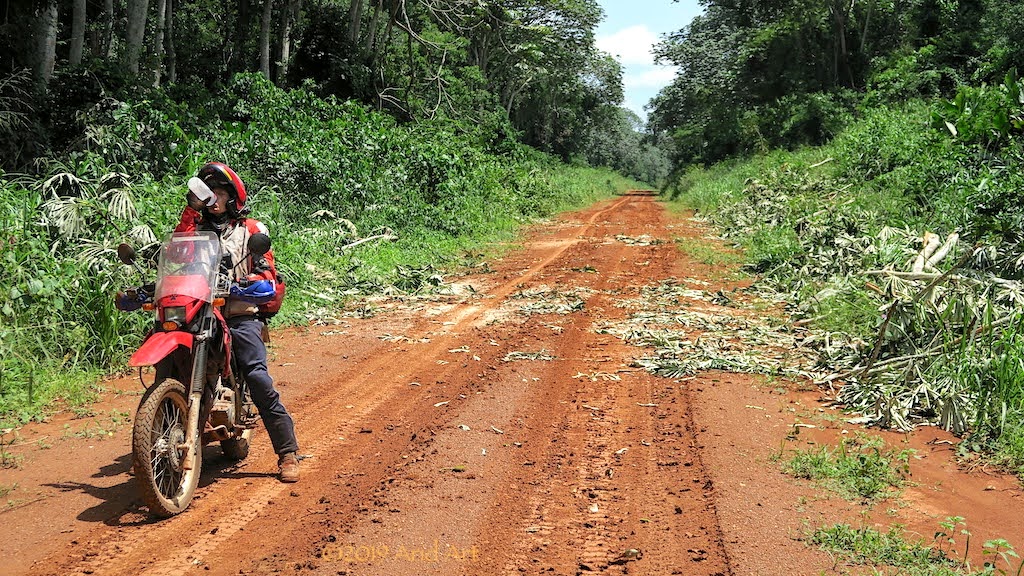
Fortunately the forest roads after Kabo are well drained and dried by the time we reach them. We make good progress until we pull over at the entrance to the forest, before tackling the last stretch from Pokola back to the ferry.
Within an hour we are back at the river once more, where there’s a queue of trucks. When we get to the front, it’s clear why: a welder is busy repairing the ramp. So everybody has to wait.
Along the side of the road a truck with cooking oil aboard has flipped over: slippery when wet?
Around the ramp, people have sought shade under the trees, munching snacks whilst watching the welder. Three pigs have been tied up and they’re squealing so their owners cool them down with water from the river. We buy cold drinks from an ice tub while waiting for the repairs and chat with a truck driver carting timber from Cameroon. He says the Congolese are lazy and don’t produce anything. From what we have seen it’s hard to argue- just about everything here is imported.
After a few hours the ferry is ready to resume service and we get directed to park behind the three pigs.
And so we cross the Sangha. On the Ouesso side, we return to the registry office to sign back into the province. It doesn’t go well.
The official isn’t happy with our passports and I get escorted to an immigration office nearby. After a few minutes an official arrives on a moped and invites me inside. The problem, and this is repeated a number of times to emphasise the seriousness of the situation, is that we did not get exit and re-entry stamps for the Congo after visiting the CAR. That was all supposed to happen in Kabo...
Happily, there’s a solution when Money is involved and despite a stubbornly dry inkpad, the requisite exit (backdated!) and entry stamps are expertly added to our passports after a few thousand CFAs have changed hands. It’s basically the same amount we would have had to pay in Kabo and I get a free lift back to the registry office on the rickety moped to boot.
All of these delays have taken up most of the afternoon, and after refuelling and restocking in Ouesso it’s clear that we won’t get very far out of town before dusk.
In fact, we manage only 50km before scanning the side of the road. Having gotten a taste of wild camping in the Congo, this is now our accommodation of choice. Obviously, it’s also much cheaper. But finding a gap in this foliage is not that easy…
..and where there is a gap, there are people.
After a false start down a soggy forest road, we spot a deserted container next to the road with a clearing around it. It looks ideal, with enough vegetation to hide us from the passing traffic. But as we unpack, a fellow appears. We cannot camp here: his boss will fire him if we do. But hey, there’s a solution: he just happens to have a veggie patch just on the opposite side where we can camp for a nominal fee, and it’s un bien meilleur endroit (a much better spot). Hmmm.
Grudgingly, we follow him to his jardin. It seems rather close to the road and a bit muddy, but it’s getting late so we settle on a few hundred CFA and pitch our tent.
We’re woken by the traffic at first light and it’s obvious that we are clearly visible from the road. Everything is quite soggy from the dew, and every vehicle duly slows down to check us out before continuing. It’s clearly time to get a move on.
We’re still getting dressed when a local policeman pulls up on his scooter and calls me over. He’s surprised at my underpants, but recovers quickly to ask for our documents. Then he wants to know the usual where-to-where-from stuff before finally pointing at his bike’s fuel tank and our containers, suggesting we contribute to filling it. It’s time to do the universally understood shoulder-raising ne comprends pas mime; this country is expensive enough without bribes.
As usual, it’s a great ride till our first coffee stop with the air crisp and cool.
Except that this stop is not just for coffee: our bikes have done 6 000 km by now, which means another oil service. Part of the attraction of last night’s container was the opportunity to also do an oil change out of sight, as we bought oil and extra fuel in Ouesso.
After an hour our opportunity presents itself at a large clearing next to the road, with empty bitumen drums and piles of gravel scattered around. We pull in a fair distance from the road and after emptying our fuel containers, I set to work on the drain plugs while an army of mosquitos sets to work on our faces. Even with our hats and Buffs, we still get stung and our insect repellent dissipates too quickly to have any lasting effect.
With all the bitumen around here, a few litres of oil in the soil won’t make much of a difference, so the whole process is fairly quick.
Back on road, we check the tyres; they’re still in great shape. Another benefit of lighter bikes.
Once again, we pass the roadblock at Odzala Reserve, and this time we get herded to a tent to have our passports checked.
Progress is good, and by lunchtime we cross the equator once more. We take a closer look at the monument this time.
And here’s a panorama of the Congo Republic’s equator marker in all its glory:
The rest of the day proceeds without further complications, although the weather is often overcast- a feature around Central Africa.
We refuel in Owando without even hitting reserve (330 km), and top up again in Oyo (111 km further). By now it’s time to start planning for supper, so we also stock up on water, eggs and bread.
We need to find a camping spot, and there are ominous clouds in the distance. Perhaps wild camping will not be such a famous idea if we get hit by a heavy rainstorm tonight, so as we pass a sign for a Roman Catholic church we decide to try our luck. It turns out to be good move: two elderly men walk up and ask if we need a place to sleep! Instead of the open church, we get led to the adjacent building which has, apart from a generous verandah, a reasonably clean toilet and bucket shower as well.
The price to be paid turns out to be a couple of young fraternity members who park themselves in front of our tent to watch every move we make. We get given a bunch of bananas and reciprocate with some biscuits while we make supper, and after showering we are finally left alone.
Although we could see the curtains of rain in the distance before darkness fell, our area stays dry.
NiteOwl said:[size=12pt][size=10pt]Despite the “camping” label, Casper Lodge is anything but a budget establishment. The fellow at reception wears a neat suit and shows us where we can shower: in the gym. There’s also a glossy restaurant where we sit down for the cheapest meal on the menu- omelettes. There's also a swimming pool, but no sunbathers. In fact, not many patrons at all and we are the only campers.
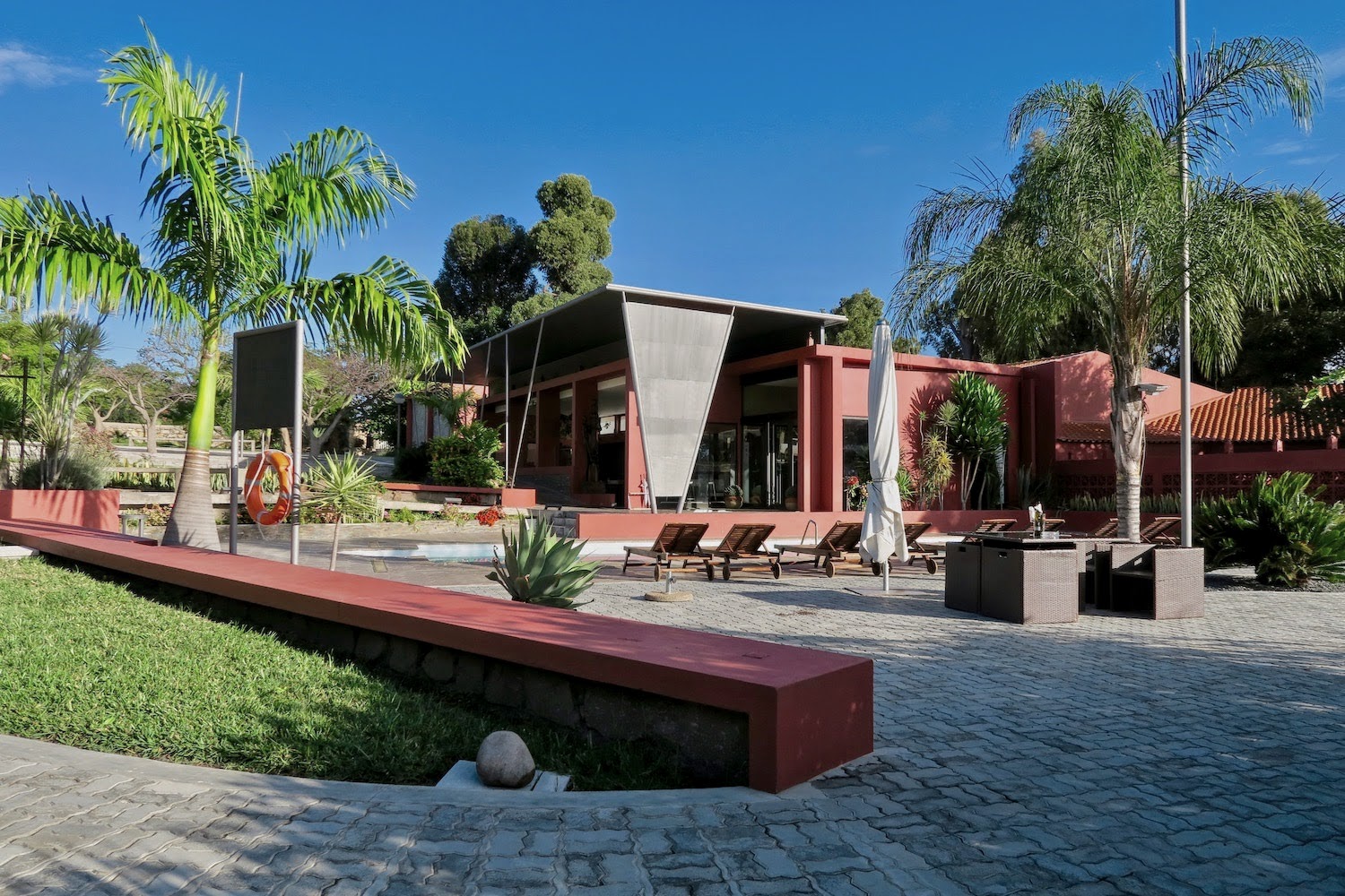
Our “campsite” is actually part of the lawn between the chalets forming part of the real Lodge, and our toilet and kitchenette look suspiciously like servant’s quarters. But we have a corner of the garden to ourselves (not to mention the gym!) and there’s a steel frame where we string up a rope to do our laundry the next morning. According to the guards at the gate (the entire compound is walled), there is a large shop down the road. It turns out to be a Shoprite, and it’s very well stocked indeed. Unfortunately, most Angolans do not have enough disposable income to buy more than a half-filled handbasket and the country’s high inflation rate and dependence on oil are not helping. The slump in Shoprite’s latest results is not surprising. https://www.theafricareport.com/16430/shoprite-slumps-as-consumers-struggle-in-angola-and-nigeria/
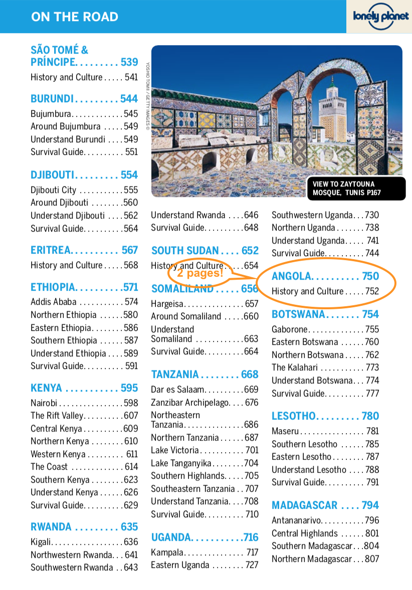
To say that Angola is not exactly a tourist Mecca is an understatement. Never mind Pam Golding, even Lonely Planet hasn’t discovered the place yet:
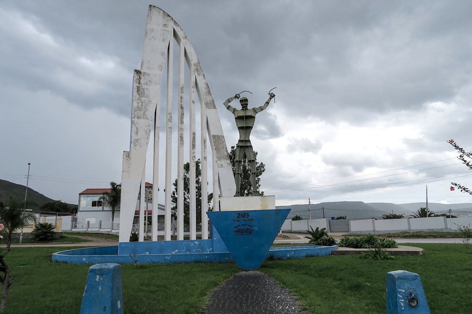
So, most of the information about the country is buried in trip reports and programmes like Voetspore. Most South African who have visited the country have done so via Lubango, so the sights around here are rather well known. We have to wait for a light shower to subside before heading out to the northwest of the city in the early afternoon. En route, yet another uhuru statue:
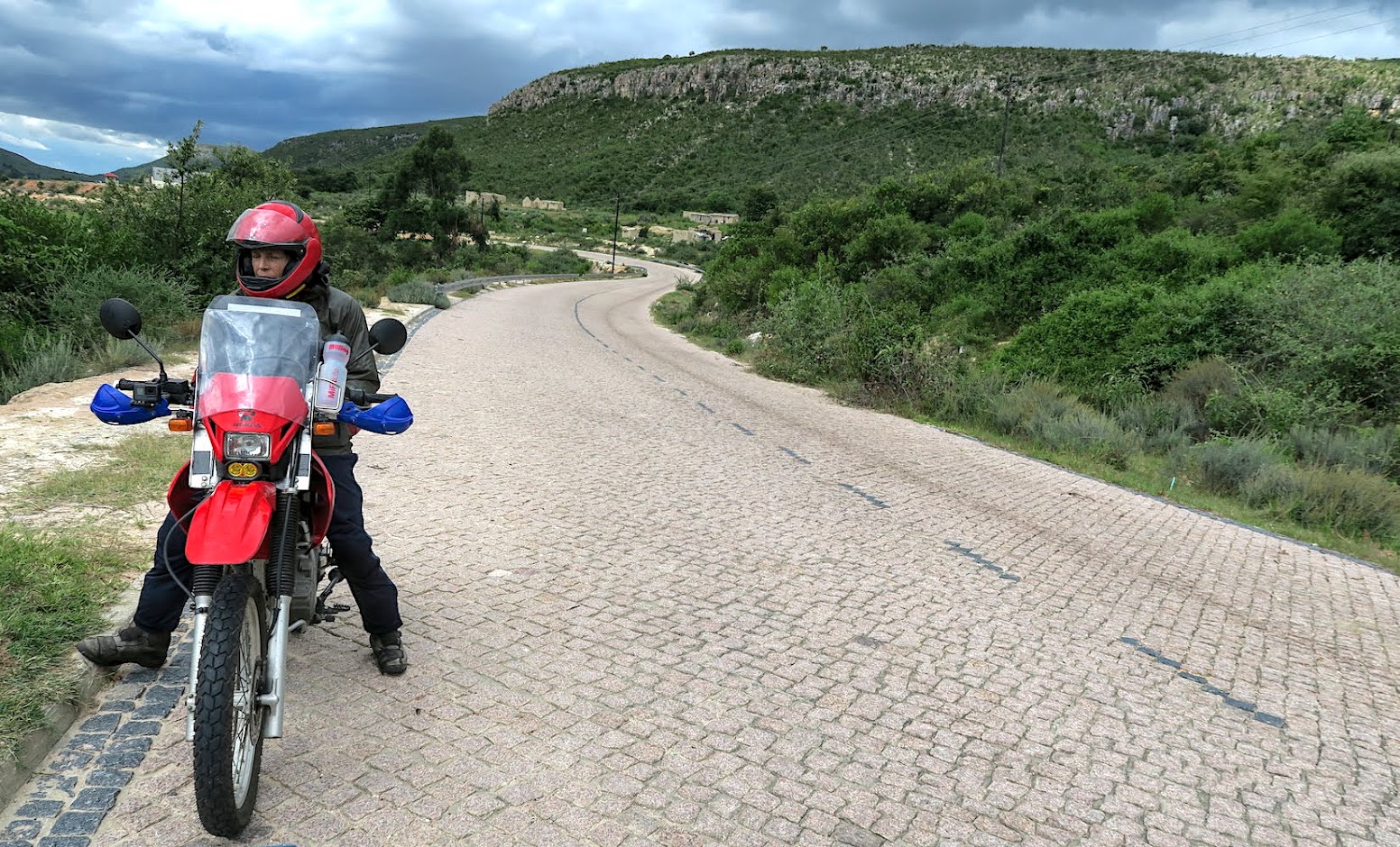
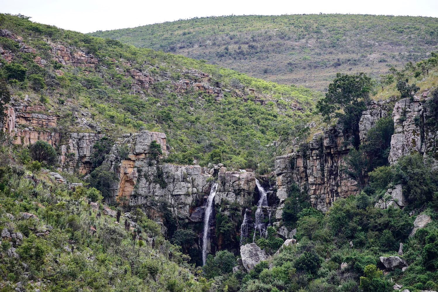
The cobblestone road (“gravel”, according to T4A) rises fairly steeply past the waterfalls below the Mapunda dam from which the local N’gola beer is brewed:
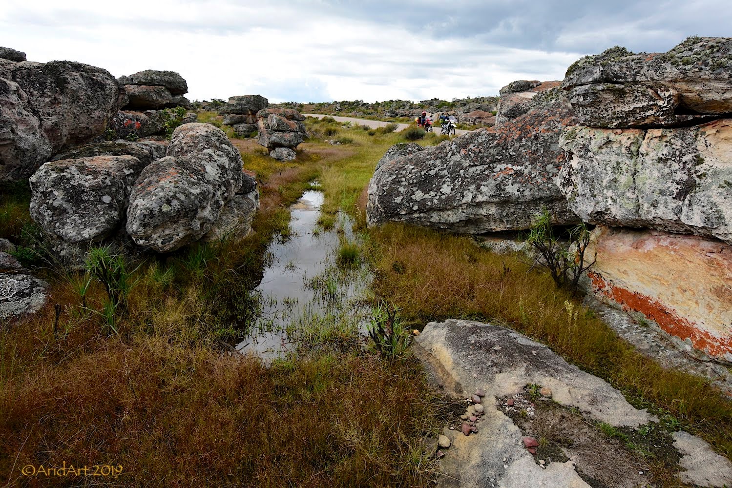
Higher up, it looks like a giant child threw its toys out – rocks litter the rough landscape, puddles of water are in between.
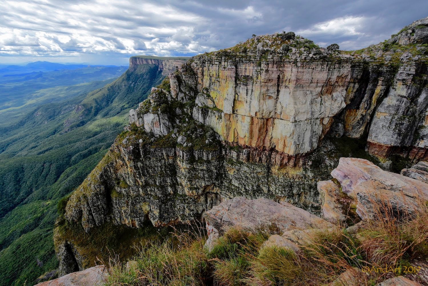
At the top is a parking area and a lookout on the edge of the Tundavala gap- a sheer drop of nearly a kilometre down the escarpment where the clouds shroud our view of the coast.
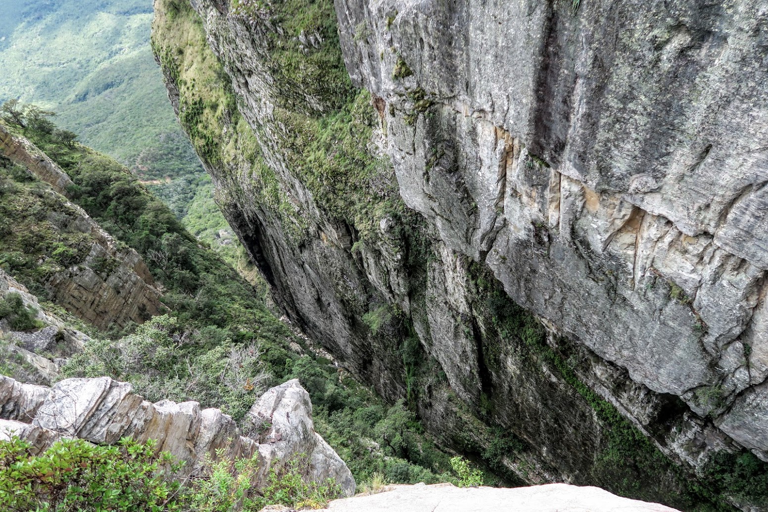
The best way to get an impression of the sight from the lookout is with a video, but I won’t spoil it for the readers planning to visit the area Trust me, it’s well worth a visit! There’s a track circling around the northern side of the Gap where one could set up a rather nice camp with a spectacular view.
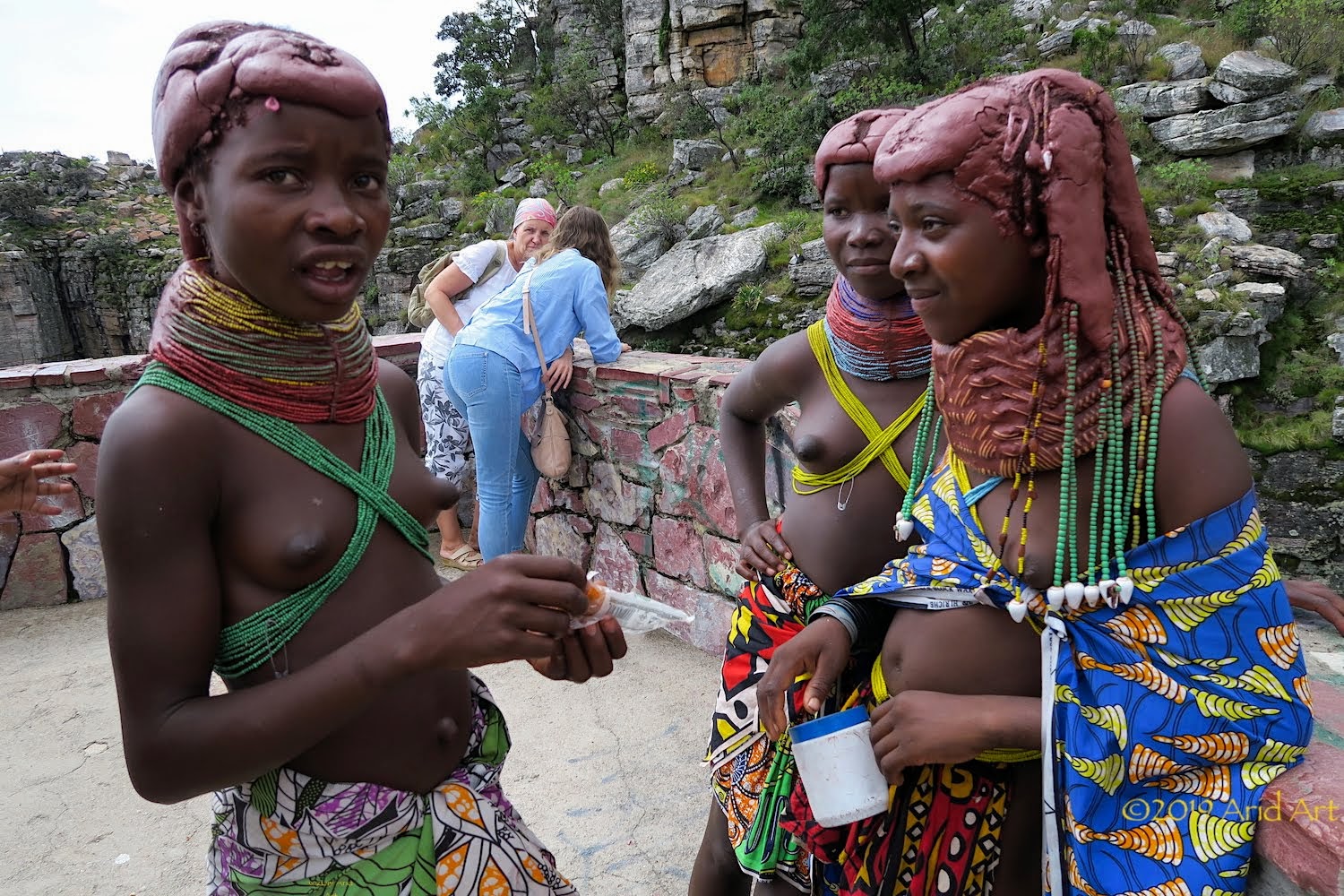
There are some women patrolling the area in search of money from the few tourists who have come to admire the sight. Their hair coating is a lot like that of Himba women, made from a paste of animal fat and locally ground stone, but they are considerably lower is stature and the facial features are less refined. They belong to the local Mumuhuila tribe.
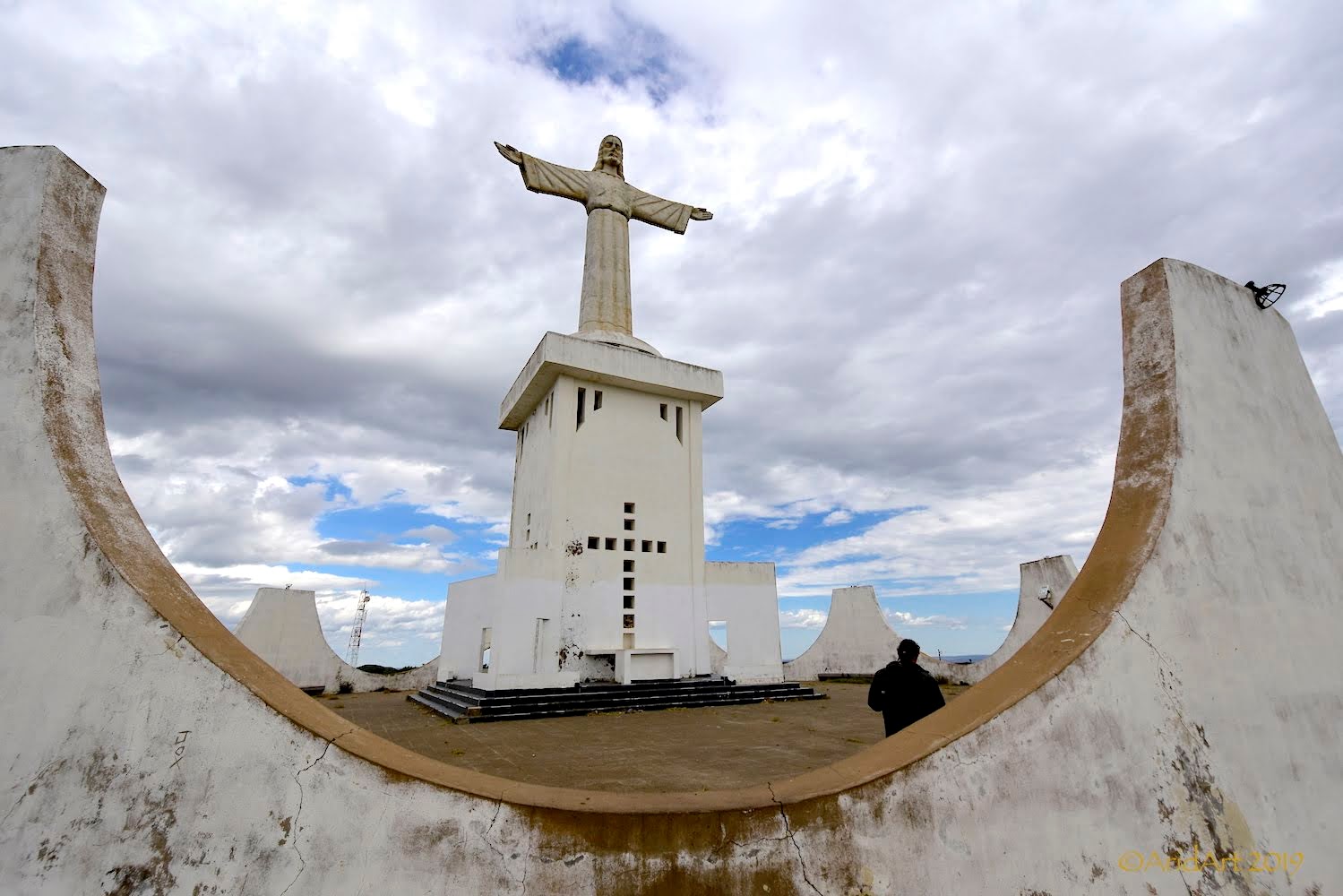
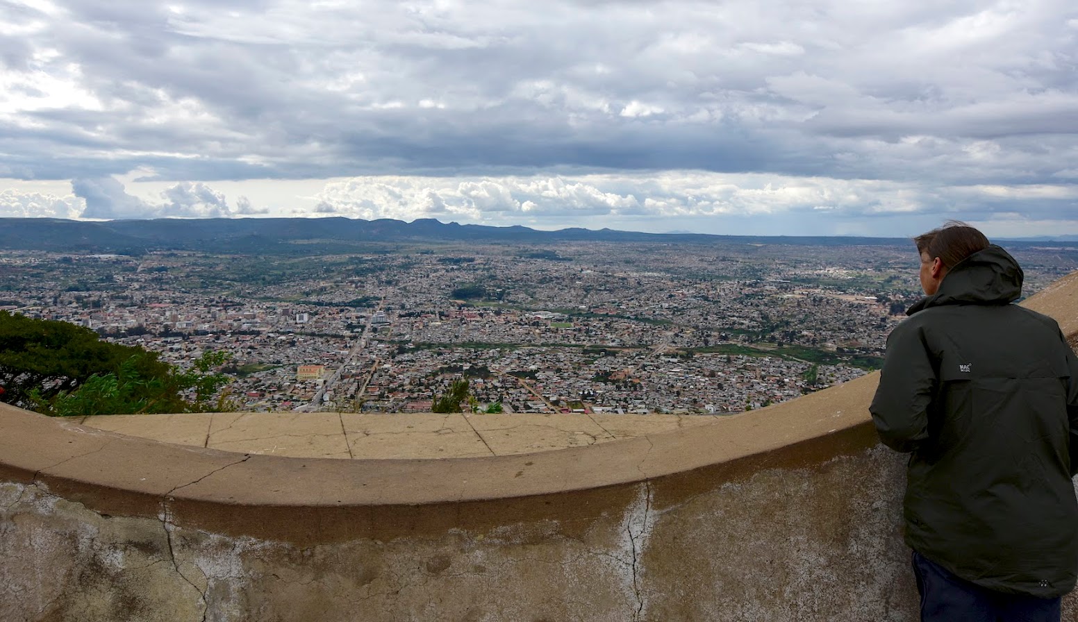
The Christo Rei statue is on the opposite side of the city (southeast). A narrow road follows the edge of the ridge overlooking Lubango.
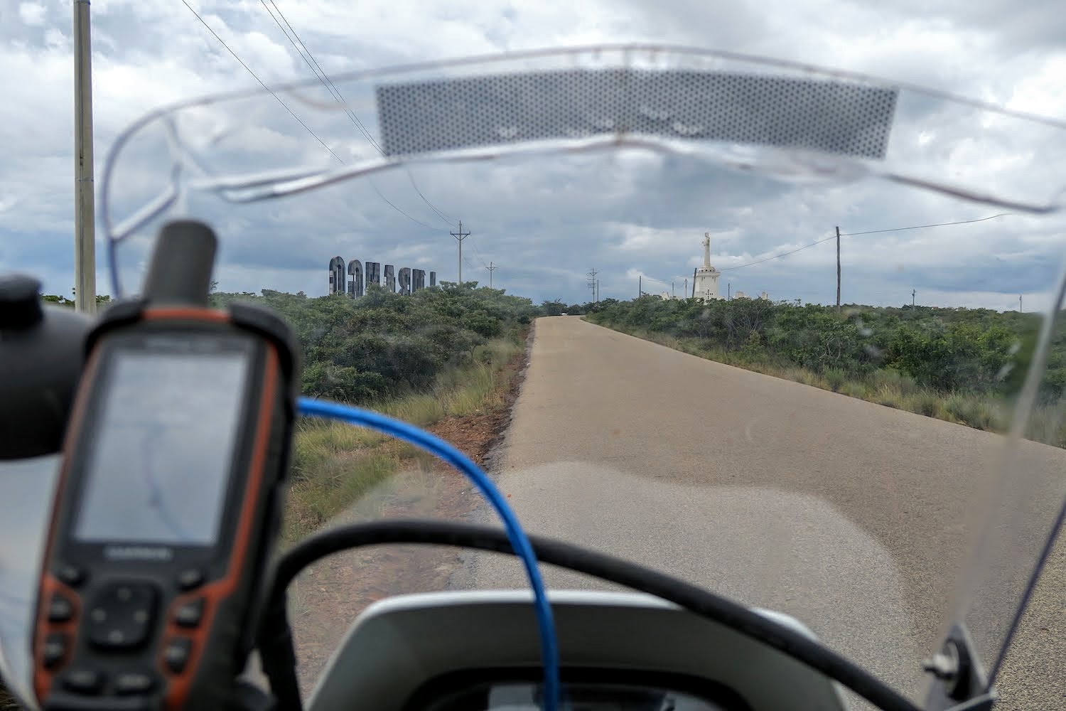
We dismount for the obligatory photos. This statue is actually modelled on a similar (bigger and better) one in Lisbon. The artwork is rather basic, even if one ignores the damage to the face. There is no sacred heart either, and no lightning conductors- clearly not a concern around these parts.
View over the city:
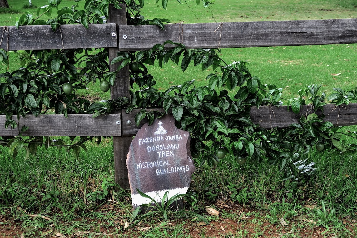
Next up we go looking for what remains of the Dorsland Trekkers around Humpata. T4A indicates a site about a hundred metres from the main road, but there’s little more than a plaque leaning against the fence of the run-down house:
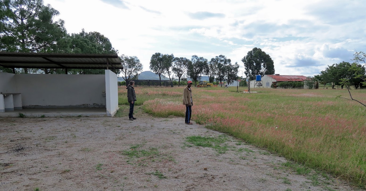
Camping is supposedly on offer nearby, at the farm of a Basie Prinsloo. It proves tricky to find among the tracks here, but when we do locate the farmhouse it turns out that it was abandoned a few months ago. There is a backpacker-like shelter about a hundred metres away with toilets, showers and a braai area. It must have been great in its heyday, but water is unlikely to ever flow through the taps again.
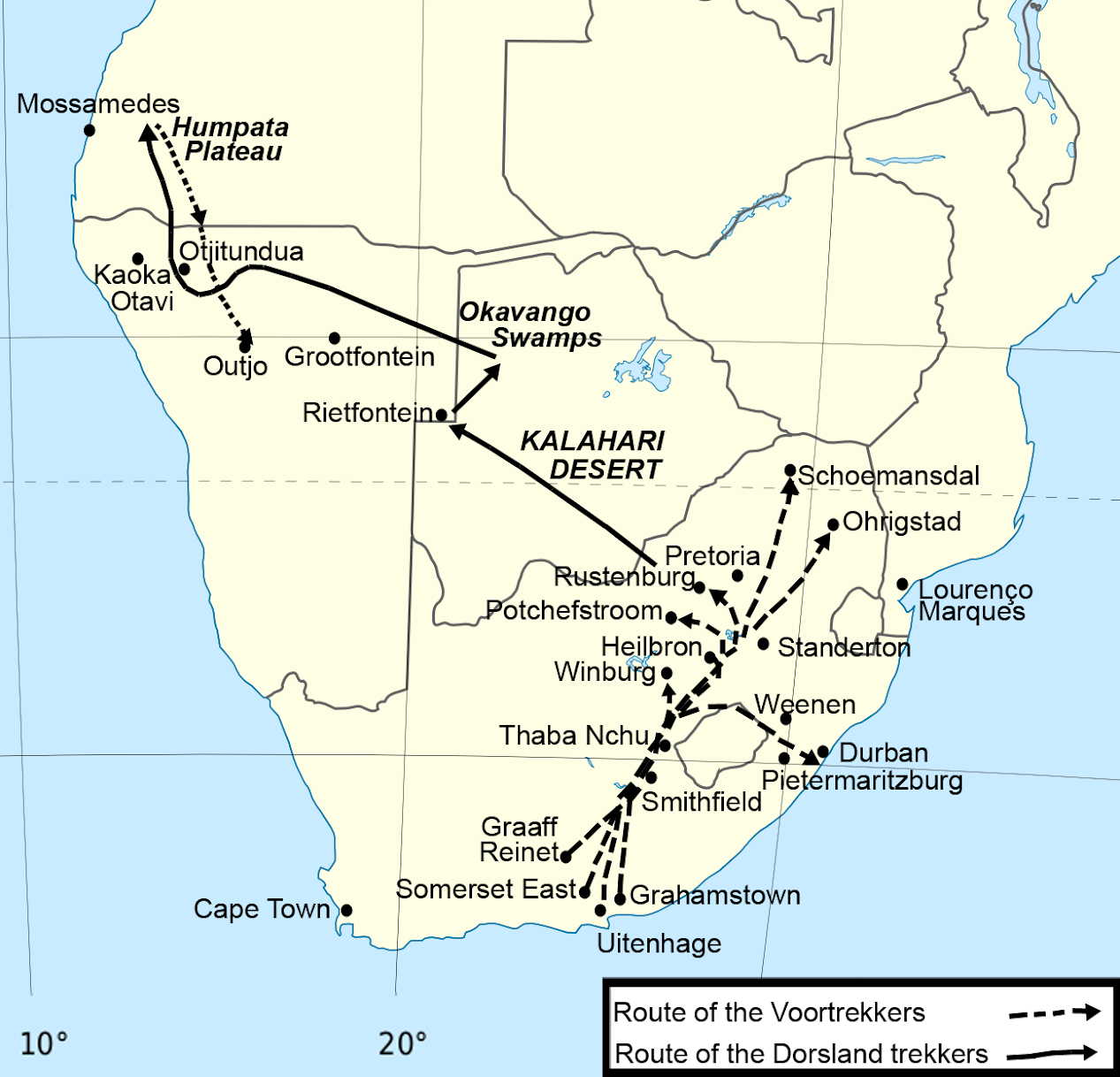
The Dorsland Trekker Monument, erected in 1957, is a little further on. The chains that used to surround it are gone and weeds are overgrowing the paving around it. The Trekkers were another important motivation to visit Angola, as I find the very idea that people would pull up their roots to cross a thousand kilometres of desert with ox-wagons for an unknown “promised land” fascinating. It has taken us a week to cover a similar distance on modern transport and paved roads!
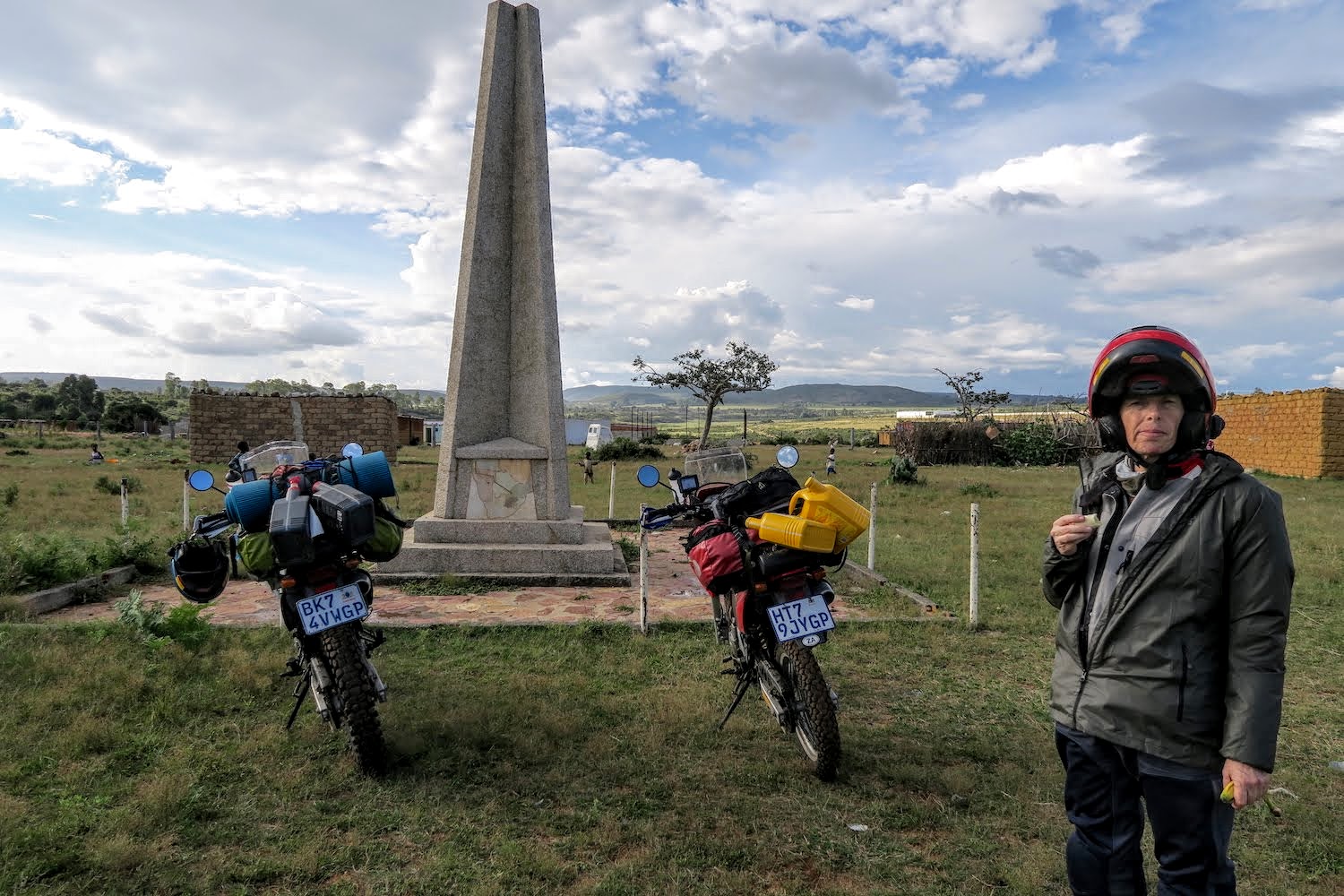
My first exposure to their history was at Swartbooisdrift during our Kaokoland trip in 2011, where there is another monument commemorating their journey:
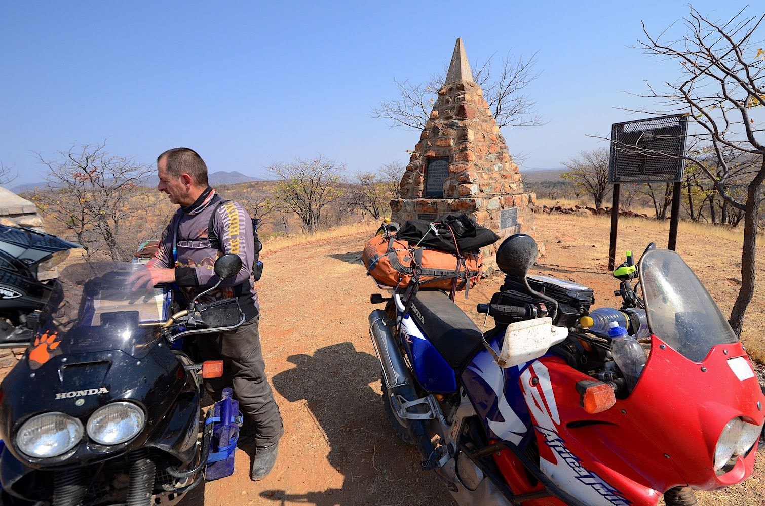
The Dorsland Trekkers crossed the Cunene river (the same river that we crossed at Xangongo the previous day) there in early 1881 with their wagons and oxen to settle in Humpata - seven years after starting their journey- right where we are now. More than half of them perished during the journey; the impoverished survivors never really integrated into their new country and had a tough time making a living on their own. In 1928 they turned back south to settle in Ovamboland (Namibia) and the last five hundred bittereinders fled the country at the outbreak of the civil war in 1975.
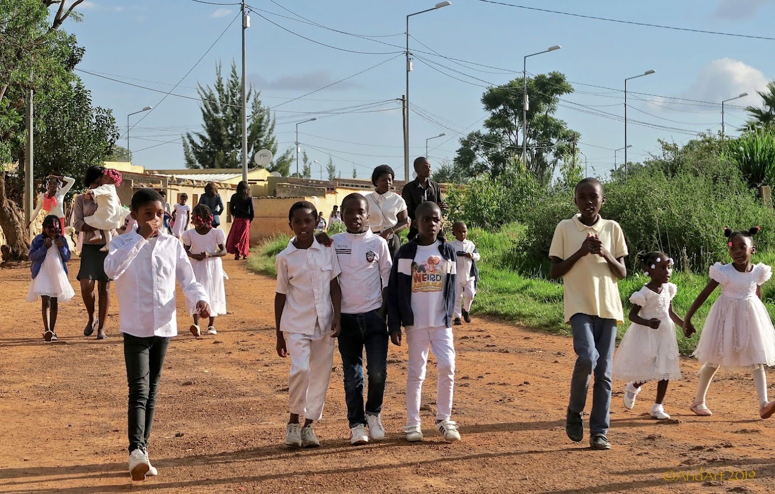
The present-day residents of Humpata are out in the street on their way to church. Everyone is dressed in their Sunday finery for the Easter service.
It’s disappointing to have come all this way for nothing more than a monument, but at least there's still time to look for alternative accommodation. We’re actually on the road that leads down the Leba Pass to Namibe (formerly Moçâmedes), but the coastal route is part of our return route. Right now, our next destination is Huambo (Nova Lisboa in the old days), nearly 400 km from here. It’s too late for that today; the best we can do is to stock up on some bread and look for a campsite alongside the road before nightfall.
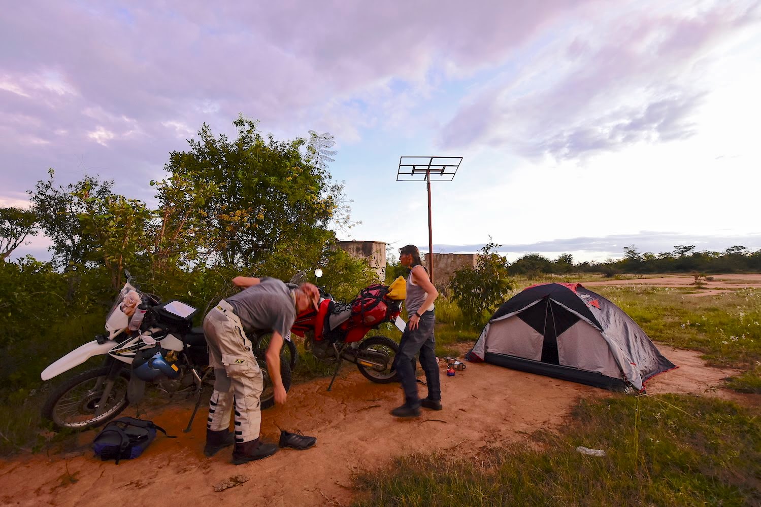
We manage to do sixty kilometres out of Lubango when we find an ideal spot behind a water tower. It’s the first of many bushcamps in Angola, and it’s relaxing to be able to do our own thing without any worry about the cost as we cook our supper without distraction. Properties here aren't fenced (land annexed by the Portuguese colonialists became state-owned after 1975, and although a Land Law was passed in 2004, there is no freehold), so camping is a pretty simple affair as long as you don't mind the lack of facilities. Very few people travel after dark and most vehicles (especially the motorcycles) don't have functional headlights.
At sunrise we are up. Since we are still more than 5000 ft above sea level, the air is crisp and there are no mosquitos about. We make an early start and the riding is pleasant in the cool air. We pass an FAS (Fundo de Apoio Social= Social Support Fund of Angola) primary school sponsored by the EU at Vihamba.
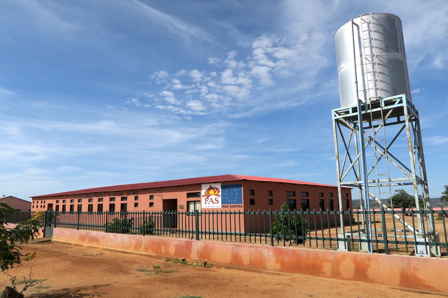
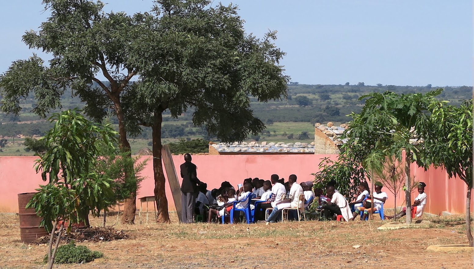
A class (with pupils that look rather old for primary schooling) is in progress under a tree within the compound, but outside the building. WTF?
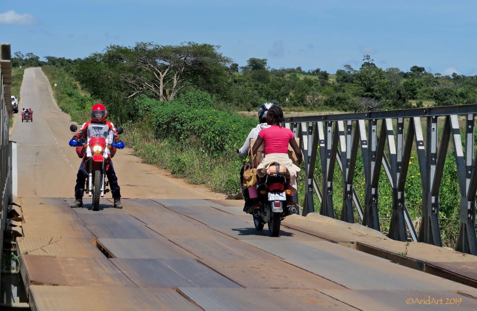
Although the road is good, some of the bridges are temporary with steel plates rattling as the traffic passes over them. War repairs?
It’s the start of the week and we pass many village markets along the road.
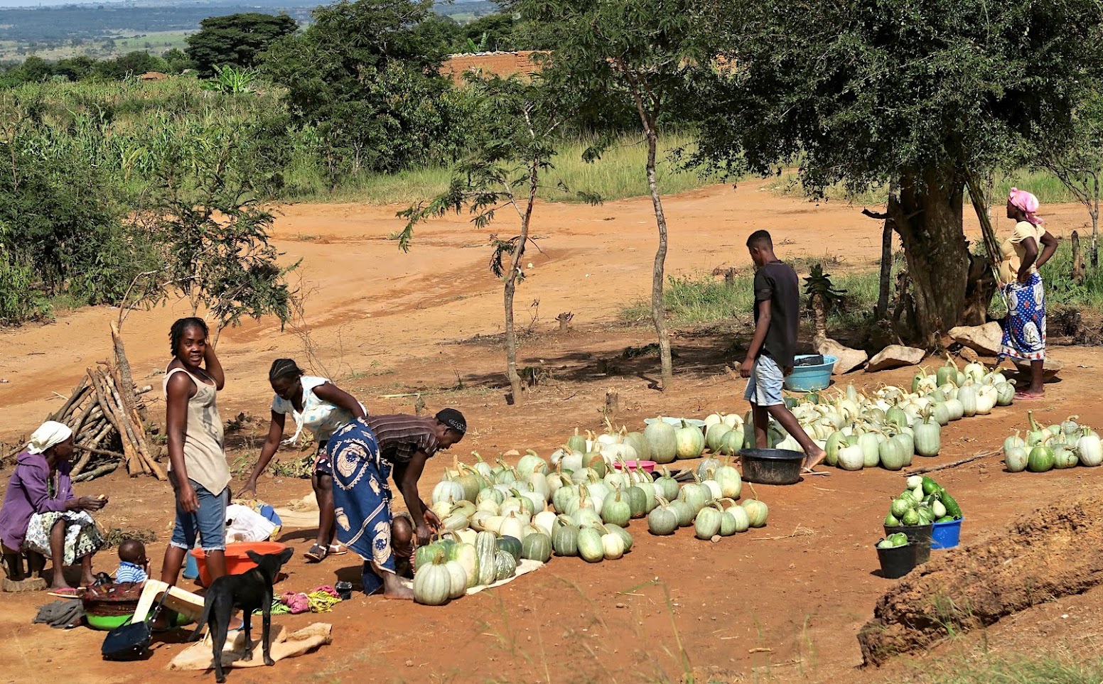
Vegetables, fruit, flour, chickens, eggs… are on offer.
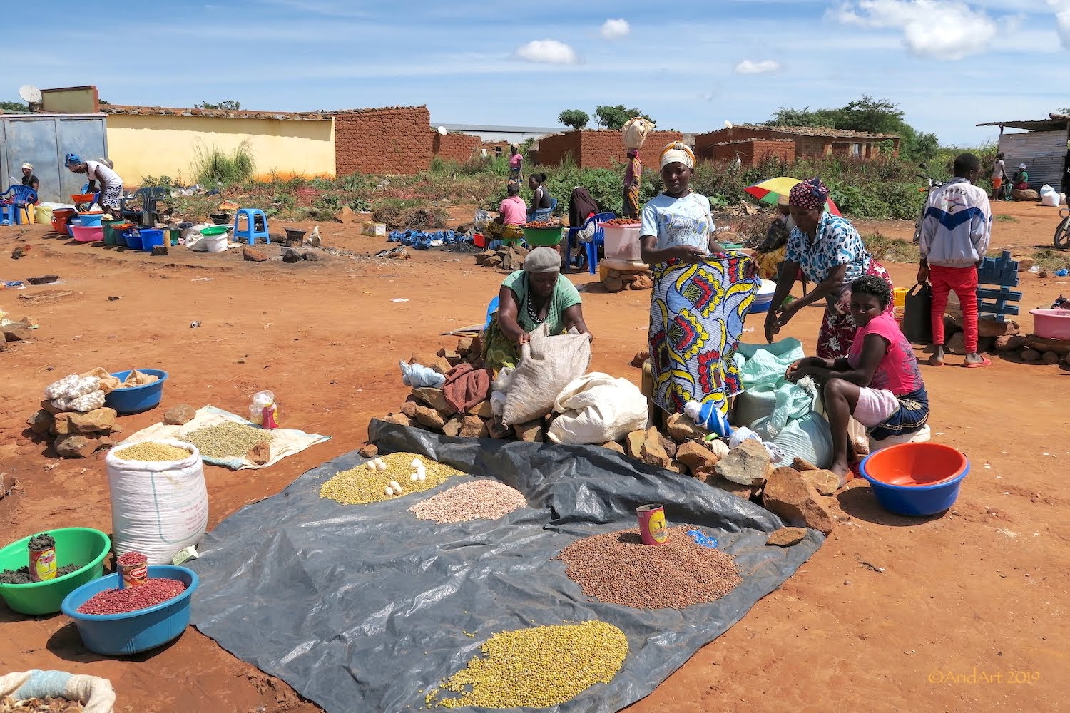
Bananas are a dime a dozen here- we buy some for lunch.
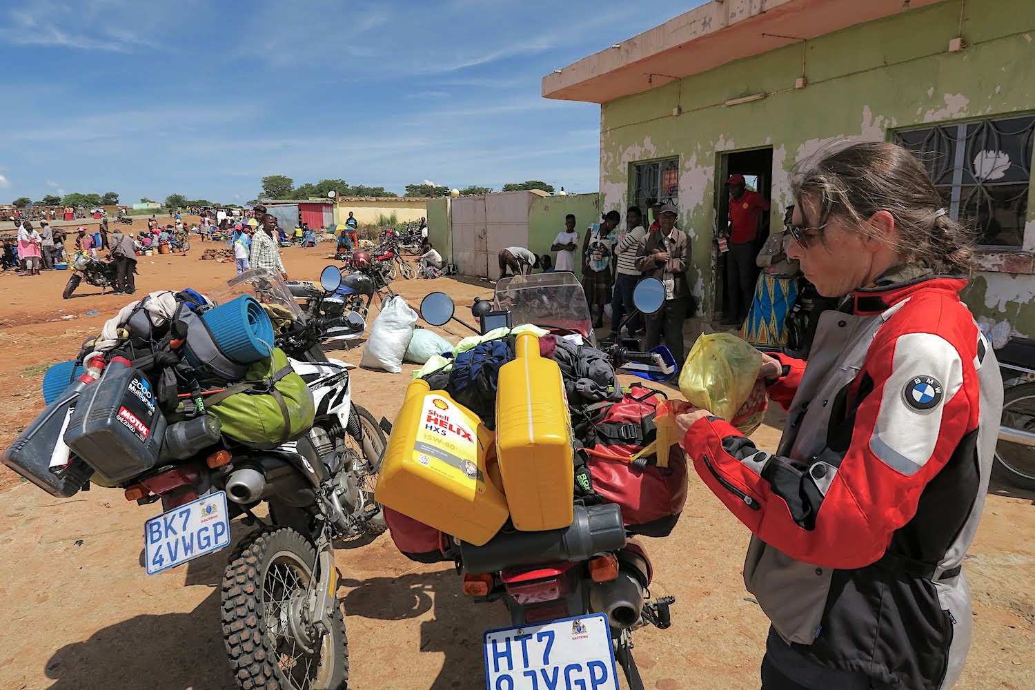
By the afternoon the weather is getting overcast again at our fuel stop in Caconda, but this time we don’t escape the rain. Unfortunately, it coincides with the end of the paved road and things quickly get very slippery and our good progress takes a turn for the worse as the rain buckets down. After a short wait, we decide to carry on, but slowly. Things can only improve if you move!
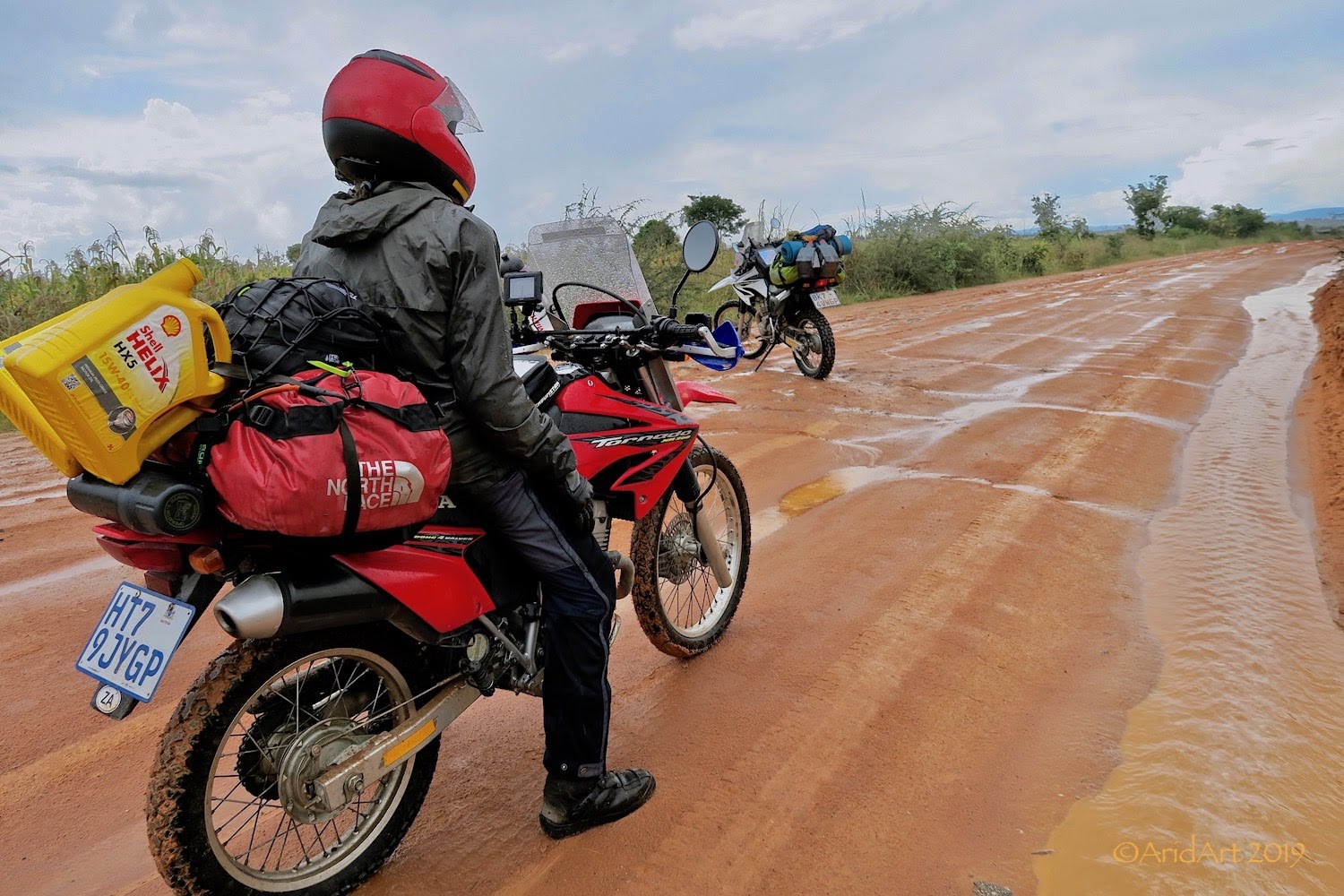
Half an hour later the rain subsides and shortly after that there are only puddles here and there. There are detours around new bridges under construction.
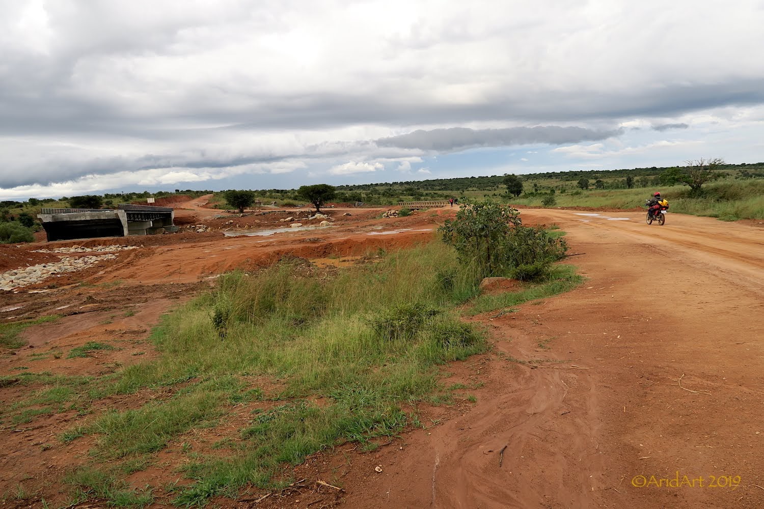
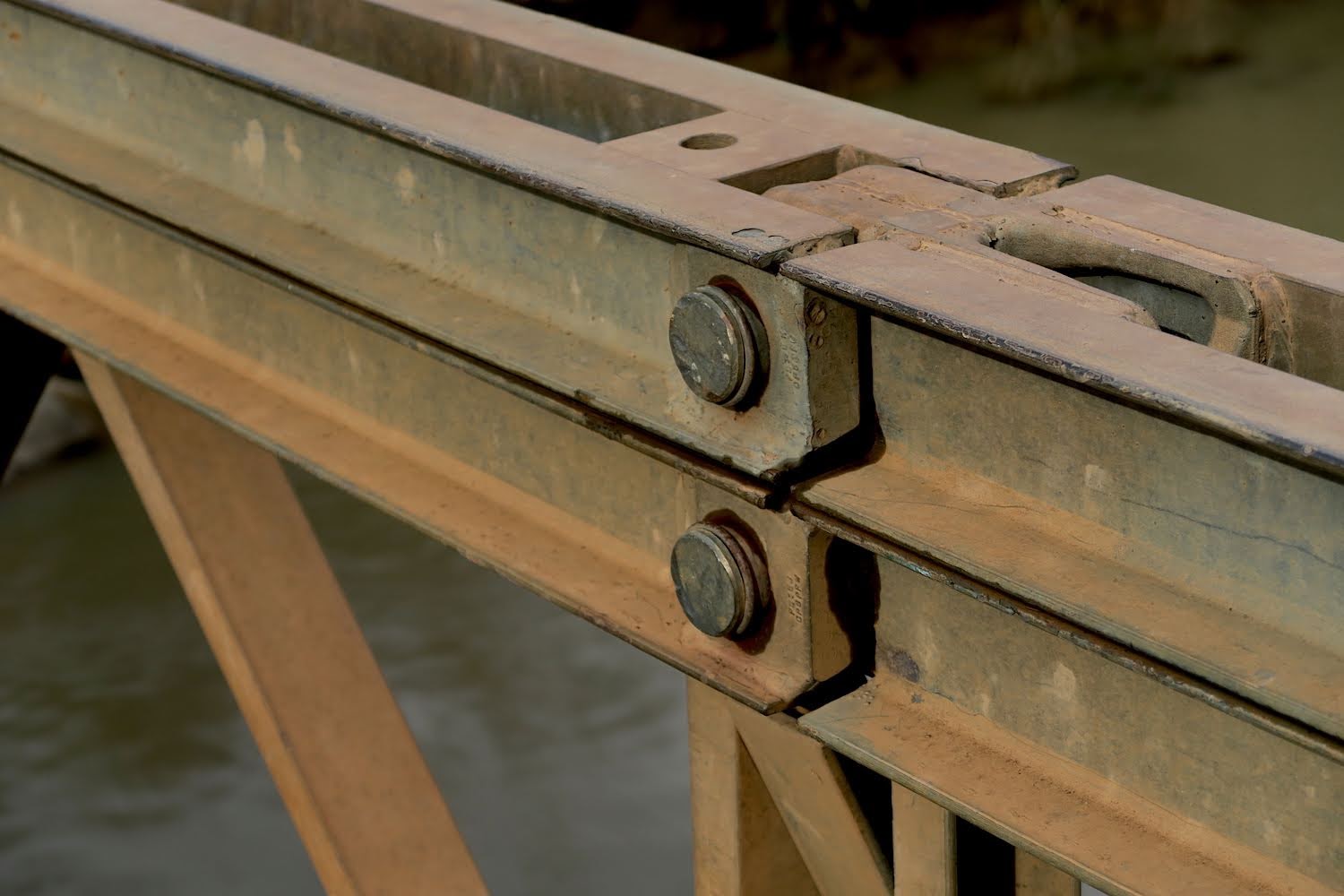
Going by the markings on the structure and fasteners, I would say that these are not Chinese- donations from the IMF or EU, perhaps?
Despite the fact that we are still on the highlands, the first sugar cane is on offer (we saw lots of it further north):
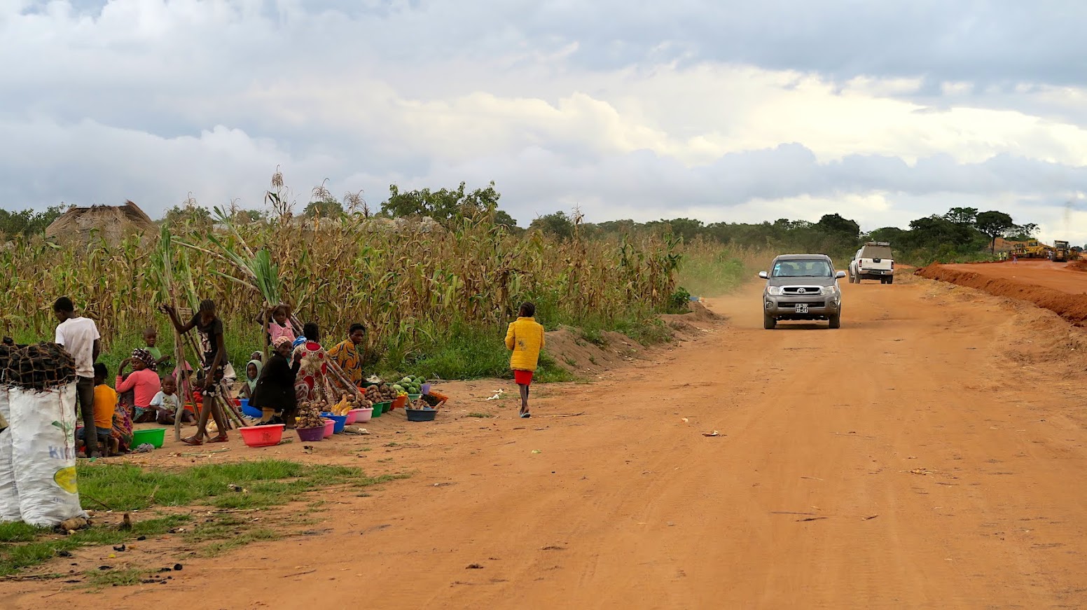
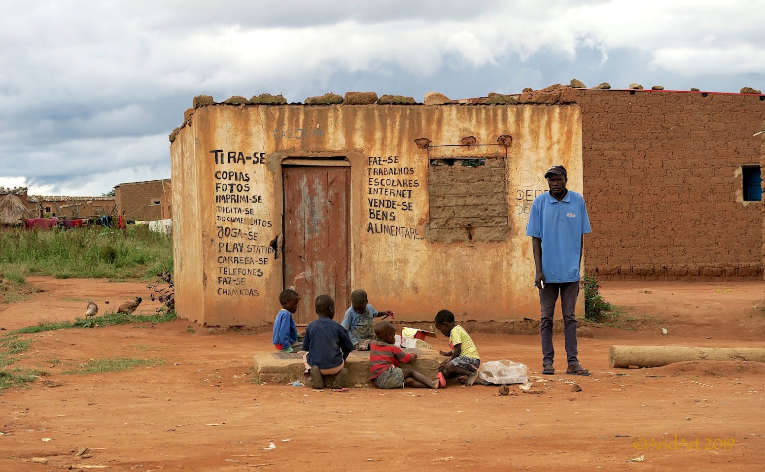
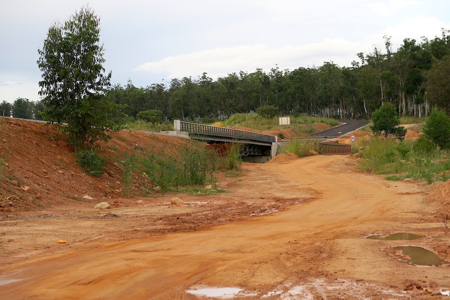
Although we are on the main road, houses are built right next to it in the villages and kids are playing in front of the structures. It’s typical for Africa, where the roads are actually a public socialising area. Needless to say, you cannot speed through here and hence a smaller bike works very well. We actually attract surprisingly little attention.
As we get closer to Huambo, road construction is further advanced and there is a tempting black ribbon running parallel with the many deviations, but nobody rides on it- so we don’t either.
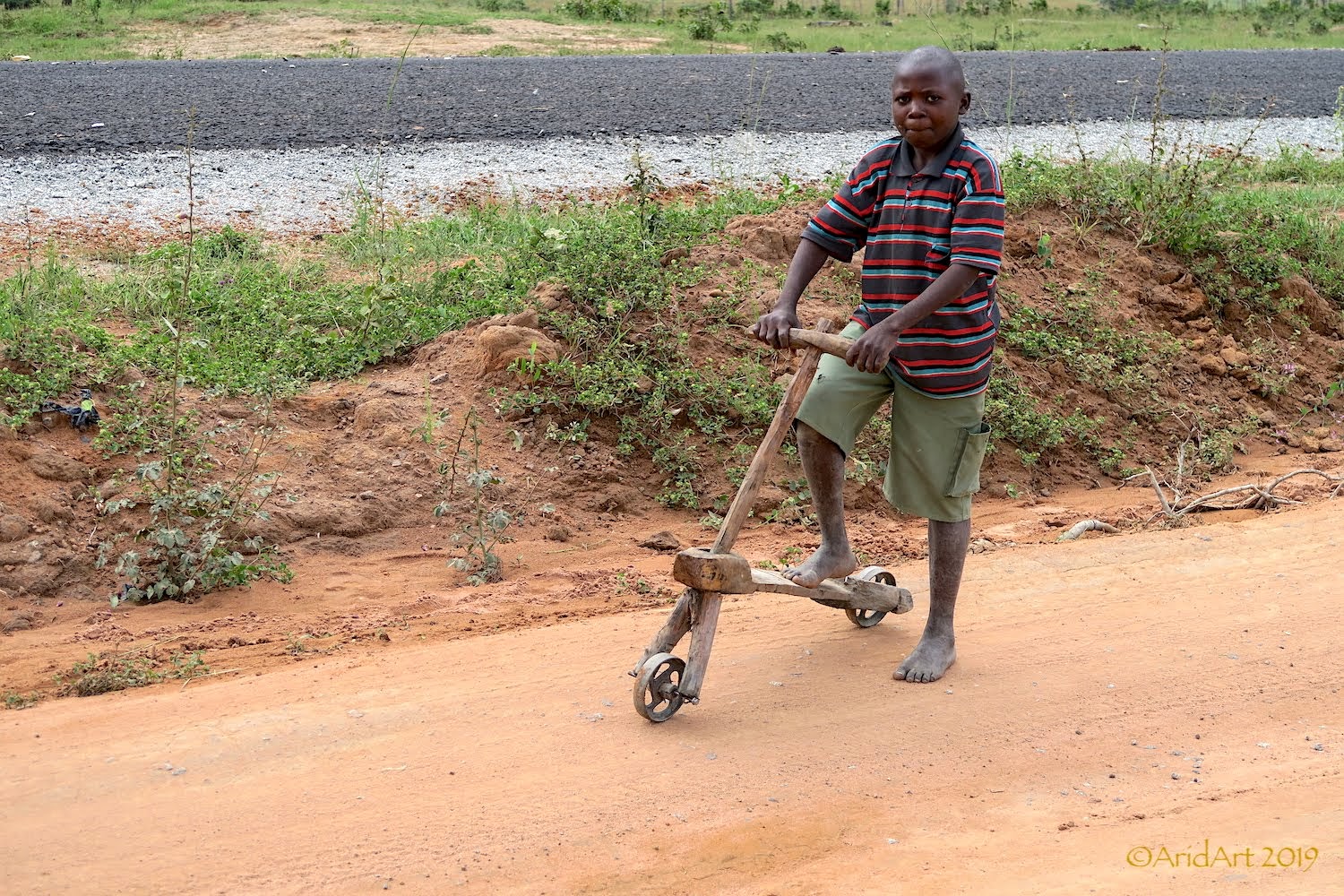
A popular “scooter” used by many of the kids. Rather different to the shiny bicycles we saw near Xangongo.
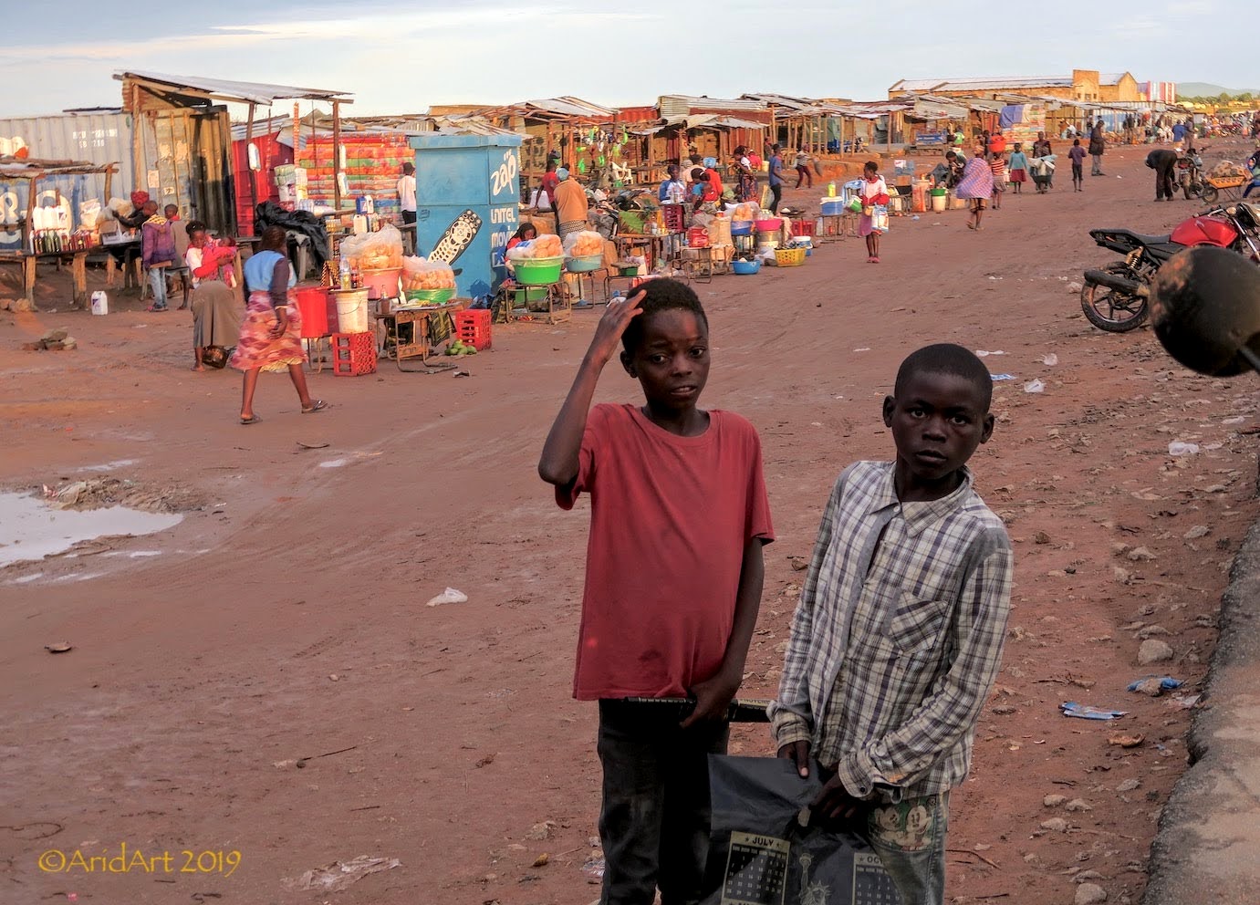
It gets noticeably busier as we approach the city….
…. which we reach once again after dark with the intercom batteries flat. This time, T4A does not have any useful suggestions, so we head for the city centre to see what we can find. Our yellow spotlights turn out to be very handy to stay together through the hectic traffic.
We locate the Nova Estrela hotel near the plaza. It looks a bit run down on the outside, but is presentable enough inside and has WiFi to boot. 10 000 Kwanza (about R450) buys us a stuffy room on the ground floor with an air-conditioner but no windows where we dump our bags.
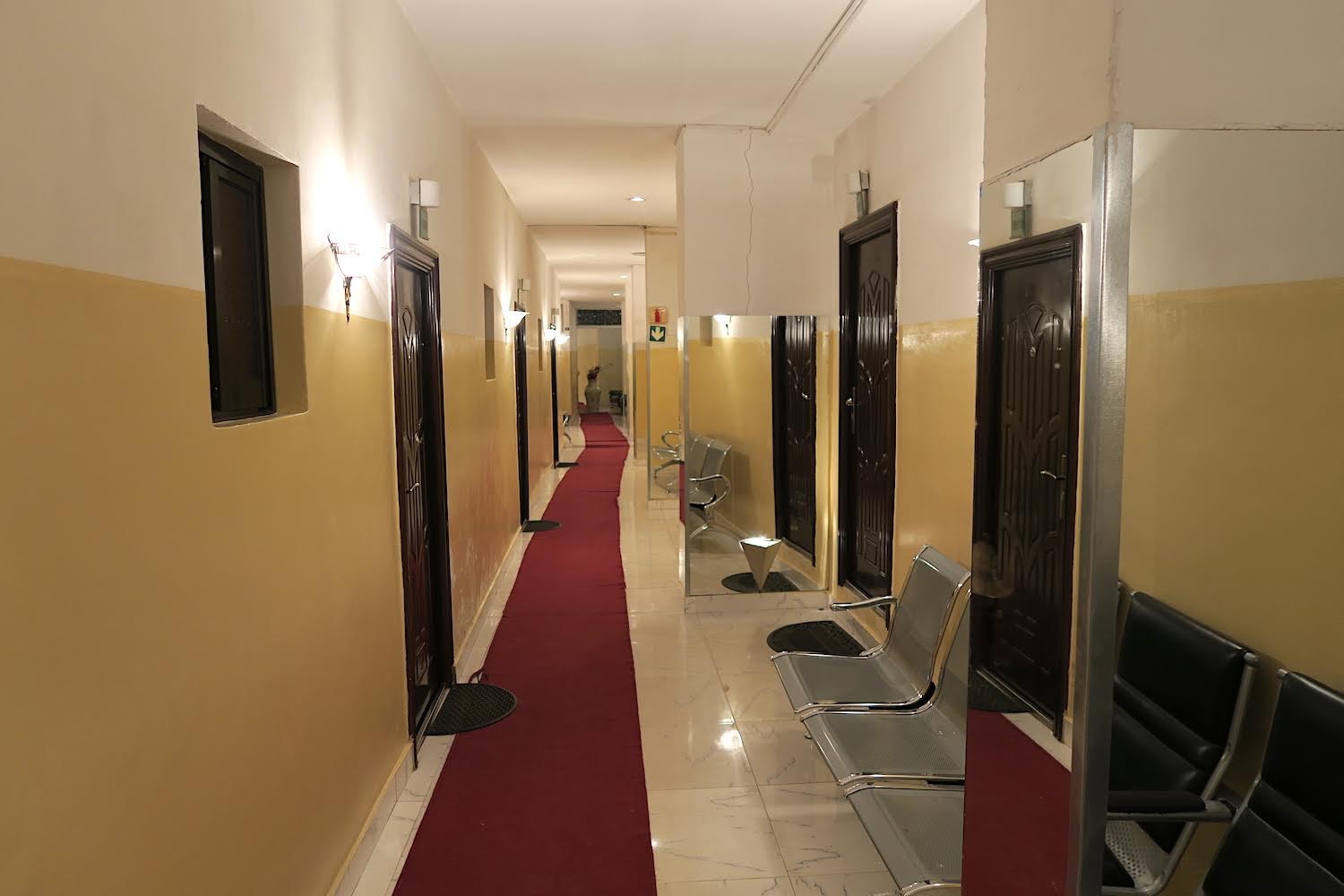
There’s courtyard at the back where the bikes are safe and a restaurant with hot trays has mixed grills and beer on offer. We are hungry! It’s popular, but not full, and one of the patrons translates for us. He was to become an important actor later in the trip ...
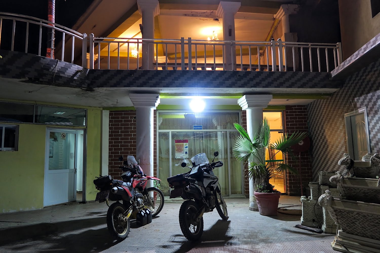
[/size][/size]
I know that Guy with the black AT.............Errol Eksteen???
Clockwork Orange
Race Dog
- Joined
- May 22, 2006
- Messages
- 2,784
- Reaction score
- 113
- Location
- United Kingdom
- Bike
- KTM 990 Adventure
Fantastic as always. Thanks for the update :thumleft:
What is the mileage on those two Tornado's now?
Likewise! This is a fascinating RR, especially it gives one a sense of place. Really enjoying it.Sam said:Thanks for the update - looking forward to the rest!
roxenz said:Likewise! This is a fascinating RR, especially it gives one a sense of place. Really enjoying it.Sam said:Thanks for the update - looking forward to the rest!
True that!
NiteOwl
Pack Dog
- Joined
- Dec 31, 2012
- Messages
- 98
- Reaction score
- 0
- Location
- Office Adventurer
- Bike
- Honda XRV 750 Africa Twin
Thanks for the positive comments and sorry for the tardy postings, but we will get to the end eventually.
Hi Petri, you don't need to quote the entire post to ask about one photo...
They have both done just short of 20 000 km. Loop soos stroop. Great choice for this trip.
petri oosthuizen said:I know that Guy with the black AT.............Errol Eksteen???
Hi Petri, you don't need to quote the entire post to ask about one photo...
ChrisL - DUSTRIDERS said:What is the mileage on those two Tornados now?
They have both done just short of 20 000 km. Loop soos stroop. Great choice for this trip.
NiteOwl
Pack Dog
- Joined
- Dec 31, 2012
- Messages
- 98
- Reaction score
- 0
- Location
- Office Adventurer
- Bike
- Honda XRV 750 Africa Twin
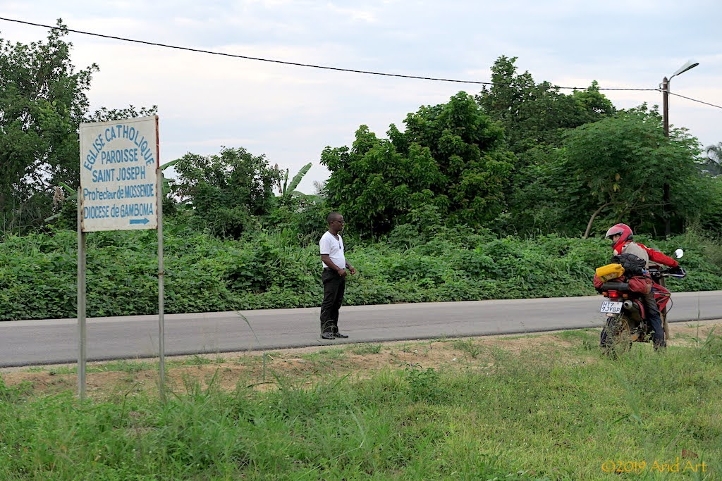
While we pack the next morning, one of the church elders comes over to hand us two papayas as padkos. The hospitality of this community accommodating two perfect strangers, with no expectation of reward, is humbling and the only payment they eventually accept is a donation to their church. Wow!
Before setting off, I take a picture of our host and the signpost of his church: it’s the St Joseph Fraterie.
It’s the short rainy season, and it's still a bit damp when we stop for coffee, but luckily we stay dry for most of the day.
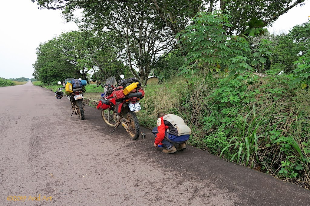
And so we carry on. The bad patch of road is now waterlogged from the rain, and puddles of water litter the road.
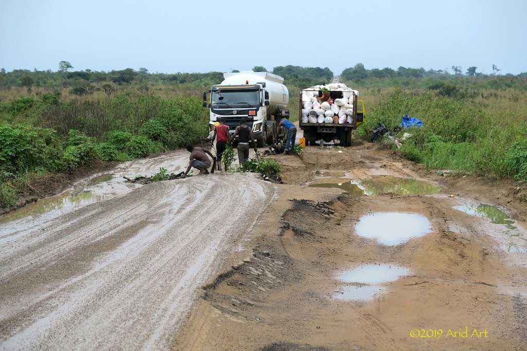
Some we ride around, some we ride through. It slows down our progress, but with the high ground clearance of our bikes we hardly get our feet wet. It would have been a different story on the secondary roads (this is the main north-south highway).
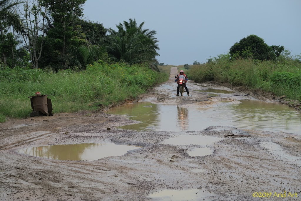
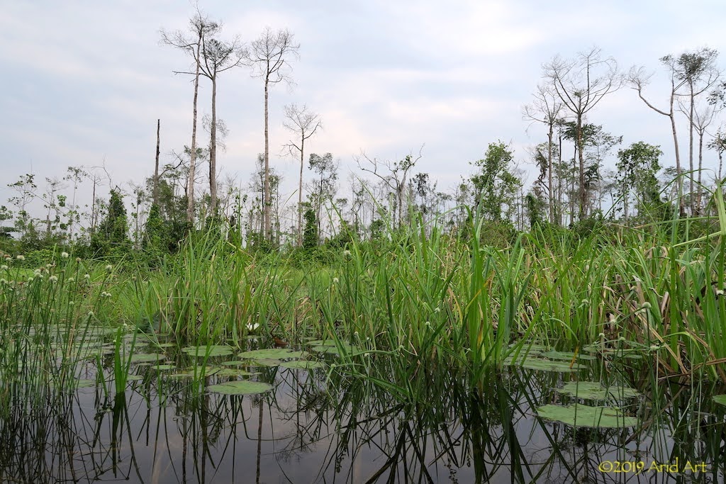
Water, water everywhere.
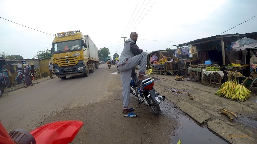
In Gamboma we buy buns and airtime. It’s a Saturday and there’s a bustling market around the main street.
When we stop to buy lunch in Ngo, mrs Owl’s rear tyre looks a bit flat...
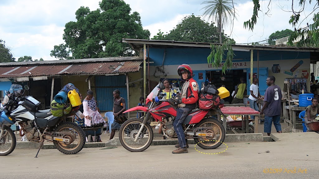
It’s no illusion: we have our first puncture and at a deserted backyard, next to the road on the outskirts of town, we pull off to fix it. There’s a handy brick terrace where we can unpack the luggage before setting to work.
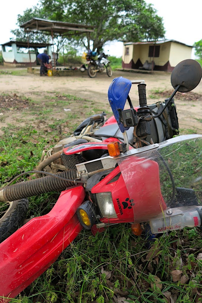
I don’t get why people take out a bike’s wheel to fix a puncture (unless you have to replace the tube, which is rarely the case). By laying the bike on its side, one can break the bead to access the tube without the hassle of opening the brake caliper or exposing the axle and bearings to sand. So that’s what we do.
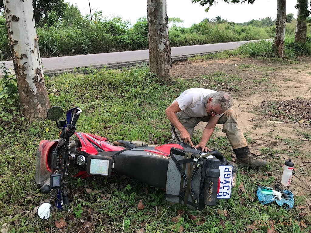
The cause of the leak is not a thorn, but a friction tear caused by a fold in the tube. So much for professional fitment- I always check this process, but missed the guy doing the rear tyre when the new tube on the front wheel disintegrated during the tyre fitting for this trip.
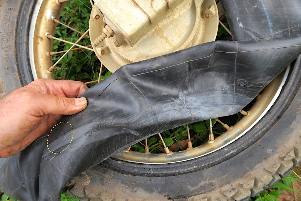
Only a small patch is needed to seal the leak, and after a quick spin up and down the road to make sure the bead is seated properly, we inflate the tyre fully and repack the luggage. By this time, some people have arrived and start demanding payment for the use of their “facilities”. Since the place was deserted when we arrived, it’s hard to feel obliged.
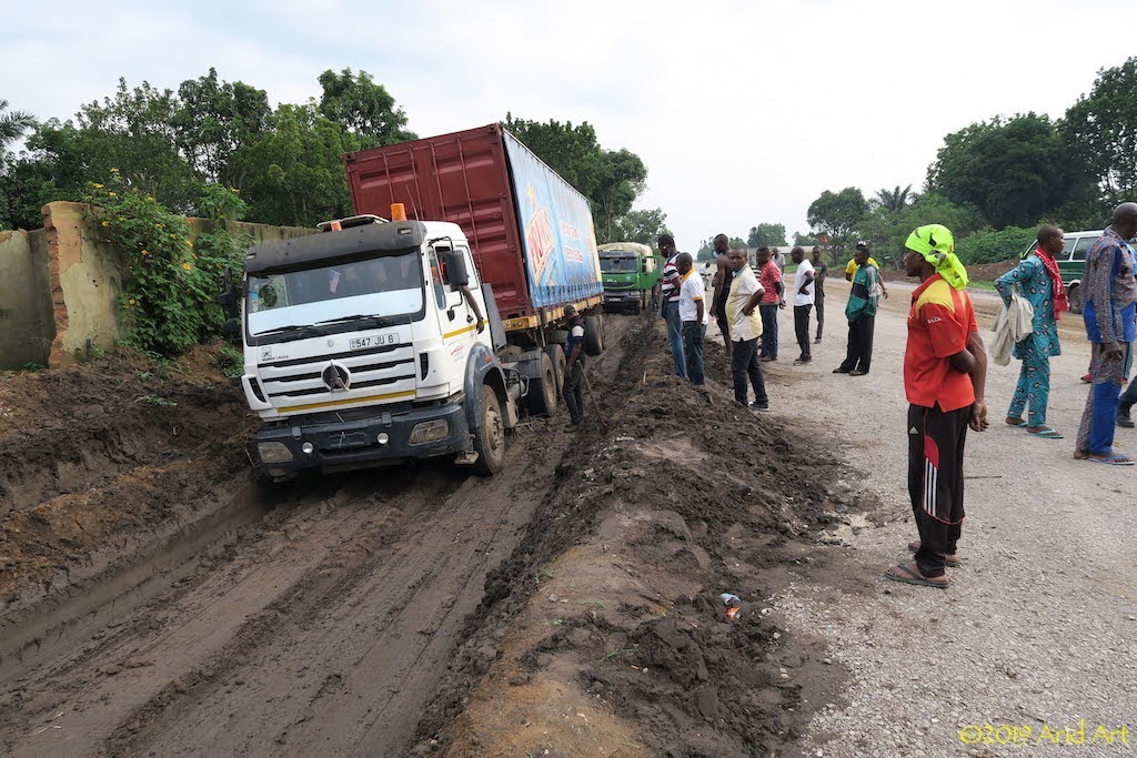
Trucks have a harder time of it than motorcycles where the road surface is damaged or under (re-)construction. While we are directed onto the new gravel bed, people pack grass in front of the tyres of the trucks that are stuck in the detour running parallel to the new section.
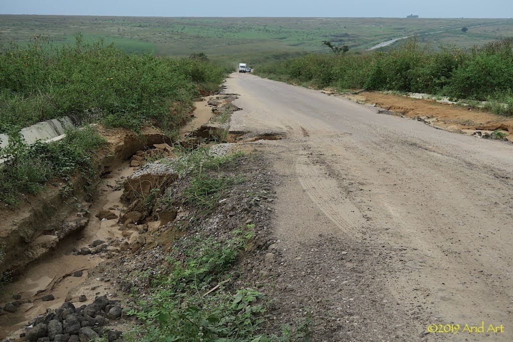
With the steep inclines and heavy rainfall, it’s easy to see how these roads get eroded so badly, especially without proper stormwater drainage.
We make good progress until we approach the heavy traffic around Brazzaville. Once again we check in at the Hippocampe Hotel and enjoy the familiar comforts of the Mandarine for the remainder of the weekend.
On Monday morning we set off early to the DRC embassy nearby to attempt an extension of our visas. The hotel’s watchman gives us directions, but laments the fate of a cyclist who recently spent 2 weeks trying to get a visa- in vain.
A stone wall would appear flexible in comparison to the DRC embassy when it comes to visas: their policy only allows the granting of visas in one’s home country, so they suggest we fly home to apply. Go figure.
After an hour of frustration, it’s clear that they really don’t need tourists in their country and we pack it in. But then I remember that there is a South African embassy across the river in Kinshasa, and google the contact number. After some to-ing and fro-ing, we get referred to Sidwell, who is apparently very well connected in Kinshasa. He does sound very sympathetic when we get hold of him- he knows this kind of problem and will call someone who can assist. I SMS our passport numbers and we wash the remainder of our kit whilst waiting for Sidwell to weave his magic.
By the time our laundry is dry there’s still no response from our man in Kinshasa and his phone goes unanswered. We can’t hang around here for two weeks, so I leave a message and we set a deadline for noon the next day. It duly passes without any visa progress, so we check out, draw money (easier said than done with a Mastercard) and refuel the bikes.
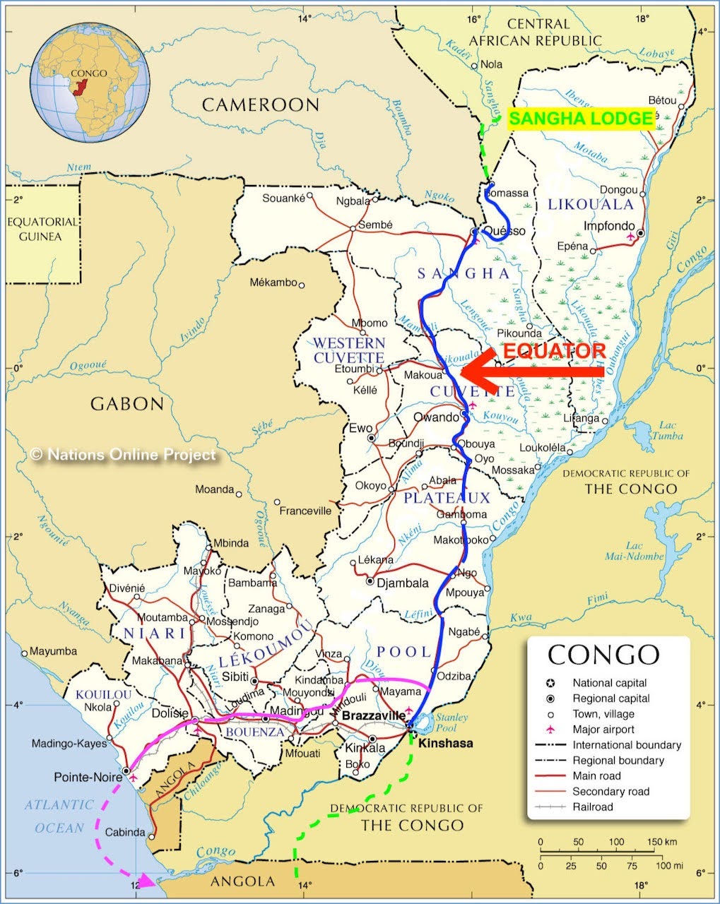
When the DRC’s borders were mapped, a slim 37 km coastline was included to avoid the country being landlocked. That strip is adjacent to Angola in the south and Cabinda (an Angolan enclave) in the north. As we don’t need visas for Angola, our best option now is to head for Pointe Noire or Cabinda and try to get a ride on a boat along the coast (see previous post of other overlander’s experiences) or catch a flight on a military cargo plane to Luanda.
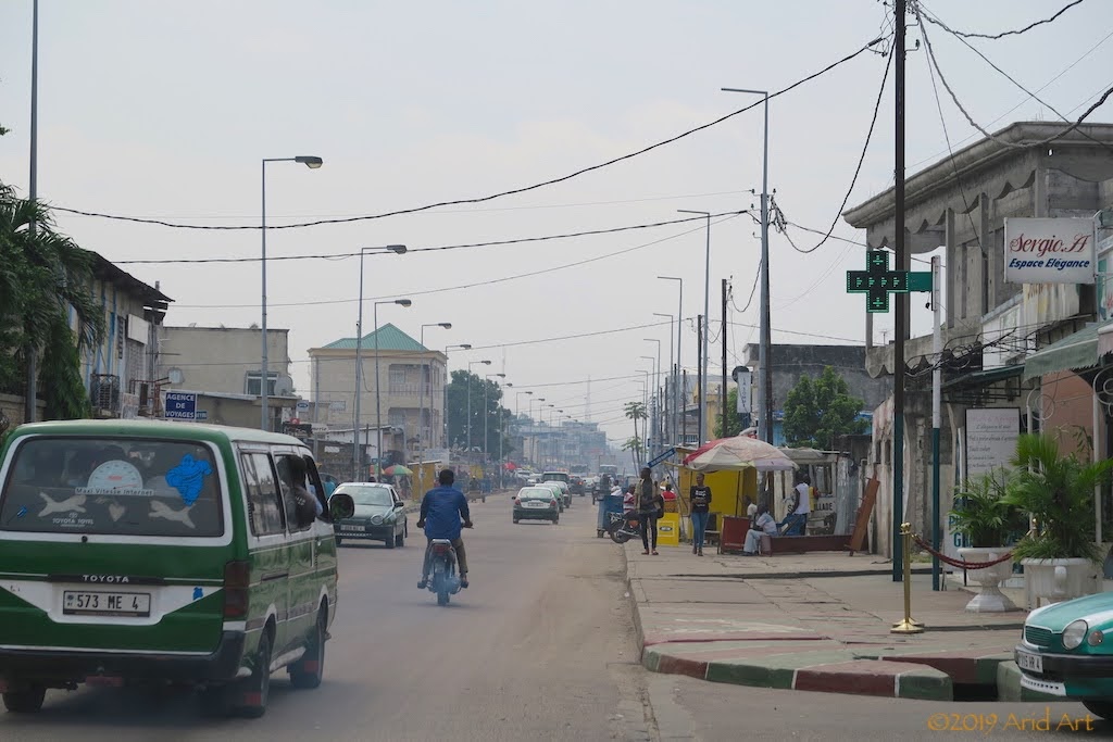
But first, we have to get to the coast. Our friendly watchman advises us to avoid the old Kinkala route, saying that there is a beautiful new tar road all the way to Pointe Noire, the Congo Republic’s west-most city (waving his hands to mimic a magic carpet ride). For the third time we ride north out of Brazzaville, and find the turnoff to the west at PK Rouge about 50 km out.
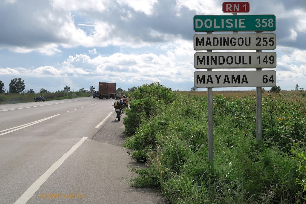
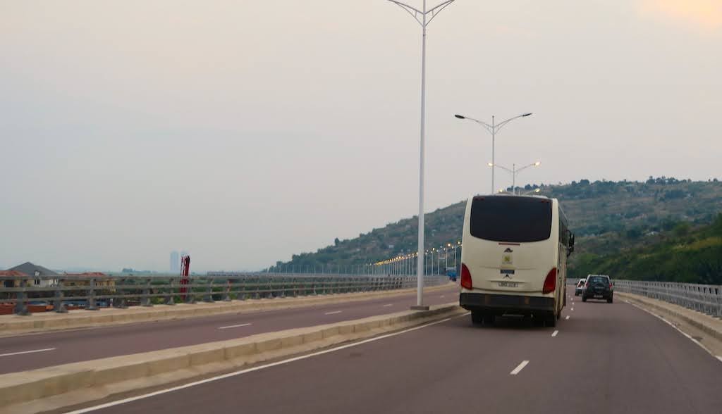
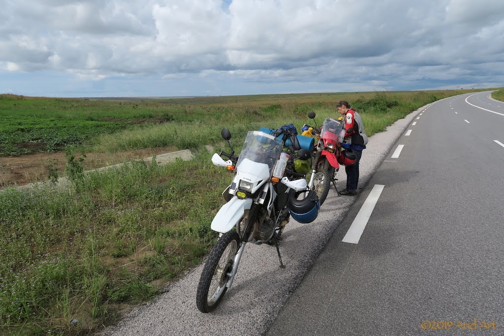
Although the Congo river flows all the way from Brazzaville to the coast, the rapids on this part of the river make navigation impossible. The French built a railway to the coast and developed Pointe Noire as a deep-water port for imports and exports, but the rail service has been disrupted by rebels. The Route Nationale (RN1) runs parallel to the railway line, and was upgraded only a few months ago: the magic carpet ride our hotel guard was talking about. It’s even possible to pull over onto the shoulder of the road for a snack:
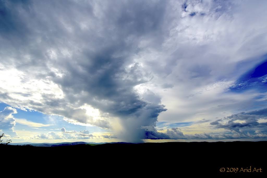
Every now and then the sun bursts through the low-hanging clouds accompanying us.
The initial flatland of the Pool province gives way to the rolling hills of Bouenza. It’s great riding!
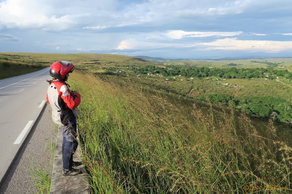
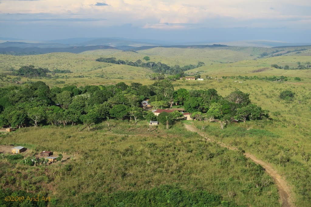
It looks a lot like South Africa’s eastern coastal regions (KZN, EC), with settlements here and there, but not right next to the highway (as on the RN2).
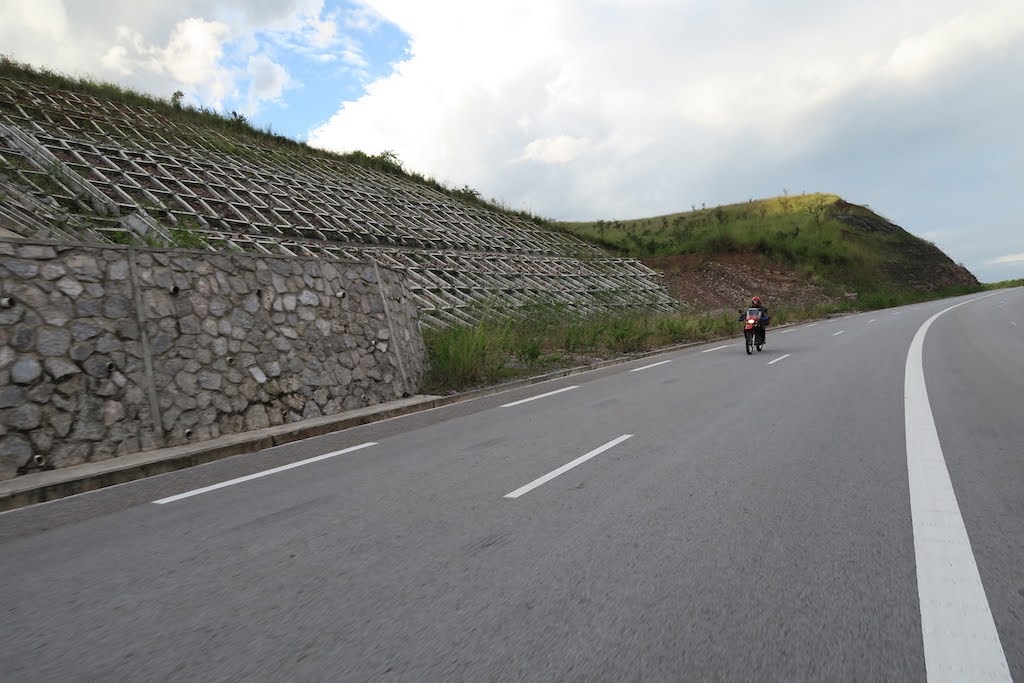
Wherever the road cuts through a hill, there’s the risk of mudslides. Hence these constructions:
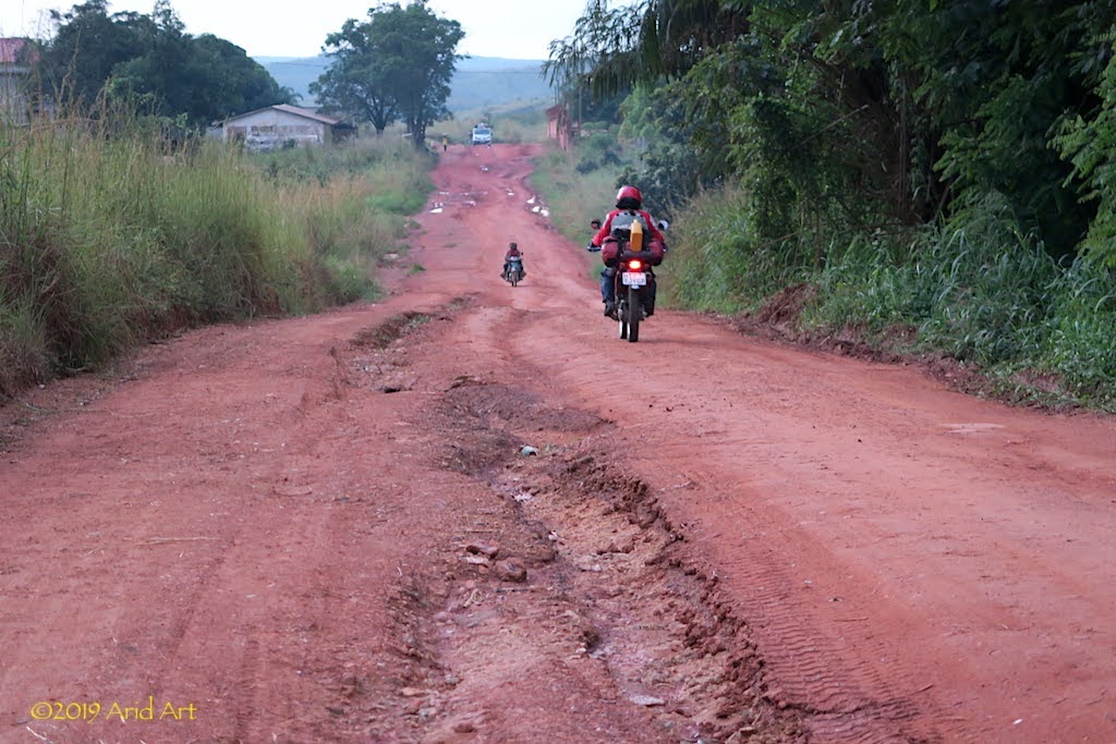
The road is excellent, but we nearly get caught out by the complete lack of filling stations. It’s getting late by the time we reach Mindouli, but instead of a town, there’s just a bunch of trading stalls lining the road. When in doubt, ask, and sure enough we hear that the village is just off the main road, and there is fuel.
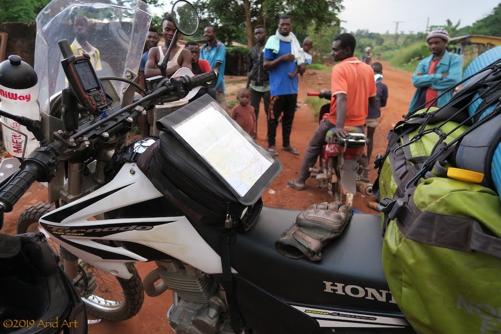
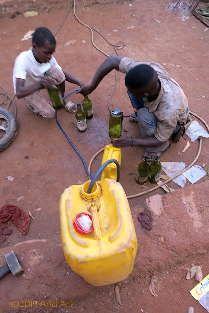
Unsurprisingly it turns out to be bush petrol, decanted from 25 litre containers into 1 litre bottles (for measurement!) before getting transferred into our tanks by the owner and his son. It’s heavily marked up, but it sure beats pushing. We buy 5 bottles apiece.
It’s dusk by the time we get back onto the highway, and now we need to find a camping spot before it’s completely dark.
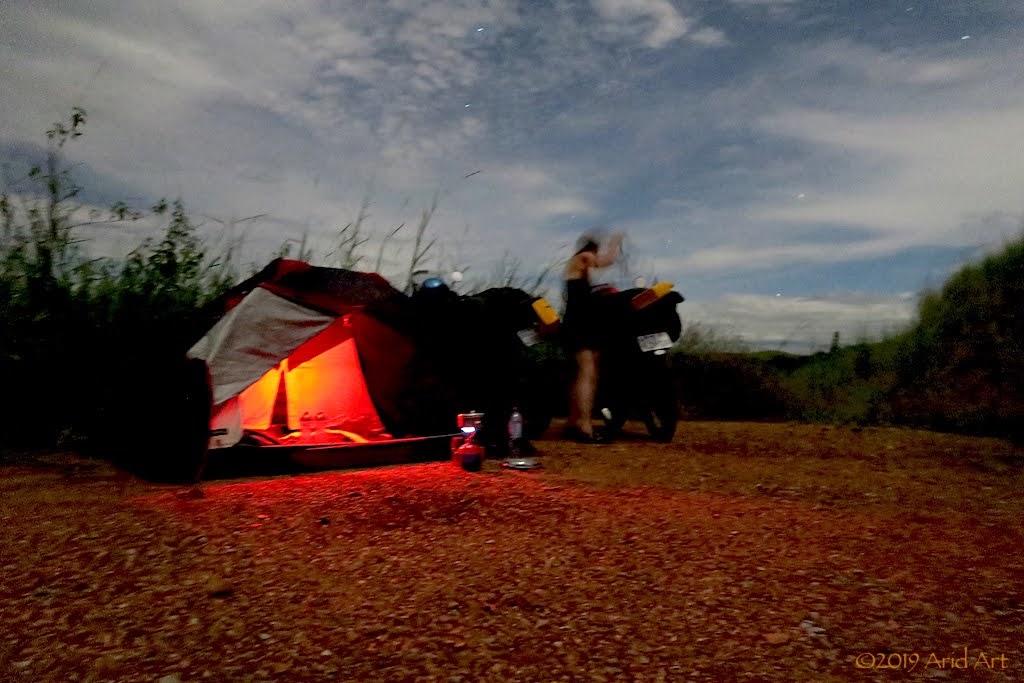
Once again the deep culverts and the dense undergrowth right along the edges make it look like an impossibility, but within 10 kilometres we spot a small clearing with concrete strips across the culverts leading into a roadwork site. We park behind some elephant grass - completely out of sight from the road- and pitch our tent. It’s a perfect campsite.
Before setting off, I take a picture of our host and the signpost of his church: it’s the St Joseph Fraterie.
It’s the short rainy season, and it's still a bit damp when we stop for coffee, but luckily we stay dry for most of the day.
And so we carry on. The bad patch of road is now waterlogged from the rain, and puddles of water litter the road.
Some we ride around, some we ride through. It slows down our progress, but with the high ground clearance of our bikes we hardly get our feet wet. It would have been a different story on the secondary roads (this is the main north-south highway).
Water, water everywhere.
In Gamboma we buy buns and airtime. It’s a Saturday and there’s a bustling market around the main street.
When we stop to buy lunch in Ngo, mrs Owl’s rear tyre looks a bit flat...
It’s no illusion: we have our first puncture and at a deserted backyard, next to the road on the outskirts of town, we pull off to fix it. There’s a handy brick terrace where we can unpack the luggage before setting to work.
I don’t get why people take out a bike’s wheel to fix a puncture (unless you have to replace the tube, which is rarely the case). By laying the bike on its side, one can break the bead to access the tube without the hassle of opening the brake caliper or exposing the axle and bearings to sand. So that’s what we do.
The cause of the leak is not a thorn, but a friction tear caused by a fold in the tube. So much for professional fitment- I always check this process, but missed the guy doing the rear tyre when the new tube on the front wheel disintegrated during the tyre fitting for this trip.
Only a small patch is needed to seal the leak, and after a quick spin up and down the road to make sure the bead is seated properly, we inflate the tyre fully and repack the luggage. By this time, some people have arrived and start demanding payment for the use of their “facilities”. Since the place was deserted when we arrived, it’s hard to feel obliged.
Trucks have a harder time of it than motorcycles where the road surface is damaged or under (re-)construction. While we are directed onto the new gravel bed, people pack grass in front of the tyres of the trucks that are stuck in the detour running parallel to the new section.
With the steep inclines and heavy rainfall, it’s easy to see how these roads get eroded so badly, especially without proper stormwater drainage.
We make good progress until we approach the heavy traffic around Brazzaville. Once again we check in at the Hippocampe Hotel and enjoy the familiar comforts of the Mandarine for the remainder of the weekend.
On Monday morning we set off early to the DRC embassy nearby to attempt an extension of our visas. The hotel’s watchman gives us directions, but laments the fate of a cyclist who recently spent 2 weeks trying to get a visa- in vain.
A stone wall would appear flexible in comparison to the DRC embassy when it comes to visas: their policy only allows the granting of visas in one’s home country, so they suggest we fly home to apply. Go figure.
After an hour of frustration, it’s clear that they really don’t need tourists in their country and we pack it in. But then I remember that there is a South African embassy across the river in Kinshasa, and google the contact number. After some to-ing and fro-ing, we get referred to Sidwell, who is apparently very well connected in Kinshasa. He does sound very sympathetic when we get hold of him- he knows this kind of problem and will call someone who can assist. I SMS our passport numbers and we wash the remainder of our kit whilst waiting for Sidwell to weave his magic.
By the time our laundry is dry there’s still no response from our man in Kinshasa and his phone goes unanswered. We can’t hang around here for two weeks, so I leave a message and we set a deadline for noon the next day. It duly passes without any visa progress, so we check out, draw money (easier said than done with a Mastercard) and refuel the bikes.
When the DRC’s borders were mapped, a slim 37 km coastline was included to avoid the country being landlocked. That strip is adjacent to Angola in the south and Cabinda (an Angolan enclave) in the north. As we don’t need visas for Angola, our best option now is to head for Pointe Noire or Cabinda and try to get a ride on a boat along the coast (see previous post of other overlander’s experiences) or catch a flight on a military cargo plane to Luanda.
But first, we have to get to the coast. Our friendly watchman advises us to avoid the old Kinkala route, saying that there is a beautiful new tar road all the way to Pointe Noire, the Congo Republic’s west-most city (waving his hands to mimic a magic carpet ride). For the third time we ride north out of Brazzaville, and find the turnoff to the west at PK Rouge about 50 km out.
Although the Congo river flows all the way from Brazzaville to the coast, the rapids on this part of the river make navigation impossible. The French built a railway to the coast and developed Pointe Noire as a deep-water port for imports and exports, but the rail service has been disrupted by rebels. The Route Nationale (RN1) runs parallel to the railway line, and was upgraded only a few months ago: the magic carpet ride our hotel guard was talking about. It’s even possible to pull over onto the shoulder of the road for a snack:
Every now and then the sun bursts through the low-hanging clouds accompanying us.
The initial flatland of the Pool province gives way to the rolling hills of Bouenza. It’s great riding!
It looks a lot like South Africa’s eastern coastal regions (KZN, EC), with settlements here and there, but not right next to the highway (as on the RN2).
Wherever the road cuts through a hill, there’s the risk of mudslides. Hence these constructions:
The road is excellent, but we nearly get caught out by the complete lack of filling stations. It’s getting late by the time we reach Mindouli, but instead of a town, there’s just a bunch of trading stalls lining the road. When in doubt, ask, and sure enough we hear that the village is just off the main road, and there is fuel.
Unsurprisingly it turns out to be bush petrol, decanted from 25 litre containers into 1 litre bottles (for measurement!) before getting transferred into our tanks by the owner and his son. It’s heavily marked up, but it sure beats pushing. We buy 5 bottles apiece.
It’s dusk by the time we get back onto the highway, and now we need to find a camping spot before it’s completely dark.
Once again the deep culverts and the dense undergrowth right along the edges make it look like an impossibility, but within 10 kilometres we spot a small clearing with concrete strips across the culverts leading into a roadwork site. We park behind some elephant grass - completely out of sight from the road- and pitch our tent. It’s a perfect campsite.
Similar threads
- Replies
- 2
- Views
- 929


