De Doorns circle route

This site may earn a commission from merchant affiliate links, including eBay, Amazon, and others.

masehare

Race Dog
Joined
Oct 26, 2010
Messages
1,007
Reaction score
38
Location
Helderberg
Bike
BMW F850GS
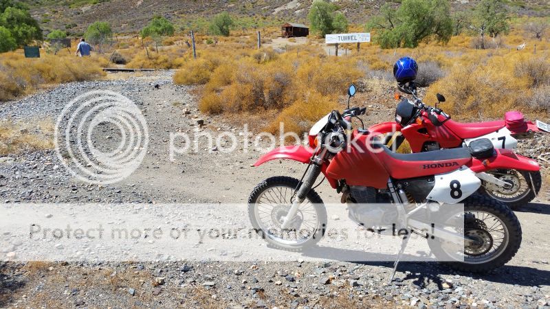
Deon scouted a possible route in De Doorns two weeks ago on his Varadero. The road became a bit hectic for the big bike, so he decided we should rather complete the trip with the smaller bikes. We left from Somerset West quite early with the bikes on a trailer and after two hours arrived in De Doorns. Deon's son came along as well, but forgot his DRZ's keys at home  :dousing:. We were a bit pissed off with ourselves for not checking, but anyway... XR's don't need keys, so we left him to guard the bakkie and agreed to keep the route as short as possible.

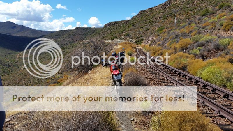
The first part was lekker gravel and then it turned into a mountain bike track:
20160319_114733_zps8q3po5lm.jpg


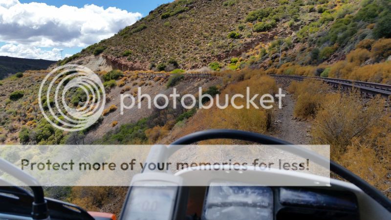
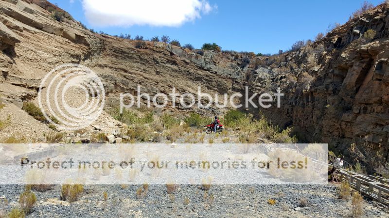
The drop to the left made me a bit nervous, so I took it slooowww. Those little bushes next to the pathway hide big white concrete stones:
20160319_115553_zpsd2geponj.jpg


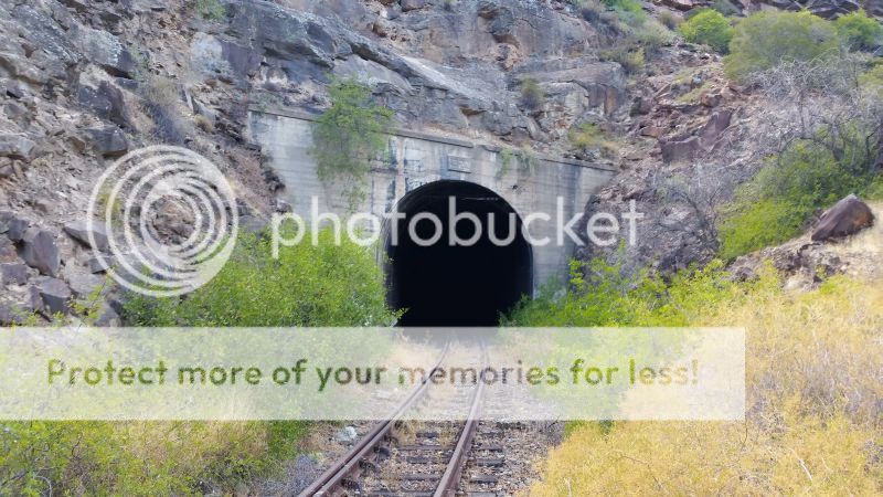
The train track is not in operation any more. It led to this tunnel:
20160319_120332_zps7eqeztdb.jpg


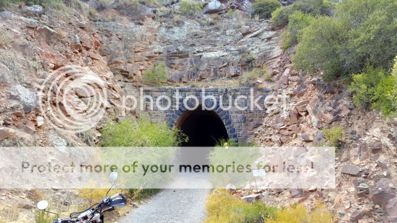
And right next to it is another tunnel. This tunnel has no track, but it was a train tunnel years ago.
Deon read up on it and this is the oldest train tunnel in South Africa. :deal:
20160319_120439_zpsxnomt9k7.jpg


View from the other side of the tunnel:
20160319_120832_zpstupurykq.jpg


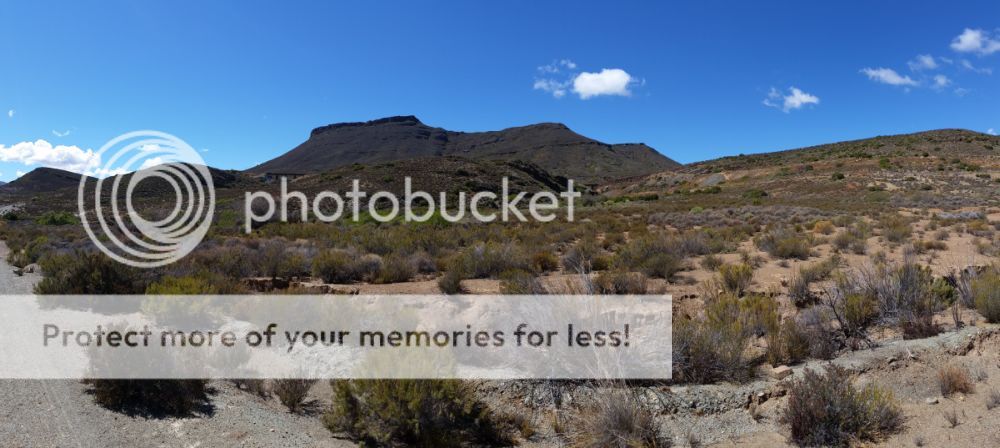
Dead end also on the other side. If you look at Google Earth, you'll notice quite a few tracks criss-crossed here:
20160319_121251_zps04scoki4.jpg


Hiker's lodge at Tunnel Station:
20160319_121703_zpsv8gbaw97.jpg


Further on, two train bridges visible:
20160319_122444_zpswoif95hi.jpg


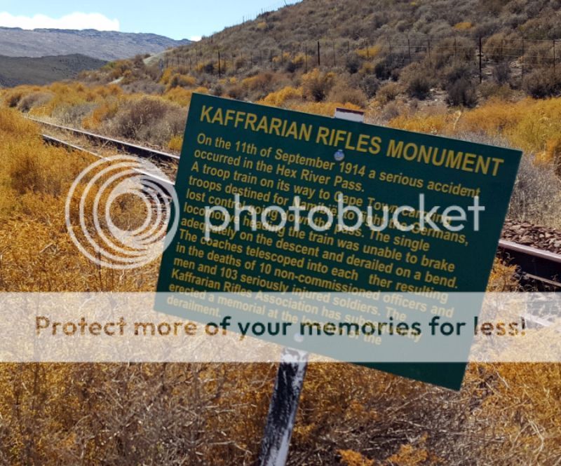
And then we came across the Kaffrarian Rifles monument. This was erected after a train derailed in 1914 at this spot and 10 men died. They were on their way to Namibia to fight Germans. Never knew this little snippet from history:
20160319_123110_zpshzofv0xe.jpg


Sign at the monument:
20160319_123251_zpsjp6dwrn5.jpg


From here we took the first road to the R318 and then the N1 back to base. Total km's about 52, total time about 2 hours.
 
    Dankie vir die deel.Stukkie geskiedenis in my agterplaas waarvan ek nie eens bewus was nie.Goeie werk manne!!!
 
https://en.wikipedia.org/wiki/Buffalo_Volunteer_Rifles

Ek moes nog so bietjie gaan oplees.
 
https://www.panoramio.com/photo/128942675

Ek was ook daar.  Op die bord is die kontaknommers van persone wat die kamplek beheer.  Die twee nommers het nie whatzap nie, so ek het hulle nie probeer kontak nie.  Ek weet nie of die private trekker/trein nog hier loop nie.

BTW, hierdie is deesdae een van my gunsteling restourante in die Strand.  Goedkoop, gemaklik en lekker pizza en hamburgers.  Ja, ok, my dieet begin more.
https://www.panoramio.com/photo/129131322


Ek ry toe met my verkenningstog oor hierdie damwal:  https://www.panoramio.com/photo/128772557
Nie gemaak vir groot bikes nie.
 
Masehare
Ek woon net oorkant die pad so 4 km na Montagu. Plaas Ratelbosch.
Hier loop 'n grondpad na die N1 so 20+ km lank. Baie speelplek vir die XR's.
Berg padjies, met baie klip.
Laat weet as jul wil kom speel.
 
Dawid S said:
Masehare
Ek woon net oorkant die pad so 4 km na Montagu. Plaas Ratelbosch.
Hier loop 'n grondpad na die N1 so 20+ km lank. Baie speelplek vir die XR's.
Berg padjies, met baie klip.
Laat weet as jul wil kom speel.

Ek is van Worcester, maar kry net nie nou tyd vir ry nie. My dogter is mar nou ses weke en laaitie wil net fietsry elke naweek. Teen die tyd wat ek wel kan ry, het ek seker ook aleer vergeet van jou... ;D :imaposer:
 
Ek wil nog vir my ook so n lekker ligte scrambler koop, juis vir sulke paadjies oos hierdie.

Dankie vir die deel  :thumleft:
 
Dawid S said:
Masehare
Ek woon net oorkant die pad so 4 km na Montagu. Plaas Ratelbosch.
Hier loop 'n grondpad na die N1 so 20+ km lank. Baie speelplek vir die XR's.
Berg padjies, met baie klip.
Laat weet as jul wil kom speel.
Reel iets en ek is daar.
 
Lekker RR!

Daars elke Mei maand 'n MTB race daar by De Doorns, die Hexrivier Autumn Splendour.

Jy ry daai selfde paadjies langs die treinspoor en dan ook deur die tonnel.

Een jaar het die sneeu lekker dik en laag gele op Matroosberg met die race..was lekker koud!


Attachments

  • 55km-Route-Map-Profile.jpg
    55km-Route-Map-Profile.jpg
    73.2 KB · Views: 896
Lyk na baie mooi roete. EK het ook al die pad langs die treinspoor soos jy De Doorns toe ry beloer en gewonder of mens met 'n bike daar nag ry.
 
We owned a very small holiday house on the old Matroosberg station, where the doomed troop train would have taken on water before starting it's journey down the Hexpass.
I explored the area in detail on motorbike, and joined the DeDoorns 4x4 trail a few times.

I probably trespassed on DawidS' land as well, who knows? :pot:

 
I am only here since Sept last year.
The road across the farm is a "Minor provincial road" connecting the R318 Koo - road and the N1.
Over weekends mountain bikers use it in a circle route. I am not sure what their route is. Some how from De Doorns to the farm up to N1 and down to De Doorns.
 
Very interesting, thanks!  :thumleft:

Question: that equipment lying in the dead-end, is it installed, or lying loose?
In other words, did they ACTAULLY lay track into a dead -end WITH signalling equipment?
Cheers
Chris
 
Dawid S said:
Masehare
Ek woon net oorkant die pad so 4 km na Montagu. Plaas Ratelbosch.
Hier loop 'n grondpad na die N1 so 20+ km lank. Baie speelplek vir die XR's.
Berg padjies, met baie klip.
Laat weet as jul wil kom speel.

Eish Dawid

Hoe kontak ons jou?

 
Plaas Gps coordinate:
Afdraai van R318: 33deg 28'00.35 S  19deg49'33.31 E Groen hek Ratelbosch  jy ry deur buurman se plaas.
My hek 33deg 28' 33.31 S  19deg 52' 40.98E
Hek aan die oostekant 33deg 25' 57.77 S  19deg 57' 51.27 E
Die is die prov, pad wat veronderstel is om geskraap te word, dit loop tot teen die N1. 33deg 23' 09.12 S 19 deg 56' 24.54 E
Daar is twee spoor padjies op die berg een wat nog net deur die bulldozser wat die pad gemaak het gery is.

 
beautiful photo,s thank u for sharing
 
Ek dink daai dead end is deel van 'n shunting spoor.  Op GE kan jy sien daar het shunting spore noord en suid gelê.  Daai mooi staal pilare lê net daar los om op te roes.

 
Dawid S said:
Plaas Gps coordinate:
Afdraai van R318: 33deg 28'00.35 S   19deg49'33.31 E Groen hek Ratelbosch  jy ry deur buurman se plaas.
My hek 33deg 28' 33.31 S  19deg 52' 40.98E
Hek aan die oostekant 33deg 25' 57.77 S  19deg 57' 51.27 E
Die is die prov, pad wat veronderstel is om geskraap te word, dit loop tot teen die N1. 33deg 23' 09.12 S 19 deg 56' 24.54 E
Daar is twee spoor padjies op die berg een wat nog net deur die bulldozser wat die pad gemaak het gery is.

Dawid, dankie, ek sal jou kontak. Dit sal 'n groot voorreg wees om daar by jou te gaan ry.
 

Latest posts

Top