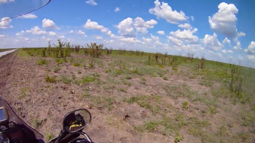
Short way around the delta

This site may earn a commission from merchant affiliate links, including eBay, Amazon, and others.
Enjoyed your RR Xpat. Thanks.
I'm looking for a "prop/stand" like yours to hold the bike up when fixing flats. Where did you get that one ?
 
I've got the stand at offroadcycles.
 
I have managed to see 70% of the pictures and read the read from Gough. Was worth staying up late to make use of that little extra bandwidth the rest of the sleeping team members are not using! Epic trip, would love to do this myself sometime in due future!  :thumleft:

Many great pics as well!!
 
Flip it man! Your adventures and writing is so epic dude! I seriously think you should put it all into a book :thumleft: :thumleft:
 
I almost missed this one!
another super inspiring RR.

Xpat, how do you take your pictures? with a phone or is it something like a gopro set to take pictures at certain intervals?
How do you map in google maps? Meticulously afterwards by zooming in and plotting from memory or do you use some kind of tracker?
 
Thanks.

@HS: well, it is all posted here so no need for book ;). And for book I would have to actually read it after myself and correct all the stupid grammar and stylistic mistakes that become visible always only once I post the report.

@ m0lte3n: for pictures I use two systems:
- for the good ones - not the riding ones - I use camera with good glass. Actually two cameras with two different lenses - in my case both Olympuses - one OMD EM1 and one OMD EM5. I try to limit my luggage, but I generally do no skimp on photo gear - except if it is just little fartabout.
- for the riding ones (and I guess those are the ones you are primarily asking about) I record video on the helmet camera (in my case Drift Ghost S) and then at home scrap the images off the video. That way I have both video as well as images. The quality is not great, but it is sufficient for documentary purposes I use it for and enable me to capture those moments that everybody misses on the trips (mostly when going gets tough, the last thing people want to do is to stop and pull out the camera - this way it just records automatically). I have tried the interval photo taking on helmet camera, but didn't like it at all - the Murphy says that all the good images are always screwed (for example the image is taken exactly as the lion is already over the road and you can see only tail on the image). The only downside is that one has to sit through a lot of footage at home scraping images of it - and if you want good quality you will need big cards, and good computer to be able to handle tons of footage - that is usually where computers run out of steam quickly.

If you want to use helmet camera the way I do, I would suggest to  use high quality setting (I use 1080p and 60 fps) - but of course that means bigger cards and more processing power. When I first used this on my first X-mas Safari trip, I had previous Drift and was recording at 720p and the lack of resolution combined with wide angle lens that makes everything much smaller were a serious limitation. Here is photo of two full grown lionesses running about 15 meters from me on the Chobe boundary, and as you can see - if I wouldn't point out those are lions, you probably wouldn't guess it. At higher resolution 1080 or ideally 4k (not available at the time) this would be much better image:

B%2526Z%2520ZIM%2520southlion.jpg


Here is the video this image was scraper from, the lion part is at 3:05 and again - without subtitles you probably wouldn't know those are lions:

[flash=800,600]https://www.youtube.com/v/IMBXb1jIa0M[/flash]
 
@m0lt3n:

Regarding the maps, yes I use googlemaps (or rather mymap application from google to route my trips. For the off the beaten track rides - which is most of my riding, I use two ways:
- The easy way - routing on googlemaps: Most people would be very surprised what little tracks are available now on googlemaps. And if it is on googlemaps, then it is fully routable - i.e. you can just create route by clicking on the spot on the route and google maps will create route for you automatically in the same way as if you say to it get me from Pretoria to Bloemfontain or some such. For example that route around Okavango I was attempting on this trip is fully routable on googlemaps and I have plotted the whole route on googlemaps probably in 15 - 20 minutes - and yet there is not a single supposedly 'adventure' biker who ever ridden it  - weird as this is probably ultimate ride anybody can do anywhere in the world. The only trick is that the real little tracks are not visible on googlemaps until you zoom very close (sometimes 500m or more). And when routing, the googlemaps has a tendency to route you on the main routes, so to avoid that you may need to click on the route itself in a way that it cannot find alternative route on main roads.

In this link you can see this specific route I did directly in googlemaps, and you can zoom in and out, as well as modify the route (I have made separate copy for you - or anybody who watches this - to play with - just be aware that if multiple people change it, it changes fo everybody so it may become unwieldy):

https://drive.google.com/open?id=1AOlj8JABioS7MQt5gPXhW6pbQzU&usp=sharing

Just in case the link doesn't work (it doesn't for me at work where Google Drive is blocked), you can try this link:

https://www.google.com/maps/d/embed?mid=1AOlj8JABioS7MQt5gPXhW6pbQzU

- The hard way: if one really wants to ride off the beaten track which does not exist on googlemaps, then you need to switch to sattelite view and plot the route yourself following it on the satellite images. But this is for really off the beaten track. I have used it to plot route along the Moz coast up to Vilanculos in X-Mas Safari 3 trip (all my trips are linked in my signature), and it takes weeks of hard work. But then you have really unique and special route - though that particular one is almost not doable even on 690. I've done about half of it and will need to come back to try to conquer the whole thing.
 
Thanks, good info.

If I may ask more:
what about battery power on the Ghost? Most GoPro's last about 3 hours, is the Ghost just very good with this? Or do you swop out and charge batteries all the time on the bike? Or only record very selectively via wifi remote or something?
I have a gopro and a knockoff one, but in general I am just to lazy to fit them, often carrying them with on trips without using. And like you said, if its not 1080, its not of much use (and my cheapies are not)


Thanks for the mapping info, also blocked for me at work, so will check it out later.  :thumleft:
 
m0lt3n said:
Thanks, good info.

If I may ask more:
what about battery power on the Ghost? Most GoPro's last about 3 hours, is the Ghost just very good with this? Or do you swop out and charge batteries all the time on the bike? Or only record very selectively via wifi remote or something?
I have a gopro and a knockoff one, but in general I am just to lazy to fit them, often carrying them with on trips without using. And like you said, if its not 1080, its not of much use (and my cheapies are not)


Thanks for the mapping info, also blocked for me at work, so will check it out later.  :thumleft:

Battery life is less bitch than I expected. Drifts generally last longer than GoPro which used to be famous for crappy battery life (I'm surprised by your 3h estimate, would expect less). The old Drift Stealth I had had an option of bigger battery which lasted about 5 hours. The new one has only smaller battery and lasts about 3.5 hour. I do carry 3 - 4 batteries on me, but rarely need to change the battery during day (provided I charged it overnight).

My approach to recording is very extensive - i.e. when I come to a part that I know will be good (or like what I see while I ride) I switch it on and forget about it. I switch it off when the part stops becoming interesting or if I stop. So my clips are usually very long and require lots of work at home. Some people try to record only interesting max 7 second bits to save themselves from huge editing effort afterwards, but to me that is a no-go. When I'm on a trip, I want to be on the trip and enjoy it to the max, rather than worry about filming - that can easily ensure that while you were there physically, you actually never were there as you were basically working on a movie. In my approach I get best of both worlds - I enjoy the ride to the max, and still have footage of everything I want. The only downside is that it takes months to process the footage, but that is the price I'll happily pay.
 
really is best to learn form experience, there is no shortcuts.
And yes you are right about it being crappy. the hero H2 I have is actually only good for about half an hour, but the knockoff, I think SJCam, lasts 3 hours (roughly, I havent really checked)

I once did a nice and fancy vidio of a trip and vowed never again, so now I am also in the category of trying to catch the good bits - ending up catching nothing.


m0lt3n said:
really is best to learn form experience, there is no shortcuts.
And yes you are right about it being crappy. the hero H2 I have is actually only good for about half an hour, but the knockoff, I think SJCam, lasts 3 hours (roughly, I havent really checked)

I once did a nice and fancy vidio of a trip and vowed never again, so now I am also in the category of trying to catch the good bits - ending up catching nothing.

Making videos is tons of work, whichever way you do it. But you can use the camera only to scrap photos off the video like I do nowadays (I have the video footage, but rarely find time to try to make video) it is not that bad. And that way you are much better able to convey what the trip was about and capture those precious moment like being stared down by lion (it takes much bigger man than me to pull out normal camera during stare-down with lion), or the hard sections of the ride, that usually you miss in your normal photos as you are having your hands full with trying to make it through.
 
Xpat. When you said plot on satellite images what program to you use. I ask because I use google earth (the downloaded program on my PC) to manually route all my tracks where none exist. It works kinda well as you create the routes and save them in whatever format you need and then put them together in base camp to make the complete route.

BTW for those of you who don't know. To convert google maps to Garmin tracks use the website called gpsvisualizer.com
 
aka.Goliath said:
Xpat. When you said plot on satellite images what program to you use. I ask because I use google earth (the downloaded program on my PC) to manually route all my tracks where none exist. It works kinda well as you create the routes and save them in whatever format you need and then put them together in base camp to make the complete route.

BTW for those of you who don't know. To convert google maps to Garmin tracks use the website called gpsvisualizer.com

I don't actually know - it is kind of weird thing. There is something called mymaps on Google - I suspect you must have google account (like gmail or Google Drive, or some such - you can register for free for those) to have this available. It used to be available from Googlemaps at the bottom of the menu, but now it for some reason disappeared. The only way I can get to it is to type in Google 'mymaps' and the first link that comes up takes me directly to it. Not sure if it works for people who do not have Google account though and I do not understand why it is not available directly on Googlemaps anymore (or maybe I'm just too stupid to be able to find it). You can create your own maps in this (either by routing existing routes on googlemaps, or by manually plotting the route on satelite image - or combination of both - you have 10 different layers available to play with) and save them - they are then stored on your Google Drive like any other documents/files you might have uploaded/created there.

It is also available as an application for Android for download in Google Store - not sure if that can be used on computer or not. And yes, you can export them as KML/KMZ files and then convert to whatever format you want for your GPS using that GPS visualizer you mentioned (or any other free SW on internet).

I do have Google Earth as well, but do not like it much (probably because I cannot use it right?), because whenever I want to see actual map instead of just satellite image (like when I want to route roads that are already available on Googlemaps, instead of just painstakingly plot them myself), it somehow switches completely to Googlemaps. I'm sure there is probably way to do this intelligently in Earth, but I wasn't able to figure it out.

Edit: Here is a page that should help you set-up and use Google MyMaps: https://support.google.com/mymaps/?hl=en#topic=3188329
 
Here is a tutorial on MyMaps - I'm sure you can find many more on youtube, just type in 'Google My Maps'

[youtube]https://www.youtube.com/watch?v=Bz2Ohi16ED8[/youtube]
 
Shot for that. Wow this is like a whole new world of mapping for me, it works a bunch better than google earth. I see I already have a bunch of maps saved to google drive from way back. These are the things that you start one evening and all of a sudden its 4.00am.
 
aka.Goliath said:
Shot for that. Wow this is like a whole new world of mapping for me, it works a bunch better than google earth. I see I already have a bunch of maps saved to google drive from way back. These are the things that you start one evening and all of a sudden its 4.00am.

Yes, I find it much easier and intuitive than Google Earth. And you can combine different layers - for example for one you can use normal Googlemaps routing like get me from Joburg to Clarens, and in the next layer you  can manually plot on the Satellite image Old Mill Route (assuming of course you don't already have it as GPS track), and combine those together in one map.

And yes, this can be extremely time consuming. I'm busy trying to plot new DS route through Lesotho (by DS I mean plated enduro bikes, not adventure bikes, as some people mistake the two) for my 500. And it's going to be weeks of work to plot - just to find out when I get there finally that the rocks are too big (ROA route on google satelite images looks quite doable) and I have no chance anyway  :imaposer:
 
Hahaha that's always the problem with routeing like this  :lol8: You never really know what you going to find, locked gate, rocks the size of your bike etc. but its all kind of part of the adventure. I've headed down 40km of  farm/gravel roads only to find a large locked gate at the far end making turn back and ride around.  :patch:
 
Top