


Mission accomplished - I think.
Sometimes it is nice to ride without a plan – just get out there and ride, but today I set some objectives and planned a route. The objectives were to show shesha, who has never been into the Valley, a couple of the sights, and then to try to get to two view sites and a waterfall that I had seen in Google Earth, but had never been to on the bike.
In retrospect the time spent on the PC preparing the tracks was time well spent, and apart from a few missed turns, we stuck to the plan and found the places.
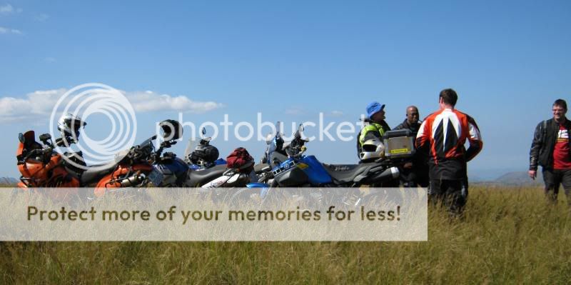
A big thank you to the pack who went along. Ugie (Dakar), Shesha (1200) , MrBanger (F800),JonW Husky (640), Ian (non-dog - Yam 250) – Anyone I forgot ?
Edit : Yes ! Me on Tenere !!
The route we took:-
First stop was to see the Inanda dam wall and snap a rainbow in the outlet spray. (A)

From there we headed up past the Shembe religious village and onto Mtabatula (B), and from there a courtesy call at the waterfall on the way out. (C)
From there onto Matata (Nanda Mountain) (D) where shesha seemed suitably impressed with the view.
From there we headed up the valley to Nagle without major mishap other than a Temporary Loss of Talent where I lost my front wheel in a rut dropped the bike and nearly collected a concrete pillar at a small bridge. No serious damage other than to my ego and a bruised knee – the previously undamaged right one this time.
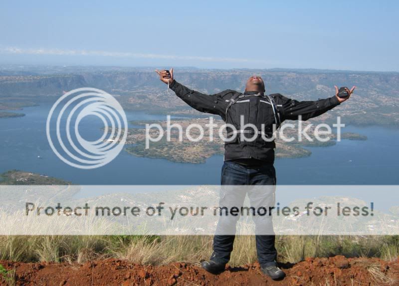
From there we headed up onto the mountain that overlooks the dam. (E) I had never been up there, but I knew it was possible as it had been documented in a Ride Report by EssBee – Thanks S.
On the mountain I struggled a bit at first as there are no roads up there at all. I learned after two more “sidestand incidents” that:-
- It is not good to try to ride cattle paths. They are too twisty and grab your front wheel in a clamp and throw you in the grass. It is far better to head through the open grass and try to avoid lurking rocks and termite mounds and then cut the cattle paths at steep angles.
- A bit of speed (fast walking speed or slow run) is better. It smoothes out the bumps and makes the bike easier to steer. A speed of 15-25 was for me a good compromise between comfort and control.
- Relax. The Tenere has far more experience built into it than I will ever have, so let it do it's thing and just let it know in broad terms where you want to go.
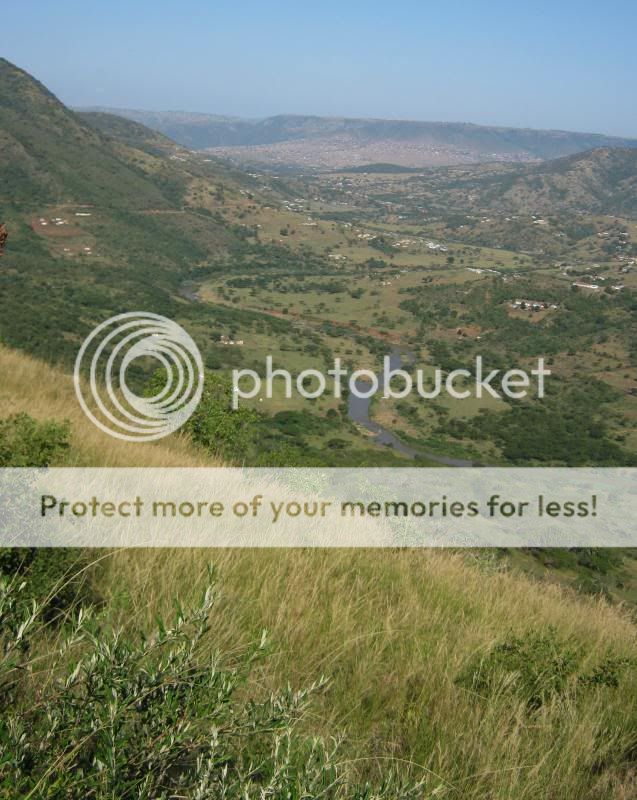
The view was more than worth a bit of bike lifting – absolutely amazing up there.
Nagle Dam. Strange dam. It is built on a hairpin bend in the Mgeni river and has three dam walls.
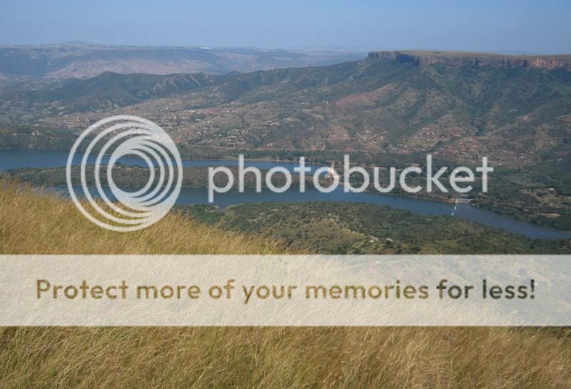


Looking up the Mgeni

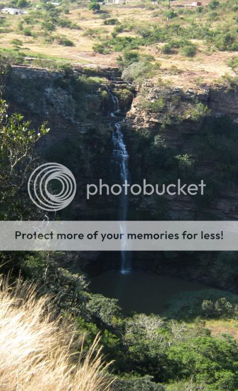
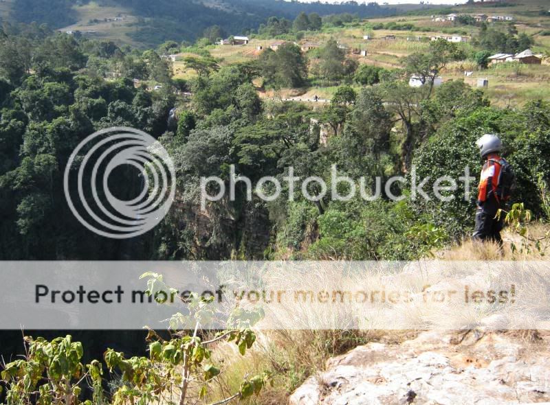
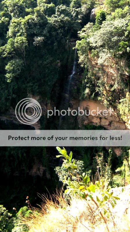
I did a bit of web surfing and found a reference to a waterfall up on the mountain, so we headed off to try and find it with just a waypoint in the GPS.
Sure enough, it is there, and worth a detour. It is at the head of a most impressive gorge, and with a bit more water in Summer would be quite spectacular,
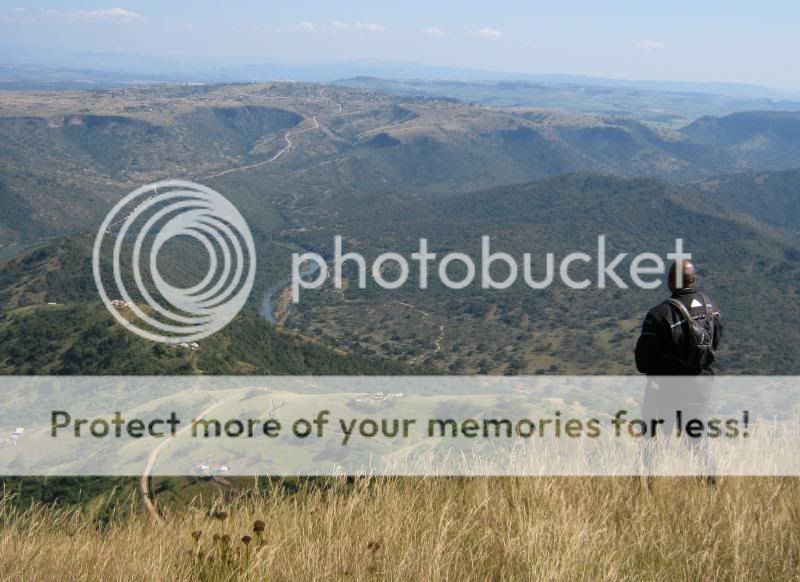
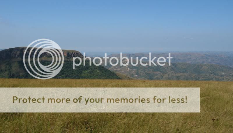
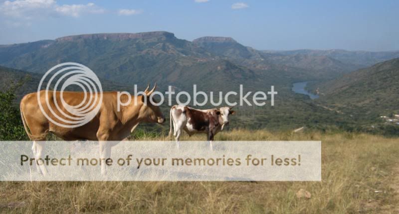
On the road up towards Pietermaritzburg. Nagle headwaters in the background. The mountain overlooking Nagle where we had just been is directly above the dappled tollie's butt.
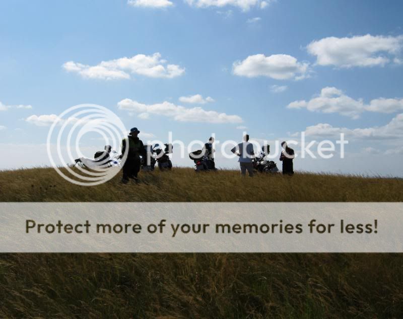
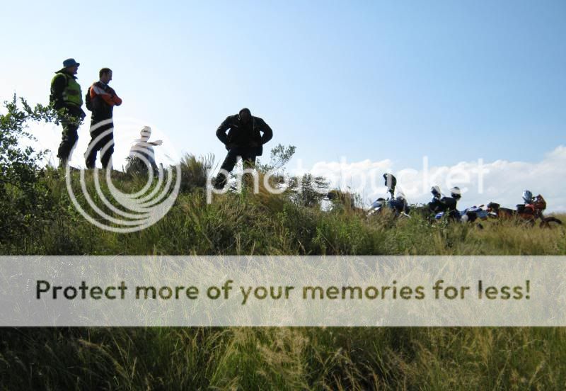
We then went looking for another view site I had seen in Google Earth. (G) It also required a bit of no-road riding through long grass, but by now we were all pros at this.
The hillock the guys are standing on is actually a giant termite mound – suspect a few hundred years old.
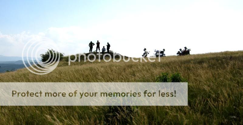
Table Mountain on the left

“Duzi” river. The Mgeni flows behind Table Mountain on the left, and the Duzi/Mgeni confluence is in the valley in the distance.
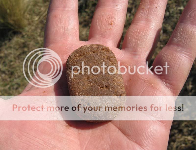
I had some Romany Creams in the top-box. They came out like rounded pebbles after being thrown about a bit.
From there it was back trough the grass, through the Duzi valley and up to the Lion Park and onto the comrades route to the Hacienda for a drink and a late lunch.

Thanks to all – It was a great ride – great company makes it special.
Sometimes it is nice to ride without a plan – just get out there and ride, but today I set some objectives and planned a route. The objectives were to show shesha, who has never been into the Valley, a couple of the sights, and then to try to get to two view sites and a waterfall that I had seen in Google Earth, but had never been to on the bike.
In retrospect the time spent on the PC preparing the tracks was time well spent, and apart from a few missed turns, we stuck to the plan and found the places.
A big thank you to the pack who went along. Ugie (Dakar), Shesha (1200) , MrBanger (F800),
Edit : Yes ! Me on Tenere !!
The route we took:-
First stop was to see the Inanda dam wall and snap a rainbow in the outlet spray. (A)
From there we headed up past the Shembe religious village and onto Mtabatula (B), and from there a courtesy call at the waterfall on the way out. (C)
From there onto Matata (Nanda Mountain) (D) where shesha seemed suitably impressed with the view.
From there we headed up the valley to Nagle without major mishap other than a Temporary Loss of Talent where I lost my front wheel in a rut dropped the bike and nearly collected a concrete pillar at a small bridge. No serious damage other than to my ego and a bruised knee – the previously undamaged right one this time.
From there we headed up onto the mountain that overlooks the dam. (E) I had never been up there, but I knew it was possible as it had been documented in a Ride Report by EssBee – Thanks S.
On the mountain I struggled a bit at first as there are no roads up there at all. I learned after two more “sidestand incidents” that:-
- It is not good to try to ride cattle paths. They are too twisty and grab your front wheel in a clamp and throw you in the grass. It is far better to head through the open grass and try to avoid lurking rocks and termite mounds and then cut the cattle paths at steep angles.
- A bit of speed (fast walking speed or slow run) is better. It smoothes out the bumps and makes the bike easier to steer. A speed of 15-25 was for me a good compromise between comfort and control.
- Relax. The Tenere has far more experience built into it than I will ever have, so let it do it's thing and just let it know in broad terms where you want to go.
The view was more than worth a bit of bike lifting – absolutely amazing up there.
Nagle Dam. Strange dam. It is built on a hairpin bend in the Mgeni river and has three dam walls.
Looking up the Mgeni
I did a bit of web surfing and found a reference to a waterfall up on the mountain, so we headed off to try and find it with just a waypoint in the GPS.
Sure enough, it is there, and worth a detour. It is at the head of a most impressive gorge, and with a bit more water in Summer would be quite spectacular,
On the road up towards Pietermaritzburg. Nagle headwaters in the background. The mountain overlooking Nagle where we had just been is directly above the dappled tollie's butt.
We then went looking for another view site I had seen in Google Earth. (G) It also required a bit of no-road riding through long grass, but by now we were all pros at this.
The hillock the guys are standing on is actually a giant termite mound – suspect a few hundred years old.
Table Mountain on the left
“Duzi” river. The Mgeni flows behind Table Mountain on the left, and the Duzi/Mgeni confluence is in the valley in the distance.
I had some Romany Creams in the top-box. They came out like rounded pebbles after being thrown about a bit.
From there it was back trough the grass, through the Duzi valley and up to the Lion Park and onto the comrades route to the Hacienda for a drink and a late lunch.
Thanks to all – It was a great ride – great company makes it special.
 She left and is working on a yacht or in some tropical island location.