Burchell's Travels by Bike; 2010

This site may earn a commission from merchant affiliate links, including eBay, Amazon, and others.
My track looking for the sites.
4649340493_b909d33624_o.jpg


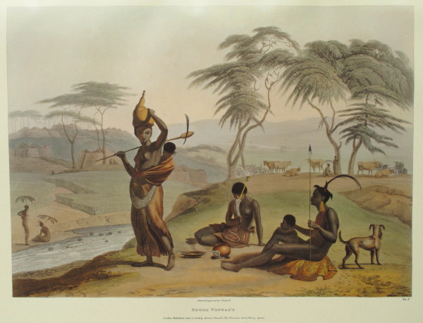
Here is a second Daniell view, similar to the previous setting but closer to what I found upstream.
4649340843_fe997078cc_o.jpg


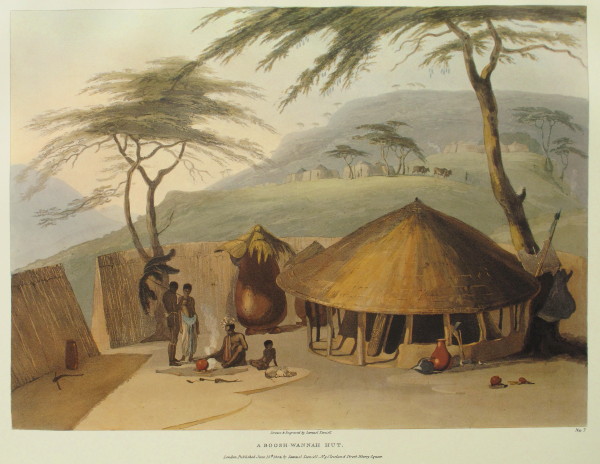
There are two other Daniell pictures.  That is a big clay mielie storage silo.  Notice the umbrella like sunshade of ostrich feathers; also on the first Daniell picture and the next one.
4649959192_8a1ebee0ff_o.jpg


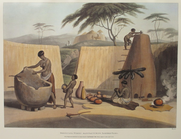
Here is a picture of a woman making one of the mielie storage silos (2:520).  The women also built the houses entirely without any input from the men (2:455  2:515).  The men attended to the cattle and gathered in the mootsi (public enclosure) to chat about social and political matters (2:371  2:386  2:522).  The women attended to the fields also.
4649959474_44d7035e02_o.jpg


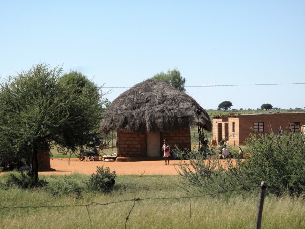
Daniell shows the roof extended past the walls and was supported by poles.  I saw a few huts like that but, unfortunately, only took one photo of a poor example.
4649341573_42f8fbcbe7_o.jpg


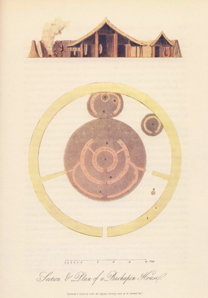
Burchell has this plan and section view of a Bachapin hut.  On the outside is a wall of woven tree branches enclosing the ‘erf’, also to be seen in the Daniell pictures.  In the drawing the entrance into the front yard is at the bottom of the picture.  Burchell writes

Plate 9 is a plan, with a geometrical elevation, or rather section, of a bachapin dwelling. In order to show its structure, it is here represented as cut through-jar to the side of the door-way in the outer fence.  In the ground-plan, A is the veranda; b, the outer room; c, the inner, or central room; D, the storeroom; E, the corn-house; F,F corn-jars; G, the servants’ house; H, the fireplace; and I, the outer fence.

I have shown that Burchell was an excellent cartographer.  Here he displays his abilities as an architect and draughtsman.  
4649339919_af4c80b14e_o.jpg


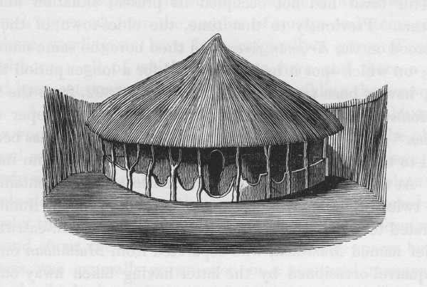
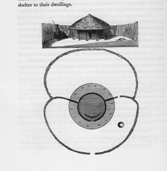
An engraving of a hut of one of the chieftans.  Burchell remarks that it was much more modest than many of the other huts at Litakun (2:521).  Status was earned by your social behaviour it seems and not by your outward appearance as is now the custom.  The yard enclosed by the reed fence had a public front section and a private rear section.  There was a screen wall inside the house so the interior was not visible from the outside.
4649340313_5e5582cc9a_o.jpg


An engraving of a ‘Bachapin’ hut.
4649958748_80c7b8d118_o.jpg


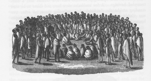
I stated that the ‘Bachapin’ men spent a lot of time talking.  Burchell includes this engraving of himself at one such meeting.
4649958600_b9de60e87e_o.jpg


The chief endlessly demanded, at such meetings, that Burchell trade a musket as the locals felt very threatened by their neighbouring clan who had recently obtained muskets (2:376).  This haggling and demanding continued until they obtained one by a ruse (2:405).
 
Giraffe Trip

I was really looking for the site of the pictures of Litakun by Samuel Daniell.    When I had finished with the picture quest my plan was to head to the N14 (Johannesburg - Upington road)  where there were some self catering chalets according to T4A.  T4A was wrong as the place had closed years ago; my experience on this trip was that T4A information is hopelessly out of date.  Time and again during this 16 day trip it was wrong as in this example.  I had the latest T4A installed the day before I left.  For the Groot Karoo it only shows the biggest roads – even less than Garmin Streetmaps. The road to the N14 was pretty corrugated & my camera was taking a beating as I had become casual about the foam packing (unrelated story behind that) before this trip so I decided to carry on to Vryburg and stay there.  Then I could rejoin my intended route up to Heuningvlei further on where the road should be better (roads tend to be most corrugated where they are most used – around the bigger towns). 

The husband of the owner of the very nice Cosy Corner self catering place was Johan.  He is an engineer working for the North West roads department.  I did not ask what his position is but it is clearly quite senior.  I am a Capie who was travelling in Black Africa (part of the old Bophuthatswana); something I have precious little knowledge about.  I had decided before  leaving Cape Town that in Litakun I would see whether I felt safe to do the next stage around through Heuningvlei & down to Hotazel by myself.  In fact I felt completely unchallenged as I rode around Dithakong so that I was quite prepared to stealth camp alongside the road as there is masses of unoccupied territory.  However there is no petrol available in Dithakong that I saw (quite a big filling station that ceased trading some time ago-T4A wrong again) so the trip out to the N14 was required in any case.  When Johan knew what my intentions were he came and gave me lots of advice.  He is going to lead a group of quads all along the Moshaweng river (the one I had been photographing) from Dithakong to Severn.  Anyway he assured me that the road was fine, there is no petrol before Hotazel (Black Rock possibly?) and nowhere to stay or get much to eat or drink and that the people are not aggressive.  I had been a bit apprehensive about this unknown & unfamiliar territory but now all of that had been allayed.

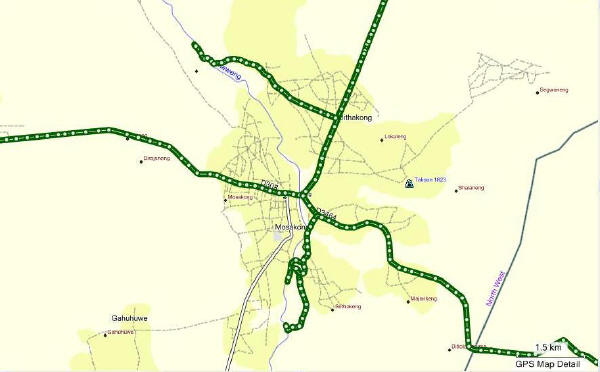
I call this leg the Giraffe Trip because on Burchell’s map he labels one of his stops as Giraffe Station and has a note ‘First Camelopardalis’ as the extreme northern point..  Burchell’s volume 2 ends as he is about to set off.  His map shows where he went after leaving Ditakong and there are the McKay maps which show it on a 1940s road map.  From Vryburg I got onto the D311 gravel road then took the D3492 across to Heuningvlei.  Then some un-numbered road (in the 3 Mapsource maps but T4A does not show it at all) down to Hotazel.

The good gravel road on the northwards leg.  Johan calls it the Bona Bona road which means Bones.
4655171749_e84173b076_o.jpg


At the end of this road is where Burchell marked the giraffes (camelopardalis).

We have now gone past the end of volume 2.  Volume 3 was intended but never came out.  750 of volume 1 were published; it came out in 1822 (that was 7 years after his return to Britain) (1:i11).  The second volume came out in 1824 but as the publisher had been disappointed by the sales of the first volume consequently only 500 of the second volume were printed (1:i14).  In the introduction to the 1967 facsimile reprint there is a detailed (& very informative) introduction.  They say that it is obvious but not certain that a third volume was intended even though they quote how Burchell ends volume 2 with (2:510):

The narrative of these travels having now proceeded as far as it was intended, the two following chapters, containing observations extracted principally from the subsequent, part of the journal, are added for the purpose of completing the work as an account on the inhabitants...

They seem to view the word journal as used above to refer to the diary Burchell kept.  So the word work would then refer to the published books.  I don’t agree with them because Burchell writes this in a footnote volume 2  page 326:

I may be allowed here to make the remark, although it belongs properly to a part of the journal not comprised in the present volume .....

Also there this footnote in volume 2 page 146:

A further account of Graaffreynet and its natural history, belongs more properly to a later period of my journal; for which it is therefore reserved.

They may wish to refrain from being certain but I am sure that a third volume was intended.  Burchell took so long in preparing his work for publication that he missed his market.  As pointed out in the introduction, it would have been ten years after the event when the third volume would have appeared and other later travellers had already issued their books by then. 

Burchell took too long in preparing his books so missed the market for the third volume.  His note books (except one) have been lost.

Now the bush where the giraffe was hunted looks like this – pretty much the same as when Burchell was there?
4655172005_57d80587c9_o.jpg

 
There are thus no more Burchell pictures to try to replicate.  Here are some by Francoise Le Vaillant who I introduced in the Hippo Hunt post.  He did not come up towards Heuningvlei but he did shoot a giraffe in the Richtersveld area; the stuffed skin was one of the first to be seen in Europe.  Giraffe were still very mysterious to Europeans in Burchell’s time.  Here are the Le Vaillant pictures.

A young giraffe.
4655174093_c72ac960b9_o.jpg


A female.
4655793038_2255866a2e_o.jpg


A male.
4655173963_c9a1a3dfbb_o.jpg


Head of a giraffe.  The first three show his ability to do accurate pictures which are also artistic.  This one, I think, shows his artistic side particularly well. (Le Vaillant did not do these drawings; the practice was that he made sketches and professional artists made the pictures for publication.)
4655793096_d0dfc30cda_o.jpg


Skeleton of a giraffe.  This one shows his fantasy side.  It is anatomically wrong in so many details.  There was a public demand for something like this so he satisfied it (he had brought just the skin of a giraffe back to Europe).  This is typical of the work that earned him such a poor reputation.  In fact Le Vaillant had his artist copy a picture from an earlier book  (see page 116 of 1973 Library of Parliament Francois le Vaillant vol 2).
4655174063_7d81199b23_o.jpg


This is a particularly well known picture of his.  It was at the end of his first journey book as a teaser for the second book.  Imaginary trees and Le Vaillant dressed in the highest fashion with two pistols in his belt, the hunting gun in hand and ostrich feathers in his hat. To me it shows what a character he was.  It is fun.  The giraffe was never in the camp and it is disputed that he actually shot it.
4655792964_31c240f21e_o.jpg


You can judge from the number of pictures Le Vaillant produced how fascinated the Europeans were by giraffes and why Burchell so much wanted to see them. He presented the British Museum with 43 of the best of the 120 skins he brought back from this trip.  A German museum had offered to buy the skins but Burchell felt the patriotic thing was to donate the finest and rarest to the British Museum (1:383).  It included two giraffe skins.  Four years later only seven were stuffed and only five put on display.  Burchell was very annoyed by this.  A year later he went to the museum to look at the horns of a Hartbees he had given them and was mortified to find that an old packing case they had stuffed many of the skins into was now swarming with live moths and maggots and the skins rendered useless (2:337).
 
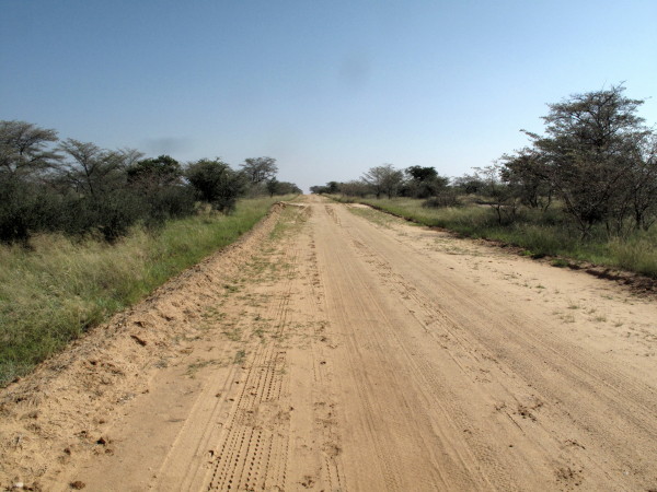
The road running westwards to Heuningvlei.  As Johan had said, the roads were good. You could stealth camp anywhere along these roads.
4655790872_df9cb42f2c_o.jpg


I have written an ode in praise of windpumps.  The Cape is reputed to be windy but I have never seen a windpump blasted like this in the Cape yet saw a few north of the Gariep river.
4655791116_90a6c2c9cb_o.jpg


Heuningvlei
4655791272_3eb0e11bc9_o.jpg


Locals riding on it.  It was only just dry enough to ride on (this is a usual cart track in the dry season). Burchell took his wagon on there and camped.
4655791366_45f10bd511_o.jpg


So I went out there too.
4655791622_f45248f7cc_o.jpg


Then you turn south for the long run down to Hotazel. 
4655172743_29817cec16_o.jpg


I have wanted to see Hotazel since noticing it on a map in primary school.  When my grandmother explained the name I thought it was a naughty thing to have done & I was very surprised it had been allowed – it tickled my fancy. Here is the story behind the name as recounted by T.V.Bulpin Discovering Southern Africa page 303:

In 1915-17 a full-scale land survey of the area was undertaken by Dirk Roos and Hendrik Wessels. They were responsible for surveying and naming many of the farms: Wessels (named by Roos after his colleague) Mamathwane (bats), and the celebrated Hotazel. This farm on the Gamagara River was surveyed by Roos assisted by J W Waldeck. The day was blazing hot and in the camp that evening Roos practically collapsed. 'What a day, what a place! Hot as hell.' he exclaimed. 'That 's it', said Waldeck 'the perfect name!' So they called the farm Hotazel without realising that the ground beneath them was almost solid manganese.

Another place I had wanted to see from those days is Verneukpan.  Now my little TW has taken me to both.
4655791934_a49d4db43d_o.jpg


The whole area around here is riddled with manganese and iron; the British had sent a geologist here as early as 1872.  Manganese mining started in 1925 and a whole succession of companies mined for it in many different places with varying success.  In the mid 1950s a geological survey was done by Leslie Boardman (he had been coming to the area since 1937).  Here is what Bulpin writes:

Using a magnetometer, Boardman conducted a careful geophysical search of the area near Black Rock. The instrument detected a great deposit of manganese below the sands on the farm Wessels. More deposits were found on the farms Smartt, Rissik, Goold and Alamathwane. What the instrument had detected was the greatest manganese deposit in the world.

S A Manganese bought Smartt. Boardman continued prospecting. Farmers were always com-ing to him with reports of manganese. A diviner from Lichtenberg, a Mr van Rensburg, was employed by the farms to find water and he reported seeing black rocks beneath the surface on farms such as Langdon and Hotazel. Almost unwillingly Boardman was induced to visit these farms. He was staggered at what he found on Hotazel. The magnetometer overshot its own scale! Only an ore body of unimaginable size could have had such an effect.

Hotazel is a company town (BHP Billiton) where I did not wish to stay so I went on to Kathu (though I still think of it as Sishen) where there is a municipal camping site.  It is called Khai-Appel.  In the Cape we have Kei-Apples (in fact I planted one on the hillside behind my house in memory of my mother).  Never heard of a Khai Appel & it is not in my Trees of Southern Africa but an interesting looking fruit, but not edible I was told.
4655172979_3bdc261fdd_o.jpg


The camping site was municipal; as was the one in Kuruman.  I now know to avoid them.  They cater for the wishes of the majority which seems to be stolen shower heads, broken and dirty lavatories, basins with missing taps, scruffy walls and no hot water.  They may be cheap but I am part of the minority that wishes for something better.  I camped twice after this but both were commercial and they were excellent.

Right in Kathu village is the best thorn tree veld that I saw anywhere. 
4655173173_e9dd83c682_o.jpg


I suspect this is how it looked when Burchell was hunting giraffe.  Those are kameeldorings which used to have the scientific name Acacia giraffe but it had to be changed as it was found to have originally been called Acacia erioloba and the original name takes precedence.  In English the Afrikaans name has been mistranslated so it is named Camel Thorn instead of the correct Giraffe Thorn, so named because it is much liked by them.  From K.C. Palgrave Trees of Southern Africa:

The pods form an excellent fodder for stock: farmers say that animals pick them up as fast as they fall to the ground and that there is a noticeable increase in the milk-yield of cows that have eaten them.

I went to have a look at Sishen.  This is the overburden dump though it could be mistaken as for natural hill.
4655792366_b2c49baca3_o.jpg


I went to see the big retired Wabco dump truck.
4655792496_8f0552eaf4_o.jpg


The steel structure painted brown at the front of the Wabco dumper is the pantograph for drawing electricity from overhead cables just like electric trains.  The diesel engine drives a generator which powers the wheel motors while the truck is off the overhead cable but then it connects up to the overhead electric cables for the long climb out of the mine to the tip as electricity is cheaper than diesel for these machines.

One of my careers was as foreman in the tyre retreading industry.  My area was re-lugging of earthmover tyres.  These machines have 36x51  tyres. The largest I ever dealt with were 21x35 &  37.5x33.  Our autoclave and buffing machine could handle tyres up to 3,3m diameter so these tyres would have just fitted in.  To metricate those tyre sizes as they are all in inches whereas bike tyres are mixed  mm section x inch rim, in bike convention those sizes are 915x51 in the picture & 533x35  &  953x33 that I worked with.

Also this old rope shovel.
4655792602_fc60354ea0_o.jpg

 
I went down to Postmasburg for a late breakfast. Burchell had now completed his Giraffe loop and was back on the track from Klaarwater to Litakun. Just outside the town is a hill with an ancient haematite quarry. Silver/grey flaky iron oxide crystals known as specularite was quarried, ground up, mixed with fat and worked into the hair.  Burchell gives this picture of the hill (he passed this way on his way up to Litakun).
4655790684_cb60225346_o.jpg


I found the hill no problem.
4655173789_9f7b21a95b_o.jpg


Hill is called Blinkklip. I walked up there and looked all over for the quarry but did not find it.  The joke is on me as now that I write this I read (2:255):

The entrance to the mine is in front, at the foot of the rock; but is not visible in this point of view.

He says the mine is 6m high by 9m deep – possibly I did not recognise it as being a mine. Antonia (wife) was here some years ago on an archaeological excursion and she has been to the quarry.  Bulpin says there are several similar places Logagena and Gatkoppies which are ‘riddled with excavations’ so possibly Antonia went to one of those.

Just to show you that I had a thorough look here is the picture from the top of the higher peak of the other outcrop and the surrounding countryside that Burchell had seen. 
4655792702_c93831c160_o.jpg


Here is a picture of a Bachapin at Litakun.  The silver in his hair is the haematite which they called sibelo.  It was only found in this small area so they came here to dig it up and used it in trade with the neighbouring clans.  It was used over quite a wide area.
4655790576_5bd2313922_o.jpg


Another portrait from Litakun.  A girl about 12 years old.  Very pretty and also has sibilo in her hair (note the hair style).
4655171523_78e4706f31_o.jpg


Then through Griekwastad where I had a beer and down towards Douglas again.  Burchell’s giraffe trip is now over.  He then went back down to Graaff-Reinet (he previously went there by horse to recruit staff) and on to what is now Grahamstown
 
Leaving the Gariep

After Griekwastad where I had a beer I headed down towards Douglas again.  I did a 40km diversion to the west as that is where Burchell forded the Gariep.  That area is heavily fenced as it is now Wouterspan Diamond Mine.
4659263651_86cdc86a19_o.jpg


Saw this big tortoise on the way back from Wouterspan.  Many tortoises in the Western Cape but I think they are not nearly as common up here.
4659263507_6d4f994c7f_o.jpg


I stayed at a pretty fancy resort outside Douglas.  Their bar/restaurant is at the river’s edge & had been 3m underwater some weeks ago when they opened the sluices at the Vaal Dam.
4659263779_e53efbc9c1_o.jpg


I tried to camp one night then stay in a self catering the next where I could wash my clothes and work on my computer (trip log, photos and Garmin) Slept well in the expensive place.  Had my phone on to see the time.  2 sms during the night – did not read until morning.  My grandson was born at 2h20.

The river is wide and sluggish here because of a barrage a little downstream.
4659263841_3667ca15f6_o.jpg


I wanted to see the barrage as it has an interesting shape.  I got to the river; you can see it is flowing properly here as I am downstream from the barrage now. 
4659887514_d9a75184ba_o.jpg


I am going to write a little about the Gariep to Sundays Transfer Scheme later.  It includes this diagram which also shows the little Gariep to Vaal transfer scheme I was wanting to see.
rm025mm.gif

https://www.dwa.gov.za/orange/mid_orange/fish-sun.aspx  Source for excellent description & map.

I think that canal is the one bringing water across from the Gariep.  Right alongside the river in another much smaller canal in amongst the trees.  It was the track alongside that little canal that I was trying to ride.  The trail up to the weir had been heavily washed away & was thick black & exceedingly slippery mud.  No prizes if I got stuck in the sloot by myself so I abandoned that quest. 
web153l.jpg

 
I then went on another 40 km diversion to try and see the other side of where Burchell crossed the Gariep.  On the way I saw a sign to the Glacial Pavement so I turned off & had a hell of a time actually finding it (keep right if you go there but it is on T4A ).  This is how big the exposed part is.
4659887882_1737f5d4fc_o.jpg


Here you can see the grooves made by hard stones as they were dragged across the pavement.
4659887706_03be74cba8_o.jpg


Here you can see the hard pebbles in the pavement have been ground down by the grit in the glacier as it moved over the pavement.
4659888102_54a6e98bb5_o.jpg


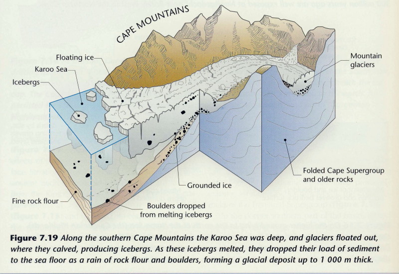
I wrote a long thing about the Geology of the Karoo
*here* Which includes this picture (notice the note on the left)
3543198644_0b29b42549_o.jpg


That explains the scratches and flat surface.  Here is another diagram from there showing how the base pavement rock was formed (notice labels ‘fine rock flour’ and ‘boulders dropped from melting icebergs’)
3543198994_f6e97163e3_o.jpg


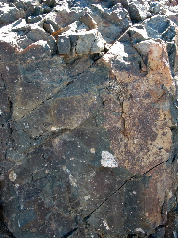
This picture from an earlier ride report of mine shows similar pavement rock in Prince Albert as this was before being glaciated.
4013803153_416ea6e794_o.jpg


The grey is the rock flour made by the glacier as it slid down the mountain (labelled fine rock flour in the diagram) and included are the stones and pebbles – all those white specks are not lichen; they are the ‘boulders dropped from melting iceberg’ in the diagram.

While trying to find the glacial pavement I came across this.  Would any one who knows about it please post what it is.  I appreciate that it is sediment but what is the matrix and when/how was it laid down.
4659264821_2f85a9c084_o.jpg

 
This is the Gariep river. That is the weir and pump station feeding the water across to the weir I tried to get to on the Vaal.
4659264989_7f6699aeb9_o.jpg


The weir is upstream from the road bridge.  Downstream is the old bridge. Another pretty bridge like the one at Schmidtsdrif.
4659265175_b5f542e6b1_o.jpg


I like bridges and wrote a report on some that I saw when motoring across France including the world’s highest bridge *here*

When I got to opposite the diamond mine I was again lucky to find a pivot irrigation farm & it was Sunday so I could ride around no problem.  There were dubbeltjie everywhere except in the tractor spoors; I kept having to stop and brush them off my front tyre.  No problem with the back as I had converted to tubeless that end. This is about where Burchell crossed.
4659888870_e2eb44a42f_o.jpg


The thorn bushes were so close together I could not get a better view.  I tried to check a bit further downstream as I could see the diamond workings on the other side.  It seems they own the land on this side of the Gariep too as there was a big fence again but no sentry towers. 

Then a long road to Hopetown.
4659889012_85ab4d7549_o.jpg


The Gariep at Hopetown.  It is usually said that the first diamond was found here in 1866.  The Readers Digest ‘Atlas of Southern Africa’ marks the actual site much closer to Douglas.
4659265609_bf542735ec_o.jpg


After crossing the Gariep where the diamond mine now is Burchell followed  along the southern bank towards the confluence at Douglas then cut across to what he called the Nu-Gariep (Gariep above the confluence with the Vaal) past present day Hopetown to Fluitjieskraal which is about where Orania now is.  He then turned south towards Graaff-Reinet.
 
Orania

Gariep at Orania from the restaurant.
4659265823_8449c5e868_o.jpg


The koeksuster statue is very well known.  It is about as big as a person; I had expected it to be bigger.  It is a piece of civic sculpture as is the pipe sculpture at the Cape Town Civic Centre.  I like the concept, shape and execution.  The village is enhanced by having it.
4659267641_517e742340_o.jpg


Edoardo Villa Sculpture Cape Town (only picture I could find on the web; those little dolls should not be on it).
brand01a.jpg


It is called ‘The Knot’ not because it is meant to look like a knot but because it suggests a knot to some people (others say it ties the art at the Civic Centre together). Equally the ‘Koeksuster’ is a pleasing abstract shape which suggests a Koeksuster to some but the sculpture is not attempting to be a faithful copy of one.

I went straight to the campsite.  It is still being built as part of a commercial complex down by the river that includes bungalows, restaurant and a hydro/gym.  The receptionist was quite the opposite of what I expected.  Instead of a surly, skinny, verkrampte person dressed in unflattering unfashionable clothing, no make-up or jewellery and scraggly hair I found a really good looking young woman at reception in fashionable and slightly revealing clothing.  I asked her when she came to Orania; she and her brother had moved there from the Free State last year, he is an accountant.  The buildings are all wood but not the usual unimaginative cluster of wendy houses.  There is clearly an architect involved so the buildings and layout have style and it is modern.  The campsite is expensive; R220 (WD thread said fully equipped chalet was R250 per head).  Everything worked & there is a washing machine and fridge to use.  The campsite was full by evening – mostly 4x4 & caravans.

It was about 16h30.  There were 2 motocross (?) bikes in one of the chalet garages  as the receptionist showed me to the campsite so I asked the guys there if I could change my engine oil as I like to do that every 2500km.  Sure they said & told me where I could get oil before 5pm.  Got the oil, back to their place, they lent me spanners (I had brought my special 6 sided socket for the Dakar instead of the one for the TW) & a cut open oil can.  Cloth to clean my hands when finished & hand cleaner.  Real nice guys (they were busy with a welding job).

This quote comes from William Dicey Borderline page 14:

Orania is odd. But not in the ways I thought it would be. For one, the Afrikaner volkstaat is no tradition-bound, Mormon-like community. It has one of the country's largest pecan orchards, and one of its most modern dairies. Anna Boshoff, Hendrik Ver¬woerd's daughter, is principal of the school. She had shown me around the day before, sad-eyed, businesslike, her hair pulled back in a bun. Pupils are given their work a week in advance. They do all their assignments on computer, a process their teacher monitors from a terminal. They don't wear uniforms and their hours of attendance are flexible. The school is, by anyone's standards, liberal. Which is not an adjective I was expecting to apply in Orania.

That’s not something I had expected in a reputedly conservative town.  In fact that is extremely progressive.  No uniforms – my children went to Michaeloak which has the same system.

From   this WD thread I knew there is a straw bale house in Orania.  They interest me so I was pleased to see this but it looks like a really sad straw bale house that has to have props to hold it together.
4659890204_9018bbd440_o.jpg


The owner/builder saw me & invited me in to have a look.  In fact those poles are holding up an outer temporary wall which keeps the rain off the permanent wall until it gets plastered.
4659266847_494534a48e_o.jpg


Inside it looks like this at present.  The roof will have sisalation and ‘Think Pink’ insulation about 300mm thick.  These houses are about low capital and running cost so heat insulation is primary, keep the heat out in summer and keep it in in winter.
4659267013_a476fb17f8_o.jpg


There are two parts to the house he is building.  The roof of the front part rests directly on the straw bale walls so the walls are load bearing.  He said it is a ball ache to build that way so the back part has steel columns to hold the roof up with the doors & windows attached to them. 
The straw bales are then simply slotted into place making it much easier to build.
4659890772_64f88a9c3f_o.jpg


The diagonal bracing is just temporary; they braced the whole roof structure before there were any windows and walls but they get removed when the straw bales are fitted.  Look at the bottom of the un-filled section at the back.  There are two 25mm (?) batterns on the concrete floor slab with aggregate (crushed stone) between.  A layer of polyethylene dampcourse gets put on top of that under the first straw bale.  If any water spills on the floor it can drain out under the straw bale without wetting the straw. I was told that termites have no interest in eating the straw.

Interestingly the owner appeared to be English speaking (it seemed to be his home language) and he does not currently live in Orania.

There are at least three other straw buildings in Orania.  This jewellery shop.
4659891450_203f26518e_o.jpg


Roelien likes the soft rounded edges judging by how she has finished the back.  I do too – a pleasant difference to the brutal hard & aggressive lines of modern houses like mine.  This is much more organic and comfortable looking.
4659267915_652b5bd310_o.jpg


That is an evaporative cooler at the back.  I have one at my house – brilliant things.  Run it at night and you don’t wake up with a scratchy throat and burny eyes.

This double storey one which is quite conventional looking.
4659891936_c332d1b5c8_o.jpg


The fourth one is my favourite. Looks like a ginger bread house.
4659268073_d734815bd5_o.jpg


Not only do these houses insulate you well both in summer and winter but they must also be lovely and quiet inside.  A really nice living space.

Here is the water supply to a house.  Two pipes.  The one with a filter is water straight out of the river for the garden, washing the car and stuff and flushing the loo.  The insulated pipe is clean drinking water (its cold here at night in winter).  Absolutely right.  Supplying us with drinking water to flush down the toilet is extravagant in the extreme.  I was really impressed in Mexico where all the drinking water is bought in 20 litre plastic bottles from the local osmosis plant.  What is piped to the house is ok for cleaning; for cooking & food preparation you add a pill to it.  Orania has chosen a slightly different system. Think of Port Elizabeth where they are building a desalination plant to supply water and lots of it is going to end up in the lavatory; if they had a water system like this or Mexico the desalination process need not be taken all the way to the drinking water stage.
4659267489_ef3d2383c6_o.jpg


In Orania the residents have 4 dustbins & separate their rubbish.  Quite novel for Africa but it is usual in the first world.
4659892148_b5259b1a44_o.jpg


This is the hydro part of the commercial development where I camped.  The west wall is very interesting.  Made like a gabion but with smooth rounded stones as you see.  In summer water flows down over the stones so the building has an entire wall as an evaporative cooler. 
4659889556_bd5bff401c_o.jpg


There are hinged glass louvers outside the gabion wall.  In winter they close them so the afternoon sun shines through & heats the wall as if it was in a greenhouse or solar heater.  At night the hot stones keep the inside cosy.
4659266205_b5b17d6810_o.jpg


The hydro was closed so this picture has been taken through the glass north wall overlooking the Gariep so there are some reflections.
4659889988_fae6d33e16_o.jpg


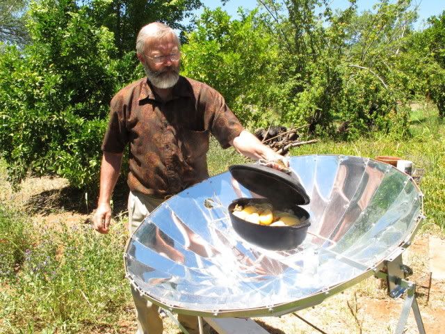
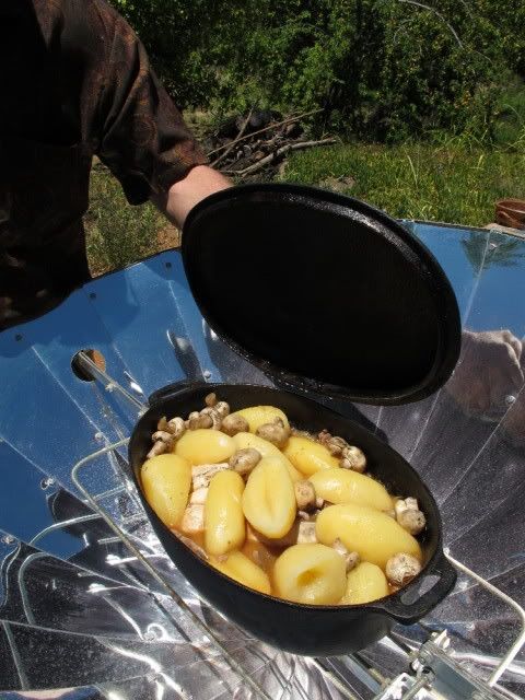
I came across this in a Wild Dog thread.  It is solar potjie braaing in Orania.
RR0019.jpg


RR0020.jpg


Graaff-Reinet

I wanted to see the Vanderkloof dam.  It was overflowing. Not the biggest dam in the country but it has the highest dam wall.
4668985249_be6218e84b_o.jpg


You can simply drive across the wall.  I was surprised as I had expected it to be closed off.
4668985567_6aeab8e11e_o.jpg


Looking up the lake.
4668985401_a7d0a159a3_o.jpg


Looking downstream.
4669609750_ce5150e327_o.jpg


As much water flows through the turbines here as at the Gariep Dam (previously H.F.Verwoed).  I was surprised that I did not see a strong current coming out from the turbines (left corner of the picture).  The electric cables are not very big (left of picture); not nearly as much hydro electricity generated as i had believed. From *this good site* I see it can make 240MW.  That is just 5% of the 4800MW that the new Medupi station will produce.

View from the road bridge.
4668985823_6c992ed5fa_o.jpg

 
Next town is Philipstown which is part of De Aar.  The ratepayers have laid a criminal charge against the municipality.  If you accept payment for something and then fail to hand that thing over it is fraud which is a criminal offence.

Upington – The municipality of Philipstown in the Northern Cape could be the first in South Africa to face charges in a criminal court due to poor service delivery.

Fed-up residents recently laid two charges of fraud against the Renosterberg municipality with police; Philipstown is part of the municipality.

According to the Philipstown Ratepayers Association, this drastic step was taken after residents could no longer watch the collapse of the town, which allegedly started when the ANC took control of it four years ago.

The municipality, which is situated about 55km from De  Aar, could collapse within one month as it, among others:
• Has no money for fuel for service vehicles
• Has no money to buy bulbs for street lamps
• Has no firefighting services
• Regularly cuts the town’s water
• Allows potholes to worsen and does not look after historic buildings
• Does not pay its electricity account
• Has no welfare services
The municipal manager said, however, that service delivery was a priority and that the ratepayers were being racist.

Municipal manager Mzamo Mtubu said there was an action plan to fix matters at the municipality.

He said faulty accounts had been sent out due to a new computer system. He admitted that the municipality, like many others, had financial problems.
*Source*

I like our undiscovered country towns with their original simple buildings.  In most towns the buildings have been redeveloped or replaced so that the town has lost its original character and the original buildings that remain are isolated in amongst modern looking houses.  Philpstown is an exception as the houses are all still pretty much as they were. I would have liked to spend more time photographing the village.
4668979843_1bb896d999_o.jpg


Unfortunately quite a few are unoccupied and collapsing.
4668979943_0f3feacde1_o.jpg


Something I wanted to see was van Plettenberg’s Baaken.  I learned about it from Nigel Penn’s book The Forgotten Frontier about the conflict between the trekboers and the San.  Governor van Plettenberg wanted to establish a fixed line for the trekboers to extend up to and leave the territory beyond that as a no-go zone to be utilised by the San.  He came all the way out here and erected a baaken to mark north-eastern corner of the colony in 1778.  The San promptly flattened it (Penn page 133).  He also shot 23 hippo in the Seekoei (Seacow) River.  Sadly I could not get to the actual beacon as it is on Quaggasfontein game farm .  This picture is not the closest I got but it gives a better idea of the locality – at the top of the grassy hill.
4668985965_c86d6bc38a_o.jpg


In Googling for stuff about the baaken I came across this which illustrates the problem van Plettenberg was trying to overcome (Gordon guided the van Plettenberg party)

The story of an ambush led by Adriaan van Jaarsveld in 1775 which Gordon relates:
“We saw the skulls of several ‘Hottentots’ (Bushmen) who had been shot by a commando two years ago. They were unable to catch the wild people who crossed the river with stolen cattle, moving on further. The farmers shot some hippopotamus and made as if to return home, travelling back a few hours, whereupon the unhappy creatures came back for the remains of the hippopotamus and about 240 were killed. The farmers say, however, that it was they who first began to shoot at them with arrows.”
*Source*

The road was wet and pretty slippery so I changed plan & did not retrace back to the Hanover road I had been on but continued to Colesburg to get onto the tar road as I wanted to get to Graaff_Reinet that day.

This is all there was to the Seekoei (Seacow) River.  For van Plettenberg & party to have shot 23 hippo it must be much deeper nearby.  The river formed the main wagon route from the Eastern Cape up to the Gariep River besides marking the eastern border of the Cape Colony. Difficult to believe what looks like such an insignificant stream was used to mark the eastern boundary of the colony.
4669610246_175f9032f0_o.jpg


I went through Colesburg and on to Noupoort; famous for its brutal drug rehabilitation centre.  It used to be a very important marshalling yard during the days of steam locomotives so there are a lot of old railway houses.  Next Middelburg (named because they established a town in the middle between Cradock, Colesburg, Richmond, & Hofmeyer) I took this nice gravel road that passes through the neck between the hills ahead but ended up chasing the rain to get off it before it was even more slippery than it already was.  We both got to the end of the road at about the same time.  I suited up & carried on to Graaff-Reinet in the rain most of the way.
4669604200_34bf4e147e_o.jpg

 
I posted this picture of Graaff-Reinet by Burchell in the Cape Mountains post.  It shows that there was not much in Graaff-Reinet in 1812.
4629090882_9e3cdfaf53_o.jpg


Burchell says there were 74 houses but that just seven years before there had been only 15 or 20.  It was growing rapidly.  Besides three blacksmiths, wagonmaker, butcher and baker there was a pagter = bottle store (2:145).  So the town was attending to priorities but that shop captured all the money Burchell’s men had before they left (2:152).

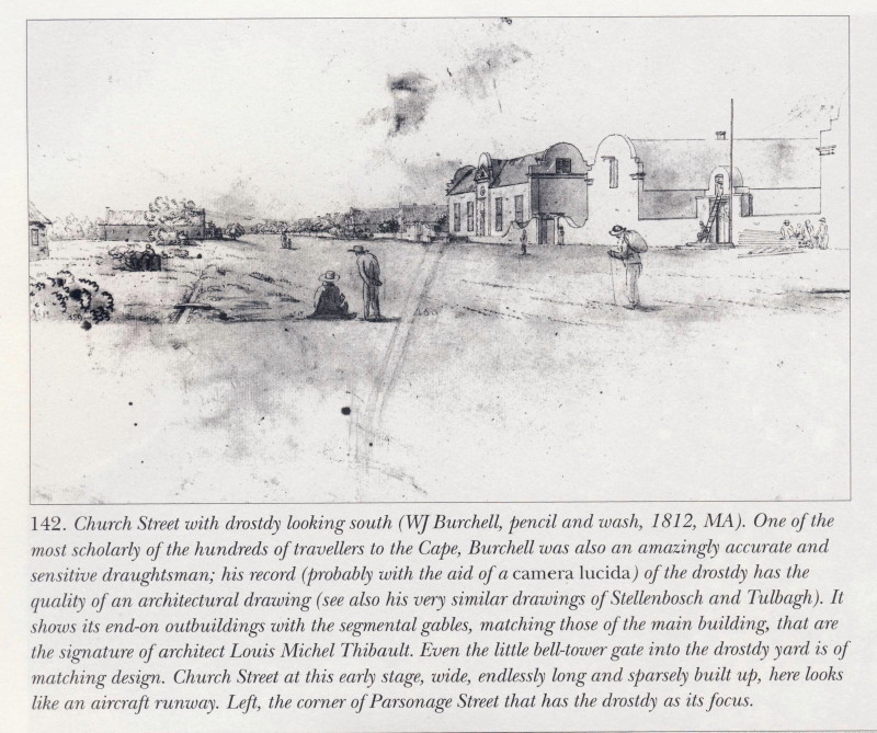
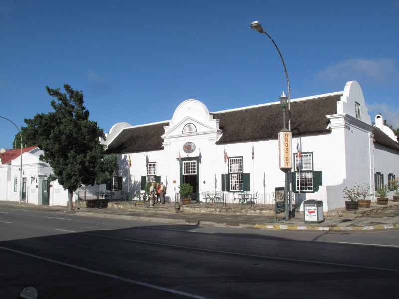
The Drostdy is still there.
4628492015_c42f8e6197_o.jpg


The town has the church at the head of the main street as usual.  This is the third (?) church on the site.  Lots of money spent making it very ornate on the outside.  To me it looks like the sort of wedding cake Sol Kerzner would select.  I much prefer buildings with strong design elements and little decoration – plainly handsome buildings.
4668980237_e29065685b_o.jpg


Graaff-Reinet is well known for its prestigious ‘Cape Dutch’ buildings.  This is the Hester Rupert Museum.  Quite a restrained building.  It was built as the Dutch Reformed Mission Church serving the Coloured community who vacated it due to the Group Areas Act.  I did not go inside.
4669603864_52d4e046ca_o.jpg


Total wanted to demolish the old slave church in Graaff-Reinet to make way for a garage. Anton Rupert intervened personally, offering to buy back the church from Total. He took the matter to their head office where he resorted to some gentle blackmail when he realised that he was getting nowhere. He apparently suggested that it would be a shame if all the hundreds of Rembrandt reps on the road those days never filled up at a Total station again, and that sealed the deal! Today the old slave church is the Hester Rupert art museum, named after Anton's mother. The story is told in his biography, published a few years ago, so I would imagine that all matters of sueing will be sorted out by now!
*Source*

Urquhart House, another of the old buildings that has been restored.  The gable was cut off during Victorian times when the then fashionable corrugated iron roof and veranda were fitted during ‘refurbishment’.  Houses Victorian furniture & has a peach pip floor.  I am very pleased that gable and facade has been restored. I did not go inside.
4668987707_a04b8fa753_o.jpg


This is the Reinet House Museum which I did go to.
4668980741_1ebb70305f_o.jpg


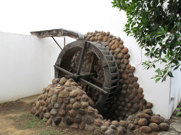
Built 1805 as the pastorie for the predekant of the church.  It has a watermill which is what attracted me to it.  Inside is this picture showing what happened during the Victorian period when gables and thatch were out of fashion but corrugated iron and no shutters was the height of fashion – it is difficult to recognise that it is the same building.  The same thing was done to Urquhart House, this was done in 1885. That is what regularly happens when developers ‘renovate’ houses today – what they actually do is transform them to what is currently in fashion.  It was properly restored in 1956 (pretty early during the revival of appreciation of Cape gables).  In 1980 the place burned down so what is now here is largely a replica.  Inside it is laid out as a functioning house so you see bedrooms, voorkamer, kitchen and laundry with lots of furniture and stuff that would have been in such a house.
4669605854_025797ef65_o.jpg

 
4668981201_a041a90b5d_o.jpg


It is actually a replica and those stones look terrible.  They did not have cement in those days and I hope they would have built something more handsome than that abortion.  A waterwheel and mill are pretty simple machines.
4669605068_43605269cf_o.jpg


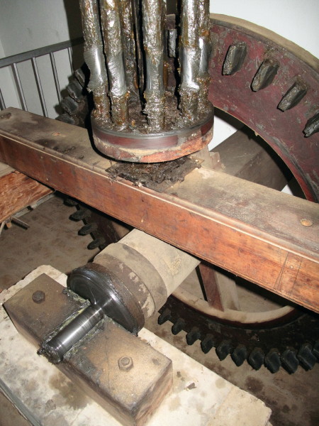
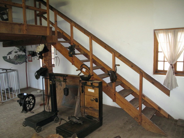
The waterwheel drives the square shaft at the back in the picture.  The large crown wheel has hard wood teeth driving the iron rods of the lantern pinion.  Notice how worn the iron rods are but the wooden teeth still look new. The advantage of the wooden teeth is they could easily be made locally and replaced as they wore out.  Cast iron may last longer but what happens if it wears or suffers an accident?  The grindstones are above driven directly by the pinion shaft (no more gearing to increase the speed).  There is a hopper above for the wheat.  Someone has to carry all the sacks of wheat up to the hopper; this lovely set of stairs is used.  The rise and reach of the steps gives the easiest stairway to climb – much appreciated by that man I hope.  If you go there try them yourself.
4669605190_aa5e5610f7_o.jpg


There is an old ox-wagon.  I took photos of it because it seems to have four wheel steering.  White Stripe’s father has made a lovely scale model of a Voortrekker wagon with four wheel steering – he showed it to me.  Unfortunately I took photos of the front axle which clearly shows that end but I did not take decent photos of the back axle mounting.  I now have a copy of the Swellendam Museum pamphlet on a Kakebeen wagon & I think this one is like that too.  I now want to go to Swellendam & Genadendal where good Kakebeen wagons are and check exactly how their steering works.   I will post this:
4669605548_76691bd319_o.jpg


This is the brake for use on steep declines.  An iron shoe that is fitted under the wheel so the wagon slides downhill on it – it is chained to the frame of the wagon. That is where the name brake shoe comes from; it persists in drum brakes even though it looks nothing like a shoe.
To tie this into Burchell here are two drawings he made of his wagon.
4668979265_57367d594b_o.jpg


That picture shows the connection between the front and back axles which can be made to steer the rear wheels.  It also shows a brake shoe in place.
4668979331_af9ae84102_o.jpg


That is a wooden brake shoe in the picture.  The lever at bottom left is the hand jack for lifting the wagon to grease the wheels.  The pegs in the yoke are jukskeis.  We can add draughtsman to the list of his abilities.

There was this:
4668981575_1862c44262_o.jpg


I know about houses and sailing galleys built out of matchsticks.  Mr H. Joubert (1834-1897) made one out of porcupine quills.  There are 52 windows with curtains; he used 40 000 pins.  Good for him, I am pleased it has survived.

There is this fretwork model of ‘Big Ben’ (Big Ben is the name of the largest bell of the Westminster Clock).  Made by Mr du Toit in 1902.  I have been up the tower to look at the real clock.  A wonderful bit of hand fretwork but it certainly is not a replica of the Westminster Clock tower.  The model  has an onion dome and other embellishments that are not on the genuine article.  
4669606040_340da774a4_o.jpg


,------------------------------------------
EDIT  April 2014.  I have been told that the wooden teeth in the crown wheel were used because of the explosive nature of flour dust.  Cast iron teeth against steel trundles makes sparks a real possibility.  Using wooden teeth eliminates that possibility.
 
Those are some of the prestigious buildings of Graaff-Reinet.  I much admire those sort of buildings but I also very much like the simpler buildings from the same era. Behind the Drostdy Hotel is a lane of restored ex labourers cottages now called Drostdy Hof.  It was originally named Stretch’s Court after the man who built it c 1840 for freed slaves.  It has been over restored so the buildings look like reproductions not originals.  Bo-Kaap is fun, this is dull by comparison = dead. I will show some old cottages in Grahamstown that are in superb condition that have been restored very sensitively.
4668987071_d4bfcef33f_o.jpg


They are now the rooms for the hotel.  Some are free standing cottages like this.
4668986909_51ef96631e_o.jpg


Others are semi-detached.
4668987243_abba977ac6_o.jpg


Inside you have a bedroom.
4669611528_e79e9de32a_o.jpg


And sitting room with period furnishings.
4669611654_060d8afd94_o.jpg


Bathroom.
4668987325_5f4d0f08a8_o.jpg


I last went to Graaff-Reinet before I developed an interest and appreciation for old buildings.  I now realise that I must spend time there as the whole town is in beautiful condition with street after street of little houses more or less unspoiled by the passage of time; i.e. not refurbished like what happened to Reinet House and Urquhart House.

The town is built inside a big loop of the Sundays River but it is very overgrown.  They could make a really nice feature of it if the wished.
4669610478_c4fecfb569_o.jpg

 
I mentioned the alarmist rumour in Graaff-Reinet before Burchell arrived in the Karoo posting thus ‘Graaff-Reinet was placed on a war footing as it expected to be invaded by 300 Klaarwater Hottentots led by a white man (2:136).  The party was, in fact, Burchell plus 6 Klaarwater basters, a San youth & a Tswana man (2:15).  Such was the suspicion, false information, exaggeration and paranoia amongst an ill informed community.’  The first boer they met was highly suspicious of them (remember that no European or Baster had travelled from Klaarwater to Graaff-Reinet before them) and cross questioned them in a hostile manner (2:106).  They come to another farm the following day where the man was away on commando for three months but the wife made Burchell & his men very welcome (2:112).  Two days later a group met up with them who had been sent out by the local veldkornet because he had heard about this party of invaders.  He was highly suspicious and left very quickly to report back (2:127).  When they were about fifteen km from Graaff-Reinet they were met by an armed party sent by the landrost to ascertain what was going on.  Burchell had letters from the Governor instructing all officials to assist Burchell.  On seeing this these men changed their attitude and sent back a written message to the landrost.  Burchell had a fever (flue) at the time and was lying in his ‘bed’ in the ruin of an abandoned boers house.  Next thing the landrost sends the dominee’s horse drawn carriage to collect Burchell (the only carriage in Graaff-Reinet) (2:136).
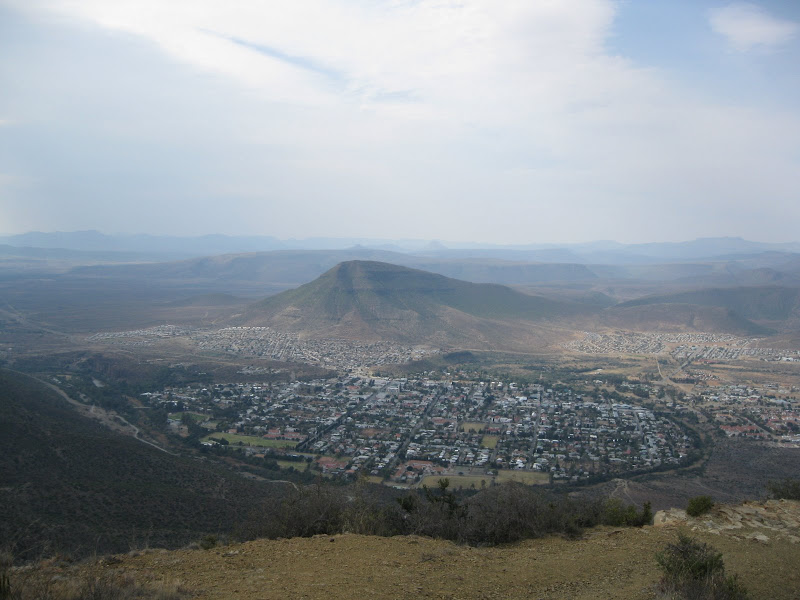
I recounted his troubles recruiting labour in Graaff-Reinet in the post about the labour recruiting trip so will not repeat it. Burchell came down to Graaff-Reinet on a horse to recruit men for his journey beyond Klaarwater (Griekwastad).  I wanted to go out to Nieu-Bethesda looking for the site of some of his pictures and, more particularly, those of Schumacher painted in the area (there are quite a few). I went up to the Valley of Desolation.  On WD Wolweseun posted *this report* of his trip which has exceptional pictures of it and Nieu-Bethesda.  This is my picture.
4669610668_b2b1a0c9e7_o.jpg


This is just one of the lots of pictures in his report – all of which are so much better than mine – showing Graaff-Reinet with the Sundays River curving round it.
IMG_2338.jpg


I posted about the geology of the Karoo based on two books I have.  I was very interested to see the brilliant diorama about it in a display board there.  It explains how the rock & mountain formations visitors have been looking at came to be.  It is behind glass & I didn’t have a polarising filter so the reflection kills the picture.  My whole post all in one poster – excellent.

This is most of the first half of the poster.
4668980369_bee3998e7c_o.jpg


I never saw this although I kept an eye out.  Burchell calls it Hottentot bread.  I searched Google using that & found what I was looking for.
4668979147_317723b981_o.jpg


Burchell’s father was a prosperous nurseryman (1:i7). William had Linnaeus’s System of Botany as a schoolboy.  After he finished school he did not go to university but worked for his father and continued with his botanical studies at Kew Gardens.  In 1803 he was elected a Fellow of the Linnaean Society of London (1:i7). He was particularly interested in the plants on his travels returning to London with 60 000 specimens most of which were plants (1:i11).  Here is his entry for this plant (2:147):

These mountains are the native soil of an extraordinary plant called Hottentots Brood .  Its bulb stands entirely above ground, and grows to an enormous size, frequently three feet in height and diameter. It is closely studded with angular ligneous protuberances, which give it some resemblance to the shell of a tortoise. The inside is a fleshy substance which may be com¬pared to a turnip, both in consistence and color. From the top of this bulb arise several annual stems, the branches of which have a disposition to twine round any shrub within reach. The Hottentots informed me, that, in former times, they ate this inner substance, which is considered not unwholesome, when cut in pieces and baked in the embers. It will easily be believed that this food may not be very unlike the yam of the East Indies, since the plant belongs, if not to the same, at least to a very closely allied, genus; as the membranaceous capsules, with which it was at this time covered, clearly proved.

Being a botanist he then has to give a formal description which he does as a footnote in the required Latin:

Testudinaria. Petals in cyathum coalita, dein reclinata, oblongs, interiors parum
latiora. Filaments 6, longiuscula in hoc ordine. Antherae oblongw emargimilatw.
Styli coaliti. Stigmata recurva, obtuse. Semina spice alata. — HerbW in Promontorio
Bonae Spei, 7-12-pedales. Radix in tuber grande areolatum supra terram emineus.
Caulis superne volubilis, teres, rigidus at quotannis periens. Folia alterna, reniformia, in
Una Soldanella. …

I have cut the Latin short as in this instance he is actually repeating what someone else wrote but his book has similar formal Latin descriptions of each new plant he discovers.

Besides its fascinating looks this plant is interesting because it is a natural source of cortisone.  It was almost exterminated by exploitation which, fortunately, stopped when cortisone was synthesized.

Here is a description from an American site where you can buy the seeds.

Dioscorea elephantipes (=Testudinaria elephantipes) "Elephant's Foot" "Turtleback"
Forms a large globose caudex, covered in a corky bark that separates with age into superbly sculptured, prominent, polygonal tubercles. Twining annual vines arise from the top of the caudex bearing glossy green heart shaped leaves and tassels of small yellow flowers. Native to South Africa where the caudex can become massive with age, up to 2 meters in diameter and height and weighing up to 700 pounds! The inner flesh of the caudex is reportedly edible and eaten by bushmen. Plants were once nearly eradicated in the wild during the search for commercially valuable sources of steroidal saponins like diosgenin; used to synthesize cortisone and birth control pills. Fortunately, removal of plants from their habitat proved difficult and as cheaper and more viable sources of these steroids became available, collection efforts ceased. This plant responds well to cultivation and makes an easy and wonderfully unusual houseplant. Sow seeds 1/4" deep and keep warm. The caudex is initially formed underground, and though you'll want to expose it, we recommend you leave it covered for the first 2-3 years because growth is most rapid this way. A must have for collectors of the bizarre!
10 seed $3
*Source*

Another good  reference https://www.plantzafrica.com/plantcd/dioscoreleph.htm 
Another reference confirming that Burchell was correct when he wrote that it was a member of the yam family  https://web.uni-frankfurt.de/fb15/kahl/pdf/Vendl_2006.pdf

We can add botanist to the list of Burchell’s qualifications.

Continuing in this theme.  Here is his drawing of a soetdoring to show how well he could draw a plant.

4669603512_53b6d5e859_o.jpg

As another example of his skilled botanical drawing here is the Grapple Plant seed Uncaria procumbens (1:536) called Duiwelsklou.  Another example of his skill as a botanical artist.
4668979495_d100a1ccf2_o.jpg


*This reference* has a picture of the seed showing how accurate it is.  *This reference* is CITES stating that it needs protection because the tubers are being dug up and sent to Germany where it is used to make medicine.

The medicinal uses of H. procumbens are numerous, it is used for the treatment of arteriosclerosis, gastro-intestinal problems, diabetes, hepatitis, and neuralgia. It also shows some indications for reduction of spasmodic blood pressure as well as positive effects on liver, gallbladder and kidney diseases (STÜBLER 1987, VOLK 1964, WATT & BREYERBRANDWIJK 1962, WENZEL & WEGENER 1995). The herb has potent anti-inflammatory characteristics and anti-arthritic activity with no notable side effects (ANON. 1998).
 
Burchell gives this picture of the pass they went through at Graaff-Reinet (on his earlier labour recruiting visit).  Most of his pictures are to record what places looked like – similar to a photographic record.  This is different as it is an artistic picture of the scenery.  I have shown his portraits now add scenic pictures too.
4669603696_cd71e7192a_o.jpg


Ouberg Pass (there are actually many passes with that name) is just after the Valley of Desolation and on the way to Nieu-Bethesda but it is not the same as what Burchell painted.  From Burchell’s decription of it being the descent from the Sneeuberg I think it is most probably at Groot Hartebeesfontein farm on map 3124 or possibly Grootklip.  Having ridden out to Nieu-Bethesda and now having a better idea of the countryside makes it easier to understand what Burchell has written. 

The plaque at the top of Ouberg Pass lists T.G.Bain as one of the two engineers.  Built in 1946 I wonder if he is part of the famous family that gave us the father & son engineers Andrew & Thomas.

I went looking for the six scenes Schumacher did of the Sneeuberg and Camdeboo.  First I went up to Nieu-Bethesda to photograph Kompasberg as Burchell has an engraving.  Then I went east looking for any of the six Schumacher scenes but found none.  Next time I know I should go out towards Richmond – after all that is where the Sneeuberg are!
'-----------------
EDIT:  April 2017.  I recently saw that same picture in a new book where the colour was more enhanced.  The mountains in the background are covered in snow.  Quite appropriate since we are talking about the Sneeuberg. 
Also see the EDIT to the following post where I give a link to my later trip where I traced the missing Schumacher scenes.
'---------------------
Luckily I had my Zumo as there are really no signs pointing to it.  That is Kompasberg on the skyline.
4669610830_ba20b74718_o.jpg


Here I made a mistake.  Wolweseun shows that he had a lovely light meal at the local micro brewery but I went to some place where I waited so long just to place an order that I walked out & went to the next place that does not sell beer.  I must be one of the very few tourists to pass through Nieu-Bethesda without going to the Owl House.  I would very much like to see it & the crushed  glass ceilings.  Wolweseun posted brilliant pictures of the Owl House in *the  report I linked before*, but it seemed deserted when I rode past.

Burchell  writes:

This is called by the colonists,Spitskop (The Peak) on account of its remarkably pointed form, by which it is distinguished as a great distance over all the surrounding country, as much as by its superior height.  It has been in later years, very unnecessarily re-named Compasberg.
(2:125)

4669603338_dec7e033a7_o.jpg


After lunch I took the northern road towards the N9 (the southern one was closed – washed away?) which got me this.
4669604642_76f466a60a_o.jpg


This is not quite the right angle so I kept going & did get the correct view.
4668980543_f8e378b802_o.jpg


S 31°  50’  51.7”  E24°  36’  47.9”  but Burchell says he was 32km from it so I was in the right direction but closer (2:184).  He made the sketch not on his labour recruiting trip but on leg of his trip I was now doing.  I had followed his route quite accurately the day before but it was rainy and cloudy so I did not see it from 32 km away.

EDIT November 2014.  I have come across this site where his route from Graaff-Reinet to the Gariep river is retraced by bicycle.  They are following the route Burchell took after he went down to Graaff-Reinet to recruit staff.  https://www.mediaclubsouthafrica.com/visitsa/3355-following-in-burchell-s-tracks
 
I then went looking for the sites of the Schumacher pictures of this area. There is an interesting gravel road that Burchell used when going to Graaff-Reinet in his wagon which follows the railway & Sondags river down towards Graaff-Reinet.  I went down that until the road breaks away from the valley to join the N9 when I turned around & rode back up to the T-junction then went further east.  Because I kept meeting the Sondags as I continued with this trip I have collected all the pictures into a separate post about the Sondags which I will post after the last crossing. 

These are the seven pictures Schumacher made in this area.  I suspect he rather liked the flat topped Karoo mountains – just as I do. Sadly he did not get to the glorious Kareeberg – I would love to seen his pictures of them.  This one is labelled ‘View of the Sneeuwbergen at Van der Walt’
4668978709_26f20f3950_o.jpg


The following one labelled ‘View of the Sneeuwbergen as wild country’
4668978857_b000b94027_o.jpg


The next one is labelled ‘The Sneeuwbergen at Koeckmoer’
4669603172_793365d6a6_o.jpg


Next one ‘The Sneeuwbergen in Northern direction.’
4669603040_f5c68d7fac_o.jpg


Next one is labelled ‘In the Camdebo on the farm of Johannes Swanenpoel’.
4669602990_689121f7c6_o.jpg


The next one is labelled ‘The Camdebo Mountains seen from the Sneeuwbergen’
4669603110_a8e6f10e28_o.jpg


Finally there is ‘Hunt for Springbuck in the vicinity of Camdebo’.  It is not obvious from this small picture but the whitish dots all across the veld are springbok on one of their mass migrations.
4668985117_6e660e8001_o.jpg


You can see the similarity in the form of the mountains but none of my pictures match Schumacher’s.  It would be an interesting project to look for them all.  I went east from Nieu-Bethesda partly because of time constraints & largely due to ignorance.  The Sneeuberg is north and slightly west of Graaff-Reinet and Camdeboo is west so I was looking in the wrong place.  Next time I will know where to look.
4668980635_0952c38a48_o.jpg


'-------------------------------------
EDIT Sept 2013

I had found a book that told me precisely where to go.  It shows the Schumacher pictures together with a photo of what the view actually looks like. I went there in my Terios and took pictures of the same views https://www.roamafrica.co.za/forum/index.php?topic=350.msg3437#msg3437.  My conclusion to that thread where I give opinion as an art critic may amuse you.

EDIT May 2020
The Roamafrica site closed some years ago.  But I posted that same report on the 4x4 site back in 2014
Reposted in 4x4 forum  https://www.4x4community.co.za/forum/showthread.php/57028-Terios-owners/page61  post #1210 page 61 of 2014/01/12
 
Agreed.  Fantstic reading and so interesting.  Keep it coming.  Can't wait for the next post.
 
Albany

From Graaff-Reinet Burchell went to the Zuurveld (between Sundays & Great Fish rivers). The area known as Albany is part of the Zuurveld.  This was 1813.  The Fourth Xhosa War had just ended. I went there too but did not follow his route accurately but went to the same places.

Schumacher gives two pictures of  Bruintjieshoogte.  It is just before Somerset East.  The first shows two wagons and two carts on the road beneath Bruintjieshoogte.
4678882616_d36b3dbd7e_o.jpg


The second one is the continuation of the first.
4678252247_f8339f100b_o.jpg


I forgot to look for the view but did take this picture.
4678877570_6e38fecbed_o.jpg


Nice easy countryside like this for his wagon after Somerset East.
4678877710_91eaabba44_o.jpg


A bit further on I passed a long row of these coops with emus or rheas.  What are they & what do they do with them?
4678878156_ff6eb5d017_o.jpg


The road passed through the Zulu Game Reserve which seemed rather out of place.  I didn’t see any game or Zulus. Then over a range of hills.  What impressed me about the Eastern Cape was the vegetation.  In the WC the mountainsides have been burned so frequently that they are almost naked & the plains are all under the plough.
4678248071_c417bc60f9_o.jpg


My intention had been to go to Grahamstown & then follow Burchell’s clockwise route down to the Fish River mouth, Port Alfred and loop back to Grahamstown.  T4A shows no camping in Grahamstown but a nice place upstream from Port Alfred so I decided to push straight through to Port Alfred on the short direct gravel road, nice to ride but more difficult for Burchell.
4678878614_fa2cc9f86e_o.jpg


When I got to the campsite I found it is now a very upmarket security village – has been for years but T4A once again had it wrong.  There is another campsite in town but close to the N2 so I was anticipating noise.  In fact not too bad & it is a commercial operation so the showers etc were spotless and the water hot. Beside the Kowie river with the bridge just visible.
4678248525_bbfc14d6cf_o.jpg

 
Top