Burchell's Travels by Bike; 2010

This site may earn a commission from merchant affiliate links, including eBay, Amazon, and others.
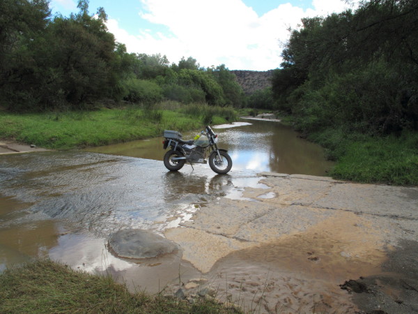
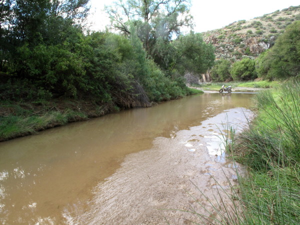
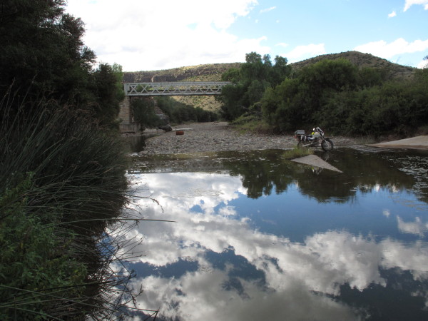
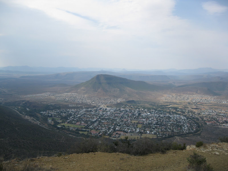
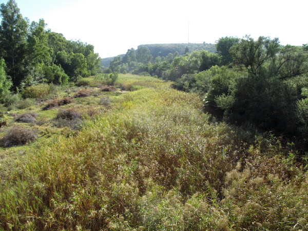
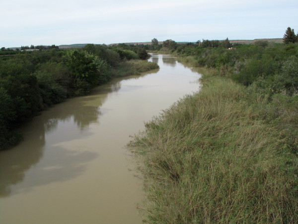
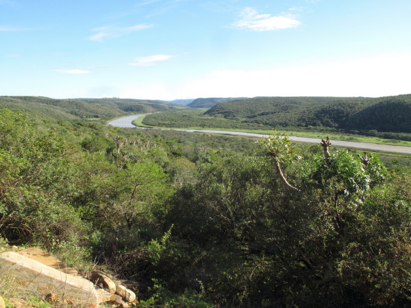
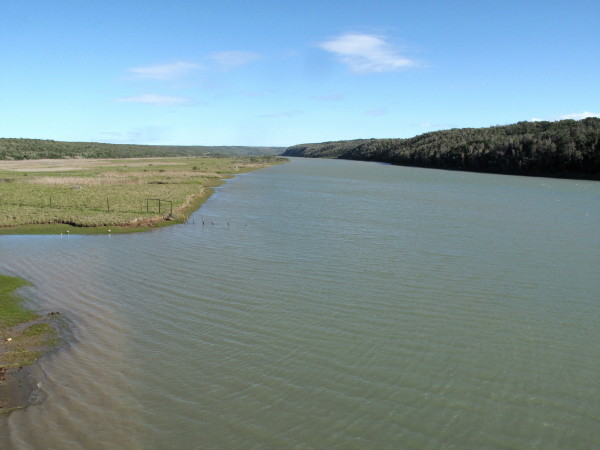
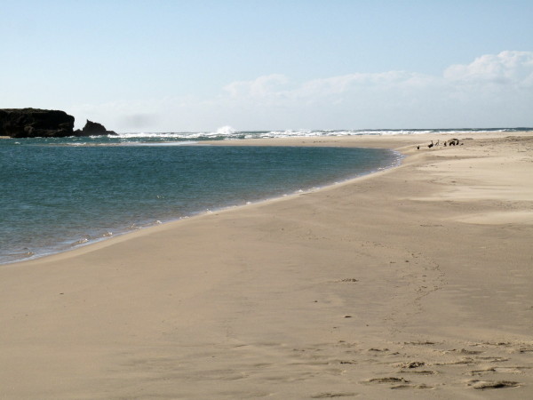
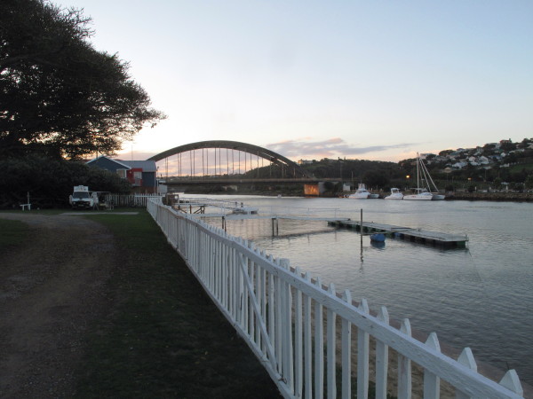
Next day I reversed what Burchell did.  I went up to the Great Fish River then turned inland to Grahamstown.  I have collected all my river pictures into a separate post which follows I repeat this one as I find the Eastern Cape rivers very attractive. We don’t have lovely river views like this in the WC.  Great Fish close to the sea.
4678249057_5c390b9e48_o.jpg


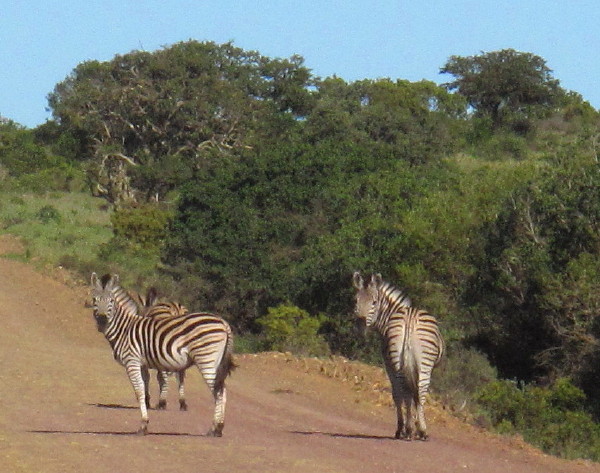
I met these zebra.  They are the usual zebra (as against the less common Mountain Zebra), their proper name is Burchell’s Zebra Equus burchelli.
4678248793_3cb4b4679e_o.jpg


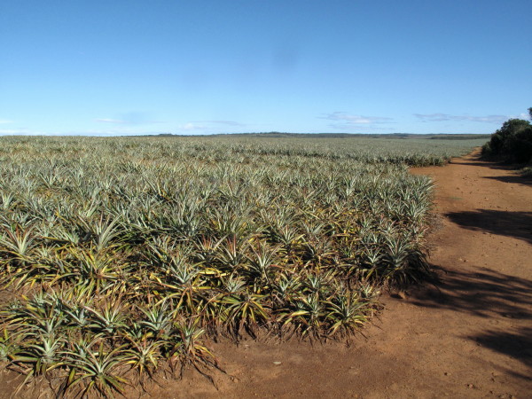
Further on field of young pineapples.  With global warming I am expecting them to replace vines in the Western Cape.
4678249345_27df591d9b_o.jpg


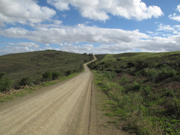
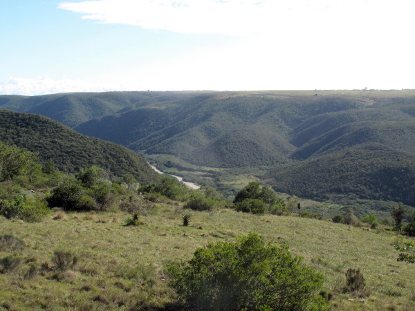
There are some lovely areas to ride and nice roads in the Eastern Cape.  Just be careful of Kudu at dusk and potholes everywhere.  Fish river again.
4678249571_4fce96815f_o.jpg


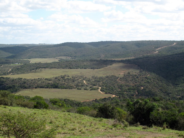
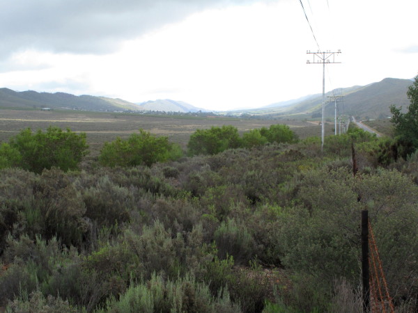
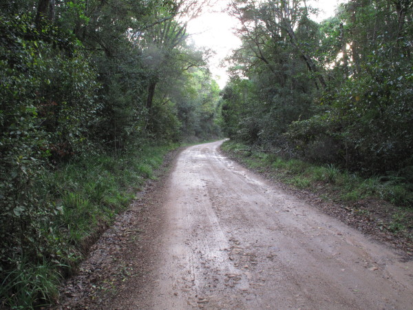
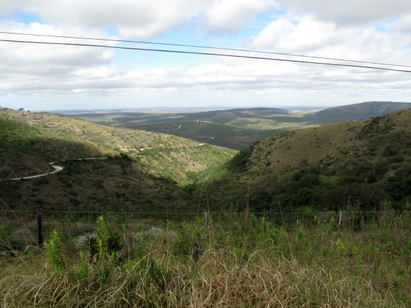
I rode through a nice indigenous forest but I show this picture which shows more of the lovely landscape (pity about the wires).
4678880126_52143c542b_o.jpg


'------------------------------------------------------------------------------------------------------------
EDIT 2017/02/14  The pineapple industry was pretty well wiped out about the same time as i took those pictures.  Fertiliser supplied by Protea Chemicals had been sourced from China.  It contained high levels of cadmium.  The cadmium was absorbed by the plants and found in the tinned fruit in Switzerland in 2006 although the fertilizer had been in use since 2004.  Once the cadmium had been detected the tinned fruit could no longer be exported to the EU.  In 2010 the crop had already been halved.
https://www.academicjournals.org/journal/AJAR/article-full-text-pdf/D17DAD634291


There was no Grahamstown when Burchell passed through in September 1813.  However he had a huge impact on the development of the town.  After the Napoleonic wars, Britain experienced a serious unemployment problem. In June 1819 Burchell was called before the House of Commons Select Committee on the Poor Laws to advise on the suitability of South Africa for the settlement of British emigrants as he was the person in England with the most recent personal knowledge of conditions in the interior of Southern Africa.  Burchell was there for three hours during which he strongly advocated that they be sent to the Albany district.  My book includes a condensed transcript of that interview. Two weeks later the British Parliament voted £50 000 for assisting persons wanting to settle in the Eastern Cape.

The British had taken over the Cape in 1806. One of the first concerns of the British overlords was to secure the eastern border of the colony, where the Xhosas had been driven back during the Fourth Frontier War in 1812. The governor of the Cape, Lord Charles Somerset, planned an agricultural settlement there as a ‘buffer’ between the Xhosas and the Cape Colony. This would reduce the need for the military to maintain the frontier.  So the settlement scheme suited both the UK and the Cape.

This period saw one of the largest stages of British settlement in Africa, and approximately 4,000 Settlers arrived in the Cape, in around 60 different parties, between April and June 1820. The settlers were granted farms near the village of Bathurst, and supplied equipment and food against their deposits. A combination of factors caused many of the settlers to leave these farms for the surrounding towns.

Firstly, many of the settlers were artisans with no interest in rural life, and lacked agricultural experience. In addition, life on the border was harsh and they suffered problems such as drought, rust conditions that affected crops, and a lack of transport.  Therefore many settlers left the eastern border in search of a better life in towns such as Port Elizabeth, Grahamstown and East London. The eastern border therefore never became as densely populated as Somerset had hoped.

The settlers who did remain as farmers made a significant contribution to agriculture, by planting maize, rye and barley. They also began wool farming which later became a very lucrative trade. Some of the settlers, who were traders by profession, also made a significant contribution to business and the economy. New towns such as Grahamstown and Port Elizabeth therefore grew rapidly.
*Source*

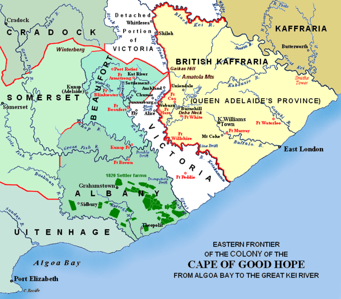
This map shows in dark green where they were settled.
684px-Eastern_Frontier%2C_Cape_of_Good_Hope%2C_ca_1835.png


Burchell produced a pamphlet Hints on Emigration to the Cape of Good Hope.  It is included in my Travels in the Interior of Southern Africa.  It is sixteen pages; he starts with brief advice to those with money intent on going to the Cape but then gives advice to those without any money.  Go to Albany as it is unoccupied & extremely fertile.  He suggests that the immigrant be given seed to plant and flour as food plus some cattle and a tent.  Spans of ploughing oxen should be available.  Grahamstown had just been founded when he wrote these hints so he suggests it as a possible centre though he believed somewhere on the Kowie river much closer to the sea would be better.  He writes about the need for a blacksmith, butcher, baker etc and also a priest and doctor for a successful community. He concludes by writing at length about expanding the colony up to the Gariep if more people emigrate than can be accommodated in Albany alone.

John Barrow (later Sir John) had been to South Africa before Burchell and had published a book with a title almost identical to that which Burchell used Travels into the Interior of Southern Africa 1801, 1804.  Before Burchell he had been regarded as the greatest British traveller in South Africa so he probably resented that the younger Burchell was consulted by Parliament.  For whatever reason he published a scathing attack on Burchell’s Hints saying amongst other things (1:i41):

He was, we understand, a “culler of simples”, and he certainly seems to have culled little else.

A small part of Barrow’s attack is included in my book. That bit is disingenuous as it states that Burchell recommended an inappropriate area behind the Sneeuberg and up at the Seekoei (Sea Cow) river. Barrow was a very influential man in British society, being the Permanent Secretary of the Admiralty for forty years when the Royal Navy was the most powerful on earth.  He was a founder member of the Roayal Geographical Society *Wiki on him*

Burchell then wrote a four page rejoinder (also included in my book) which includes (1:i43):

Before a writer comes forward to instruct the public, he should first instruct himself.

Which I take as a direct response to Barrow’s quote given above.  Burchell then exposes the misrepresentation concerning the Seekoei river and sums up with (1:i45):

The vulgarity and malignity of his language present a true and faithful portrait of his mind.  Take from him his pen, and he is nothing.

Powerful stuff.  Extremely ill advised to write like that about so well connected a person as Sir John Barrow.  This was in 1819.  Burchell’s first volume came out in 1822 and the second in 1824.  He took the opportunity to insert some further attacks on Barrow’s book in them.  The books were ignored by the very influential Quarterly Review as that is where Barrow’s work had appeared and he was part of the editorial group.  750 copies of volume 1 were printed, that was reduced to 500 for volume 2 and volume 3 never appeared.  Had Burchell not responded to Barrow’s stupid attack so virulently the success of his writing may have been greater and volume 3 may well have appeared.  Burchell also missed his market by the books being very slow in appearing as he had returned to London in 1815 so the third volume would be at least 10 years after the event and other more recent travellers had books on the market by then (1:i14).
https://en.wikipedia.org/wiki/1820_Settlers
 
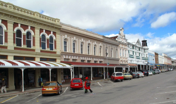
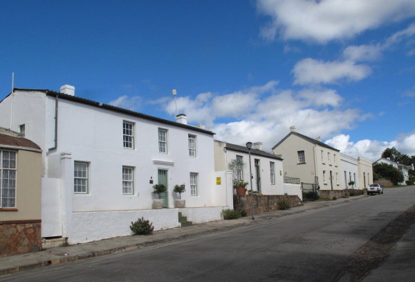
I got to Grahamstown.  You probably know by now that I appreciate unspoiled streetscapes.  This is exceptional.  Allow one modern building here and the whole scene is destroyed. 
4678880304_d645c06edd_o.jpg


This is what Hans Fransen writes:

Much of all this has been well restored over recent decades, particularly since the appearance in 1963 of Ronald Lewcock’s book which is still the best study of Georgian and Regency architecture in this country.  It makes ‘English’ Grahamstown a worthy counterpart to ‘Dutch’ Stellenbosch as the best-preserved old town in the entire Cape.
(Source: Hans Fransen Old Towns and Villages of the Cape 310). 

That coming from the author of The Old Buildings of the Cape which is largely responsible for the appreciation of Cape ‘Dutch’ architecture and the consequential preservation and restoration of those buildings and towns is high praise indeed.

But what I was really looking for was this.
4678250493_c97d7b5868_o.jpg


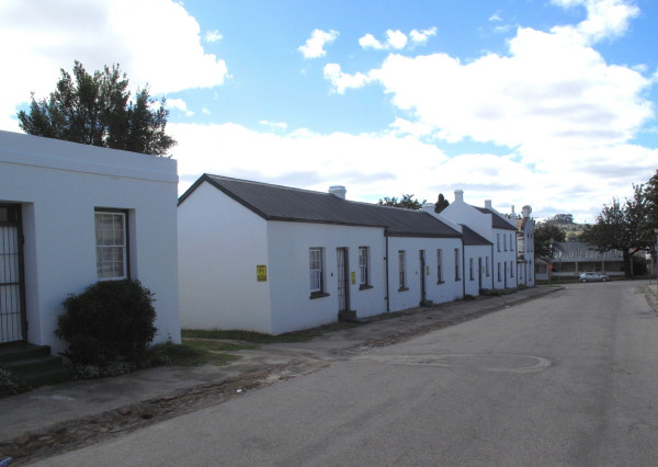
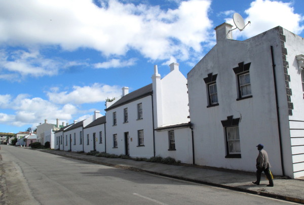
It may not impress you.  It is called Artificers Square but Garmin does not know about it.  Luckily I went to the excellent Red’s Cafe for late breakfast with Windhoek lager & asked there.  The owner(?) did not know where it was but sms’d a friend who replied with the directions.  It certainly is not a square.  Those houses are original Settler’s houses.  I enjoy modest as against grand houses so these I really liked.
4678250743_128625413a_o.jpg


4678250875_c1866acfbf_o.jpg


They have not been tarted up by applying un-original pastel painted shutters and matching coloured doors, wine barrel flower boxes and fancy wrought iron lights like was done to Stretch’s Court.  Just restored to more or less as they were (corrugated iron roofs in place of thatch so not restored to how they originally were).  It is great that there are no telephone or electric poles, the pavement and kerb could be improved.

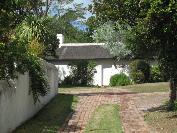
Unfortunately this one is set back from the road.  It still has a thatch roof.
4678251151_0dd47fc9b4_o.jpg


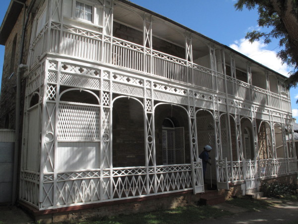
How about this? I love it.
4678251365_968e89a76f_o.jpg


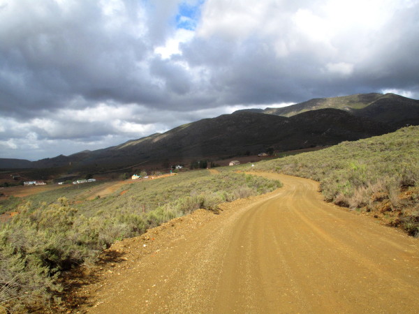
From Grahamstown I wanted to go down to Salem; it is one of the small 1820 settlements complete with church.  Burchell had passed that way.  Again I was riding through the lovely Eastern Cape countryside. I understand why Burchell recommended it so highly.
4678882010_32fe1fc1b6_o.jpg


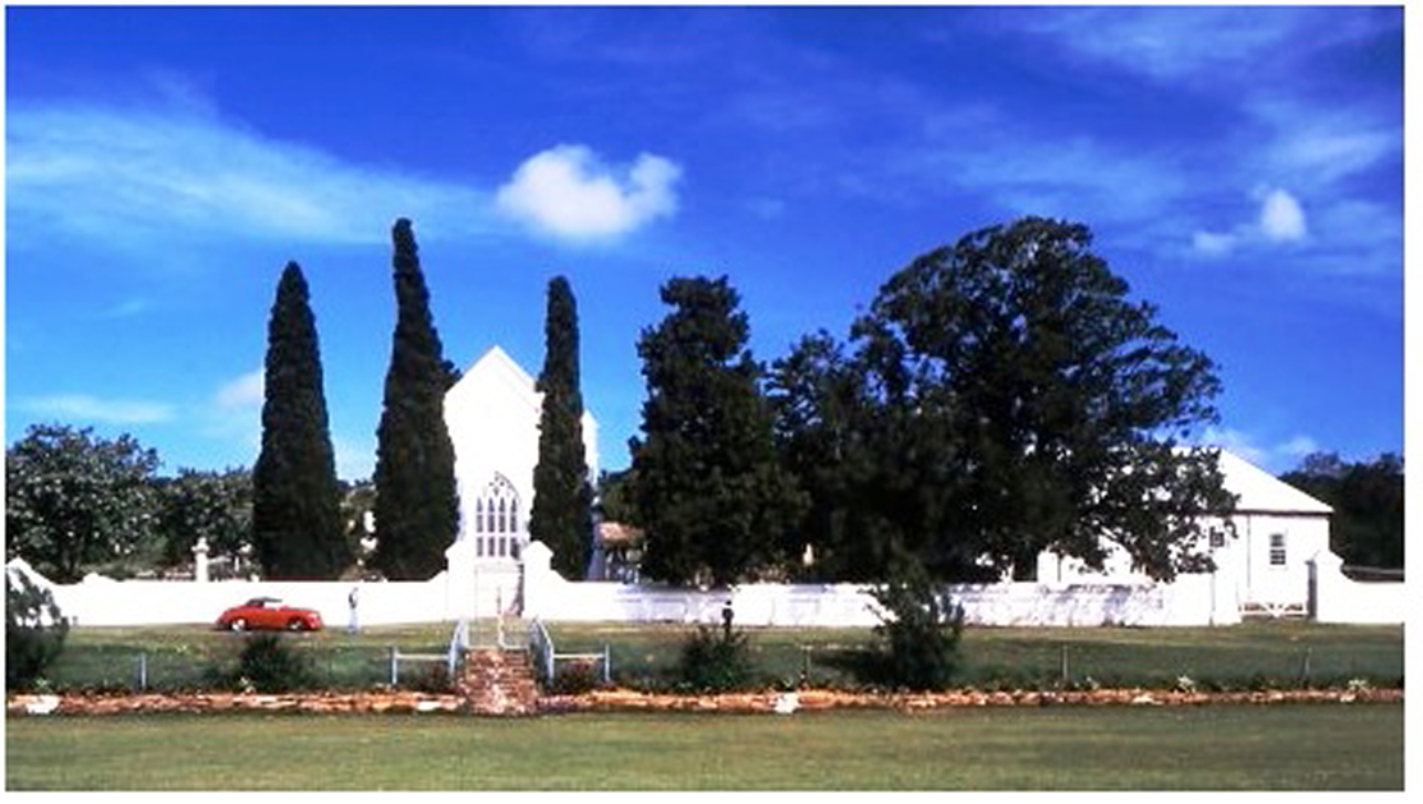
The village has the oldest cricket pitch in the country.  1844.  I did not realise it when I was there so I have found a much better picture on the web than the close ups I took of the church and parsonage in this picture. Church built 1832.
32744575452_5aef803217_o.jpg


I smile because I had a real red Porsche 356A like that but I expect that is just a replica with VW engine.  The cricket field is in the foreground.

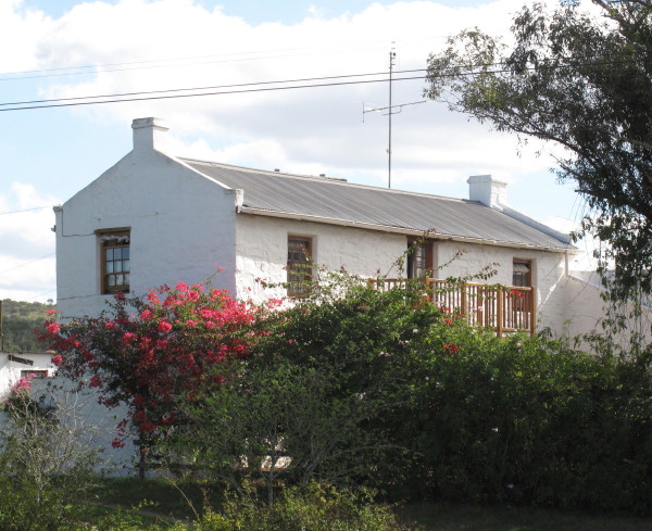
One of the houses in the village.  It is stone built but the white paint disguises it.
4678251877_cce3064db9_o.jpg


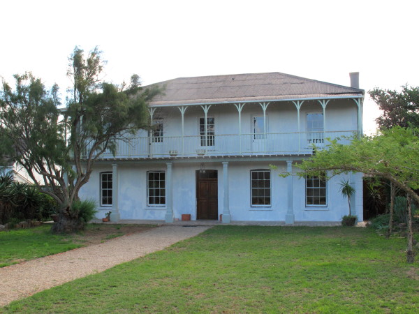
This is the hotel.  It is being very sensitively restored.  The concrete pillars are going to be replaced.
4678882538_2e5b427be5_o.jpg


The contractor doing the restoration is a black man called Sam.  He is building a nice business specialising in proper restoration of 1820 Settler era buildings.  The front will be painted white with the plaster mouldings in a pale colour to emphasise them discreetly.
 
Rivers

I have shown plenty of pictures of the Gariep and Vaal.  Judging by the number of pictures I took of rivers on this trip they must have some significance to me. Here I want to collect some of those photos together.  My first big ride on this bike was to follow the Sak river from its source to where it joins the Gariep; though it loses itself in the Grootvloer and the river that reappears is called the Hartbees.  But that is a river of historical social significance; it is not much of a river actually.
*Sak River RR*


Sondags River

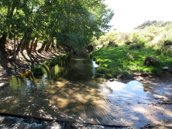
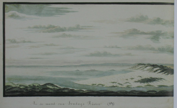
I have a lot of pictures of the Sondags because I kept meeting it.  It is not much of a river really as you will see from these pictures – except right at the coast.

This map from the Department of Water Affairs shows how water from the Gariep runs through a tunnel to the headwaters of the Great Fish River then through two other canal & tunnel systems water is transferred to the Darlington Dam on the Sundays River.  Finally some is pumped across to Port Elizabeth.  PE is in such a water crises that they are now having to build a sea water desalination plant there costing R750 million. *source* .  This is fearsomely expensive water, R8 per kl compared to R1 in Cape Town *source*.
rm025mm.gif

*Source*

I have camped at the absolutely beautiful mouth of the Sondags and would be riding along it from Addo to Kirkwood so I thought it would be interesting to see how it grows in size. The map shows that the Sondags catchment area is north of Graaff-Reinet in the Sneeuberg.  I crossed over the N9 after I had been to Nieu-Bethesda and followed the road alongside the railway line.  They snake down alongside the Sondags river.  The first time you cross it is just a stream.
4684221125_bbc3a3cb54_o.jpg


I crossed the river 10 times on this little piece going down towards the N9; then I turned around & went back up.  The stream became wider and deeper as the valley became deeper. Burchell went down this valley to get to Graaff-Reinet with his wagon. I skipped it on my ride to G-R because time was running out & it was raining.
4682642506_2a13315cee_o.jpg


It is a lovely little ride.  I think it would be a great ride to follow any of the bigger Eastern Cape rivers from source to sea.

4684221249_622b1008ab_o.jpg


The railway also wiggles down this valley.
4684855980_61c8303590_o.jpg


When I got back to the T-junction near the start I went off again looking for Schumacher views.
Graaff-Reinet is built inside a big loop in the river as shown by this picture by Wolweseun.
IMG_2338.jpg


Graaff-Reinet seems to take little pleasure from having the river there as it is choked with riet.  It could be made into a lovely winding park around the town if someone had a little imagination.
4669610478_c4fecfb569_o.jpg


I crossed the canal bringing water from the Gariep to the Sondags just after leaving Somerset East – the Cookhouse tunnel ends at Uitkeer.  I saw it but did not realise its significance so failed to take a picture.  The water flows into the Little Fish and down to the De Mistkraal weir.  Then it goes by canal to a small river flowing into the Darlington Dam on the Sundays River.
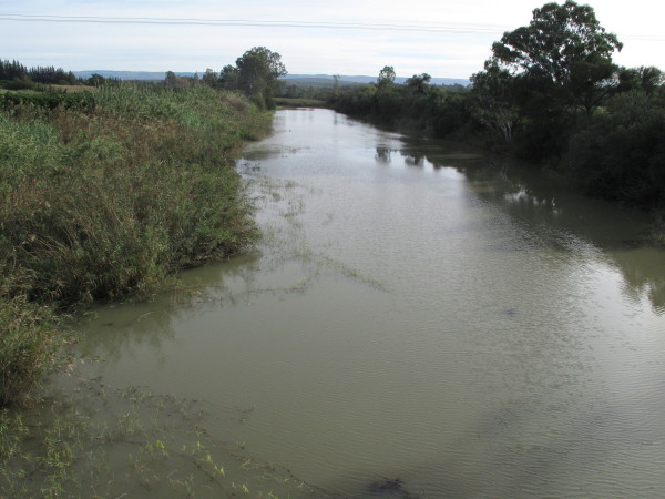
This is the Sondags downstream of the dam flowing towards Kirkwood.
4684221469_0ecdfc1e8d_o.jpg


Upstream is the Korhaans weir with Kirkwood canal on E side of river.  The first significant irrigation scheme in the country was built there in 1913.  Kirkwood was the person who had the vision; by 1883 he had 21 farms there but when he tried to float a company on the Stock Exchange it failed because of the Great Depression.  He died two years later.  Sir Percy Fitzpatrick (Jock of the Bushveld) saw the potential here (after visiting the pioneer citrus farm) & invested.  The irrigation scheme suffered due to both drought & flood but that was resolved when Lake Mentz (Darlington Dam) was built in 1922. (Bulpin p420).  The water from the Gariep arrived in 1987 when the De Mistkraal Weir and canal were built on the Little Fish River.  There is an excellent write up of the whole scheme *here*

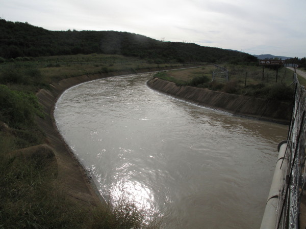
I wanted to see the Kirkwood irrigated area as I had long known about it but never seen it. The Kirkwood irrigation canal.
4682643606_fd74886e73_o.jpg


This is the river just before Addo village which is after the whole irrigation scheme.
4684221409_5cc06e5abe_o.jpg


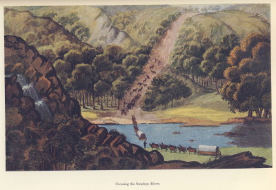
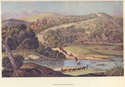
Le Vaillant ‘Crossing the Sundays River’.  I did not look for this scene.
4682012271_ea7762b810_o.jpg


I first met Trailrider at the 2007 WD Bash in Hogsback and joined him and Snap Crackle Pop for their ride back.  TR had arranged for us to camp at Colechester.  This is what I wrote about it in my RR of that trip.

I was gobsmacked by the beauty of the place.  Why?  Because it is still the same as when Bartholomew Dias sailed past, still the same as when Mohammed walked this earth probably.  Absolutely pristine.  I am an old surfer & my favourite surf spot on the peninsula is Scarbourough because when you stand in the car park & check the break (point, not the beach break as the rip there kills me) you see not even a telegraph pole; there is nothing to show you that people have been around.  It is a great wave to surf but that setting really makes a big difference to how I feel about the spot.  (You can surf in the Cape Point Nature Reserve also & those spots are absolutely unspoiled but then you are not in an urban area.  I salute Nature Conservation for permitting surfing there).  Here is an estuary 30km from PE which is pristine; I had never imagined such a thing could exist.

2047104244_3c964412d0_o.jpg

..
2047104716_b14ef0f903_o.jpg

..
2047104498_d4437f6335_o.jpg

..
2047103986_859864c422_o.jpg


Schumacher did a panoramic picture of the estuary as two pictures.  I have stitched them together.
4682012379_bf47eabc97_o.jpg


There is nowhere for Schumacher to have been to get this birds-eye view.  He has created it so that he can better represent the locality.  Here is the left hand portion by itself.
4682010615_12b09fbcae_o.jpg

 
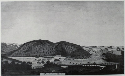
Van Stadens River

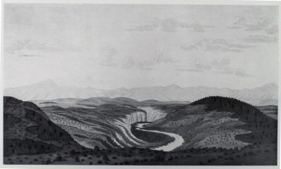
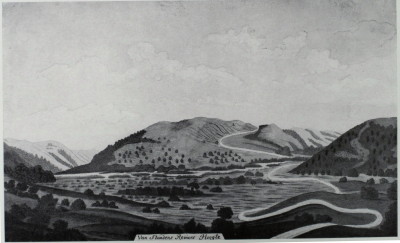
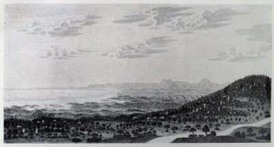
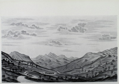
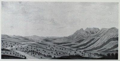
Schumacher did four pictures of the Van Stadens river.  This is the most upstream picture  looking inland (northwards).
4682010291_5c452a670e_o.jpg


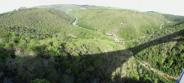
I took this picture from the N2 bridge looking downstream at the same part of the river.
4682010451_17022f25d7_o.jpg


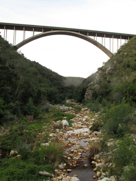
The old road and pass can be seen at the bottom.  Slightly further upstream is the narrow gauge Apple Express railway bridge, *this* WD thread tells you how to get there – quite obscure.  A very elegant steel trestle bridge.

This is the bridge I was standing on.
4682641242_3b4508ed13_o.jpg


It was built in 1971 whereas the Storms River bridge was built in 1956.  It is known as ‘Suicide Bridge’ .https://en.wikipedia.org/wiki/Van_Stadens_Bridge.
4682010979_b48518e7ef_o.jpg


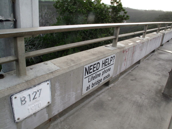
Those Lifeline phones at each end of the bridge have been *misused a lot*, in March the *75th suicide* took place.

The next Schumacher picture shows a fork in the river.  The map shows one upstream from the N2 road bridge.  There is a red dashed road shown on map #3324 going to Sunnyside station on the narrow gauge railway.  That road would be along the top of the hills in the background of this picture.  The WD link I gave above probably describes how to get there.
4682640310_b41a847f29_o.jpg


This one is closer to the coast.
4682010123_1e5c6fd240_o.jpg


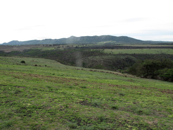
The Maitland River which is similar – it is the next river along from Van Stadens.  When I took the picture I was riding upstream from the river mouth and I did not realise that I had crossed over to the Maitland river.  There is no public road alongside the Van Stadens river.  The 1:250 000 map #3324 shows a road to Yellowwood farm on the east bank which should give you a glimpse of the Schumacher view shown above. A similar bend on the Maitland river.
4682010807_2c28c5b020_o.jpg


This is the river mouth.
4682010061_1167da3cfb_o.jpg


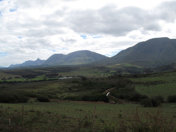
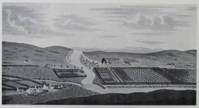
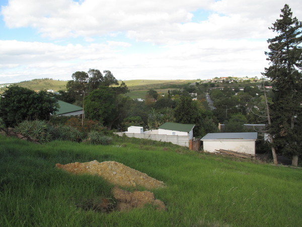
The distant hills match; my point is that Schumacher painted accurately though his style was naive.  I really like his naive paintings.
4684221543_2fc3fe2959_o.jpg

 
Fish River

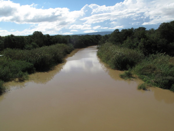
I saw the Great Fish River a few times.  I think this would be a particularly good river to follow from source to mouth by bike.  Downstream from Somerset East.  Very muddy.
4682642652_ed2c7af497_o.jpg


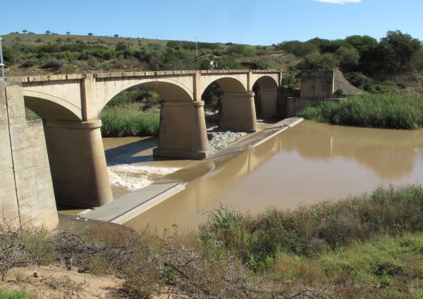
A bit further on is this handsome bridge.  The arches are elegantly flat and the columns have an aesthetically pleasing rounded and tapering form with a capital like a Greek temple column. Today’s concrete bridges are purely functional but this has an aesthetic aspect as well.  I wrote about  several bridges in France *here*
4682012817_2650a7441c_o.jpg


The hillside maintains its original well wooded covering making it a very special sight for someone from the Western Cape.
4678249571_4fce96815f_o.jpg


Getting down towards the coast.  This is preserved because it is Kap River Nature Reserve on the left of the Fish River in this picture.
4682013417_3a077e10dc_o.jpg


4678249057_5c390b9e48_o.jpg


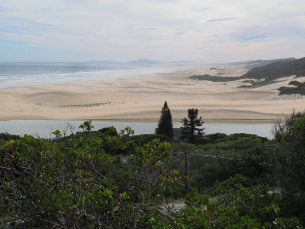
Right at the coast looking upstream.  I was really impressed by how unspoiled much of the Eastern Cape is.  Burchell would have seen pretty much the same scene.  If this was in the Western Cape you would be looking at some ‘developers’ abomination – think of Still Bay.
4682643136_9e03ba5284_o.jpg


I rode down to the mouth and walked to the sea.
.
4682013079_3a669af888_o.jpg

 
Amazon

Burchell visited a friend who had recently returned from an expedition to Brazil which resulted in him going there in 1825. It is probable that the publisher’s decision not to bring out the third volume was conveyed to Burchell when he delivered the second so Burchell was then free to travel again (i:i13).  He was stuck in Rio de Janeiro for a year while he tried to get papers allowing him to travel overland across Peru, he did three local treks during this period.  When the papers arrived he moved to Santos then trekked northwards to Goias (due west of present day Brasilia) where he stayed for nine months.  He then heard that his father was ill so he abandoned the plan to travel through the jungle to Peru and instead went north to the mouth of the Amazon.  He travelled down the Tocantins river which has lots of rapids and waterfalls.  He had to wait eight months at Belem (then called Para but that is now the name of the state) before he could catch a boat to England.  He was away for just over five years.  His father had died by the time he got back. (1:i17).  He brought back over 20 000 insect specimens from this trip.  They together with his notes about them are at Oxford University now.  All his plant specimens (SA & Brazil) and notes are at Kew Gardens. The journals he made during both of his travels have been lost.

He returned from Brazil in 1830 but, sadly, published nothing during the next 33 years.  Burchell became an invalid and died by suicide in 1863 aged 82.

He was 29 when he arrived at the Cape.  That trip lasted 5 years.  He spent 10 years in the UK before going to Brazil when he was 44.  He was again away for 5 years.
 
Kowie

I camped next to the Kowie in Port Alfred.
4682012937_bfa1921dc7_o.jpg


There is an interesting history to this place.  I copy what Bulpin says.  Burchell advocated that the settlers live alongside the river so that they could be serviced by seagoing ships – not as easy as he thought.

When the 1820 Settlers came to the Eastern Cape, they viewed the mouth of the Kowie with interest. At that time the estuary consisted of a swampy mixture of islets, canals and reeds confined east and west by the low hills known as the East and West banks. The area was entirely unpopulated and a great resort for birds and fish.

Several individuals conceived the idea of a port at the mouth of the river. In 1821 the government, at their suggestion, sent a small brig, the Locust, to sound the entrance to the river, and this was the first vessel ever known to sail the waters of the Kowie. The bar across the entrance to the river varied from 1 m to over 2 m in depth, with reasonably deep water further inland. A rich fishing ground lay in the roadstead east of the river mouth close to the Fountain Rocks, so named on account of the swell which at high tide spouted up there in a jet of water.

As a result of this investigation, Mr J Dyason was appointed pilot and harbour-master of the Kowie, a flagstaff was erected on the East Bank and a boat's crew appointed. This was the beginning of Port Kowie. A special light-draught schooner, the Elizabeth, was built to serve the port; and on 9 November 1821 this little vessel successfully entered the river. Unfortunately, on her next voyage from Port Elizabeth the schooner was totally wrecked on Cape Recife.

Other coasters soon replaced the wreck, for there was a genuine need for a port to serve the Settler country. But, like all shallow river mouths, the Kowie was a death-trap for sailing vessels. A sudden drop in wind or an unexpected rush of tidal water could defeat the genius of any sailing master and land his vessel unceremoniously on the beach.

For the next ten years the government struggled to develop Port Kowie into a harbour. The town which grew up on the banks of the river was at first called Port Frances in honour of the wife of Colonel Henry Somerset, son of the Governor, but in 1860 the name was finally changed to Port Alfred in honour of Prince Alfred who was on a visit to South Africa at the time.

The efforts to develop a harbour failed. In 1831 the office of harbour-master was abolished and the port was left to a few fishermen and the enterprise of private individuals. Among these was William Cock who in 1836 settled there, building on the West Bank what became known as Cock's Castle. His daughter, Mary, has left her name on Mary's Cove. For years these private individuals laboured, trying a series of schemes to open the river mouth. Cock was the motivating force for most of these efforts and it was he who changed the flow of the river to a new channel below the West Bank.

A vast amount of energy and money was expended on the Kowie by Cock and other people. Ships came and went, but the number that were wrecked was considerable and professional ship¬masters detested the place because of its dangers and uncertainties. The only saving grace was that Port Elizabeth, the nearest harbour, was also a great hazard to shipping.

In 1857 the government once again launched a scheme to develop the port. Piers were built, a steam tug was stationed there in 1863 and a dredger employed in deepening the channel. A company, the Kowie Harbour Improvement Company, had the running of the port. This was the golden age of the harbour, with ships such as the 340 ton Icon trading there. Larger ships anchored in the roadstead and were serviced by lighters. In this way the mailships of the Union Steamship Navigation Company paid regular visits from 1875 onwards, with 101 ships landing 12 750 tons of cargo in Port Alfred in 1876.

The year 1881 saw a great activity, with a railway being built from Port Alfred to Grahamstown. The constructional materials and rolling-stock were all shipped to the harbour. Included with this material was the steelwork for the 61 m high bridge over the Blaauwkranz where the railway disaster took place in 1911. The railway was built by a private company, the Kowie Railway Company, which went into liquidation in 1886 and was taken over by another concern. It is interesting to know that two of the locomotives used on this railway are still preserved, one on a pedestal in the Cape Town railway station and the other in the Port Elizabeth Museum.

That locomotive in Cape Town Station is a National Monument.  The Station has been redeveloped ready for the soccer WC.  The locomotive has been illegally moved during the renovations.  I don’t know if it has been put back or what has happened to it.

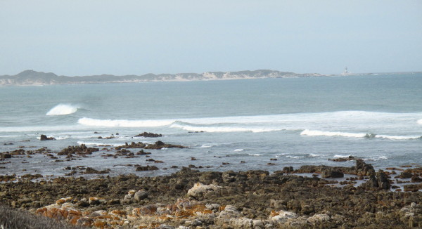
This is the entrance to the sea now.  Rocks all the way out past the breakers so that it remains open all the time (no sandbar).  Photo taken on the 2007 WD Bash trip.
2047103642_d0239a7387_o.jpg

 
I have pictures of some of the other rivers along the trip so i will include them here for completeness. 

Swartkops

The Swartkops just downstream of Uitenhage. Looking upstream.
4682013993_62f3008cb7_o.jpg


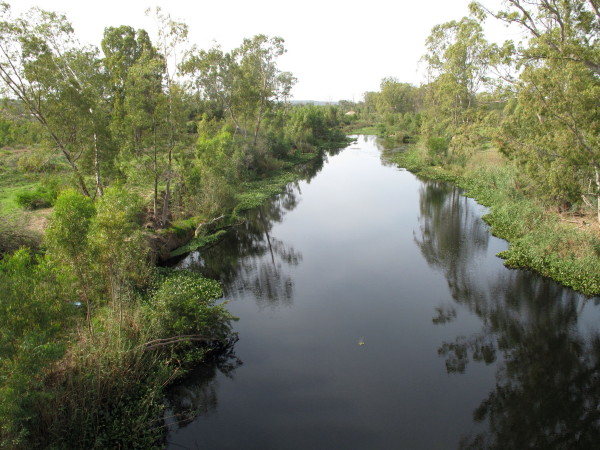
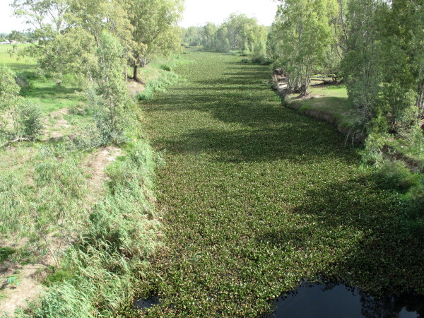
But looking downstream it is sad.  Water hyacinth; from South America but a plague in Africa (& elsewhere).  They have a weevil that does it some harm but nothing yet to keep it in check other than physically removing it.
4682644252_97e0c3a0c0_o.jpg


Le Vaillant.  Swartkops river crossing.
4682642132_afe3318e93_o.jpg


I don’t have the mountains in the background but Le Vaillant took liberties with his pictures (and writing).
4682644492_0c9a051453_o.jpg


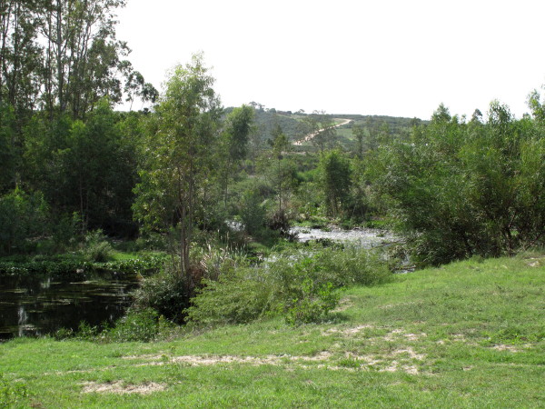
This is at the same place as the other pictures just outside Utenhage.  The road still goes where it used to go.

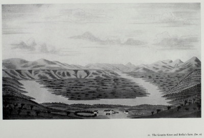
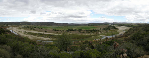
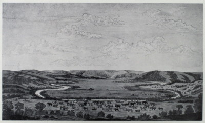
Gaurits

Gaurits.
4682009955_4ef5affaef_o.jpg


4682010531_32a87c18fe_o.jpg

They look similar but Schumacher has the end of the Langeberg in the background.  The river has several loops in this area at Herbertsdale.

Bushmans

4682010361_957809ce5a_o.jpg


It is very similar to the Gaurits loop.  The Bushmans is a very crinkly river but I did not see much of it.

Very good description of sand problems at Bushmans https://www.brm.org.za/articles/Dredging%20Project%20Proposal.pdf
St Francis bay has huge problems caused by the buildings sitting on the sandfield.  It is to prevent things like this happening that Environmental Impact assessments are required. https://www.asrltd.com/projects/st_francis_bay/

Gamtoos

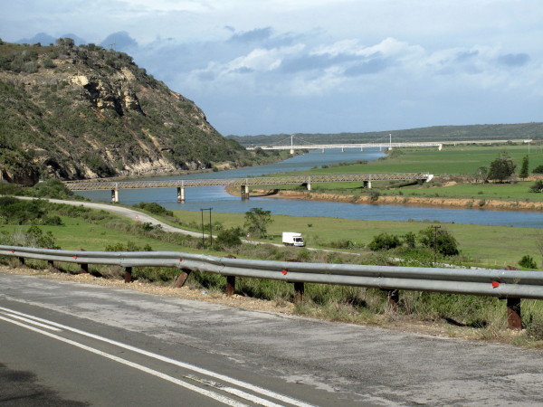
This is the Gamtoos river with the N2 bridge in the distance.
4682011385_cd2a48d477_o.jpg


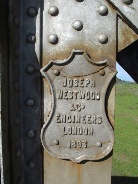
The bridge in the foreground is over 100 years old.
4682011567_1fbe0d1aae_o.jpg


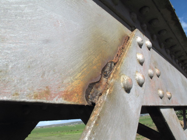
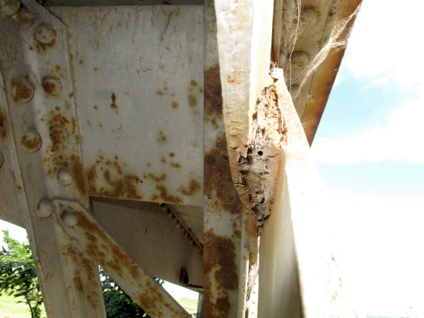
But ‘negative displacement’* (as I refer to BEE) has resulted in the loss of responsible and competent people.  If you fail to do routine maintenance on a steel bridge (= cleaning & painting) it rusts.  As you will see in the picture the main girders are almost completely rusted through at the overlaps.

*Note: I am a B.Sc Mech Eng. Positive displacement = a type of pump where the fluid is pushed away by a piston.  My term is a play on that.

4682011709_307bcbeb3e_o.jpg


You need to look at this carefully; the main plate is rusted half way through and bent aside by the swelling rust.
4682011863_e27db9326b_o.jpg


Too late to save it now in my opinion but will they even close it before it fails?  The weakest link pretty well determines the overall strength of a structure like this.

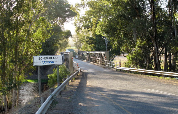
Sonderend

The river = Sonderend.  The town = Riviersonderend. Map #3319 gives Riviesonderend.  It is a bit like Onrust becoming Onrus.  Burchell refers to it as the Zondereinde river (1:104  1:116).  Even the town of Riviersonderend refers to the river as the Sonderend *see here*
4682012083_5821e3173a_o.jpg

 
Algoa & Home

After Salem I cut through towards Kirkwood.  Burchell went that way and I was interested in seeing the Kirkwood citrus irrigation scheme.  My gravel road route took me through Shamwari although I did not realise it when planning the route in Mapsource – not the main part with free range lions in it it turned out.  Man at the gate acted as though I had to plead for permission to ride on a public road but reluctantly wrote down my details & let me enter the convalescent area.  I ride across but I can’t make out how to get through to the road outside the fence.  There was the vetenary hospital where I found someone to ask.  The gate has been closed because they had a security (poaching?) problem.  I have very mixed feelings about places like Shamwari that behave as if they are national parks but, in fact, they are just tourist attractions like Disneyland or uSharka Marine World.  I like that they conserve the environment and provide a habitat for game (especially the simple little animals & plants).  I object to their intrusion into public open space but have to admit that if they own farms on both sides of a public road they should be allowed to take down the fences and control access.  In this case they were not doing that as they had completely closed off the connection from the road across their land to the bordering main road – they had stolen the public road.  I have had the same problem at Sanbona – I did not know there were lions there when i was denied entry on a bike.  I spent the night at Addo village.

The Cockscomb is a landmark from all sides.  I was riding down from Kirkwood to Uitenhage.
4688152532_3aeba97e02_o.jpg


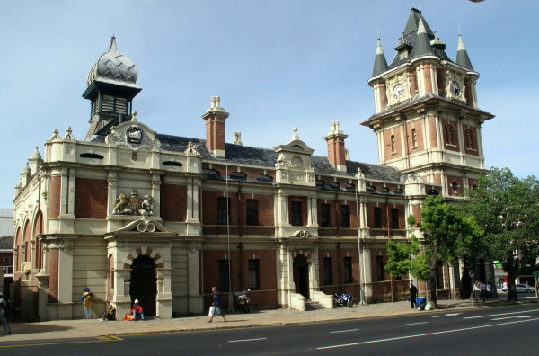
This is the old court house named Victoria Tower – very Teutonic. But notice the big Royal Coat of Arms still above the door – I am amazed that survived when SA became a Republic.  I am very pleased it did as it adds to the interest of the building.  Above it is a boars head (griffon?), I don’t know what the significance of it is.  Things like that may be offensive to some but if they obliterate them when they gain control a piece of our heritage is lost.  If all the ghastly mine hostels with concrete bunks on the Reef are knocked down what will there be for later generations to visit to appreciate the awful conditions their predecessors lived in?
4687519917_d6403a5c4c_o.jpg


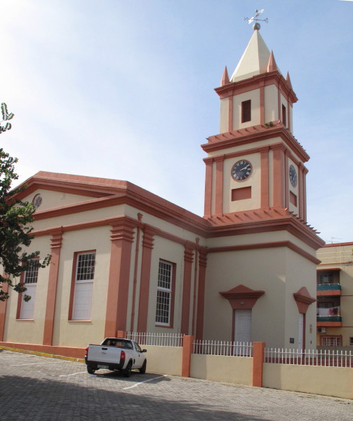
Beside it is this Dutch Reformed church.  I very much like the colour scheme and the dignified but restrained design.  An unusual church.  I said I did not much care for all the decorations on the DRC in Graaff-Reinet.  Well this is bit the other way to me – very harsh without any decoration. Apparently the people of Graaff-Reinet felt the same for their previous church was very much like this so that wedding cake was the reaction when they built the present one.  The two buildings standing near each other make a grand sight.
4688152674_1d63043601_o.jpg


I had my usual late breakfast and beer at the wonderful Browns cafe in Utenhage.

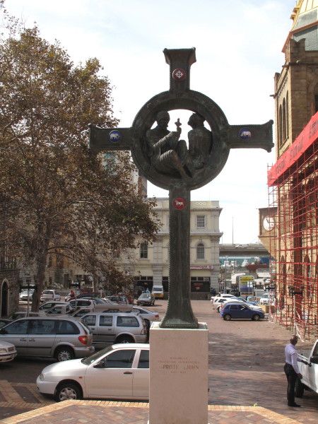
Burchell went out to Cape Recife.  In PE I wanted to see the replica of the cross that Dias erected at Cape Padrone (near Kenton-on-Sea).  It is in the Mayor’s garden.  It is not shown by Garmin or T4A so I asked & was directed to this cross.  Not the one I wanted.  The inscription reads ‘In memory of those seafarers who searched for Prester John 1145 – 1645’.  Dias was here in 1488; I wonder which seafarers are commemorated from before that date.
4687520209_12b0c890cd_o.jpg


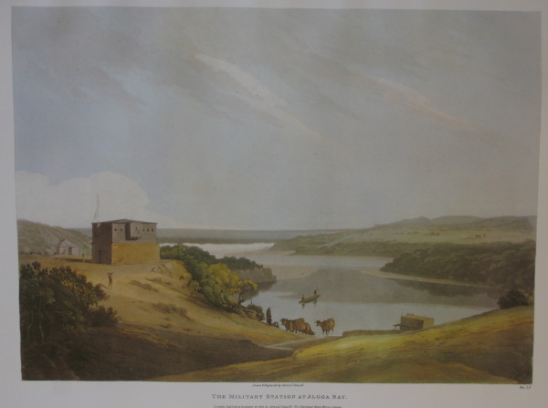
This is the first stone built building by Europeans in the Eastern Cape.  Daniell picture of Fort Frederick built 1799 by British. 
4688152434_5fca9b2d86_o.jpg


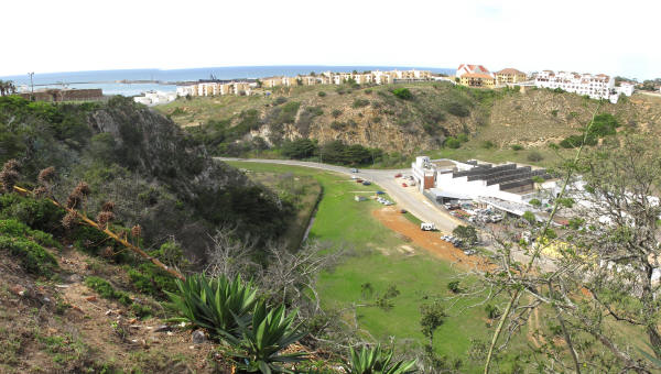
It is not very clear but this is a similar view.  The Bakens River has now been filled in and developed with industrial warehouses.
4688152362_5f82211d0d_o.jpg


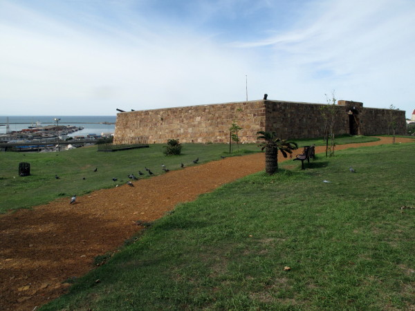
The upper wooden superstructure has been lost.
4687520039_df6668825e_o.jpg

 
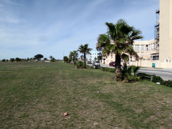
I then headed out towards Cape Recife.  I was really impressed by the PE seafront.  It is not well looked after (PE is a very poorly administered city) but the road is set back from the coast with no buildings between the road and coast.  The whole way you have this public open space between the ocean & road.  In new developments the prime sites are the front ones so houses spring up right on the beach front and the general public get excluded (such as Sea View not far away) – a very anti social & anti community approach.  Melkbosch is brilliant with a big open space alongside the beach which is occupied by lots of the community each day – many schoolchildren but lots of other people besides.  A real community asset.  The space in PE is not utilised to the same degree but the potential remains.
4687520351_ac074202f5_o.jpg


I did not get to Cape Recife because it is a reserve but Burchell did, that is the lighthouse.
4688153352_082f492fee_o.jpg


I continued round the big cape that shelters Port Elizabeth.  Past the handsome  Maitland river mouth and on to Van Stadens mouth as described in the previous post. Burchell actually went back to Uitenhage from Recife then went to Van Stadens afterwards.  Burchell then went up the Langkloof  because the Outeniqua Forest stretched from Humansdorp as far as Plettenberg Bay.

Schumacher picture of the Langkloof.
4688155804_ccb823b328_o.jpg


Sadly it was cloudy & rainy as I went through so I could not get good viewpoint.
4688153464_6f423f96b3_o.jpg


The little road down to De Vlugt. 
4688153590_709ede78fa_o.jpg


The road was pretty slippery & slidy and I had expected to have to replace my back tyre in Graaff-Reinet as I had now done 20 000 km on it but I had felt I could make it home on it.  (Fronts wear out quicker than backs on a TW it seems as I fitted a new one before the start of this trip.)  I stopped for a beer at Angie’s G Spot.  Now we are in the area of the 4x4 Burchell Route which was the instigator of this whole thing.  The ride report for when I did it with Trailrider and Letsgofishing is *here*
 
Talking about how things start it is appropriate to tell how William Burchell came to do his trip.  He was born in 1781.  His father was the prosperous owner of the Fulham Nursery, 3,8 hectares in what is now a very desirable part of London.  William never had a proper job so his father must have been very wealthy.  He had four sisters but no brothers are mentioned in the introduction to my book or Wikipedia.  He did not go to university and declined to join his father in the business. When he was 24 he wanted to become engaged to Miss Lucia Green but his parents disapproved.  Shortly afterwards William left for St Helena; whether it was to escape his parents domination or not can only be speculated upon.  He started a merchant business there together with a partner from London, William Balcombe.  A year of trading saw Burchell unhappy as he found running a business very stressful so the partnership was dissolved.

As a side note:  When Napoleon was banished to St Helena he stayed in a house on Balcombe’s property for the first seven weeks.  A friendship developed and Balcombe visited Napoleon frequently.  The Governor alleged that Balcome was helping to smuggle letters from Napoleon to Europe resulting in Balcome suddenly leaving St Helena.

William became the schoolmaster and superintendent of the botanical garden. He had kept writing to Lucia and his parent’s attitude towards her had softened.  It was arranged for her to go out and marry him there.  She went by the Walmer Castle but transferred her affections to the Captain on the voyage and married him before they arrived in St Helena. Poor William never did marry.  That was in 1808.  He carried on as schoolmaster and botanist for two years but became bored and told the Governor that he would refuse any more salary until he was usefully employed. He finally resigned and sailed to Cape Town where he had been in correspondence with the Rev Hesse of the Lutheran Church in Cape Town.  He stayed with the Rev Hesse in Martin Melk House in Strand Street.  (That is now the Gold of Africa Museum; my daughter was married in that building a few years ago and my parents had a small reception after their wedding there too so it has some connection to me as well.)  Somewhere in his book he mentions the advantage of being single but I can’t find the passage now.

-------------------------------------

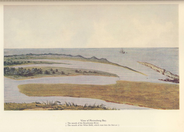
Burchell went down to Plettenberg Bay but I was wanting to push on towards home so skipped it out.  However after I did the Burchell Route with TR & LGF I did go to Plett so I have done that piece of the original trek in context already.  I would like to include this picture of the bay and lagoon by Le Vaillant because to me it is particularly attractive.
4687522693_72e82efa42_o.jpg


I went through Kom se Pad down to Knysna.  I had planned on taking the 7 passes route to George but time was marching on, the roads were wet and I wanted to get to Trairiders before dark so I took the tar N2 to George.  Trailrider and Viervlieggie welcomed me, fed me & gave me a room.  Many thanks.
4688153792_f53cc42b36_o.jpg


Here is the story of the Great Fire of 1869 which took out the forest that prevented Burchell from getting to Plett along the coast from PE.

150 years ago, the Tsitsikamma Forest between Plettenberg Bay and Humansdorp was the thickest and most forbidding in the entire Cape colony, and it presented travellers with an impassable, virtually solid barrier. Many a determined explorer had to turn back, hat in hand, for the Tsitsikamma with its dense underbrush, deep ravines, mighty rivers, tangled roots and tall trees would not be conquered easily. In 1839, the chief engineer of the Cape Colony even insisted that “there is no practical way – not even a foot path – to get from Plettenberg Bay to the Tsitsikamma country“. But in 1869, nature did what armies of engineers could not. The Great Fire of 1869 was the first fire in South Africa to be officially declared a disaster. It was extremely widespread and raged across almost the whole area from Swellendam to Uitenhage and inland to Meiringspoort, through the Langkloof and over the mountains almost right to the sea at Great Brak River, Victoria Bay and Knysna. Ash fell on ships far out to sea. This huge fire thinned out the forest, and gave legendary road builder Thomas Bain the opportunity to build the much-anticipated road through the once impenetrable wilderness. With many of the trees gone, Bain’s main problem was not clearing the path, but conquering the sheer river gorges that cut through the land. With three great gorges – the Groot, Bloukrans and Storms River – to be crossed, this would be a gargantuan task. But Bain would not be deterred, and in 1885, after six years of painstaking road building, his Gorges Road was complete – a winding and complex route carefully picking its way through wooded terrain and around the river gorges.
*Source*

Unfortunately we do not have Burchell’s account of how he got through the forest from Plett to Mossel bay.  We do have his map from which we can see he followed where the N2 goes more or less from Plettenberg Bay to Mossel Bay but then he followed the base of the mountains all the way to Swellendam and beyond.

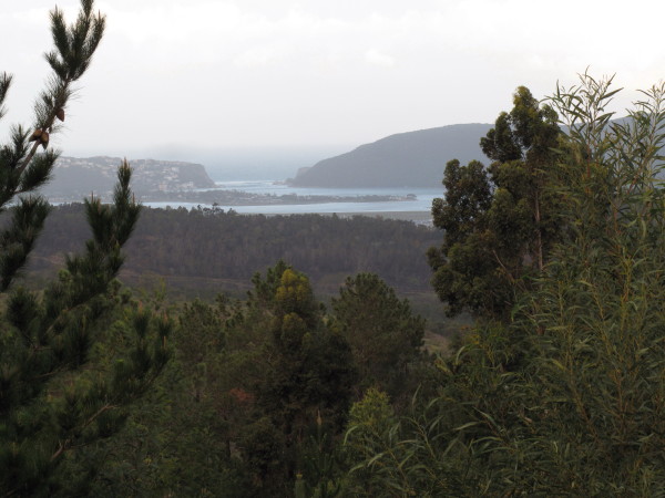
Knysna.  It was a bit misty and dizzeling.
4688153954_7da4b47533_o.jpg


I am a fan of corrugated iron houses.  Trailrider had told me of two in Klein Brak so I went looking for them.  I have always driven past Klein & Great Brak.
4687521191_62610258aa_o.jpg

 
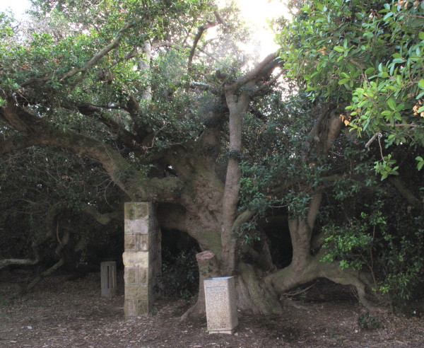
I went to Mossel Bay.  There is another replica of a Portugese Padrao in the museum and I also wanted to see the Post Office Tree and the caravel.  I spent 1,5 hours there.  The Post Office Tree; it is quite likely the original tree where the Portugese used to leave messages.
4687521383_e3e67f630e_o.jpg


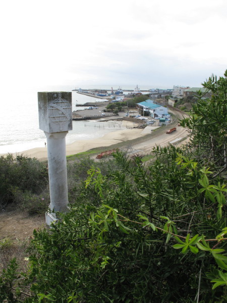
The Padrao.  It is a replica donated by the Portugese government.  It was erected by Vasco Da Gama in 1497; he came here 9 years after Dias and succeeded in getting to India. It was as padrao like this that I was expecting in PE but never found.  I am interested in getting to significant places like where Dias erected his cross & seeing a replica.  *Brief history of Mossel Bay*
4688154392_20f2e03556_o.jpg


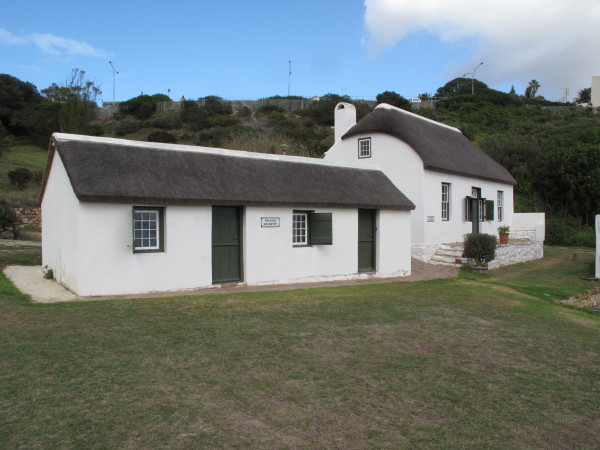
A Scotsman was given a licence to hunt the seals in the bay but ended up running a pub from these buildings now in the museum as representative of what the early buildings were like.  (Many seals on Seal Island so there are many great whites in the bay.  There is also excellent surfing.)
4688154534_be14b423f2_o.jpg


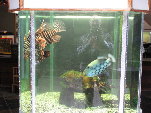
The spring that the Portugese drew their water from is next to the milkwood tree but has not flowed above surface since the 1970s.  There is an aquarium.  These two fish as you walk in.  Sadly the spotty one was a bit quick for my camera settings.  When I was a schoolboy & you collected stamps then the Mozambique ones with their fishes (like this) were very sought after.
4688154690_2ae7d52423_o.jpg


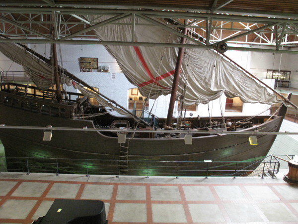
The highlight of the museum is the full size replica of a Portuguese caravel as used by Dias and Da Gama.  I say full size but it was how small it is that made such an impression on me.  The fishing boats in Kalk Bay are longer.  There is a person under the red cross on the sail for scale. 
4687521903_5e02a7f894_o.jpg


I spent 1,5 hours at the museum and still wanted to get back to Cape Town this day.  I went out to the swimming pool for late breakfast and beer.  I have had two lovely surf sessions there but it was wild then & no one was out.
 
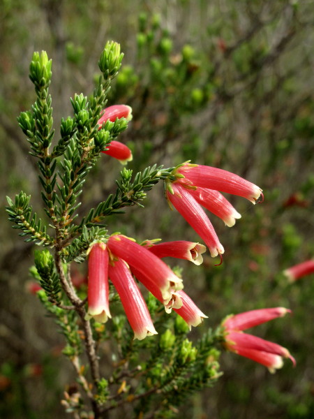
I had a nice route planned from Herbetsdale but once again T4A was wrong & the road has long been closed. I was forced onto the usual road to Riversdale.  Some ericas growing by the roadside; I have grown to love our fynbos.
4687522135_36f5548fbc_o.jpg


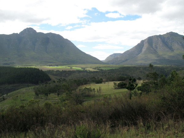
Garcia Pass goes through that kloof.  The light was nice even though it was the middle of the day. Beautiful scene.
4688155210_e174518250_o.jpg


Grootvadersbosch area.  I have just passed the entrance to Gysmanshoek – a very easy pass but the Tradouw Pass was developed through a much more challenging valley simply because it was closer to Swellendam showing how important minimum distance was in the days of animal drawn vehicles.
4688155414_8e9501e76b_o.jpg


Schumacher Grootvadersbosch.
4687522791_45423fc2c4_o.jpg


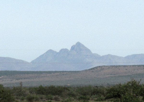
I should be quite a bit more to the left but you can recognise that sharp peak.
4687522003_90bf6ff9a7_o.jpg


Schumacher has this picture of the Drostdy at Swellendam.
4687522739_b61e80d657_o.jpg


My picture is from pretty much the same place.  It is all the oak trees that make it not obvious; the Drostdy is completely hidden now but the tar road runs just where the road in Schumacher’s picture goes.
4687522569_3d69c383ef_o.jpg


Time was getting on & I wanted to get home now that I was in familiar territory so I abandoned the gravel roads of my route & went home on the N2.  Arrived home at 19h20.
 
Fantasties en dankie vir al jou moeite om met ons te deel!! Groetnis en sterkte met volgende trip! :thumleft:
 
I do not know how I missed this awesome RR,Thanks for the link tok-tokkie.
This is what I really enjoy doing.Reading your report was an absolute pleasure.I shall have to purchase a lighter bike if I want to do what you did and follow the old wagon routes ect.
  :thumleft: :thumleft:
 
Pleased you liked it.  i was a bit disappointed with it in retrospect.  It is very dry- just about his trip & mine but there was no real human interest in it.  I learned from that & later wrote up trip I did visiting steam engines in England where I deliberately added human interest to make it more interesting & that thread (on ADV Rider) gets a lot of hits - 50 000 in less than 3 years.  So this thread contributed a lot to the success of that one.  https://advrider.com/forums/showthread.php?t=756771

It is now 200 years since he went through the Garden Route on that trip.  There was a commemorative gathering in George during September attended by a group of people who know a lot about him - including one from Canada & another from England.  The George Botanical Gardens have been renamed in his honour.  I linked this thread as an external link on Wikipedia which makes the odd person come & read it - I was invited to the George meeting but did not attend but they asked for a picture of me.
 
tok-tokkie said:
Pleased you liked it.  i was a bit disappointed with it in retrospect.  It is very dry- just about his trip & mine but there was no real human interest in it.  I learned from that & later wrote up trip I did visiting steam engines in England where I deliberately added human interest to make it more interesting & that thread (on ADV Rider) gets a lot of hits - 50 000 in less than 3 years.  So this thread contributed a lot to the success of that one.  https://advrider.com/forums/showthread.php?t=756771

It is now 200 years since he went through the Garden Route on that trip.  There was a commemorative gathering in George during September attended by a group of people who know a lot about him - including one from Canada & another from England.  The George Botanical Gardens have been renamed in his honour.  I linked this thread as an external link on Wikipedia which makes the odd person come & read it - I was invited to the George meeting but did not attend but they asked for a picture of me.
The best RR's to me are the ones that takes you back in time and serves up a good history lesson. I really enjoy Bigdogs posts on Advrider. He will go and look for water mills, old suspended bridges and even natural springs !
 
I'm not one for reading long stories, never did well in languages and history etc... but this is very interesting, thanks! Going to keep me busy for a while here in Sudan.  :thumleft:
 
Top